Gleason, Tennessee

Last updated

Gleason, Tennessee
Gleason-State-Championship-Rd-tn.jpg
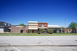
Buildings along State Championship Road
Weakley County Tennessee Incorporated and Unincorporated areas Gleason Highlighted 4729300.svg
Location of Gleason in Weakley County, Tennessee.
Coordinates: 36°12′56″N88°36′44″W / 36.21556°N 88.61222°W / 36.21556; -88.61222
Country United States
State Tennessee
County Weakley
Area
[1]
  Total2.24 sq mi (5.81 km2)
  Land2.24 sq mi (5.81 km2)
  Water0.00 sq mi (0.00 km2)
Elevation
[2]
407 ft (124 m)
Population
 (2020) [3]
  Total1,369
  Density610.34/sq mi (235.64/km2)
Time zone UTC-6 (Central (CST))
  Summer (DST) UTC-5 (CDT)
ZIP code
38229
Area code 731
FIPS code 47-29300 [4]
GNIS feature ID1303460 [2]
Website www.gleasononline.com

Gleason is a town in Weakley County, Tennessee, United States. The population was 1,445 at the 2010 census. The city holds an annual Tater Town Parade and festival in the fall. The girls High School basketball team, the Lady Bulldogs, won the State Championship in 1992, 1999 and 2007.

Contents

Geography

Gleason is located at 36°12′56″N88°36′44″W / 36.21556°N 88.61222°W / 36.21556; -88.61222 (36.215641, -88.612114). [5]

According to the United States Census Bureau, the town has a total area of 2.3 square miles (6.0 km2), all land.

Demographics

Historical population
CensusPop.Note
1880 121
1890 324167.8%
1910 388
1920 4023.6%
1930 76089.1%
1940 88316.2%
1950 1,06320.4%
1960 900−15.3%
1970 1,31446.0%
1980 1,3351.6%
1990 1,4025.0%
2000 1,4634.4%
2010 1,445−1.2%
2020 1,369−5.3%
Sources: [6] [7] [3]

2020 census

Gleason racial composition [8]
RaceNum.Perc.
White (non-Hispanic)1,29594.59%
Black or African American (non-Hispanic)130.95%
Native American 70.51%
Other/Mixed 352.56%
Hispanic or Latino 191.39%

As of the 2020 United States census, there were 1,369 people, 604 households, and 394 families residing in the town.

2000 census

As of the census [4] of 2000, there were 1,463 people, 599 households, and 431 families residing in the town. The population density was 640.5 inhabitants per square mile (247.3/km2). There were 657 housing units at an average density of 287.6 per square mile (111.0/km2). The racial makeup of the town was 98.43% White, 0.55% African American, 0.34% Native American, 0.41% from other races, and 0.27% from two or more races. Hispanic or Latino of any race were 1.37% of the population.

There were 599 households, out of which 36.2% had children under the age of 18 living with them, 54.3% were married couples living together, 12.4% had a female householder with no husband present, and 27.9% were non-families. 25.4% of all households were made up of individuals, and 11.9% had someone living alone who was 65 years of age or older. The average household size was 2.44 and the average family size was 2.89.

In the town, the population was spread out, with 27.5% under the age of 18, 7.3% from 18 to 24, 28.2% from 25 to 44, 22.9% from 45 to 64, and 14.1% who were 65 years of age or older. The median age was 35 years. For every 100 females, there were 91.2 males. For every 100 females age 18 and over, there were 86.6 males.

The median income for a household in the town was $29,597, and the median income for a family was $35,000. Males had a median income of $26,397 versus $19,643 for females. The per capita income for the town was $13,747. About 13.6% of families and 15.0% of the population were below the poverty line, including 18.4% of those under age 18 and 16.4% of those age 65 or over.

Notable Natives

Gleason School

The most notable building in the town is Gleason School, a Pre-K through 12 school with a population of 470 (2017) in the Weakley County School system. The school is split into three parts, the Elementary School (K-5), the Junior High School (6-8), and the High School (9-12).

Junior high school

GJHS is home to three clubs:The Junior High Beta Club,

Media

Related Research Articles

<span class="mw-page-title-main">Weakley County, Tennessee</span> County in Tennessee, United States

Weakley County is a county located in the northwest of the U.S. state of Tennessee. As of the 2020 census, the population was 32,902. Its county seat is Dresden. Its largest city is Martin, the home of the University of Tennessee at Martin. The county was established by the Tennessee General Assembly on October 21, 1823, and is named for U.S. Congressman Robert Weakley (1764–1845). Weakley County comprises the Martin, TN Micropolitan Statistical Area.

<span class="mw-page-title-main">Henry County, Tennessee</span> County in Tennessee, United States

Henry County is a county located on the northwestern border of the U.S. state of Tennessee, and is considered part of West Tennessee. As of the 2020 census, the population was 32,199. Its county seat is Paris. The county is named for the Virginia orator and American Founding Father Patrick Henry.

<span class="mw-page-title-main">Carroll County, Tennessee</span> County in Tennessee, United States

Carroll County is a county located in the western division of the U.S. state of Tennessee. As of the 2020 census, the population was 28,440. Its county seat is Huntingdon. The county was established by the Tennessee General Assembly on November 7, 1821, and was named for Governor William Carroll.

<span class="mw-page-title-main">Benton County, Tennessee</span> County in Tennessee, United States

Benton County is a county located in the U.S. state of Tennessee. As of the 2020 census, the population was 15,864. Its county seat is Camden. The county was created in December 1835 and organized in 1836.

<span class="mw-page-title-main">Bruceton, Tennessee</span> Town in Tennessee, United States

Bruceton is a town in Carroll County, Tennessee, United States. The population was 1,507 in the 2020 census.

<span class="mw-page-title-main">Hollow Rock, Tennessee</span> Town in Tennessee, United States

Hollow Rock is a town in Carroll County, Tennessee, United States. The population was 718 at the 2010 census. Hollow Rock is just west of, and adjacent to, the town of Bruceton and is 70 km (43 mi) northeast of Jackson.

<span class="mw-page-title-main">Huntingdon, Tennessee</span> Town in Tennessee, United States

Huntingdon is a town in Carroll County, Tennessee, United States. The population was 4,439 at the 2020 census and 3,985 in 2010. It is the county seat of Carroll County.

<span class="mw-page-title-main">Dyer, Tennessee</span> City in Tennessee, United States

Dyer is a city in Gibson County, Tennessee, United States. The population was 2,341 at the 2010 census. Dyer was originally known as Dyer Station, a name given by railroad workers in the early days of rail.

<span class="mw-page-title-main">Gibson, Tennessee</span> Town in Tennessee, United States

Gibson is a town in Gibson County, Tennessee, United States. The population was 396 at the 2010 census.

<span class="mw-page-title-main">Rutherford, Tennessee</span> Town in Tennessee, United States

Rutherford is a town in Gibson County, Tennessee, United States. At the 2000 census, its population was at 1,272 and in 2010 the population was 1,151.

<span class="mw-page-title-main">Ridgely, Tennessee</span> Town in Tennessee, United States

Ridgely is a town in Lake County, Tennessee, United States. The population was 1,667 at the 2000 census and 1,795 at the 2010 census.

<span class="mw-page-title-main">Linden, Tennessee</span> Town in Tennessee, United States

Linden is a town in and the county seat of Perry County, Tennessee, United States. The population was 1,015 at the 2000 census and 908 at the 2010 showing a loss of 107. Linden was officially incorporated in 1850.

<span class="mw-page-title-main">Cumberland City, Tennessee</span> Town in Tennessee, United States

Cumberland City is a town in Stewart County, Tennessee. The population was 311 at the 2010 census. It is part of the Clarksville, TN — Kentucky Metropolitan Statistical Area.

<span class="mw-page-title-main">Dover, Tennessee</span> City in Tennessee, United States

Dover is a city in and the county seat of Stewart County, Tennessee, 67 miles (108 km) west-northwest of Nashville on the Cumberland River. Fort Donelson National Cemetery is in Dover. The population was 1,442 at the 2000 census and the 2010 census showed a population of 1,417.

Walnut Grove is a census-designated place in Sumner County, Tennessee, United States. Its population was 864 as of the 2010 census. The community incorporated as a town in 1998. It disincorporated on July 1, 2001, after the law under which it had incorporated was ruled unconstitutional.

<span class="mw-page-title-main">Dresden, Tennessee</span> Town in Tennessee, United States

Dresden is a town in and the county seat of Weakley County, Tennessee, United States. The population was 3,005 at the 2010 census.

<span class="mw-page-title-main">Greenfield, Tennessee</span> City in Tennessee, United States

Greenfield is a city in northwestern Weakley County, Tennessee, United States. The population was 2,182 at the 2010 census and 2,078 in 2018.

<span class="mw-page-title-main">Martin, Tennessee</span> City in Tennessee, United States

Martin is a city in Weakley County, Tennessee, United States. The population was 10,825 according to the 2020 census. The city is the home of the University of Tennessee at Martin.

<span class="mw-page-title-main">Sharon, Tennessee</span> Town in Tennessee, United States

Sharon is a town in Weakley County, Tennessee, United States. The population was 988 at the 2000 census and 944 at the 2010 census.

<span class="mw-page-title-main">McKenzie, Tennessee</span> City in Tennessee, United States

McKenzie is a city at the tripoint of Carroll, Henry, and Weakley counties in Tennessee, United States. The population was 5,310 at the 2010 census.

References

  1. "ArcGIS REST Services Directory". United States Census Bureau. Retrieved October 15, 2022.
  2. 1 2 U.S. Geological Survey Geographic Names Information System: Gleason, Tennessee
  3. 1 2 "Census Population API". United States Census Bureau. Retrieved October 15, 2022.
  4. 1 2 "U.S. Census website". United States Census Bureau . Retrieved January 31, 2008.
  5. "US Gazetteer files: 2010, 2000, and 1990". United States Census Bureau. February 12, 2011. Retrieved April 23, 2011.
  6. "Census of Population and Housing: Decennial Censuses". United States Census Bureau . Retrieved March 4, 2012.
  7. "Incorporated Places and Minor Civil Divisions Datasets: Subcounty Resident Population Estimates: April 1, 2010 to July 1, 2012". Population Estimates. U.S. Census Bureau. Archived from the original on June 11, 2013. Retrieved December 11, 2013.
  8. "Explore Census Data". data.census.gov. Retrieved December 8, 2021.