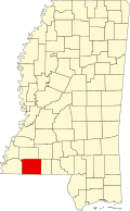
Gloster | |
---|---|
Coordinates: 31°11′49″N91°1′9″W / 31.19694°N 91.01917°W Coordinates: 31°11′49″N91°1′9″W / 31.19694°N 91.01917°W | |
Country | United States |
State | Mississippi |
County | Amite |
Government | |
• Mayor | Wayne Jerry Norwood |
Area | |
• Total | 1.82 sq mi (4.72 km2) |
• Land | 1.82 sq mi (4.72 km2) |
• Water | 0.00 sq mi (0.00 km2) |
Elevation | 423 ft (129 m) |
Population (2020) | |
• Total | 897 |
• Density | 491.78/sq mi (189.88/km2) |
Time zone | UTC-6 (Central (CST)) |
• Summer (DST) | UTC-5 (CDT) |
ZIP code | 39638 |
Area code | 601 |
FIPS code | 28-27820 |
GNIS feature ID | 0693304 |
Website | www |
Gloster is a town in central Amite County, Mississippi, United States. The population was 897 at the 2020 census. [2]
Gloster was incorporated on March 11, 1884. [3]
Drax Biomass operates a 450,000-metric-ton (440,000-long-ton) per year wood pellet production facility in Gloster. The facility was expected to create 45 jobs, and is called Amite BioEnergy. [4]
Historical population | |||
---|---|---|---|
Census | Pop. | %± | |
1890 | 1,142 | — | |
1900 | 1,661 | 45.4% | |
1910 | 1,486 | −10.5% | |
1920 | 1,079 | −27.4% | |
1930 | 1,139 | 5.6% | |
1940 | 1,232 | 8.2% | |
1950 | 1,467 | 19.1% | |
1960 | 1,369 | −6.7% | |
1970 | 1,401 | 2.3% | |
1980 | 1,726 | 23.2% | |
1990 | 1,323 | −23.3% | |
2000 | 1,073 | −18.9% | |
2010 | 960 | −10.5% | |
2020 | 897 | −6.6% | |
U.S. Decennial Census [5] |
According to the 2020 census, there were 897 people in Gloster.
Race | Num. | Perc. |
---|---|---|
White (non-Hispanic) | 230 | 25.64% |
Black or African American (non-Hispanic) | 633 | 70.57% |
Native American | 3 | 0.33% |
Asian | 1 | 0.11% |
Other/Mixed | 14 | 1.56% |
Hispanic or Latino | 16 | 1.78% |
As of the 2020 United States census, there were 897 people, 402 households, and 306 families residing in the town.
As of the census [7] of 2010, there were 960 people, 223 households, and 114 families residing in the town. The population density was 588.4 people per square mile (227.6/km2). There were 481 housing units at an average density of 263.8 per square mile (102.0/km2). The racial makeup of the town was 54.99% African American, 44.18% White, 0.56% from other races, and 0.28% from two or more races. Hispanic or Latino of any race were 1.77% of the population.
There were 422 households, out of which 35.8% had children under the age of 18 living with them, 36.7% were married couples living together, 29.4% had a female householder with no husband present, and 29.1% were non-families. 26.8% of all households were made up of individuals, and 14.9% had someone living alone who was 65 years of age or older. The average household size was 2.54 and the average family size was 3.05.
In the town, the population was spread out, with 30.4% under the age of 18, 10.1% from 18 to 24, 24.6% from 25 to 44, 21.1% from 45 to 64, and 13.9% who were 65 years of age or older. The median age was 33 years. For every 100 females, there were 77.6 males. For every 100 females age 18 and over, there were 74.1 males.
The median income for a household in the town was $19,922, and the median income for a family was $23,750. Males had a median income of $25,833 versus $17,222 for females. The per capita income for the town was $10,536. About 35.0% of families and 39.8% of the population were below the poverty line, including 61.5% of those under age 18 and 22.4% of those age 65 or over.
It is in the Amite County School District. [8]
Wilkinson County is a county located in the southwest corner of the U.S. state of Mississippi. As of the 2010 census, the population was 9,878. Its county seat is Woodville. Bordered by the Mississippi River on the west, the county is named for James Wilkinson, a Revolutionary War military leader and first governor of the Louisiana Territory after its acquisition by the United States in 1803.
Pike County is a county located on the southwestern border of the U.S. state of Mississippi. As of the 2010 census, the population was 40,404. The county seat is Magnolia. Pike County is named for explorer Zebulon Pike.
Amite County is a county located in the state of Mississippi on its southern border with Louisiana. As of the 2020 census, the population was 12,720. Its county seat is Liberty. The county is named after the Amite River, which runs through the county.
Bastrop is A Northeast Louisiana city it is the parish seat of Morehouse Parish, Louisiana, United States. The population was 11,365 at the 2010 census, a decrease of 1,623 from the 12,988 tabulation of 2000. The population of Bastrop is 73 percent African American. It is the principal city of and is included in the Bastrop, Louisiana Micropolitan Statistical Area, which is included in the Monroe-Bastrop, Louisiana Combined Statistical Area.
Amite City is a town in Tangipahoa Parish, of which it is the parish seat, in southeastern Louisiana, United States. The population was 4,141 at the 2010 census. It is part of the Hammond Micropolitan Statistical Area.
Liberty is a town in Amite County, Mississippi. It is part of the McComb, Mississippi Micropolitan Statistical Area. It has a population of 728 according to the 2010 census. It is the county seat of Amite County.
Bruce is a town situated along the Skuna River in Calhoun County, Mississippi, United States. As of the 2010 census, it had a population of 1,939.
Calhoun City is a town in Calhoun County, Mississippi, United States. The population was 1,774 at the 2010 census.
Ackerman is a town in Choctaw County, Mississippi, United States. The population was 1,510 at the 2010 census, down from 1,696 at the 2000 census. It is the county seat of Choctaw County.
Coahoma is a town in Coahoma County, Mississippi, United States. Per the 2020 census, the population was 229.
West is a town in northeastern Holmes County, Mississippi, United States. Per the 2020 census, the population was 153. The Mayor of West, MS as of December 2020 is Michael Fancher.
Bassfield is a town in Jefferson Davis County, Mississippi, United States. The population was 254 at the 2010 census, down from 315 at the 2000 census. As of 2017, the estimated population was 216.
Saltillo is a city in Lee County, Mississippi, located in the northern part of the Tupelo micropolitan area. The population was 4,752 at the 2010 Census.
Rolling Fork is a town in Sharkey County, Mississippi. The population was 1,883 as of the 2020 Census. It is the county seat of Sharkey County.
Lyon is a town in Coahoma County, Mississippi, United States. Per the 2020 census, the population was 296.
Tillatoba is a town in Yalobusha County, Mississippi, United States. The population was 91 at the 2010 census.
Swansea is a town in Lexington County, South Carolina, United States. The population was 827 at the 2010 census. It is part of the Columbia, South Carolina Metropolitan Statistical Area.
Centreville is a town in Amite and Wilkinson counties, Mississippi, United States. The population was 1,684 at the 2010 census. It is part of the McComb, Mississippi Micropolitan Statistical Area.
Crosby is a town in Amite and Wilkinson counties, Mississippi, United States. Its population was 318 at the 2010 census. It is part of the McComb, Mississippi Micropolitan Statistical Area.
The McComb Micropolitan Statistical Area is a micropolitan area in southwestern Mississippi that includes Amite, and Pike Counties, which had a combined population of 53,124 as of the 2020 census.