Goreville, Illinois

Last updated

Goreville, Illinois
Johnson County Illinois Incorporated and Unincorporated areas Goreville Highlighted.svg
Location of Goreville in Johnson County, Illinois.
Illinois in United States (US48).svg
Location of Illinois in the United States
Coordinates: 37°33′12″N88°58′22″W / 37.55333°N 88.97278°W / 37.55333; -88.97278
CountryUnited States
StateIllinois
County Johnson
Area
[1]
  Total2.71 sq mi (7.01 km2)
  Land2.69 sq mi (6.96 km2)
  Water0.02 sq mi (0.06 km2)
Elevation
[2]
722 ft (220 m)
Population
 (2020)
  Total1,068
  Density397.62/sq mi (153.55/km2)
Time zone UTC-6 (CST)
  Summer (DST) UTC-5 (CDT)
ZIP Code(s)
62939
Area code 618
FIPS code 17-30575
GNIS feature ID2398181 [2]
Wikimedia CommonsGoreville, Illinois
Website villageofgoreville.com

Goreville is a village in Johnson County, Illinois, United States. The population was 1,049 as of the 2010 census, [3] up from 938 at the 2000 census.

Contents

Geography

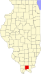
Goreville is located in northwestern Johnson County at 37°33′12″N88°58′22″W / 37.55333°N 88.97278°W / 37.55333; -88.97278 (37.553212, -88.972783). [4] It is bordered to the south by Ferne Clyffe State Park. Illinois Route 37 passes through the village, leading south 6 miles (10 km) to Buncombe and north 5 miles (8 km) to Interstate 57 at Exit 45, just north of that highway's interchange with Interstate 24.

According to the 2010 census, Goreville has a total area of 1.679 square miles (4.35 km2), of which 1.66 square miles (4.30 km2) (or 98.87%) is land and 0.019 square miles (0.05 km2) (or 1.13%) is water. [5]

Demographics

Historical population
CensusPop.Note
1900 406
1910 55436.5%
1920 5814.9%
1930 531−8.6%
1940 508−4.3%
1950 58114.4%
1960 6257.6%
1970 1,10977.4%
1980 978−11.8%
1990 872−10.8%
2000 9387.6%
2010 1,04911.8%
2020 1,0681.8%
U.S. Decennial Census [6]

As of the census [7] of 2000, there were 938 people, 392 households, and 286 families residing in the village. The population density was 575.3 inhabitants per square mile (222.1/km2). There were 426 housing units at an average density of 261.3 per square mile (100.9/km2). The racial makeup of the village was 98.61% White, 0.21% Native American, 0.11% Asian, 0.96% from other races, and 0.11% from two or more races. Hispanic or Latino of any race were 1.07% of the population.

There were 392 households, out of which 32.9% had children under the age of 18 living with them, 60.7% were married couples living together, 9.9% had a female householder with no husband present, and 26.8% were non-families. 25.5% of all households were made up of individuals, and 14.5% had someone living alone who was 65 years of age or older. The average household size was 2.39 and the average family size was 2.83.

In the village, the population was spread out, with 24.2% under the age of 18, 7.7% from 18 to 24, 28.1% from 25 to 44, 21.9% from 45 to 64, and 18.1% who were 65 years of age or older. The median age was 38 years. For every 100 females, there were 88.7 males. For every 100 females age 18 and over, there were 87.6 males.

The median income for a household in the village was $33,750, and the median income for a family was $42,563. Males had a median income of $31,848 versus $21,786 for females. The per capita income for the village was $16,491. About 8.1% of families and 12.2% of the population were below the poverty line, including 11.4% of those under age 18 and 14.2% of those age 65 or over.

Related Research Articles

<span class="mw-page-title-main">Elizabethtown, Illinois</span> Village in Illinois, United States

Elizabethtown is a village in and the county seat of Hardin County, Illinois, United States, along the Ohio River. The population was 299 at the 2010 census, down from 348 at the 2000 census. It is the least-populous county seat in the state.

<span class="mw-page-title-main">Buckley, Illinois</span> Village in Illinois, United States

Buckley is a village in Artesia Township, Iroquois County, Illinois, United States. The population was 600 at the 2010 census. Buckley celebrated its sesquicentennial in 2006.

<span class="mw-page-title-main">Woodland, Illinois</span> Village in Illinois, United States

Woodland is a village in Belmont Township, Iroquois County, Illinois, United States. The population was 324 as of the 2010 census.

<span class="mw-page-title-main">Vergennes, Illinois</span> Village in Illinois, United States

Vergennes is a village in Jackson County, Illinois, United States. The population was 298 at the 2010 census, down from 491 at the 2000 census.

<span class="mw-page-title-main">Belknap, Illinois</span> Village in Illinois, United States

Belknap is a village in Johnson County, Illinois, United States. The population was 104 at the 2010 census.

<span class="mw-page-title-main">Buncombe, Illinois</span> Village in Illinois, United States

Buncombe is a village in Johnson County, Illinois, United States. The population was 203 at the 2010 census and as of 2018, the population had declined to an estimated 173.

<span class="mw-page-title-main">New Burnside, Illinois</span> Village in Illinois, United States

New Burnside is a village in Johnson County, Illinois, United States. The population was 211 at the 2010 census.

<span class="mw-page-title-main">Simpson, Illinois</span> Village in Illinois, United States

Simpson is a village in Johnson County, Illinois, United States. The population was 60 at the 2010 census.

<span class="mw-page-title-main">Virgil, Illinois</span> Village in Illinois, United States

Virgil is a village in Virgil Township, Kane County, Illinois, United States. It was incorporated on November 6, 1990. The population was 329 at the 2010 census, up from 266 in 2000.

<span class="mw-page-title-main">Round Lake Heights, Illinois</span> Village in Illinois, United States

Round Lake Heights is a village in Lake County, Illinois, United States. Per the 2020 census, the population was 2,622.

<span class="mw-page-title-main">Emington, Illinois</span> Village in Illinois, United States

Emington is a village in Livingston County, Illinois, United States. The population was 117 at the 2010 census.

<span class="mw-page-title-main">Spring Grove, Illinois</span> Village in Illinois, United States

Spring Grove is a village in McHenry County. Portions of unincorporated Lake County, Illinois also utilize Spring Grove postal addresses. It is a commuter village within the Chicago metropolitan area. Per the 2020 census, the population was 5,487. It is also home to Chain O'Lakes State Park.

<span class="mw-page-title-main">Mansfield, Illinois</span> Village in Illinois, United States

Mansfield is a village in Piatt County, Illinois in the United States. The population was 906 at the 2010 census.

<span class="mw-page-title-main">Eddyville, Illinois</span> Village in Illinois, United States

Eddyville is a village in Pope County, Illinois, United States. The population was 153 at the 2000 census. Two designated wilderness areas, the Burden Falls Wilderness and the Lusk Creek Wilderness, are nearby.

<span class="mw-page-title-main">Karnak, Illinois</span> Village in Illinois, United States

Karnak is a village in Pulaski County, Illinois, United States. The population was 499 at the 2010 census.

<span class="mw-page-title-main">Muddy, Illinois</span> Village in Illinois, United States

Muddy is a small incorporated village located in the Harrisburg Township in Saline County, Illinois, United States. The population was 78 at the 2000 census.

<span class="mw-page-title-main">Stonefort, Illinois</span> Village in Illinois, United States

Stonefort is a village in Saline and Williamson Counties, Illinois, United States. The population was 297 at the 2010 census.

<span class="mw-page-title-main">Pittsburg, Illinois</span> Village in Illinois, United States

Pittsburg is a village in Williamson County, Illinois. The population was 572 at the 2010 census.

<span class="mw-page-title-main">Spillertown, Illinois</span> Village in Illinois, United States

Spillertown is a village in Williamson County, Illinois, United States. The population was 203 at the 2010 census and as of 2018, the population has grown to an estimated 272.

<span class="mw-page-title-main">Tower Lakes, Illinois</span> Village in Illinois, United States

Tower Lakes is a village in Lake County, Illinois, United States. Per the 2020 census, the population was 1,226.

References

  1. "2020 U.S. Gazetteer Files". United States Census Bureau. Retrieved March 15, 2022.
  2. 1 2 U.S. Geological Survey Geographic Names Information System: Goreville, Illinois
  3. "Geographic Identifiers: 2010 Census Summary File 1 (G001): Goreville village, Illinois". American Factfinder. U.S. Census Bureau. Archived from the original on February 13, 2020. Retrieved May 14, 2018.
  4. "US Gazetteer files: 2010, 2000, and 1990". United States Census Bureau. February 12, 2011. Retrieved April 23, 2011.
  5. "G001 - Geographic Identifiers - 2010 Census Summary File 1". United States Census Bureau. Archived from the original on February 13, 2020. Retrieved August 3, 2015.
  6. "Census of Population and Housing". Census.gov. Retrieved June 4, 2015.
  7. "U.S. Census website". United States Census Bureau . Retrieved January 31, 2008.