Grinnell, Kansas

Last updated

Grinnell, Kansas
Gove County Kansas Incorporated and Unincorporated areas Grinnell Highlighted.svg
Location within Gove County and Kansas
Map of Gove Co, Ks, USA.png
Coordinates: 39°07′36″N100°37′52″W / 39.12667°N 100.63111°W / 39.12667; -100.63111 [1]
Country United States
State Kansas
County Gove
Founded1880s
Incorporated 1917
Named for Moses Grinnell
Area
[2]
  Total0.49 sq mi (1.27 km2)
  Land0.49 sq mi (1.27 km2)
  Water0.00 sq mi (0.00 km2)
Elevation
[1]
2,914 ft (888 m)
Population
 (2020) [3]
  Total260
  Density530/sq mi (200/km2)
Time zone UTC-6 (CST)
  Summer (DST) UTC-5 (CDT)
ZIP code
67738
Area code 785
FIPS code 20-28900
GNIS ID 2394253 [1]
Website Info

Grinnell is a city in Gove County, Kansas, United States. [1] As of the 2020 census, the population of the city was 260. [3]

Contents

History

Grinnell in 1943 Kansas - Garden City through Guinnel - NARA - 23940109 (cropped).jpg
Grinnell in 1943

Grinnell was named for businessman Moses Hicks Grinnell. [4]

The first newspaper in Grinnell was the Golden Belt, in 1885. [5]

Geography

According to the United States Census Bureau, the city has a total area of 0.51 square miles (1.32 km2), all of it land. [6]

Demographics

Historical population
CensusPop.Note
1920 162
1930 30387.0%
1940 289−4.6%
1950 36426.0%
1960 3968.8%
1970 44913.4%
1980 410−8.7%
1990 348−15.1%
2000 329−5.5%
2010 259−21.3%
2020 2600.4%
U.S. Decennial Census

2020 census

The 2020 United States census counted 260 people, 129 households, and 68 families in Grinnell. [7] [8] The population density was 528.5 per square mile (204.0/km2). There were 151 housing units at an average density of 306.9 per square mile (118.5/km2). [8] [9] The racial makeup was 94.62% (246) white or European American (92.69% non-Hispanic white), 0.0% (0) black or African-American, 0.0% (0) Native American or Alaska Native, 0.0% (0) Asian, 0.0% (0) Pacific Islander or Native Hawaiian, 2.31% (6) from other races, and 3.08% (8) from two or more races. [10] Hispanic or Latino of any race was 5.38% (14) of the population. [11]

Of the 129 households, 16.3% had children under the age of 18; 41.9% were married couples living together; 24.8% had a female householder with no spouse or partner present. 44.2% of households consisted of individuals and 23.3% had someone living alone who was 65 years of age or older. [8] The average household size was 2.0 and the average family size was 2.8. [12] The percent of those with a bachelor’s degree or higher was estimated to be 16.2% of the population. [13]

21.5% of the population was under the age of 18, 6.2% from 18 to 24, 20.0% from 25 to 44, 23.8% from 45 to 64, and 28.5% who were 65 years of age or older. The median age was 46.0 years. For every 100 females, there were 83.1 males. [8] For every 100 females ages 18 and older, there were 90.7 males. [8]

The 2016-2020 5-year American Community Survey estimates show that the median household income was $55,769 (with a margin of error of +/- $9,039) and the median family income was $62,500 (+/- $5,637). [14] Males had a median income of $60,368 (+/- $11,714) versus $24,583 (+/- $12,636) for females. The median income for those above 16 years old was $41,667 (+/- $9,898). [15] Approximately, 1.4% of families and 2.6% of the population were below the poverty line, including 3.2% of those under the age of 18 and 5.3% of those ages 65 or over. [16] [17]

2010 census

As of the census [18] of 2010, there were 259 people, 135 households, and 81 families residing in the city. The population density was 507.8 inhabitants per square mile (196.1/km2). There were 156 housing units at an average density of 305.9 per square mile (118.1/km2). The racial makeup of the city was 100.0% White. Hispanic or Latino of any race were 0.4% of the population.

There were 135 households, of which 14.1% had children under the age of 18 living with them, 54.8% were married couples living together, 3.7% had a female householder with no husband present, 1.5% had a male householder with no wife present, and 40.0% were non-families. 38.5% of all households were made up of individuals, and 18.6% had someone living alone who was 65 years of age or older. The average household size was 1.92 and the average family size was 2.48.

The median age in the city was 55.9 years. 13.5% of residents were under the age of 18; 5% were between the ages of 18 and 24; 16.6% were from 25 to 44; 32.8% were from 45 to 64; and 32% were 65 years of age or older. The gender makeup of the city was 52.1% male and 47.9% female.

2000 census

As of the census [19] of 2000, there were 329 people, 149 households, and 87 families residing in the city. The population density was 662.2 inhabitants per square mile (255.7/km2). There were 158 housing units at an average density of 318.0 per square mile (122.8/km2). The racial makeup of the city was 99.70% White and 0.30% African American. Hispanic or Latino of any race were 0.61% of the population.

There were 149 households, out of which 19.5% had children under the age of 18 living with them, 51.7% were married couples living together, 4.0% had a female householder with no husband present, and 41.6% were non-families. 39.6% of all households were made up of individuals, and 28.2% had someone living alone who was 65 years of age or older. The average household size was 2.21 and the average family size was 2.98.

In the city, the population was spread out, with 22.5% under the age of 18, 7.6% from 18 to 24, 19.5% from 25 to 44, 21.6% from 45 to 64, and 28.9% who were 65 years of age or older. The median age was 45 years. For every 100 females, there were 104.3 males. For every 100 females age 18 and over, there were 105.6 males.

The median income for a household in the city was $35,833, and the median income for a family was $41,750. Males had a median income of $27,167 versus $21,500 for females. The per capita income for the city was $20,056. About 9.2% of families and 8.2% of the population were below the poverty line, including 8.5% of those under age 18 and 8.6% of those age 65 or over.

Education

The community is served by Grinnell USD 291 public school district, and has a cooperative agreement with Wheatland USD 292 to educate high school students at Wheatland High School. [20] The Wheatland High School mascot is a Thunderhawk. [21] Grinnell High School was closed with the cooperative agreement.

The Grinnell Warriors [22] won the following Kansas State High School championships:

Notable people

Related Research Articles

<span class="mw-page-title-main">Miltonvale, Kansas</span> City in Cloud County, Kansas

Miltonvale is a city in Cloud County, Kansas, United States. As of the 2020 census, the population of the city was 440.

<span class="mw-page-title-main">Lewis, Kansas</span> City in Edwards County, Kansas

Lewis is a city in Edwards County, Kansas, United States. As of the 2020 census, the population of the city was 400. It is located along Highway 50.

<span class="mw-page-title-main">Bucklin, Kansas</span> City in Ford County, Kansas

Bucklin is a city in Ford County, Kansas, United States. As of the 2020 census, the population of the city was 727. It is located along U.S. Route 54 highway.

<span class="mw-page-title-main">Gove City, Kansas</span> City in Gove County, Kansas

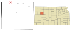
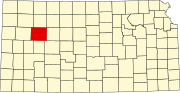
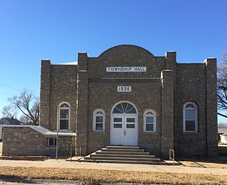
Gove City, more commonly known as Gove, is a city in and the county seat of Gove County, Kansas, United States. As of the 2020 census, the population of the city was 80.

<span class="mw-page-title-main">Grainfield, Kansas</span> City in Gove County, Kansas, United States

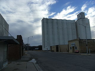
Grainfield is a city in northern Gove County, Kansas, United States. As of the 2020 census, the population of the city was 322.

<span class="mw-page-title-main">Bogue, Kansas</span> City in Graham County, Kansas

Bogue is a city in Graham County, Kansas, United States. As of the 2020 census, the population of the city was 155. Bogue is located on K-18, south of U.S. Route 24, on the South Fork Solomon River.

<span class="mw-page-title-main">Morland, Kansas</span> City in Graham County, Kansas

Morland is a city in Graham County, Kansas, United States. As of the 2020 census, the population of the city was 115.

<span class="mw-page-title-main">Madison, Kansas</span> City in Greenwood County, Kansas

Madison is a city in Greenwood County, Kansas, United States, along the Verdigris River. As of the 2020 census, the population of the city was 689.

<span class="mw-page-title-main">Burrton, Kansas</span> City in Harvey County, Kansas

Burrton is a city in Harvey County, Kansas, United States. It is named after Isaac T. Burr, former vice-president of the Atchison, Topeka and Santa Fe Railway. As of the 2020 census, the population of the city was 861.

<span class="mw-page-title-main">Frankfort, Kansas</span> City in Marshall County, Kansas

Frankfort is a city in Marshall County, Kansas, United States. As of the 2020 census, the population of the city was 730.

<span class="mw-page-title-main">Ransom, Kansas</span> City in Ness County, Kansas, United States

Ransom is a city in Ness County, Kansas, United States. As of the 2020 census, the population of the city was 260.

<span class="mw-page-title-main">Almena, Kansas</span> City in Norton County, Kansas, United States

Almena is a city in Norton County, Kansas, United States. As of the 2020 census, the population of the city was 363.

<span class="mw-page-title-main">Norton, Kansas</span> City in Norton County, Kansas

Norton is a city in, and the county seat of, Norton County, Kansas, United States. As of the 2020 census, the population of the city was 2,747.

<span class="mw-page-title-main">Downs, Kansas</span> City in Osborne County, Kansas

Downs is a city in Osborne County, Kansas, United States. As of the 2020 census, the population of the city was 800.

<span class="mw-page-title-main">Natoma, Kansas</span> City in Osborne County, Kansas

Natoma is a city in Osborne County, Kansas, United States. As of the 2020 census, the population of the city was 302.

<span class="mw-page-title-main">Logan, Kansas</span> City in Phillips County, Kansas

Logan is a city in Phillips County, Kansas, United States. As of the 2020 census, the population of the city was 460.

<span class="mw-page-title-main">Long Island, Kansas</span> City in Phillips County, Kansas

Long Island is a city in Phillips County, Kansas, United States. As of the 2020 census, the population of the city was 137.

<span class="mw-page-title-main">Little River, Kansas</span> City in Rice County, Kansas

Little River is a city in Rice County, Kansas, United States. As of the 2020 census, the population of the city was 472.

<span class="mw-page-title-main">Brewster, Kansas</span> City in Thomas County, Kansas

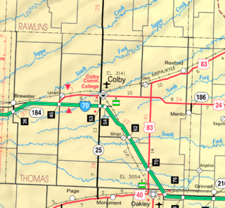
Brewster is a city in Thomas County, Kansas, United States. As of the 2020 census, the population of the city was 291.

<span class="mw-page-title-main">Oakley, Kansas</span> City in Gove / Logan / Thomas Counties of Kansas

Oakley is a city in Gove, Logan, and Thomas counties in the U.S. state of Kansas. It is the county seat of Logan County. As of the 2020 census, the population of the city was 2,046.

References

  1. 1 2 3 4 "Grinnell, Kansas", Geographic Names Information System , United States Geological Survey, United States Department of the Interior
  2. "2019 U.S. Gazetteer Files". United States Census Bureau. Retrieved July 24, 2020.
  3. 1 2 "Profile of Grinnell, Kansas in 2020". United States Census Bureau. Archived from the original on November 26, 2021. Retrieved November 26, 2021.
  4. Heim, Michael (2007). Exploring Kansas Highways. p. 29. ISBN   9780974435886.
  5. Blackmar, Frank Wilson (1912). Kansas: A Cyclopedia of State History, Embracing Events, Institutions, Industries, Counties, Cities, Towns, Prominent Persons, Etc. Standard Publishing Company. pp.  797.
  6. "US Gazetteer files 2010". United States Census Bureau. Archived from the original on January 25, 2012. Retrieved July 6, 2012.
  7. "US Census Bureau, Table P16: HOUSEHOLD TYPE". data.census.gov. Retrieved January 3, 2024.
  8. 1 2 3 4 5 "US Census Bureau, Table DP1: PROFILE OF GENERAL POPULATION AND HOUSING CHARACTERISTICS". data.census.gov. Retrieved January 3, 2024.
  9. Bureau, US Census. "Gazetteer Files". Census.gov. Retrieved December 30, 2023.
  10. "US Census Bureau, Table P1: RACE". data.census.gov. Retrieved January 3, 2024.
  11. "US Census Bureau, Table P2: HISPANIC OR LATINO, AND NOT HISPANIC OR LATINO BY RACE". data.census.gov. Retrieved January 3, 2024.
  12. "US Census Bureau, Table S1101: HOUSEHOLDS AND FAMILIES". data.census.gov. Retrieved January 3, 2024.
  13. "US Census Bureau, Table S1501: EDUCATIONAL ATTAINMENT". data.census.gov. Retrieved January 3, 2024.
  14. "US Census Bureau, Table S1903: MEDIAN INCOME IN THE PAST 12 MONTHS (IN 2020 INFLATION-ADJUSTED DOLLARS)". data.census.gov. Retrieved January 3, 2024.
  15. "US Census Bureau, Table S2001: EARNINGS IN THE PAST 12 MONTHS (IN 2020 INFLATION-ADJUSTED DOLLARS)". data.census.gov. Retrieved January 3, 2024.
  16. "US Census Bureau, Table S1701: POVERTY STATUS IN THE PAST 12 MONTHS". data.census.gov. Retrieved January 3, 2024.
  17. "US Census Bureau, Table S1702: POVERTY STATUS IN THE PAST 12 MONTHS OF FAMILIES". data.census.gov. Retrieved January 3, 2024.
  18. "U.S. Census website". United States Census Bureau . Retrieved July 6, 2012.
  19. "U.S. Census website". United States Census Bureau . Retrieved January 31, 2008.
  20. "High School - USD 291". USD 291. Retrieved January 4, 2017.
  21. "USD 292 Wheatland". USD 292. Retrieved January 4, 2017.
  22. "Grinnell Warriors", Hays Daily News, 11 September 1975, p.19.
  23. 1 2 "Basketball". KSHSAA. Archived from the original on January 2, 2017. Retrieved January 3, 2017.
  24. 1 2 3 4 5 6 "Volleyball". KSHSAA. Retrieved January 3, 2017.

Further reading