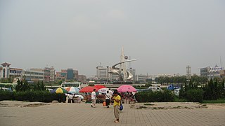
Longyao County is a county in southwestern Hebei province, China. It is under the administration of Xingtai City, with a population of 490,000 residing in an area of 749 km2 (289 sq mi). It was combined from Longping County and Yaoshan County in 1947.

Xifeng County is a county in the northeast of Liaoning province, China, bordering Jilin to the north and east. It is under the administration of the prefecture-level city of Tieling, with an area of 2,699 square kilometres (1,042 sq mi) and a population of 340,000.

Pingxiang County is a county under the administration of the prefecture-level city of Xingtai, in the south of Hebei province, China, located about 45 km (28 mi) from downtown Xingtai. It has a population of 280,000 residing in an area of 406 km2 (157 sq mi). In the Han dynasty, Pingxiang County was known as Julu County (钜鹿县) and was the site of the Battle of Julu in 207 BC, as well as being the birthplace of Zhang Jue and his brothers Zhang Bao and Zhang Liang, who started the Yellow Turban Rebellion in the 180s.

Wangdu is a county of west-central Hebei province, China, directly serviced by China National Highway 107. It is under the jurisdiction of the prefecture-level city of Baoding and has a population of 260,000 residing in an area of 357 km2 (138 sq mi).

Anxin is a county in central Hebei province, China. It is under the jurisdiction of Baoding City, the centre of which lies about 40 km (25 mi) to the west, and as of 2006, it has a population of 420,000 residing in an area of 726 km2 (280 sq mi). Most of Baiyang Lake is located in the county.

Rongcheng is a county in central Hebei province, China. It is under the jurisdiction of Baoding prefecture-level city. The area of the county is 311 km2 (120 sq mi), while the county seat is located in Rongcheng Town.

Yongfeng County is a county of central Jiangxi province, People's Republic of China. It is under the jurisdiction of the prefecture-level city of Ji'an.

Yongqing is a county in Hebei province, China. It is under the administration of the prefecture-level city of Langfang. It borders Guangyang District to the north, Anci District to the east, Bazhou to the south, and Gu'an County to the west, and has a population of 382,000 residing in an area of 774 km2 (299 sq mi).

Dongguang County is a county under the jurisdiction of the prefecture-level city of Cangzhou, in the east of Hebei province, People's Republic of China, bordering Shandong province to the southeast.

Cao County or Caoxian is a county in Heze City in southwestern Shandong Province, China. It borders Henan Province to the west.

Qing County or Qingxian, or Qingxian, is a county in the east of Hebei province, China, bordering Tianjin to the north. It is under the administration of Cangzhou prefecture-level city, with a population of 390,000 residing in an area of 968 km2 (374 sq mi). G2 Beijing–Shanghai Expressway, which is concurrent with G3 Beijing–Taipei Expressway in the province, as well as China National Highway 104, pass through the county.

Suning County is a county in the central part of Hebei province, China. It is under the administration of the prefecture-level city of Cangzhou, and as of 2004, it had a population of 330,000 residing in an area of 497 km2 (192 sq mi).

Wei County or Weixian is a county in the south of Hebei province, China. It is under the administration of the prefecture-level city of Xingtai, with a population of 540,000 residing in an area of 994 km2 (384 sq mi). It is served by G45 Daqing–Guangzhou Expressway and China National Highway 106.
Cheng'an is a county of southern Hebei province, China. It is under the administration of Handan City, about 25 km (16 mi) to the northwest.

Feixiang is a district of southern Hebei province, China, served directly by China National Highway 309. It is under the administration of Handan City, with a population of 310,000 residing in an area of 496 km2 (192 sq mi).
Guangping County (simplified Chinese: 广平县; traditional Chinese: 廣平縣; pinyin: Guǎngpíng Xiàn; lit. 'broad flatness' is a county of southern Hebei province, China. It is under the administration of Handan City, and as of 2006, has a population of 260,000 residing in an area of 320 km2.
Guantao County is a county of southern Hebei province, China, bordering Shandong's Guan County and Linqing to the east across the Wei Canal (卫运河). It is under the administration of Handan City, and has a population of 320,000 residing in an area of 456 km2 (176 sq mi). Jinan lies 160 kilometres (99 mi) to the east, Handan 75 km (47 mi) to the west, and Beijing 420 km (260 mi) to the north, and the county is served by G22 Qingdao–Lanzhou Expressway and China National Highways 106 and 309. The area was formerly part of Shandong Province.

Quzhou is a county under the administration of the prefecture-level city of Handan, in the south of Hebei Province, China. It has a population of 400,000 residing in an area of 667 km2 (258 sq mi).

Nong'an County is a county of Jilin Province, Northeast China, it is under the administration of the prefecture-level city of Changchun, the capital of Jilin. The westernmost county-level division of Changchun City, it borders Dehui to the east, Kuancheng and Luyuan Districts to the southeast, as well as the prefecture-level cities of Siping to the southwest and Songyuan to the northwest.
Wangqing County is a county of southeastern Jilin province, China. It is under the administration of the Yanbian Korean Autonomous Prefecture. The county's name Wangqing comes from the Manchu language meaning fortress.


