Hawley Heights, Florida

Last updated

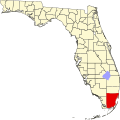
Hawley Heights is a neighborhood of Kendall, [1] a CDP and unincorporated community in Miami-Dade County, Florida, United States. It is located west of Pinecrest, and just south of Green-Mar Acres, a neighboring neighborhood.

Contents

Language

The Hawley Heights / Howard neighborhood exhibits linguistic diversity, with residents speaking a variety of languages. These languages represent the preferences of individuals when communicating within their homes and with their families. The predominant language in this neighborhood is Spanish, spoken in approximately 49.3% of households. English, Russian, Chinese, and Portuguese are also significant languages spoken by residents in this area. [2]

Geography

Hawley Heights is located at 25°39′40″N80°20′38″W / 25.661°N 80.344°W / 25.661; -80.344 , with an elevation 10 feet (3.0 m). [3]

Related Research Articles

<span class="mw-page-title-main">Brownsville, Florida</span> Census-designated place in Florida, United States

Brownsville is an unincorporated community and census-designated place (CDP) in metropolitan Miami, Florida, United States. As of the 2010 census, the population was 16,583, up from 15,313 in 2010. After three decades of population loss, Brownsville gained population for the first time in over 40 years in the 2010 US Census.

<span class="mw-page-title-main">El Portal, Florida</span> Village in Florida

El Portal is a village in Miami-Dade County, Florida, United States. The name is derived from the Spanish term for "the gate", after two wooden gates that once stood as a gateway to the village. El Portal was originally annexed into the city of Miami in 1925. With the arrival of the Great Depression, Miami gave up its jurisdiction, and El Portal was incorporated as its own village in 1937. The village is part of South Florida's Miami metropolitan area. As of the 2020 census, the population of El Portal was 1,986, down from 2,325 in 2010.

<span class="mw-page-title-main">Glenvar Heights, Florida</span> Census-designated place in Florida, United States

Glenvar Heights is a census-designated place (CDP) and neighborhood in Miami-Dade County, Florida, United States. The population was 20,786 at the 2020 census, up from 16,898 in 2010. The community is served by the Miami ZIP codes 33143 and 33155.

<span class="mw-page-title-main">Kendale Lakes, Florida</span> Census-designated place in Florida, United States

Kendale Lakes is a census-designated place (CDP) and a suburb of Miami in Miami-Dade County, Florida, United States. The population was 55,646 at the 2020 census.

<span class="mw-page-title-main">Kendall, Florida</span> Census-designated place in Florida, United States

Kendall is an unincorporated area and census-designated place in Miami-Dade County, Florida. At the 2020 census, the area had a population of 80,241.

<span class="mw-page-title-main">Kendall West, Florida</span> Census-designated place in Florida, United States

Kendall West is a census-designated place and unincorporated community in Miami-Dade County, Florida, west of the Florida Turnpike. The population was 36,536 at the 2020 census.

<span class="mw-page-title-main">Pinecrest, Florida</span> Village in Miami-Dade County, Florida

Pinecrest is a suburban village in Miami-Dade County, Florida, United States. The village is part of South Florida's Miami metropolitan area. As of the 2020 census the population was 18,388.

<span class="mw-page-title-main">Richmond Heights, Florida</span> Census-designated place in Florida, United States

Richmond Heights is a census-designated place (CDP) in Miami-Dade County, Florida, United States. The population was 8,944 at the 2020 census.

<span class="mw-page-title-main">Sunset, Florida</span> Census-designated place in Florida, United States

Sunset is a census-designated place (CDP) in Miami-Dade County, Florida, United States. The population was 15,912 at the 2020 census. The U.S. Postal Service uses the ZIP Codes of 33173 and 33183 for Sunset.

<span class="mw-page-title-main">The Crossings, Florida</span> CDP in Florida, United States

The Crossings is a census-designated place (CDP) and suburb of Miami in Miami-Dade County, Florida, United States. The population was 23,276 at the 2020 census. The CDP includes the neighborhoods of The Crossings, Devon Aire and Calusa.

<span class="mw-page-title-main">Three Lakes, Florida</span> Census-designated place in Florida, United States

Three Lakes is a census-designated place (CDP) in Miami-Dade County, Florida, United States. The population was 16,540 at the 2020 census, up from 15,047 in 2010. Its name comes from the planned community of Three Lakes, which is located inside Three Lakes CDP boundaries.

<span class="mw-page-title-main">University Park, Florida</span> Neighborhood and Former CDP in Miami-Dade, Florida, United States

University Park is a neighborhood and former census-designated place (CDP) located in an unincorporated area of western Miami-Dade County, Florida, United States. It was merged into Westchester CDP for the 2020 U.S. Census. In 2010, the population was 26,995. It encompasses the Modesto A. Maidique Campus of Florida International University and the Fair Expo Center, and was the former name of the former's campus.

<span class="mw-page-title-main">West Miami, Florida</span> City in Florida, United States

West Miami is a city in Miami-Dade County, Florida, United States. The city is part of South Florida's Miami metropolitan area. The population was 7,233 at the 2020 census, up from 5,965 in 2010.

<span class="mw-page-title-main">Allapattah</span> Neighborhood of Miami in Miami-Dade County, Florida, United States

Allapattah is a neighborhood, located mostly in the city of Miami, Florida in metropolitan Miami. As of May 2011, the county-owned portion of Allapattah, from State Road 9 to LeJeune Road, is being annexed by the city proper.

<span class="mw-page-title-main">Liberty City (Miami)</span> Neighbourhood in Miami, Florida, US

Liberty City is a neighborhood in Miami, Florida, United States. The area is roughly bound by NW 79th Street to the north, NW 27th Avenue to the west, the Airport Expressway to the South, and Interstate 95 to the east. The neighborhood is home to one of the largest concentrations of African Americans in South Florida, as of the 2000 census. Although it was often known as "Model City" both historically and by the City of Miami government, residents more commonly call it Liberty City.

<span class="mw-page-title-main">Palmetto Bay, Florida</span> Village in Florida

Palmetto Bay is a suburban incorporated village in Miami-Dade County, Florida, United States. Palmetto Bay includes two neighborhoods that were former census-designated places, Cutler and East Perrine. The village is part of South Florida's Miami metropolitan area. The population was 24,439 as of the 2020 US census.

<span class="mw-page-title-main">Dadeland</span>

Dadeland is a commercial district and urban neighborhood similar to an edge city, amid the sprawling metropolitan Miami suburbs of Kendall, Glenvar Heights, and Pinecrest, in the U.S. state of Florida, at the end of the Metrorail line.

<span class="mw-page-title-main">Buena Vista (Miami)</span> Neighborhood of Miami in Miami-Dade County, Florida, United States

Buena Vista is a neighborhood in Miami, Florida, United States. It is located south of Little Haiti, north of the Miami Design District.

<span class="mw-page-title-main">Coral Way</span> Neighborhood within Miami, Florida, US

Coral Way is a neighborhood within Miami, Florida that is defined by Coral Way, a road established by Coral Gables founder George E. Merrick during the 1920s. It is located in Miami-Dade County, Florida.

Howard was a predominantly low income African-American neighborhood of Kendall, an unincorporated community and CDP located in Miami-Dade County, Florida, United States. It is located just west of downtown Pinecrest, and just north of The Falls, a shopping mall.

References

  1. "Hawley Heights, Kendall, FL Real Estate & Homes For Sale | Trulia". Trulia Real Estate Search. Retrieved March 31, 2020.
  2. "Hawley Heights & Howard Miami, FL 33176, Neighborhood Profile - NeighborhoodScout". www.neighborhoodscout.com. Retrieved July 3, 2023.
  3. Hawley Heights, FL Community Profile

25°39′40″N80°20′38″W / 25.661°N 80.344°W / 25.661; -80.344