Headon cum Upton

Last updated

Headon cum Upton
Civil parish
Village sign, Upton - geograph.org.uk - 4129513.jpg
Village sign
Headon cum Upton
Parish map
Nottinghamshire UK location map.svg
Red pog.svg
Headon cum Upton
Location within Nottinghamshire
Area3.66 sq mi (9.5 km2)
Population192 (2021 Census)
  Density 52/sq mi (20/km2)
OS grid reference SK 74900 76985
  London 125 mi (201 km)  SE
District
Shire county
Region
Country England
Sovereign state United Kingdom
Settlements Headon
Upton
Nether Headon
Post town RETFORD
Postcode district DN22
Dialling code 01777
UK Parliament
List of places
UK
England
Nottinghamshire
53°17′02″N0°52′37″W / 53.284°N 0.877°W / 53.284; -0.877

Headon cum Upton is a civil parish in the Bassetlaw district, in the county of Nottinghamshire, England. The parish includes the villages of Headon, Upton and the hamlet of Nether Headon. The parish is adjacent to Askham, Gamston, East Drayton, Eaton, Grove, Rampton and Woodbeck, Stokeham and Treswell. [1] In the 2021 census, the parish had a population of 192. [2] The area is 3.5 miles south east of the nearest market town Retford, 26 miles north east of the county town Nottingham and 125 miles north of London. Headon cum Upton shares a parish council with Grove and Stokeham. [3] There are 6 listed buildings in Headon cum Upton.

Contents

Toponymy

Headon was known as Hedun in the Domesday Book and is possibly derived from the Old English for high hill. [4]

Upton was also in Domesday as Upetun, and may have referred to an 'Up Farm' or 'Up town'. [5]

Nether Headon means 'under Headon'.

Geography

Location

The parish lies in the north east portion of the Nottinghamshire county and southern area of Bassetlaw district. It is one of the larger parishes in Bassetlaw, with almost 3000 acres.

It is surrounded by the following local areas:

Settlements

The parish consists of three settlements and a mixed use area:

Headon

This is the historic village in the area. Primarily residential with several farms, it is located in the southern centre of the parish, and clustered around three roads - Yew Tree Road and Thorpe Street, with the community amenities of a church and village hall on Church Street.

Upton

The hamlet is a linear settlement in the very south of the parish, ¾ km (0.46 mi) south of Headon. It is predominantly laid out along Main Street for ½ km (0.31 mi). The area is mainly a mix of residential, farm houses and agricultural buildings. There are some farm houses and cottages on the fringes of the location but there is very little by way of public facilities.

Nether Headon

This hamlet is ½ km (0.31 mi) to the north of Headon. Primarily residential and agricultural, it is a linear settlement aligned to Greenspotts Lane.

Ladywell Rise/Nether Headon Camp

This is a former World War II era prisoner of war camp which afterwards was converted into a primarily industrial area with some residential plots, located north of Lady Well Lane. It is considered a distant portion of Nether Headon. [6] and includes a number of tenanted residential housing fronting the road, with industrial properties mainly further inset of the site.

Landscape

Upton Upton, Main Street - geograph.org.uk - 211265.jpg
Upton

Predominantly, many of the parish residents are clustered around the villages. Outside of these is a scattering of farms, farmhouses and cottages amongst a wider rural setting. Some small wooded areas exist, mainly to the north of the villages.

The parish is low-lying. The land height is lowest in the south east corner of the parish, at around 20 metres (66 ft). The highest points are Lodge Field Clump and Mill Hill both at 70 metres (230 ft) in the north and east of the parish respectively, these providing clear views of the Trent Valley and the wider region. The villages all lay within the 30–35 metres (98–115 ft) range, with the church and village hall on a small peak within Headon.

The North Beck stream forms much of the north eastern edge of the parish.

Headon Manor, at Nether Headon Headon Manor - geograph.org.uk - 211291.jpg
Headon Manor, at Nether Headon

Governance and demographics

Headon, Upton and Nether Headon/Ladywell Rise form discrete settlements.

However, together these are within Headon cum Upton parish for administrative identity.

For population purposes the parish reports a total of 192 residents in the 2021 census. [2]

It is managed at the first level of public administration by the combined Headon, Grove & Stokeham Parish Council, for wider area neighbourhood purposes it is abbreviated to HUGS. [7]

At district level, this is managed by Bassetlaw District Council.

Nottinghamshire County Council governs the wider area, managing the highest level of local services.

History

Local fields have unearthed flint tools, showing the area was settled in for at least 5000 years or more. Several Roman pottery pieces excavated prove there were people living in the locality during Roman times. With Viking invasions the hamlet of Thorpe was eventually formed, and there was some proof that Saxons and Danes were living alongside each other, with Danish words naming local fields such as the Wong and Gooseholm. The other two villages of "up town" (Upton) and Nether Headon eventually were formed from population expansion.

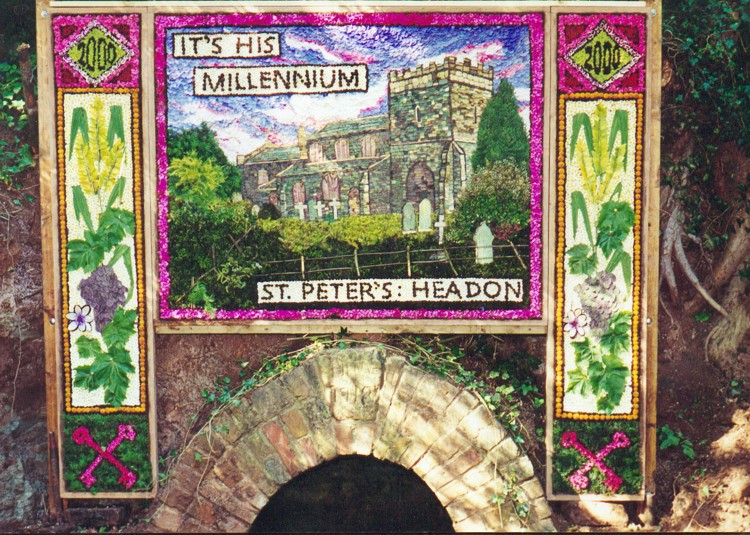
Headon was recorded in the Domesday Book, being relatively notable due to six thegns or nobles being noted, each of whom had a hall. Domesday also lists that Headon had a sizeable population. This is shown by the size of the Church of St Peter, which was much larger in medieval times. The church was first reported as being in the village by 1171. An Anglo-Saxon burial mound exists in Gamston wood near the parish boundary, with another possibly at Lodge Field Clump.

There is a possible association to Robin Hood. Present day Manor Farm is probably the site of the original village manor, and remains of a moat are near this. Simon de Headon owned the manor in the 13th century and his son Gerard both became sheriffs of Nottinghamshire (in 1259,1267 and 1269) so one of them may have been a rival of Robin Hood's. A tomb cover depicting a knight in chain mail armour was found outside Headon church during the 1980s. It dates from c.1275, and likely belonged to one of the de Headons.

The Dumblehole is part of the footpath leading from Nether Headon to Grove. Remains of fish ponds which belonged to the de Headons can still be seen alongside the Dumblehole. Mill Hill Clump was once the site of a windmill. In 1710 Sir Hardolph Wasteneys built Headon Hall within the grounds of Headon Park, which was designed by Sir Thomas Hewitt. In 1792, the heir of the lordship, and son of local MP Gervase Eyre, Anthony Hardolph Eyre, demolished the Hall. [8] He founded a school near the site which later on became the East West Cottage. During his time oak and ash tree plantations were established and hop yards and gypsum quarries provided employment for locals, by which time in 1798 numbered 286.

With a well head, archway and trough, and constructed in red brick and ashlar Lady Well is said to be of medieval origin, though its present outer materials dates from the 18th and 19th centuries with a keystone inscribed date of 1718. South of this, a clay pit and brick yard also existed in Nether Headon, with the Brickyard Farm presently on the upper edge of the site.

In 1818 some 3000 acres of open field in Headon and Upton were enclosed by Act of Parliament, creating the present layout by planting thorn hedges, digging drainage ditches and closing off footpaths. The Harcourt Vernons were successors to the Eyres, [9] and built a new school for the village around the start of the 20th century. The school also functioned as a community centre from the beginning. The Grove Estate was sold by auction in 1946, and Headon village bought the school, via local subscriptions.

Three council houses were built by 1958, allowing for the demolition of the Sparrow Barracks cottages. Two bungalows, intended for elderly residents was subsequently built in the cleared area. [10]

Nether Headon PoW Camp

Prior to the 1940s, the area remained as undeveloped agricultural land. In 1940-1944 the camp was constructed during WWII to hold prisoners of war. It was alternatively known as POW Camp 52. The camp was one of only a small number of this type in Nottinghamshire and the only such site in the district which is substantially intact (the other local sites were at Serlby Hall, Carlton Hall at Carlton-in-Lindrick, Norton and Carburton). Local records recorded German and Italian prisoners on site during the war and in the immediate period after. Although a number of the camp buildings on the site have been demolished, the overall layout and composition of the camp is still intact, including a still intact water tower.

The main entrance was off Ladywell Lane, with a main access road heading northwards with small units either side (possibly workshops and other non-accommodation buildings). Towards the north end of the site were 3 rows of barracks, where the POWs would have resided. Immediately south of this was a fourth row of buildings, which included shower blocks which have partially survived. Some of the service buildings such as the chapel (which according to local residents was a building at the western end of the site) have been demolished. To the east of the site is a large water tower and outside of the prisoner part of the site, to the east was the officers’ mess and administration buildings. Further buildings exist in the south west corner of the site, although their original function is unknown. The buildings towards the front appear to have been further administration buildings. [11] The precise date that the camp was redeveloped as an industrial estate is unknown, however it is likely that this transformation was gradual, with former POW buildings being progressively converted to industrial uses, [12] with civil use recorded since the 1950-60s. [13]

Culture and community

There is a village hall in Headon. Originally the Headon National School built at the turn of the 20th century, it replaced the previous school on the site of Headon Hall, The school closed in 1959 and subsequently converted into the village hall. [10]

The Lady Well on Ladywell Lane has occasionally given a well dressing for church fundraising events. It is a regional ritual which was carried out throughout 1981-1991 and more recently in celebration of the millennium. [10]

Religious sites

There is one church in the parish, at Headon village. The Church of England parish church dedicated to St Peter, although recorded as being in the village from earlier, has 13th-century Anglo-Saxon features.

Economy

Landmarks

Listed structures

Several buildings and structures throughout the parish are listed as features of historical interest, [15] notably:

Related Research Articles

<span class="mw-page-title-main">Retford</span> Market town in Nottinghamshire, England

Retford, also known as East Retford, is a market town in the Bassetlaw District in Nottinghamshire, England. It lies on the River Idle and the Chesterfield Canal. Retford is 26 miles (42 km) east of Sheffield, 23 miles (37 km) west of Lincoln and 31 miles (50 km) north-east of Nottingham. The population at the 2021 census was 23,740. Retford railway station is on the East Coast Main Line and the town is bypassed by the A1 road.

<span class="mw-page-title-main">Bassetlaw Wapentake</span>

Bassetlaw was a wapentake in the English county of Nottinghamshire. The wapentake covered an area in the north of the county, roughly equivalent to the modern Bassetlaw local government district. The wapentake was divided into the divisions of Hatfield, North Clay and South Clay.

<span class="mw-page-title-main">Upton, Bassetlaw</span>

Upton is a small village in the English county of Nottinghamshire. It is located north of Askham and south of Headon; with the latter it forms the civil parish of Headon cum Upton. The population of this civil parish at the 2011 census was 253.

<span class="mw-page-title-main">A638 road</span> Road in England

The A638 is a major road in England. It runs between the A1 at Markham Moor, Nottinghamshire and Chain Bar Interchange – Junction 26 of the M62 motorway, south of Bradford in West Yorkshire.

<span class="mw-page-title-main">Gamston, Bassetlaw</span> Human settlement in England

Gamston is a village and civil parish four miles south of Retford in the English county of Nottinghamshire. The village lies on the A638 road between Retford and the Markham Moor junction with the A1 and the A57 roads. The population of the civil parish as at the 2011 Census was 246. The River Idle lies to the west of the village.

<span class="mw-page-title-main">St Peter's Church, Headon-cum-Upton</span> Church

St. Peter's Church, Headon-cum-Upton is a parish church in the Church of England in Headon, Nottinghamshire.

<span class="mw-page-title-main">Our Lady and St Peter's Church, Bothamsall</span> Church in Bothamsall, England

Our Lady and St Peter's Church, Bothamsall is a Grade II listed parish church in the Church of England in Bothamsall. The church is part of the Lound Hall Estate, Bothamsall. The buildings repair costs are procured by the Lord of the manor.

<span class="mw-page-title-main">St Peter's Church, Gamston</span> Church in Bassetlaw, England

St Peter's Church, Gamston is a Grade I listed parish church in the Church of England in Gamston, Bassetlaw.

<span class="mw-page-title-main">St Paul's Church, West Drayton</span> Church in Nottinghamshire, England

St Paul's Church is a Grade II* listed parish church in the Church of England in West Drayton, Nottinghamshire.

<span class="mw-page-title-main">All Saints' Church, South Leverton</span> Church in South Leverton, England

All Saints’ Church, South Leverton is a Grade II* listed parish church in the Church of England in South Leverton, Nottinghamshire.

<span class="mw-page-title-main">Stokeham</span> Village and civil parish in Nottinghamshire. England

Stokeham is a small village and civil parish in the Bassetlaw district,: in the county of Nottinghamshire, England. In 1961 the parish had a population of 66. Stokeham was recorded in the Domesday Book as Estoches.

<span class="mw-page-title-main">Rampton and Woodbeck</span> Civil parish in England

Rampton and Woodbeck is a civil parish in the Bassetlaw district, within the county of Nottinghamshire, England. The overall area had a population of 1,077 at the 2021 census. The parish lies in the north east of the county. It is 125 miles north west of London, 27 miles north east of the city of Nottingham, and 5 miles south east of the town of Retford. The parish rests alongside the county border with Lincolnshire. It is the site of Rampton Secure Hospital, which is one of only three high security psychiatric hospitals in England.

<span class="mw-page-title-main">Woodbeck</span> Human settlement in England

Woodbeck is a village within the Rampton and Woodbeck civil parish of the Bassetlaw district, within the county of Nottinghamshire, England. The overall area had a population of 1,139 at the 2011 census. The village lies in the north east of the county. It is 125 miles north west of London, 27 miles north east of the city of Nottingham, and 5 miles south east of the town of Retford. It is the site of Rampton Secure Hospital, which is one of only three high security psychiatric hospitals in England.

<span class="mw-page-title-main">Headon, Nottinghamshire</span> Human settlement in England

Headon is a village in Headon cum Upton civil parish, in the Bassetlaw district, of the county of Nottinghamshire, England. The village is adjacent to the villages of Upton, Nether Headon, East Drayton, Eaton, Gamston, Woodbeck and Stokeham. In 2011 the parish, together with Stokeham had a population of 253. The area is 3.5 miles south east of the nearest market town Retford, 26 miles north east of the county town Nottingham and 125 miles north of London. There are 2 listed buildings in Headon village.

<span class="mw-page-title-main">Nether Headon</span> Human settlement in England

Nether Headon is a hamlet in Headon cum Upton civil parish, within the Bassetlaw district, of the county of Nottinghamshire, England. It is 3.5 miles south east of the nearest market town Retford, 26 miles north east of the county town Nottingham and 125 miles north of London. The hamlet is adjacent to the villages of Upton, Headon, East Drayton, Eaton, Grove, Woodbeck and Stokeham. In 2011 the parish, together with Stokeham had a population of 253.

<span class="mw-page-title-main">Little Gringley</span> Hamlet in Nottinghamshire, England

Little Gringley is a hamlet in the Bassetlaw district of northern Nottinghamshire, England. It is 130 miles (210 km) north of London, 27 miles (43 km) north east of the county town and city of Nottingham, and 1+34 miles (2.8 km) east of the nearest town Retford.

There are a number of listed buildings in Nottinghamshire. The term "listed building", in the United Kingdom, refers to a building or structure designated as being of special architectural, historical, or cultural significance. Details of all the listed buildings are contained in the National Heritage List for England. They are categorised in three grades: Grade I consists of buildings of outstanding architectural or historical interest, Grade II* includes significant buildings of more than local interest and Grade II consists of buildings of special architectural or historical interest. Buildings in England are listed by the Secretary of State for Culture, Media and Sport on recommendations provided by English Heritage, which also determines the grading.

Headon cum Upton is a civil parish in the Bassetlaw District of Nottinghamshire, England. The parish contains six listed buildings that are recorded in the National Heritage List for England. Of these, one is listed at Grade I, the highest of the three grades, and the others are at Grade II, the lowest grade. The parish contains the settlements of Headon, Upton and Nether Headon, and the surrounding countryside. The listed buildings consist of two cottages, two farmhouses, a church and a well.

References

  1. "Headon cum Upton". Ordnance Survey. Retrieved 29 November 2020.
  2. 1 2 UK Census (2021). "2021 Census Area Profile – Headon cum Upton parish (E04007815)". Nomis. Office for National Statistics . Retrieved 12 January 2024.
  3. "Headon cum Upton, Grove and Stokeham Parish Council". Nottinghamshire County Council . Retrieved 27 November 2020.
  4. GENUKI. "Genuki: Headon, Nottinghamshire". www.genuki.org.uk. Retrieved 28 November 2020.
  5. "Upton :: Survey of English Place-Names". epns.nottingham.ac.uk. Retrieved 28 November 2020.
  6. "Headon, Upton, Grove & Stokeham (HUGS) Neighbourhood Plan 2018 - 2035 - Map 3: House types in Nether Headon" (PDF). p. 17.
  7. S80 2AH, Phil Mitchell, Bassetlaw District Council, Queen's Buildings, Potter Street, Worksop, Notts. "HUGS neighbourhood plan MADE". Bassetlaw District Council. Retrieved 28 November 2020.{{cite web}}: CS1 maint: multiple names: authors list (link) CS1 maint: numeric names: authors list (link)
  8. Sites (www.communitysites.co.uk), Community. "Headon Hall | Retford | Notts Places | Our Nottinghamshire". www.ournottinghamshire.org.uk. Retrieved 29 November 2020.
  9. "Biography of Granville Harcourt Vernon (1792-1879) - The University of Nottingham". www.nottingham.ac.uk. Retrieved 29 November 2020.
  10. 1 2 3 "HUGS assessment profile" (PDF).
  11. "HUGS character assessment" (PDF).
  12. "APPLICATION FOR THE CONTINUED USE OF THE EXISTING INDUSTRIAL SITE AND BUILDINGS FOR THE PRODUCTION OF A RANGE OF WOOD FUEL PRODUCTS AND FOR THE IMPORTATION AND PROCESSING OF WASTES TO PRODUCE A RANGE OF RECOVERED FUEL PRODUCTS AT HEADON CAMP INDUSTRIAL ESTATE LADY WELL LANE HEADON RETFORD NOTTINGHAMSHIRE".
  13. "Why people occupy Headon Camp" (PDF).
  14. "Microlight Training | Microlight Flying Lessons | Trial Flights | Microlight Aviation |". Microflight Aviation School. Retrieved 29 November 2020.
  15. "Listed Buildings in Headon cum Upton, Bassetlaw, Nottinghamshire". britishlistedbuildings.co.uk. Retrieved 29 November 2020.