
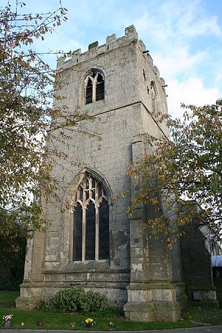
Scrooby is a small village on the River Ryton in north Nottinghamshire, England, near Bawtry in South Yorkshire. At the time of the 2001 census it had a population of 329, in 2011 the count was 315 and by the 2021 census this had fallen further to 307 residents. Until 1766, it was on the Great North Road so became a stopping-off point for numerous important figures including Queen Elizabeth I and Cardinal Wolsey on their journeys. The latter stayed at the Manor House briefly, after his fall from favour.

Pilton is a village and civil parish in Somerset, England, situated on the A361 road in the Mendip district, 3 miles (5 km) south-west of Shepton Mallet and 6 miles (10 km) east of Glastonbury. The village has a population of 998. The parish includes the hamlets of West Compton, East Compton, Westholme, Beardly Batch and Cannards Grave.
Chilwell is a suburban area and former civil parish in the borough of Broxtowe in Nottinghamshire, England. It lies on the west side of the town of Beeston and is 4 miles (6.4 km) south-west of the centre of Nottingham.

North Leverton with Habblesthorpe is a village and civil parish in the English county of Nottinghamshire. It is about 5 miles or 8 km east of Retford. The population as at the 2011 Census was 1,047, and in the Census 2021 it had increased to 1,079.
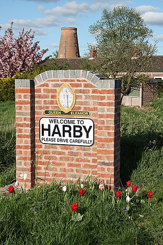
Harby is a village and civil parish in the Newark and Sherwood district of Nottinghamshire, England. It is close to Doddington, Lincolnshire, and is the easternmost settlement in Nottinghamshire, the boundary separating the two. According to the 2011 census, it had a population of 336, up from 289 at the 2001 census. It increased to 346 at the 2021 census.

Colwick is a village and civil parish, in the Borough of Gedling of Nottinghamshire, England. It is situated to the east of Nottingham's city boundary, and forms the Colwick ward. At the time of the 2011 census, the village had a population of 2,829, falling to 2,778 at the 2021 census.
Ault Hucknall is a village and civil parish in the Bolsover district of Derbyshire, England. The population of the civil parish at the 2011 census was 1,053.

Saxilby is a village and civil parish in the West Lindsey district of Lincolnshire, England, about 6 miles (9.7 km) north-west from Lincoln, on the A57 road at the junction of the B1241. It is part of the civil parish of Saxilby and Ingleby, which includes the village of Ingleby. The population of the civil parish in 2001 was 3,679, increasing to 3,992 at the 2011 census.

Broadholme is a village and civil parish in the West Lindsey district of Lincolnshire, England. It is situated 5 miles (8 km) west from the city and county town of Lincoln, and less than 1 mile (1.6 km) south from the A57 road and the village of Saxilby. According to the 2001 census it had a population of 88. At the 2011 census, the population remained less than 100 and is now included in the civil parish of Scampton.
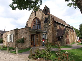
Saughall is a village and former civil parish in the unitary authority area of Cheshire West and Chester and the ceremonial county of Cheshire, England. Located between Shotwick and Blacon, it is approximately 4.8 km (3.0 mi) north west of Chester and 1.8 km (1.1 mi) from Sealand across the Welsh border.

Eakring is a village and civil parish in the Newark and Sherwood district of Nottinghamshire, England. Its population at the 2011 census was 419, and this increased to 440 residents for the 2021 census. There was sizeable oil production there in the mid-20th century.

South Leverton is a village and civil parish in Bassetlaw, north Nottinghamshire, England, four miles from Retford. According to the 2001 census it has a population of 478, increasing marginally to 480 at the 2011 census, and more substantially to 514 at the 2021 census.

Cottam is a village and civil parish in Nottinghamshire 8 miles east of Retford within the Bassetlaw district. The name is pronounced 'Cotum' locally.
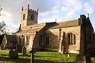
North Wheatley is a village and former civil parish, now in the parish of North and South Wheatley, in Bassetlaw district, in the county of Nottinghamshire, England. At the time of the 2001 census it had a population of 489, increasing to 509 at the 2011 census. It is located 6 miles north-east of Retford. The village has a number of 17th century brick houses. The Old Hall on Low Street/Church Hill is dated 1673, with the arms of the Cartwright family. The parish church of St Peter and St Paul was restored in 1896. Many farms in the area have dovecotes, either as free-standing buildings or above farm buildings. On 1 April 2015 the civil parish was merged with South Wheatley to form "North and South Wheatley".

Kettlethorpe is a village and civil parish in the West Lindsey district of Lincolnshire, England. It is situated 10 miles (16 km) west of Lincoln. The villages of Drinsey Nook and Laughterton lie within Kettlethorpe parish. The population of the civil parish taken at the 2011 census was 426.

Drinsey Nook is a small village in the West Lindsey district of Lincolnshire, England. It is situated approximately 2 miles (3 km) south-west from Saxilby, close to the county border with Nottinghamshire. The village sits on the bank of the east of Lincoln section of the Foss Dyke, a canal which runs from the River Trent to the River Witham. The population of the village is included in the civil parish of Kettlethorpe. The main building is the former Drinsey Nook Inn which is actually situated in Nottinghamshire; this was previously known as the 'Buffalo Inn' on old Ordnance Survey maps.

Plungar is a village and former civil parish, now in the parish of Redmile, and the Melton district of Leicestershire, England. It is about 9 miles (14 km) north of the market town of Melton Mowbray and 7 miles (11 km) west from Grantham. Plungar is adjacent to the Grantham Canal and stands in the Vale of Belvoir. In 1931 the parish had a population of 205.

Thorney is a village and civil parish about 10 miles (16 km) north of Newark-on-Trent, in the Newark and Sherwood district, in the county of Nottinghamshire, England. The settlement is close to the eastern edge of the county. In the census of 2011, the parish had a population of 248, falling to 228 at the 2021 census. A small portion of Drinsey Nook mainly in Lincolnshire falls into the parish to the north, Thorney Moor is a hamlet to the south of the parish area. The parish borders other nearby parishes including Wigsley, Kettlethorpe, Newton on Trent, Saxilby with Ingleby, Harby, North Clifton, South Clifton and Hardwick.

Rampton and Woodbeck is a civil parish in the Bassetlaw district, within the county of Nottinghamshire, England. The overall area had a population of 1,077 at the 2021 census. The parish lies in the north east of the county. It is 125 miles north west of London, 27 miles north east of the city of Nottingham, and 5 miles south east of the town of Retford. The parish rests alongside the county border with Lincolnshire. It is the site of Rampton Secure Hospital, which is one of only three high security psychiatric hospitals in England.
Clarborough and Welham is a civil parish in the Bassetlaw district, in the county of Nottinghamshire, England. The parish includes the village of Clarborough and the hamlet of Welham. In 2021 the parish had a population of 1,041. It is 130 miles north of London, 28 miles north east of the city of Nottingham, and 2 miles north east of the market town of Retford. The parish touches Hayton, North and South Wheatley, North Leverton with Habblesthorpe and Sturton Le Steeple. There are 14 listed buildings in Clarborough and Welham.


