Hells Gate State Park

Last updated

Hells Gate State Park
IUCN category V (protected landscape/seascape)
Hells Gate State Park logo.png
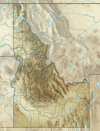
USA Idaho relief location map.svg
Red pog.svg
Location in Idaho
Usa edcp relief location map.png
Red pog.svg
Location in the United States
Location Nez Perce County, Idaho, United States
Nearest city Lewiston, Idaho
Coordinates 46°21′29″N117°03′34″W / 46.3580°N 117.0594°W / 46.3580; -117.0594 [1]
Area960 acres (390 ha) [1]
Elevation733 ft (223 m) [1]
Designation Idaho state park
Established1973 [2]
Administrator Idaho Department of Parks and Recreation
Website Hells Gate State Park

Hells Gate State Park is a public recreation area located on the southern edge of Lewiston, Idaho, at the Snake River's downstream entrance to Hells Canyon, the deepest canyon in North America. The state park was created by the U.S. Army Corps of Engineers to mitigate the construction of the Lower Granite Dam; the Idaho Department of Parks and Recreation began leasing the site in 1973. [2] The park's 960 acres (390 ha) offer trails for hiking, mountain biking, and horseback riding as well as opportunities for camping, picnicking, fishing, boating, swimming, and taking jet boat trips into the canyon. The park sits at the lowest elevation of any Idaho state park, at 733 feet (223 m) above sea level. [1]

Contents

See also

Related Research Articles

<span class="mw-page-title-main">Snake River</span> Major river in the northwestern United States

The Snake River is a major river of the greater Pacific Northwest region in the United States. At 1,078 miles (1,735 km) long, it is the largest tributary of the Columbia River, in turn, the largest North American river that empties into the Pacific Ocean. The Snake River rises in western Wyoming, then flows through the Snake River Plain of southern Idaho, the rugged Hells Canyon on the Oregon–Idaho border and the rolling Palouse Hills of Washington, emptying into the Columbia River at the Tri-Cities in the Columbia Basin of Eastern Washington.

<span class="mw-page-title-main">Hells Canyon</span> Canyon in the western United States

Hells Canyon is a ten-mile-wide (16 km) canyon in the Western United States, located along the border of eastern Oregon, a small section of eastern Washington and western Idaho. It is part of the Hells Canyon National Recreation Area which is also located in part of the Wallowa-Whitman National Forest. It is North America's deepest river gorge at 7,993 feet (2,436 m), running deeper than the Grand Canyon in Arizona.

<span class="mw-page-title-main">Detroit Lake</span> Reservoir in Oregon, United States

Detroit Lake is a reservoir impounded by the Detroit Dam on the North Santiam River 46 miles (74 km) southeast of Salem, Oregon, United States. The lake is adjacent to Oregon Route 22 near the city of Detroit. This mesotrophic lake stores water for use by the city of Salem and other nearby communities.

Hells Gate, Hell's Gate, Hell Gate or Hells Gates may refer to:

<span class="mw-page-title-main">Lake Allatoona</span> Reservoir in Georgia, United States

Lake Allatoona is a U.S. Army Corps of Engineers reservoir on the Etowah River in northwestern part of the State of Georgia. This reservoir is mostly in southeastern Bartow County and southwestern Cherokee County. A small portion is located in Cobb County near Acworth.

<span class="mw-page-title-main">Table Rock Lake</span> Man-made lake in Missouri and Arkansas, United States

Table Rock Lake is an artificial lake or reservoir in the Ozarks of southwestern Missouri and northwestern Arkansas in the United States. Designed, built and operated by the U.S. Army Corps of Engineers, the lake is impounded by Table Rock Dam, which was constructed from 1954 to 1958 on the White River.

<span class="mw-page-title-main">Dworshak Dam</span> Dam in Idaho

Dworshak Dam is a concrete gravity dam in the western United States, on the North Fork of the Clearwater River in north central Idaho. In Clearwater County, the dam is located approximately four miles (6 km) northwest of Orofino and impounds the Dworshak Reservoir for flood control and hydroelectricity generation.

<span class="mw-page-title-main">Beech Fork State Park</span> State Park in Cabell and Wayne counties, West Virginia

Beech Fork State Park is a state park located in Cabell County and Wayne County, West Virginia. The park is located on the tailwater shores of Beech Fork Lake, a flood control impoundment of the U.S. Army Corps of Engineers on the Beech Fork of Twelvepole Creek. Since its development in the mid-1970s, Beech Fork State Park has proven to be a popular recreation spot for the residents of nearby Barboursville and Huntington, West Virginia, as well as those living in the surrounding region. The park is located about 10 miles (16 km) south of the Hal Greer Exit of Interstate 64.

<span class="mw-page-title-main">Tuttle Creek Lake</span> Kansas reservoir on the Big Blue River

Tuttle Creek Lake is a reservoir on the Big Blue River 5 miles (8 km) north of Manhattan, in the Flint Hills region of northeast Kansas. It was built and is operated by the Army Corps of Engineers for the primary purpose of flood control. Secondary functions of the project include release of water stores to maintain barge traffic on the Mississippi River during seasons of drought, maintenance of a multi-use conservation pool for fish and wildlife enhancement and recreation, and release of sufficient water in droughts to maintain water quality for downstream communities.

<span class="mw-page-title-main">Wilson Lake (Kansas)</span> Reservoir in Russell and Lincoln counties in Kansas

Wilson Lake is a reservoir in the U.S. state of Kansas, on the border of Russell County and Lincoln County. Built and managed by the U.S. Army Corps of Engineers for flood control, it is also used for wildlife management and recreation. Several parks are located along its shoreline, including Wilson State Park.

<span class="mw-page-title-main">Isabella Dam</span> Dam in Kern County, California

Isabella Dam is an embankment dam located in the Kern River Valley, about halfway down the Kern River course, between the towns of Kernville and Lake Isabella in Kern County, California.

<span class="mw-page-title-main">Canyon Lake (Texas)</span> Man-made reservoir in Texas, United States

Canyon Lake is a reservoir on the Guadalupe River in the Texas Hill Country in the United States. Canyon Lake is a U.S. Army Corps of Engineers reservoir formed on the Guadalupe River in Comal County by Canyon Dam, which is located about sixteen miles northwest of New Braunfels. The dam, lake, and all adjacent property are managed by the U.S. Army Corps Of Engineers. Water rights, waste water treatment, and hydroelectric generating facilities are managed by the Guadalupe-Blanco River Authority. Construction of the dam began in 1958 and was completed in 1964. The reservoir serves to provide flood control and water supply for the communities downstream from the dam. The lake is also a popular recreational destination.

<span class="mw-page-title-main">Hells Canyon National Recreation Area</span> United States historic place

Hells Canyon National Recreation Area is a United States national recreation area on the borders of the U.S. states of Oregon and Idaho. Managed by the U.S. Forest Service as part of the Wallowa-Whitman National Forest, the recreation area was established by Congress and signed by President Gerald Ford in late 1975 to protect the historic and archaeological values of the Hells Canyon area and the area of the Snake River between Hells Canyon Dam and the Oregon–Washington border.

<span class="mw-page-title-main">Lake Dennison Recreation Area</span> State park in Winchendon, Massachusetts

Lake Dennison Recreation Area is a 121-acre (49 ha) Massachusetts state park located in the town of Winchendon. It comprises a small portion of the 4,221 acres (1,708 ha) of the U.S. Army Corps of Engineers' Birch Hill Flood Control Project that are managed by the Department of Conservation and Recreation and that also include Otter River State Forest.

<span class="mw-page-title-main">Hells Canyon Dam</span> Dam in Wallowa County, Oregon, United States

Hells Canyon Dam is a concrete gravity dam in the western United States, on the Snake River in Hells Canyon along the Idaho-Oregon border. At river mile 247, the dam impounds Hells Canyon Reservoir; its spillway elevation is 1,680 feet (512 m) above sea level.

The Raccoon Strait is a waterway of the San Francisco Bay between Angel Island and the Tiburon Peninsula, mainland Marin County, California, United States. During the ice ages, when sea levels were considerably lower and San Francisco Bay was a grassy valley, the combined Sacramento-San Joaquin river flowed through what is now Raccoon Strait before flowing through the canyon at the Golden Gate.

<span class="mw-page-title-main">Lyons Ferry State Park</span> State park in Washington (state), United States

Lyons Ferry State Park is a public recreation area located near the confluence of the Snake and Palouse rivers, seven miles (11 km) northwest of Starbuck, Washington. The state park is on Route 261 abreast of Lake Herbert G. West, a reservoir on the Snake River created with the construction in the 1960s of the Lower Monumental Dam some 17 miles (27 km) downstream. The park offers facilities for boating, fishing, and swimming. The area is managed cooperatively by the Washington State Parks and Recreation Commission and the U.S. Army Corps of Engineers, which operates the Lyons Ferry Marina.

<span class="mw-page-title-main">John Redmond Reservoir</span> Reservoir in Coffey County, Kansas

John Redmond Reservoir is a reservoir on the Neosho River in eastern Kansas. Built and managed by the U.S. Army Corps of Engineers, it is used for flood control, recreation, water supply, and wildlife management. It borders the Flint Hills National Wildlife Refuge to the northwest.

<span class="mw-page-title-main">Lucky Peak State Park</span> State park in Idaho, United States

Lucky Peak State Park is a public recreation area covering a total of 240 acres (97 ha) on and near Lucky Peak Lake approximately ten miles (16 km) east of Boise in Ada County, Idaho. The state park has three units: Discovery Park off State Highway 21, a roadside park for picnicking and fishing in the Boise River; Sandy Point at the base of the Lucky Peak Dam, with sandy beach and calm waters for wading and swimming; and the Spring Shores unit with boat ramps and marina at the northern end of the lake. The park was created in 1956 by agreement with the United States Army Corps of Engineers, following completion of the Lucky Peak Dam. The park is also home to the Lucky Peak Dam Zeolite Occurrence.

<span class="mw-page-title-main">Kanopolis Lake</span> Reservoir in Ellsworth County, Kansas

Kanopolis Lake is a reservoir in Ellsworth County in the Smoky Hills of central Kansas, about 31 miles southwest of Salina and a few miles southeast of the town of Kanopolis. The lake is formed by Kanopolis Dam. Completed in 1948 as a flood control and water conservation project of the United States Army Corps of Engineers, the dam impounds the Smoky Hill River.

References

  1. 1 2 3 4 "Hells Gate State Park". Idaho Parks and Recreation. Retrieved October 19, 2018.
  2. 1 2 "History: State Lands in Idaho". Idaho Museum of Natural History. Retrieved March 4, 2011.