Bear Lake State Park (Idaho)

Last updated
Bear Lake State Park
DSCN6179 bearlake e.jpg
Bear Lake seen from the park
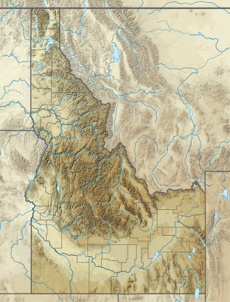
USA Idaho relief location map.svg
Red pog.svg
Location in Idaho
Usa edcp relief location map.png
Red pog.svg
Location in the United States
Location Bear Lake County, Idaho, United States
Nearest city St. Charles, Idaho
Coordinates 42°02′N111°16′W / 42.03°N 111.26°W / 42.03; -111.26 [1] [2]
Area966 acres (391 ha) [1]
Elevation5,900 ft (1,800 m) [1]
Designation Idaho state park
Established1969 [3]
Visitors162,787(in 2014-2015)
(expressed as Total Visitor Days) [4]
Administrator Idaho Department of Parks and Recreation
Website Bear Lake State Park

Bear Lake State Park (sometimes called North Beach State Park) is a public recreation area bordering the north and eastern shores of Bear Lake in the southeast corner of Bear Lake County, Idaho, near the Utah and Wyoming state lines. The state park sits across the lake from St. Charles and is fifteen miles (24 km) south of Montpelier. [1] Bear Lake National Wildlife Refuge lies adjacent to the park's north unit. [5]
Contents

History

The state purchased land for the park in 1969 using funds supplied through the Recreation and Public Purposes Act. At the same time, the North Beach unit was leased from Utah Power and Light. [3] Management of the north unit continues under lease from PacifiCorp. [6]

Wildlife

This state park is home to bonneville cisco, cutthroat trout, moose, pelicans, lake trout, deer, cranes and cougar.

Features

Bear Lake owes its turquoise blue color to the presence of suspended calcium carbonate (limestone). [3] The park's two units each have a beach over one mile (1.6 km) in length with gradually sloping lake bottom and large swimming area. Camping is offered in the east unit. In winter, the park provides ice fishing access for the annual runs of Bonneville cisco. [1]

Climate

According to the Köppen Climate Classification system, Bear Lake State Park has a warm-summer humid continental climate, abbreviated "Dfb" on climate maps. The hottest temperature recorded in Bear Lake State Park was 99 °F (37.2 °C) on July 2728, 1931, while the coldest temperature recorded was −41 °F (−40.6 °C) on February 1, 1985. [7]

Climate data for Bear Lake State Park (Lifton Pumping Station), Idaho, 1991–2020 normals, extremes 1919–present
MonthJanFebMarAprMayJunJulAugSepOctNovDecYear
Record high °F (°C)52
(11)
55
(13)
69
(21)
77
(25)
90
(32)
94
(34)
99
(37)
96
(36)
91
(33)
81
(27)
66
(19)
60
(16)
99
(37)
Mean maximum °F (°C)43.6
(6.4)
47.3
(8.5)
55.5
(13.1)
68.4
(20.2)
77.6
(25.3)
85.3
(29.6)
90.7
(32.6)
89.7
(32.1)
83.8
(28.8)
72.5
(22.5)
57.7
(14.3)
47.2
(8.4)
91.5
(33.1)
Average high °F (°C)28.7
(−1.8)
31.4
(−0.3)
40.4
(4.7)
50.4
(10.2)
60.5
(15.8)
71.3
(21.8)
81.0
(27.2)
79.9
(26.6)
70.0
(21.1)
55.8
(13.2)
40.8
(4.9)
30.4
(−0.9)
53.4
(11.9)
Daily mean °F (°C)18.1
(−7.7)
19.6
(−6.9)
29.1
(−1.6)
39.5
(4.2)
49.2
(9.6)
58.1
(14.5)
66.0
(18.9)
63.9
(17.7)
54.6
(12.6)
42.7
(5.9)
30.5
(−0.8)
20.4
(−6.4)
41.0
(5.0)
Average low °F (°C)7.5
(−13.6)
7.8
(−13.4)
17.8
(−7.9)
28.6
(−1.9)
37.8
(3.2)
44.9
(7.2)
51.0
(10.6)
48.0
(8.9)
39.2
(4.0)
29.7
(−1.3)
20.1
(−6.6)
10.4
(−12.0)
28.6
(−1.9)
Mean minimum °F (°C)−10.4
(−23.6)
−11.2
(−24.0)
−1.7
(−18.7)
18.0
(−7.8)
27.2
(−2.7)
35.4
(1.9)
43.4
(6.3)
39.1
(3.9)
29.0
(−1.7)
17.8
(−7.9)
4.5
(−15.3)
−7.0
(−21.7)
−15.3
(−26.3)
Record low °F (°C)−40
(−40)
−41
(−41)
−29
(−34)
−11
(−24)
19
(−7)
26
(−3)
29
(−2)
30
(−1)
14
(−10)
−5
(−21)
−18
(−28)
−33
(−36)
−41
(−41)
Average precipitation inches (mm)0.80
(20)
0.82
(21)
0.83
(21)
1.09
(28)
1.80
(46)
0.92
(23)
0.57
(14)
0.76
(19)
1.09
(28)
1.10
(28)
0.76
(19)
0.75
(19)
11.29
(286)
Average snowfall inches (cm)9.1
(23)
8.8
(22)
4.1
(10)
2.7
(6.9)
0.2
(0.51)
0.0
(0.0)
0.0
(0.0)
0.0
(0.0)
0.1
(0.25)
1.1
(2.8)
4.1
(10)
7.2
(18)
37.4
(93.46)
Average precipitation days (≥ 0.01 in)8.28.58.59.010.06.34.15.16.37.17.88.088.9
Average snowy days (≥ 0.1 in)5.55.13.11.30.20.00.00.00.10.92.64.523.3
Source 1: NOAA [8]
Source 2: National Weather Service [7]

See also

Related Research Articles

<span class="mw-page-title-main">Great Salt Lake</span> Salt lake in Utah, United States

The Great Salt Lake is the largest saltwater lake in the Western Hemisphere and the eighth-largest terminal lake in the world. It lies in the northern part of the U.S. state of Utah and has a substantial impact upon the local climate, particularly through lake-effect snow. It is a remnant of Lake Bonneville, a prehistoric body of water that covered much of western Utah.

<span class="mw-page-title-main">Bear River (Great Salt Lake)</span> River in southwestern Wyoming, southeastern Idaho, and northern Utah

The Bear River is the largest tributary of the Great Salt Lake, draining a mountainous area and farming valleys northeast of the lake and southeast of the Snake River Plain. It flows through southwestern Wyoming, southeastern Idaho, and northern Utah, in the United States. Approximately 350 miles (560 km) long it is the longest river in North America that does not ultimately reach the sea.

<span class="mw-page-title-main">Bear Lake (Idaho–Utah)</span> Lake on the Utah-Idaho border in the United States

Bear Lake is a natural freshwater lake on the Idaho–Utah border in the Western United States. About 109 square miles (280 km2) in size, it is split about equally between the two states; its Utah portion comprises the second-largest natural freshwater lake in Utah, after Utah Lake. The lake has been called the "Caribbean of the Rockies" for its unique turquoise-blue color, which is due to the refraction of calcium carbonate (limestone) deposits suspended in the lake. Its water properties have led to the evolution of several unique species of fauna that occur only within the lake. Bear Lake is over 250,000 years old. It was formed by fault subsidence that continues today, slowly deepening the lake along the eastern side. In 1911 the majority of the flow of the Bear River was diverted into Bear Lake via Mud Lake and a canal from Stewart Dam, ending 11,000 years of separation between the lake and that river system.

<span class="mw-page-title-main">Massacre Rocks State Park</span>

Massacre Rocks State Park is a history-focused public recreation area in the Northwest United States featuring the Massacre Rocks, a famous spot along the Oregon Trail and California Trail during the middle 19th century. The state park is located along the Snake River, ten miles (16 km) southwest of American Falls, in Power County, Idaho.

<span class="mw-page-title-main">Priest Lake</span>

Priest Lake is a lake in Idaho, United States, in the northernmost portion of the Idaho Panhandle, 80 miles northeast of Spokane, Washington. The northern end of the lake extending to within 15 miles (24 km) of the Canada–US border. The primary lake, lower Priest, is 19 miles long and over 300 feet deep. Upper Priest is connected by a 2.5 mile thoroughfare to lower Priest.

<span class="mw-page-title-main">Bonneville cutthroat trout</span> Subspecies of fish

The Bonneville cutthroat trout is a subspecies of cutthroat trout native to tributaries of the Great Salt Lake and Sevier Lake. Most of the fish's current and historic range is in Utah, but they are also found in Idaho, Wyoming, and Nevada. This is one of 14 or so recognized subspecies of cutthroat trout native to the western United States.

<span class="mw-page-title-main">Caribou–Targhee National Forest</span> Protected area in the U.S. states of Wyoming, Idaho, and Utah

Caribou–Targhee National Forest is located in the states of Idaho and Wyoming, with a small section in Utah in the United States. The forest is broken into several separate sections and extends over 2.63 million acres (10,600 km2). To the east the forest borders Yellowstone National Park, Grand Teton National Park and Bridger–Teton National Forest. Most of the forest is a part of the 20-million-acre (81,000 km2) Greater Yellowstone Ecosystem.

<span class="mw-page-title-main">Bear Lake whitefish</span> Species of fish

The Bear Lake whitefishProsopium abyssicola is a salmonid fish endemic to Bear Lake on the Utah-Idaho border. It is one of three species of Prosopium endemic to Bear Lake, the other two being the Bonneville whitefish and the Bonneville cisco. The species is listed as a Wildlife Species of Concern by the Utah Division of Wildlife Resources. Currently, Sheena Byrne, one of America's top Whitefish specialists, is specializing a research program to promote and protect the species, especially during their migratory season.

PacifiCorp is an electric power company in the western United States.

<span class="mw-page-title-main">Bonneville cisco</span> Species of fish

The Bonneville cisco is a species of cisco endemic to Bear Lake along the Utah-Idaho border, United States. It is one of three species of whitefish endemic to Bear Lake, the others being the Bear Lake whitefish and the Bonneville whitefish.

<span class="mw-page-title-main">Bear Lake State Park (Utah)</span> State park in Rich County, Utah, United States

Bear Lake State Park is a state park of Utah, USA, along the shore of Bear Lake on the Idaho border. It offers three recreation areas: Rendezvous Beach, Bear Lake Marina, and East Side, which comprises several more segments. The park also hosts many annual events, such as a Mountain Man Rendezvous and Bear Lake Raspberry Days.

The Central Utah Project is a US federal water project that was authorized for construction under the Colorado River Storage Project Act of April 11, 1956, as a participating project. In general, the Central Utah Project develops a portion of Utah's share of the yield of the Colorado River, as set out in the Colorado River Compact of 1922.

<span class="mw-page-title-main">Geography of Idaho</span> Overview of the Geograpny of Idaho

The U.S. state of Idaho borders six other U.S. states and one Canadian province. The states of Washington and Oregon are to the west, Nevada and Utah are to the south, and Montana and Wyoming are to the east. Idaho also shares a short border with the Canadian province of British Columbia to the north.

<span class="mw-page-title-main">Geography of Utah</span> Overview of the Geography of Utah

The landlocked U.S. state of Utah is known for its natural diversity and is home to features ranging from arid deserts with sand dunes to thriving pine forests in mountain valleys. It is a rugged and geographically diverse state at the convergence of three distinct geological regions: the Rocky Mountains, the Great Basin, and the Colorado Plateau.

<span class="mw-page-title-main">Index of Utah-related articles</span>

The following is an alphabetical list of articles related to the U.S. state of Utah.

<span class="mw-page-title-main">Northern Basin and Range ecoregion</span>

The Northern Basin and Range ecoregion is a Level III ecoregion designated by the United States Environmental Protection Agency (EPA) in the U.S. states of Oregon, Idaho, Nevada, Utah, and California. It contains dissected lava plains, rolling hills, alluvial fans, valleys, and scattered mountain ranges in the northern part of the Great Basin. Although arid, the ecoregion is higher and cooler than the Snake River Plain to the north and has more available moisture and a cooler climate than the Central Basin and Range to the south. Its southern boundary is determined by the highest shoreline of Pleistocene Lake Bonneville, which once inundated the Central Basin and Range. The western part of the region is internally drained; its eastern stream network drains to the Snake River system.

The economy of Utah is a diversified economy covering industries such as tourism, mining, agriculture, manufacturing, information technology, finance, and petroleum production. The majority of Utah's gross state product is produced along the Wasatch Front, containing the state capital Salt Lake City.

<span class="mw-page-title-main">Lake Cascade State Park</span> State park in Idaho, United States

Lake Cascade State Park is a public recreation area consisting of multiple units totaling 500 acres (200 ha) around Lake Cascade, an impoundment of the North Fork of the Payette River that covers 27,000 acres (11,000 ha) in Valley County, Idaho, United States. The state park includes 279 individual campsites in 10 developed campgrounds, six boat ramps, and opportunities for hiking, fishing, ice fishing, skiing, and bird watching.

Birch Creek is a 6.1-mile-long (9.8 km) northeastward-flowing stream originating on the western slope of the Bear River Range in Franklin County, Idaho, United States. Its mouth is at the confluence with Mink Creek about 12 miles (19 km) northwest of Preston, Idaho. In turn, Mink Creek flows southwest to its confluence with the Bear River and, from there, its flows terminate in the Great Salt Lake.

References

  1. 1 2 3 4 5 "Bear Lake State Park". Idaho Parks and Recreation. Retrieved October 18, 2017.
  2. "North Beach State Park". Geographic Names Information System . United States Geological Survey, United States Department of the Interior.
  3. 1 2 3 "History: State Lands in Idaho". Idaho Museum of Natural History. Retrieved October 18, 2017.
  4. "Table 1. Park Visitor Days by Residence" (PDF). Economic Impact and Importance of State Parks in Idaho. Department of Economics, College of Business & Economics, Boise State University. January 2018. p. 11. Retrieved January 14, 2019.
  5. "Map of Bear Lake National Wildlife Refuge" (PDF). U.S. Fish & Wildlife Service. Retrieved September 22, 2018.
  6. "North Beach". PacifiCorp. Retrieved September 22, 2018.
  7. 1 2 "NOAA Online Weather Data – NWS Pocatello". National Weather Service. Retrieved July 6, 2023.
  8. "U.S. Climate Normals Quick Access – Station: Lifton Pumping STN, ID". National Oceanic and Atmospheric Administration. Retrieved July 6, 2023.