National Parks in Idaho

Last updated

The six national parks, reserves, historic sites, and monuments in Idaho contain a wide variety of interesting places and experiences. These include recreational areas, archeological sites, nature preserves and volcanic parks.

Contents

The parks

City of Rocks National Reserve

Designated as a National Reserve in 1988 and located in on the southern edge of Idaho near the Utah border ( 42°04′02″N113°42′05″W / 42.067271°N 113.701399°W / 42.067271; -113.701399 (City of Rocks National Reserve) ), this site is also known as the Silent City of Rocks. The park covers almost 14,000 acres (57 km2) and is adjacent to Castle Rocks State Park. As its name implies, the area is notable for its rock formations and is largely composed of granitic rock; the park is a popular location for rock climbers, offering a variety of routes for climbers of different skill levels. [1] [2] [3] [4]

At the time settlers began traveling through the area the Shoshone and Bannock tribes inhabited the region. In 1826, Peter Skene Ogden and his Snake River brigade of beaver trappers were the first Euro-Americans to note the City of Rocks. However, the lack of beavers in the area caused the area to be ignored until the 1840s, when immigrant wagon trains began traveling through the area along the California Trail during the summer migration season. In 1849, a party of settlers "encamped at the city of the rocks" on the California Trail. Visitors can see marks on rock faces from axle grease. One immigrant described seeing distant rocks and said they were like "water thrown up into the air from numerous artificial hydrants." Since then the City of Rocks became a landmark for emigrants traveling along the California Trail and Salt Lake Alternate Trail. [5] [1] [2]

Craters of the Moon National Monument and Preserve

This national park and monument is located in central Idaho ( 43°13′16″N113°30′42″W / 43.221242°N 113.511654°W / 43.221242; -113.511654 (Craters of the Moon National Monument and Preserve) ) along the Snake River plain. The park covers an area of 410,000 acres (1,700 km2) and has an average elevation of 5,900 ft (1,800 m) The area contains different volcanic formations, basalt flows, and significant lava flows, tubes, and tree molds. [6] Areas of sagebrush, steppe, and grassland cover a total area of 1,117 square miles (2,893 km2). An area within the preserve was named a national monument on May 2, 1924 and expanded by President Bill Clinton in 2000. [7] [8] [9] It currently covers parts of Blaine, Butte, Lincoln, Minidoka, and Power counties. The park was officially named Craters of the Moon National Preserve in August 2002. The park is jointly managed by the National Park Service and the Bureau of Land Management.

Craters of the Moon National Monument and Preserve.jpg
A panoramic image of the Craters of the Moon

Hagerman Fossil Beds National Monument

Located in south central Idaho ( 42°49′12″N114°53′55″W / 42.820073°N 114.898490°W / 42.820073; -114.898490 (Hagerman Fossil Beds National Monument) ), running along the west bank of the Snake River, this national park is home to a large collection of Hageraman Horse fossils. This paleontological site dates to the late Pliocene era and is known as the Hagerman Horse Quarry . The site contains many fossilized plants and animals and are considered some of the latest fossils from their era. In 1975, the archeological site was declared a National Natural Landmark by President Gerald Ford. [10] [11] The visitor center and museum for the park is in the town of Hagerman, Idaho, located on the east side of the Snake river, opposite the park. Developed locations for visitors to the monument and park are two overlook locations, one of the Snake river, and one overlooking a section of the historic Oregon Trail. [12]

Minidoka National Historic Site

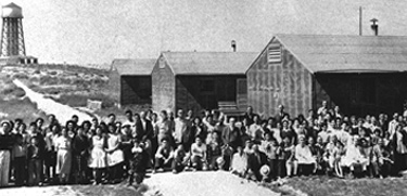
Located in south central Idaho ( 42°40′44″N114°14′38″W / 42.679°N 114.244°W / 42.679; -114.244 (Minidoka National Historic Site) ), this historic site remembers the 9,000+ Japanese Americans that were unjustly imprisoned at the Minidoka Internment Camp during World War II. [13] The camp site was placed on the National Register of Historic Places on July 10, 1979. The site measures approximately 210 acres (0.85 km2). [14]

Nez Perce National Historical Park

Established in 1965 and consisting of 38 individual locations spread across Idaho, Washington, Oregon, and Montana, the park preserves some of the lands originally home to the Nez Perce tribe of Native Americans. The Nez Perce National Historical Park Visitor Center () is home to a museum about the Nez Perce and their history. Since the park is spread across such as wide area, it includes several distinct ecosystems, climates and histories, each of which impacted the life of the Nez Perce. [15]

Yellowstone National Park

Established by Congress in 1872, Yellowstone was the first national park established in the United States, and covers an area of 3,468.4 square miles (8,983 km2); [16] it is regarded by some as the world's first national park. [17] Yellowstone is renowned for its geothermal landscapes and features; Old Faithful geyser is located in the park and is a key attraction at the park. Much of Yellowstone is situated on four overlapping volcanic calderas, collectively known as the Yellowstone Caldera. This vast underground system is responsible for the volcanism and geothermal activity at the park. The Greater Yellowstone Ecosystem is one of the last remaining large, nearly intact ecosystems in the northern temperate zone of the Earth. [lower-alpha 1] [18] While the park is widely known for its geothermal landscapes, it contains a vast area of subalpine forests. Yellowstone's bison herds make up the largest bison population in the United States and are notable for being one of the few bison herds that has not been altered by inbreeding with cattle. [19] [20]

Further reading

See also

Notes

Related Research Articles

<span class="mw-page-title-main">Idaho</span> U.S. state

Idaho is a landlocked state in the Pacific Northwest and Mountain West subregions of the Western United States. It borders Montana and Wyoming to the east, Nevada and Utah to the south, and Washington and Oregon to the west; it shares a small portion of the Canada–United States border to the north, with the province of British Columbia. The state's capital and largest city is Boise. With an area of 83,569 square miles (216,440 km2), Idaho is the 14th-largest state by land area. With a population of approximately 2.0 million, it ranks as the 13th-least populous and the seventh-least densely populated of the 50 U.S. states.

<span class="mw-page-title-main">Nez Perce</span> Indigenous peoples of North America

The Nez Perce are an Indigenous people of the Plateau who still live on a fraction of the lands on the southeastern Columbia River Plateau in the Pacific Northwest. This region has been occupied for at least 11,500 years.

<span class="mw-page-title-main">Snake River</span> Major river in the northwestern United States

The Snake River is a major river in the interior Pacific Northwest region of the United States. About 1,080 miles (1,740 km) long, it is the largest tributary of the Columbia River, which is the largest North American river that empties into the Pacific Ocean. Beginning in Yellowstone National Park, western Wyoming, it flows across the arid Snake River Plain of southern Idaho, the rugged Hells Canyon on the borders of Idaho, Oregon and Washington, and finally the rolling Palouse Hills of southeast Washington. It joins the Columbia River just downstream from the Tri-Cities, Washington, in the southern Columbia Basin.

<span class="mw-page-title-main">Minidoka County, Idaho</span> County in Idaho, United States

Minidoka County is a county located in the U.S. state of Idaho. As of the 2020 census, the population was 21,613. The county seat and largest city is Rupert.

<span class="mw-page-title-main">Hagerman, Idaho</span> City in Idaho, United States

Hagerman is a city in Gooding County, Idaho, United States. The population was 872 at the 2010 census, up from 656 in 2000. The area is noted for its fossil beds and the Thousand Springs of the Eastern Snake Plain Aquifer. Hagerman is home to a national fish hatchery, a university research station, and extensive aquaculture, assisted by an abundance of geothermal water for temperature regulation.

<span class="mw-page-title-main">Craters of the Moon National Monument and Preserve</span> National monument in Idaho, United States

Craters of the Moon National Monument and Preserve is a U.S. national monument and national preserve in the Snake River Plain in central Idaho. It is along US 20, between the small towns of Arco and Carey, at an average elevation of 5,900 feet (1,800 m) above sea level.

Targhee Pass is a mountain pass in the western United States on the Continental Divide. It is located along the border between southeastern Idaho and southwestern Montana, in the Henrys Lake Mountains at an elevation of 7,072 feet (2,156 m) above sea level. The pass is named for a Bannock chief.

<span class="mw-page-title-main">North Central Idaho</span> Region of Idaho, USA

North Central Idaho is an area which spans the central part of the state of Idaho and borders Oregon, Montana, and Washington. It is the southern half of the state's Panhandle region and is rich in agriculture and natural resources. Lewis and Clark traveled through this area on their journey to the Pacific Ocean in September 1805, crossing Lolo Pass and continuing westward in canoes on the Clearwater River. They returned the following spring on their way eastward.

<span class="mw-page-title-main">Nez Perce National Historical Park</span> Series of federally protected historic sites in the northwestern United States

The Nez Perce National Historical Park is a United States National Historical Park comprising 38 sites located across the states of Idaho, Montana, Oregon, and Washington, which include traditional aboriginal lands of the Nez Perce people. The sites are strongly associated with the resistance of Chief Joseph and his band, who in June 1877 migrated from Oregon in an attempt to reach freedom in Canada and avoid being forced on to a reservation. They were pursued by U.S. Army cavalry forces and fought numerous skirmishes against them during the so-called Nez Perce War, which eventually ended with Chief Joseph's surrender in the Montana Territory.

<span class="mw-page-title-main">Snake River Plain</span> Geologic feature in Idaho, US

The Snake River Plain is a geologic feature located primarily within the U.S. state of Idaho. It stretches about 400 miles (640 km) westward from northwest of the state of Wyoming to the Idaho-Oregon border. The plain is a wide, flat bow-shaped depression and covers about a quarter of Idaho. Three major volcanic buttes dot the plain east of Arco, the largest being Big Southern Butte.

<span class="mw-page-title-main">Battle of the Big Hole</span> 1877 battle of the Nez Perce War

The Battle of the Big Hole was fought in Montana Territory, August 9–10, 1877, between the United States Army and the Nez Perce tribe of Native Americans during the Nez Perce War. Both sides suffered heavy casualties. The Nez Perce withdrew in good order from the battlefield and continued their long fighting retreat that would result in their attempt to reach Canada and asylum.

<span class="mw-page-title-main">Yellowstone hotspot</span> Volcanic hotspot in the United States

The Yellowstone hotspot is a volcanic hotspot in the United States responsible for large scale volcanism in Idaho, Montana, Nevada, Oregon, and Wyoming, formed as the North American tectonic plate moved over it. It formed the eastern Snake River Plain through a succession of caldera-forming eruptions. The resulting calderas include the Island Park Caldera, Henry's Fork Caldera, and the Bruneau-Jarbidge caldera. The hotspot currently lies under the Yellowstone Caldera. The hotspot's most recent caldera-forming supereruption, known as the Lava Creek Eruption, took place 640,000 years ago and created the Lava Creek Tuff, and the most recent Yellowstone Caldera. The Yellowstone hotspot is one of a few volcanic hotspots underlying the North American tectonic plate; another example is the Anahim hotspot.

<span class="mw-page-title-main">Magic Valley</span> Region in Idaho, United States

The Magic Valley, also known as South Central Idaho, is a region in south-central Idaho constituting Blaine, Camas, Cassia, Gooding, Jerome, Lincoln, Minidoka, and Twin Falls counties. It is particularly associated with the agricultural region in the Snake River Plain located in the area. The northern Magic Valley region — particularly Blaine and Camas Counties — is also known as the Wood River Valley after the Big Wood River.

<span class="mw-page-title-main">Big Hole National Battlefield</span> Historical battlefield in Montana, United States

Big Hole National Battlefield preserves a battlefield in the western United States, located in Beaverhead County, Montana. In 1877, the Nez Perce fought a delaying action against the U.S. Army's 7th Infantry Regiment here on August 9 and 10, during their failed attempt to escape to Canada. This action, the Battle of the Big Hole, was the largest battle fought between the Nez Perce and U.S. Government forces in the five-month conflict known as the Nez Perce War.

<span class="mw-page-title-main">Nez Perce National Historic Trail</span>

The Nez Perce (Nee-Me-Poo) National Historic Trail follows the route taken by a large group of the Nez Perce tribe in 1877 to avoid being forced onto a reservation. The 1,170-mile (1,883 km) trail was created in 1986 as part of the National Trails System Act and is managed by the U.S. Forest Service. The trail traverses through portions of the U.S. states of Oregon, Idaho, Wyoming, and Montana and connects sites across these states that commemorate significant events of the Nez Perce War that took place between June and October 1877, as several bands of the Nez Perce tried to escape capture by the U.S. Cavalry. The sites are among the 38 that are part of the National Park service's Nez Perce National Historical Park, managed over all by the National Park Service, with some sites managed by local and state affiliated organizations.

<span class="mw-page-title-main">Geography of Idaho</span>

The U.S. state of Idaho borders six other U.S. states and one Canadian province. The states of Washington and Oregon are to the west, Nevada and Utah are to the south, and Montana and Wyoming are to the east. Idaho also shares a short border with the Canadian province of British Columbia to the north.

<span class="mw-page-title-main">Culture of Idaho</span>

Although the culture of Idaho is reflective of the broader culture of the United States to some extent, some of the forces that have shaped the more distinctive aspects of the Idaho culture are ethnographic, geographic, and historical in nature. Additionally, the culture of Idaho is reflected in the state's symbols, traditions, stories, art, and cuisine.

Teton Valley is located on the west slope of the Teton Mountain Range in the western United States. Sometimes known as "The quiet side of the Tetons", it is composed of the cities of Victor, Idaho, Driggs, Idaho, Tetonia, Idaho, and Alta, Wyoming. The valley's economy is based in agriculture and ranching, with a shifting emphasis towards recreational tourism. Teton Valley has a unique climate and geology, as well as a wide variety of attractions including national parks and opportunities for wildlife viewing, fishing, hiking, horseback riding, skiing and participating in the arts.

<span class="mw-page-title-main">Snake River Archaeological Site</span> Historic district in Washington, United States

The Snake River Archaeological District is an archaeological area in the United States, located in Nez Perce County, Idaho, and Asotin County, Washington, and centered on the Snake River, which divides the two states. The area includes a number of sites inhabited by the Nez Perce people, who used it as a fishing ground and a winter campsite. Settlement in the area stretches from roughly 6000 B.C. to the 20th century A.D. Several hundred pictographs are part of the area, usually painted at village sites.

References

  1. 1 2 "City Of Rocks National Reserve". U.S. National Park Service. Retrieved August 20, 2020.
  2. 1 2 "City of Rocks National Reserve". Legends of America. Retrieved August 20, 2020.
  3. "Cassia Silent City of Rocks". National Natural Landmarks. National Park Service. Retrieved October 9, 2018.
  4. "City of Rocks". NPGallery. National Park Service. Retrieved October 9, 2018.
  5. "City of Rocks National Preserve". U.S. National Park Service. Retrieved August 20, 2020.
  6. USGS contributors. "America's Volcanic Past: Craters of the Moon National Monument". United States Geological Survey. Archived from the original on May 17, 2008. Retrieved August 20, 2020.{{cite web}}: |author= has generic name (help)
  7. "Craters Of The Moon National Monument & Preserve". U.S. National Park Service. Retrieved August 20, 2020.
  8. Henderson, Paul (1986). Craters of the Moon: Around the Loop. Craters of the Moon Natural History Association.
  9. Kiver, Eugene P.; Harris, David V. (1999). Geology of U.S. Parklands (5th ed.). New York: John Wiley & Sons. pp. 329–339. ISBN   978-0-471-33218-3.
  10. "Hagerman Fossil Beds National Monument". U.S. National Park Service. Retrieved August 20, 2020.
  11. "Hagerman Fossil Beds National Monument". The American Southwest. Retrieved August 20, 2020.
  12. "Hagerman Fossil Beds National Monument, Idaho". The American Southwest. Retrieved September 24, 2020.
  13. Bilal Qureshi (August 9, 2013). "From Wrong To Right: A U.S. Apology For Japanese Internment". NPR. Retrieved August 18, 2020.
  14. "Minidoka National Historic Site". U.S. National Park Service. Retrieved August 20, 2020.
  15. "Nez Perce National Historical Park". U.S. National Park Service. Retrieved August 20, 2020.
  16. "Yellowstone, the First National Park". Library of Congress . Archived from the original on May 11, 2017.
  17. "Biosphere Reserve Information – United States – Yellowstone". UNESCO – MAB Biosphere Reserves Directory. UNESCO. August 17, 2000. Archived from the original on August 4, 2007. Retrieved August 14, 2016.
  18. Schullery, Paul. "The Greater Yellowstone Ecosystem". Our Living Resources. U.S. Geological Survey. Archived from the original on September 27, 2006. Retrieved March 13, 2007.
  19. "Yellowstone Bison". National Park Service. Retrieved August 19, 2020.
  20. "Yellowstone National Park". U.S. National Park Service. Retrieved August 20, 2020.