Three Island Crossing State Park

Last updated
Three Island Crossing State Park
IUCN category V (protected landscape/seascape)
Three Island Crossing Oregon National Historic Trail (23749131021).jpg
USA Idaho relief location map.svg
Red pog.svg
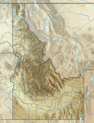
Location in Idaho
Usa edcp relief location map.png
Red pog.svg
Location in the United States
Location Glenns Ferry, Idaho, United States
Coordinates 42°56′41″N115°19′05″W / 42.94472°N 115.31806°W / 42.94472; -115.31806 Coordinates: 42°56′41″N115°19′05″W / 42.94472°N 115.31806°W / 42.94472; -115.31806 [1]
Area613 acres (248 ha) [1]
Elevation2,484 ft (757 m) [1]
Designation Idaho state park
Established1968 [2]
Administrator Idaho Department of Parks and Recreation
Website Three Island Crossing State Park

Three Island Crossing State Park is a history-focused public recreation area in Glenns Ferry, Elmore County, Idaho, United States, that interprets the site of a ford of the Snake River on the Oregon Trail. The state park features camping, cabins, disk golf, and a visitors center with interpretive exhibits. [1]

Contents

History

The site was used as a river crossing until 1869 when Gus Glenn built a ferry across the river about 2 miles (3.2 km) upstream. [1] The land was deeded from the city of Glenns Ferry to the Idaho Department of Parks and Recreation in 1968 and was formally opened to the public as a state park in 1971. [2]

Wildlife

Residential animals of this state park feature deer, waterfowl, fox, swans, songbirds, pelicans, eagles.

See also

Related Research Articles

Idaho U.S. state

Idaho is a state in the Pacific Northwest region of the Western United States. To the north, it shares a small portion of the Canadian border with the province of British Columbia. It borders the state of Montana and Wyoming to the east, Nevada and Utah to the south, and Washington and Oregon to the west. The state's capital and largest city is Boise. With an area of 83,570 square miles (216,400 km2), Idaho is the 11th largest state by land area, but with a population of approximately 1.8 million, it ranks as the 13th least populous and the 7th least densely populated of the 50 U.S. states.

Idaho Falls, Idaho City in Idaho, United States

Idaho Falls is a city in and the county seat of Bonneville County, Idaho, United States. It is the state's largest city outside the Boise metropolitan area. As of the 2020 census, the population of Idaho Falls was 64,818. In the 2010 census, the population of Idaho Falls was 56,813, with a metro population of 133,265.

Glenns Ferry, Idaho City in Idaho, United States

Glenns Ferry is a city in Elmore County, Idaho, United States. The population was 1,319 at the 2010 census. The city is adjacent to Interstate 84 and the Snake River.

Coeur dAlene, Idaho City in Idaho, United States

Coeur d'Alene is a city and the county seat of Kootenai County, Idaho, United States. It is the largest city in North Idaho and the principal city of the Coeur d'Alene Metropolitan Statistical Area. In 2020, the United States Census Bureau estimated the city's population at 53,354. Coeur d'Alene is a satellite city of Spokane, which is located about thirty miles (50 km) to the west in the state of Washington. The two cities are the key components of the Spokane–Coeur d'Alene Combined Statistical Area, of which Coeur d'Alene is the third-largest city. The city is situated on the north shore of the 25-mile (40 km) long Lake Coeur d'Alene and to the west of the Coeur d'Alene Mountains. Locally, Coeur d'Alene is known as the "Lake City," or simply called by its initials, "CDA."

North River (Hudson River) Section of the Hudson River between New York City and New Jersey

North River is an alternative name for the southernmost portion of the Hudson River in the vicinity of New York City and northeastern New Jersey in the United States. The entire watercourse was known as the North River by the Dutch in the early seventeenth century; the term fell out of general use for most of the river's 300+ mile course during the early 1900s. However the name remains in very limited use as an artifact among history-inclined local mariners and others and on some nautical charts and maps. The term is also used for infrastructure on and under the river, such as the North River piers, North River Tunnels, and the North River Wastewater Treatment Plant.

Washington Crossing State Park United States historic place

Washington Crossing State Park is a 3,575-acre (14 km2) New Jersey state park that is part of Washington's Crossing, a U.S. National Historic Landmark area. It is located in the Washington Crossing and Titusville sections of Hopewell Township in Mercer County, north of Trenton along the Delaware River. The park is operated and maintained by the New Jersey Division of Parks and Forestry. It is supported by the Washington Crossing Park Association, a friends group that works to preserve, enhance, and advocate for the park.

Lees Ferry Historical Colorado River ferry crossing

Lees Ferry is a site on the Colorado River in Coconino County, Arizona in the United States, about 7.5 miles (12.1 km) southwest of Page and 9 miles (14 km) south of the Utah–Arizona state line.

Washington Crossing Historic Park United States historic place

Washington Crossing Historic Park is a 500-acre (2 km2) state park operated by the Pennsylvania Department of Conservation and Natural Resources in partnership with the Friends of Washington Crossing Park. The park is divided into two sections. One section of the park, the "lower park," is headquartered in the village of Washington Crossing located in Upper Makefield Township in Bucks County, Pennsylvania. It marks the location of George Washington's crossing of the Delaware River during the American Revolutionary War.

United States National Register of Historic Places listings Register for landmarks in the United States

The National Register of Historic Places in the United States is a register including buildings, sites, structures, districts, and objects. The Register automatically includes all National Historic Landmarks as well as all historic areas administered by the U.S. National Park Service. Since its introduction in 1966, more than 90,000 separate listings have been added to the register.

Mountains-to-Sea Trail Long-distance hiking trail in North Carolina, United States

The Mountains-to-Sea State Trail (MST) is a long-distance trail for hiking and backpacking, that traverses North Carolina from the Great Smoky Mountains to the Outer Banks. The trail's western endpoint is at Clingman's Dome, where it connects to the Appalachian Trail in the Great Smoky Mountains National Park. Its eastern endpoint is in Jockey's Ridge State Park on the tallest sand dune on the east coast. The trail is envisioned as a scenic backbone of an interconnected trail system spanning the state. As such, the trail's route attempts to connect as many trail systems and natural scenic areas as practicable. A little over half of the trail is complete in multiple segments across the state.

Eagle Island State Park (Idaho)

Eagle Island State Park is a public recreation area on the southwest outskirts of the city of Eagle, Idaho. The state park covers 545 acres (221 ha) that are bordered by the north and south channels of the Boise River. The park's recreational facilities include swimming beach, picnic area, equestrian trails, and a water slide.

Fort Boise United States historic place

Fort Boise is either of two different locations in the western United States, both in southwestern Idaho. The first was a Hudson's Bay Company (HBC) trading post near the Snake River on what is now the Oregon border, dating from the era when Idaho was included in the British fur company's Columbia District. After several rebuilds, the fort was ultimately abandoned in 1854, after it had become part of United States territory following settlement in 1846 of the northern boundary dispute.

Hells Canyon National Recreation Area United States historic place

Hells Canyon National Recreation Area is a United States national recreation area on the borders of the U.S. states of Oregon and Idaho. Managed by the U.S. Forest Service as part of the Wallowa-Whitman National Forest, the recreation area was established by Congress and signed by President Gerald Ford in late 1975 to protect the historic and archaeological values of the Hells Canyon area and the area of the Snake River between Hells Canyon Dam and the Oregon–Washington border.

Historic ferries in Oregon are water transport ferries that operated in Oregon Country, Oregon Territory, and the state of Oregon, United States. These ferries allowed people to cross bodies of water, mainly rivers such as the Willamette in the Willamette Valley, and the Columbia, in order to transport goods, move people, and further communications until permanent bridges were built to allow faster crossing of the water. The early ferries were used by wagons and pedestrians, while later ones transported trains and then automobiles. Oregon has a few automobile ferries still in operation.

Spokane River Centennial Trail

The Spokane River Centennial Trail is a 37-mile (60 km) paved trail in Eastern Washington for alternate transportation and recreational use. It is managed by Washington State Parks as the Spokane River Centennial State Park Trail.

Thousand Springs State Park

Thousand Springs State Park is a public recreation and nature preservation area consisting of multiple units — Billingsley Creek, Earl M. Hardy Box Canyon Springs Nature Preserve, Malad Gorge, Niagara Springs, and Ritter Island — in Gooding County, Idaho.

Heyburn State Park

Heyburn State Park is a public recreation area in the U.S. state of Idaho. It is located almost entirely in Benewah County, with a small portion extending into southern Kootenai County. The park was founded in 1908 and is the oldest state or provincial park in the Pacific Northwest. The park has 5,744 acres (23.2 km2) of land and 2,332 acres (9.4 km2) of water on three lakes: Benewah, Chatcolet, and Hidden. A dam constructed on the Spokane River in Post Falls in 1906 raised the level of Lake Coeur d'Alene, connecting it to the park's three lakes. The surface elevation of the lakes is 2,125 feet (648 m) above sea level. The park's year-round recreational opportunities include camping, boating, hiking, horseback riding, fishing, and picnicking.

Route of the Oregon Trail

The historic 2,170-mile (3,490 km) Oregon Trail connected various towns along the Missouri River to Oregon's Willamette Valley. It was used during the 19th century by Great Plains pioneers who were seeking fertile land in the West and North.

Lucky Peak State Park State park in Idaho, United States

Lucky Peak State Park is a public recreation area covering a total of 240 acres (97 ha) on and near Lucky Peak Lake approximately ten miles (16 km) east of Boise in Ada County, Idaho. The state park has three units: Discovery Park off State Highway 21, a roadside park for picnicking and fishing in the Boise River; Sandy Point at the base of the Lucky Peak Dam, with sandy beach and calm waters for wading and swimming; and the Spring Shores unit with boat ramps and marina at the northern end of the lake. The park was created in 1956 by agreement with the United States Army Corps of Engineers, following completion of the Lucky Peak Dam. The park is also home to the Lucky Peak Dam Zeolite Occurrence.

The Idaho Department of Parks and Recreation (IDPR) is a state-level government agency of Idaho that manages state parks throughout Idaho as well as the registration programs for boats, snowmobiles and other off-highway vehicles.

References

  1. 1 2 3 4 5 "Three Island Crossing State Park". Idaho Parks and Recreation. Retrieved October 22, 2017.
  2. 1 2 "History: State Lands in Idaho". Idaho Museum of Natural History. Retrieved October 22, 2017.