Huddersfield Viaduct

Last updated

Huddersfield Viaduct
Huddersfield Railway Viaduct.jpg
Huddersfield Viaduct
Coordinates 53°39′11″N1°46′52″W / 53.653°N 1.781°W / 53.653; -1.781
OS grid reference SE145173
Carries Huddersfield line
Other name(s)Hillhouse Viaduct
Owner Network Rail
Characteristics
Total length663 yards (606 m)
Height53 feet (16 m) (Maximum)
No. of spans47
Rail characteristics
No. of tracks 2 (4 by 2030s) [note 1]
Track gauge 4 ft 8+12 in (1,435 mm) standard gauge
Electrified Overhead catenary (2030s)
History
Construction start10 October 1845
Construction cost£49,000 (1847)
Opened3 August 1847
Rebuilt1883
Statistics
Listed Building – Grade II
Designated28 September 1978
Reference no. 1223531
Location
Huddersfield Viaduct

Huddersfield Viaduct (or Hillhouse Viaduct) [2] is a railway bridge to the north-east of Huddersfield railway station in West Yorkshire, England. The viaduct carries the Huddersfield Line connecting Huddersfield with Dewsbury, Leeds, and York eastwards, and Manchester and Liverpool westwards. The viaduct was built to carry two lines, but was widened in the 1880s to take four tracks, and then reduced to two tracks in 1970. Huddersfield Viaduct is less well-known than other viaducts in the Kirklees area as they are higher, but Huddersfield Viaduct is the longest in the Kirklees district.

Contents

As part of the Transpennine Route Upgrade (TRU), the viaduct will again have four lines along the whole 663 yards (606 m), and will additionally be electrified with a 25 kV overhead catenary by the 2030s.

History

The first railway in the area was the Manchester and Leeds Railway (M&L) which passed Huddersfield 3.25 miles (5.23 km) to the north. Initially, the operators of that line were reluctant to provide a route into Huddersfield from the north, but in the face of opposing railway companies submitting bills through Parliament, the M&L optioned their own scheme which would have taken a route along the valley floor, thus making any station a dead-end as it could not rise up to the height needed to exit the valley to the south or west. [3] [4] A joint scheme between the M&L and the Huddersfield and Manchester Railway, proposed the alternative elevated route and built Huddersfield Viaduct to a length of 663 yards (606 m), [note 2] with 47 spans, 45 of which are masonry spans, whilst two have iron decks over major roads beneath the viaduct. [3] [2] Forty-three of the spans are square on to the roads they cross, but four are set at oblique angles. [6] Most of the arched spans are 30 feet (9.1 m) across, although one of the skewed bridge sections measures 57 feet (17 m) across. [7] Whilst it is debated who was the engineer on the project, it was either Thomas Nicholson or A. S. Jee, who both worked on bridges and viaducts on the line between Stalybridge and Heaton Lodge Junction. [8] [note 3] Marshall states that Jee was the engineer, being appointed in July 1845, with Nowell & Hattersley being the contractors who started work on 10 October 1845. [9]

The viaduct was opened up to traffic in August 1847 with only a single line connecting Huddersfield with Heaton Lodge Junction on the Manchester and Leeds line through the Calder Valley. [10] Construction of the viaduct started in 1845, but it was delayed in opening as it had to be re-profiled due to there being some error in achieving the correct gradients, and the entire track had to be taken up and replaced as the contractors had used the wrong size of sleeper despite it being stipulated quite clearly in the contract. [11] [12] The gradient out of the station was 1-105, which was thought to be dangerous, so the gradient was re-profiled to 1-in-350 by raising the end of the viaduct. [13] This added an extra £1,000, (equivalent to £115,000in 2023) on the existing cost of building the viaduct, which brought the total spent on the venture to £49,000 (equivalent to £5,656,000in 2023). [3] [12]

Initially the west end of the viaduct (that nearest the railway station) had two lines, which widened to accommodate four lines. However, in 1883, the entire structure was widened to take five lines between Huddersfield and the yards and depot at Hillhouse, using stone which had been quarried from Springwood Cutting (west of Huddersfield station) when the lines there were also being widened to four tracks. [14] [8] The cost of widening the viaduct was £50,000 (equivalent to £6,361,000in 2023). [15] During the widening process, other schemes were also implemented, including changing the arched span over John William Street to an iron span without the arched sides for full headway, the removal of goods sidings to the yard at Hillhouse, and the "...discontinuance of any buildings under the arches of the Huddersfield Viaduct south of Bradford Road....". [16] The span over Bradford road was widened using an iron deck on either side of the stone viaduct. When seen from ground level, the original two-track width stone arch is visible, encased in iron spans at the top. [17] A reduction in traffic between Heaton Lodge Junction and Huddersfield resulted in the tracks between the two points being reduced from four down to two in 1970. [18]

The viaduct also had a signal box (Huddersfield No. 2 Signal Box), which was about 100 yards (91 m) east of the station. [19] [20] The viaduct crosses over several roads, the Huddersfield Ring Road, the A641 Bradford Road, and numerous minor roads, but also historically bridged several tram lines and the level road-running industrial line to Huddersfield gas works. [21] In the Kirklees area, Huddersfield Viaduct is less well-known than some of the other railway viaducts (such as Crimble, Golcar, Denby Dale, Slaithwaite, Lockwood and Penistone), as they are significantly higher, but Huddersfield Viaduct is the longest. [22] [23] The maximum height that the viaduct reaches is 53 feet (16 m) with the tallest arches being at the northern end of the viaduct in Hillhouse. The land falls away from south to north undulating as it does so, so the shallowest arch is that nearest the station in Huddersfield, but the height of the structure varies along its course. [2] [24]

The viaduct had a new bridge deck built upon it during an engineering blockade over the Easter bank holiday weekend of 2024, in preparation for the lines on the viaduct being expanded from two lines to four as part of the Trans-Pennine Route Upgrade (TRU). [25] [26] Other works on the viaduct as part of the TRU will include extending the platforms at Huddersfield onto the viaduct, the replacement of corroded wrought iron decks with concrete supports, and the overhead line equipment (OLE), which will be supported by masts fixed to the outside of the viaduct between spans 1 and 33, thereafter, the OLE will be fixed onto the deck of the viaduct. [27] [28] [note 4] Five lines will run onto the viaduct direct from the station, and these will combine into four tracks by span 17, all along the rest of the viaduct north-eastwards. [30] From the west side of the viaduct to the east side, the lines will be Down Slow, Up Slow, Down Fast, and Up Fast. [31]

The viaduct was grade II listed in 1978 and also forms part of Huddersfield Town Conservation area at the south-western end of the viaduct. [32] [33]

Accidents

See also

Notes

  1. Date given is for completion of the Transpennine Route Upgrade. Sections of work around Huddersfield may be finished and implemented earlier than the projected timeline for the full line upgrade. [1]
  2. According to trackmaps, the viaduct extends for 29 chains (1,900 ft; 580 m). [5]
  3. Historic England state it was possibly Nicholson, whilst Biddle and Marshall state it was Jee.
  4. Spans are counted from the station towards the North-East direction, so the span over John William Street at the station end of the viaduct is span number 1, and then each span increases in number until number 47 which is at Hillhouse. [29]

Related Research Articles

<span class="mw-page-title-main">Manchester Piccadilly station</span> Railway station in Manchester, England

Manchester Piccadilly is the main railway station of the city of Manchester, in the metropolitan county of Greater Manchester, England. Opened originally as Store Street in 1842, it was renamed Manchester London Road in 1847 and became Manchester Piccadilly in 1960. Located to the south-east of the city centre, it hosts long-distance intercity and cross-country services to national destinations including London, Birmingham, Nottingham, Glasgow, Edinburgh, Cardiff, Bristol, Exeter, Plymouth, Reading, Southampton and Bournemouth; regional services to destinations in Northern England including Liverpool, Leeds, Sheffield, Newcastle and York; and local commuter services around Greater Manchester. It is one of 19 major stations managed by Network Rail. The station has 14 platforms: 12 terminal and two through platforms. Piccadilly is also a major interchange with the Metrolink light rail system with two tram platforms in its undercroft.

<span class="mw-page-title-main">Ribblehead Viaduct</span> Railway viaduct in North Yorkshire, England

The Ribblehead Viaduct or Batty Moss Viaduct carries the Settle–Carlisle railway across Batty Moss in the Ribble Valley at Ribblehead, in North Yorkshire, England. The viaduct, built by the Midland Railway, is 28 miles (45 km) north-west of Skipton and 26 miles (42 km) south-east of Kendal. It is a Grade II* listed structure. Ribblehead Viaduct is the longest and the third tallest structure on the Settle–Carlisle line.
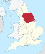
<span class="mw-page-title-main">Huddersfield line</span> Inter-regional railway in Northern England

The Huddersfield line is the main railway line between the English cities of Leeds and Manchester, via Huddersfield. It is one of the busiest MetroTrain lines. The route travels south-south-west from Leeds through Dewsbury. After a short westward stretch through Mirfield, where it runs on the ex-L&YR section, it continues south-west through Huddersfield, using the Colne Valley to its headwaters. The long Standedge Tunnel, just after Marsden, crosses under the watershed; the majority of the run down to Manchester is in the Tame Valley. From Manchester, some services continue to Manchester Airport and others to Liverpool.

<span class="mw-page-title-main">Penistone Line</span> Railway line between Huddersfield and Sheffield

The Penistone Line is operated by Northern Trains in the West Yorkshire Metro and Travel South Yorkshire areas of northern England. It connects Huddersfield and Sheffield via Penistone and Barnsley, serving many rural communities. Metrocards can be used for travel between Huddersfield and Denby Dale and intermediate stations.

The Ashton, Stalybridge and Liverpool Junction Railway was opened in 1846 to connect the industrial town of Ashton-under-Lyne to the developing railway network, and in particular to the port of Liverpool. It was a short line, joining the Manchester and Leeds Railway at Miles Platting and the connection to Liverpool was over that line and the Liverpool and Manchester Railway.

<span class="mw-page-title-main">Liverpool and Bury Railway</span> Railway line in England

The Liverpool and Bury Railway was formed by an Act in 1845 to link Liverpool and Bury via Kirkby, Wigan and Bolton, the line opening on 20 November 1848. The line became the Lancashire and Yorkshire Railway's main line between Liverpool, Manchester and Yorkshire. Most of it is still open.

<span class="mw-page-title-main">Ribble Valley line</span> Railway line in North West England

The Ribble Valley line is a railway line that runs from Manchester Victoria through Blackburn, in Lancashire, to Hellifield in North Yorkshire. Regular passenger services normally run as far as Clitheroe, but occasional passenger services run the whole line through north Lancashire to Hellifield, where it joins the Settle–Carlisle line. The line passes over the distinctive 48-span Whalley Viaduct.

<span class="mw-page-title-main">Mirfield railway station</span> Railway station in West Yorkshire, England

Mirfield railway station serves the town of Mirfield in West Yorkshire, England. It lies on the Huddersfield Line and is managed by both Northern and Grand Central train operating companies, and is served by TransPennine Express as well. The station is 4 miles (6 km) north east from Huddersfield.

<span class="mw-page-title-main">Lockwood railway station</span> Railway station in West Yorkshire, England

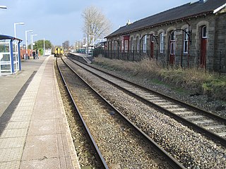
Lockwood railway station is a railway station in Huddersfield, England. It is situated 1.5 miles (2 km) south of Huddersfield station on the Penistone Line between Huddersfield and Sheffield. It serves the Lockwood district of Huddersfield, and services are provided by Northern.

<span class="mw-page-title-main">Holmfirth branch line</span> Disused railway line in West Yorkshire, England

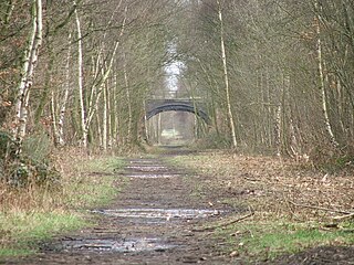
The Holmfirth branch line is a disused railway line that ran for 2 miles (3.2 km) from Brockholes to Holmfirth, in West Yorkshire, England. The line was built as double track as there were plans to extend the line up the Holme Valley.

The Queensbury lines was the name given to a number of railway lines in West Yorkshire, England, that linked Bradford, Halifax and Keighley via Queensbury. All the lines were either solely owned by the Great Northern Railway (GNR) or jointly by the GNR and the Lancashire and Yorkshire Railway (L&YR). The terrain was extremely challenging for railway construction, and the lines were very expensive to build. The lines were

<span class="mw-page-title-main">Stockport Viaduct</span> Viaduct in Greater Manchester, England

Stockport Viaduct carries the West Coast Main Line across the valley of the River Mersey in Stockport, Greater Manchester, England. It is one of the largest brick structures in the United Kingdom and a major structure of the early railway age. It is immediately north of Stockport railway station.

<span class="mw-page-title-main">Meldon Viaduct</span> Bridge in United Kingdom

Meldon Viaduct is a disused railway viaduct crossing the West Okement River at Meldon, 2.5 miles (4.0 km) south-west of Okehampton, on the edge of Dartmoor in Devon, South West England. This truss bridge was constructed from wrought iron, instead of stone or brick arches. It opened in 1874 for a single track; in 1879 its width was doubled for a second track. Although regular services were withdrawn in 1968, the bridge was used for shunting by a local quarry. In the 1990s the remaining single track was removed.

<span class="mw-page-title-main">Staithes Viaduct</span> Former railway viaduct in North Yorkshire, England

Staithes Viaduct was a railway bridge that straddled Staithes Beck at Staithes, Yorkshire, England. It was north of the closed Staithes railway station. It was known for an anemometer, a fitting to tell the signaller if winds across the viaduct were too strong for crossing trains.

<span class="mw-page-title-main">Dent Head Viaduct</span> A railway viaduct in Cumbria, England

Dent Head Viaduct is a railway viaduct on the Settle–Carlisle line in Dentdale, Cumbria, England. It is the second major viaduct on the line northwards after Ribblehead Viaduct, and is just north of Blea Moor Tunnel at milepost 251, and to the south of Arten Gill Viaduct. Construction of the viaduct began in 1869, and it was completed in 1875, extra time being needed due to periods of heavy rainfall. The line bows slightly to the east in order to follow the contours of Woldfell, which it navigates on the western side. The viaduct was grade II Listed in 1999. Dent Head Viaduct is 17 miles (27 km) north of Settle Junction, and 57 miles (92 km) south of Carlisle railway station.

<span class="mw-page-title-main">Kilton Viaduct</span> Viaduct in Yorkshire, England

Kilton Viaduct was a railway viaduct that straddled Kilton Beck, near to Loftus, in North Yorkshire, England. The viaduct was opened to traffic in 1867, however in 1911, with the viaduct suffering subsidence from the nearby ironstone mining, the whole structure was encased in waste material from the mines creating an embankment which re-opened fully to traffic in 1913. The railway closed in 1963, but then in 1974, it re-opened as part of the freight line to Boulby Mine carrying potash traffic.

<span class="mw-page-title-main">Clayton West branch line</span> Former railway line in Yorkshire, England

The Clayton West branch line was a standard gauge passenger and freight railway near Huddersfield, in West Yorkshire, England. The line was built by the Lancashire and Yorkshire Railway, opening to traffic in September 1879. Many proposals were considered to extending the line eastwards towards Darton, and then connecting to Barnsley, but these never came to fruition. In 1963, both stations on the line,, were listed for closure under the Beeching cuts, but the branch survived as a passenger carrying railway until 1983. The branch also forwarded coal from two collieries adjacent to the line, which maintained a freight service on the branch up until closure.

<span class="mw-page-title-main">Kirkburton branch</span> Former railway line in Yorkshire, England

The Kirkburton branch was a railway branch in West Yorkshire, England. The line was built by the London and North Western Railway (LNWR) in the 1860s, the only LNWR branch line in the Huddersfield area, although originally, the intention had been to link Kirkburton with Clayton West and through to Barnsley, but this never came to fruition. The line opened to traffic in 1867, and was closed to passengers in 1930. Freight carried on using the branch until 1965. A second railway station for Deighton was opened in 1982 on the main running line between Huddersfield and Mirfield. The removal of passenger services along the branch was down to low passenger numbers; the railway ran along the valley floor and most of the populated areas were high up on the valley sides.

<span class="mw-page-title-main">Heaton Lodge Junction</span> Railway junction in Yorkshire, England

Heaton Lodge Junction is a railway junction on the Trans-Pennine line, which connects Manchester Piccadilly with Leeds via Huddersfield, and the Calder Valley Line through Sowerby Bridge to Wakefield. The line and junctions were historically important as they connected the industrialised areas of Lancashire and Yorkshire.

<span class="mw-page-title-main">Royston to Thornhill line</span> Disused railway in West Yorkshire, England

The Royston to Thornhill line was a Midland Railway venture constructed in West Yorkshire, England, that had the intent to allow trains to travel from Sheffield to Bradford without going through Leeds. The scheme, which was promoted as the West Riding Lines, would have travelled underneath Bradford city centre in a long tunnel and ended up in the Aire Valley providing a through line across Bradford. In the event, only the section from Royston to Thornhill, a smaller branch to a goods station at Dewsbury Savile Town, and a longer branch from Mirfield to Huddersfield were ever built. By the late 1960s, the lines had all been closed, however, the viaducts at Bradley, Crigglestone, and Horbury still remain.

References

  1. Johnston, Howard (13 December 2023). "£3.9bn for trans-Pennine route after HS2 cancellation". Rail Magazine. No. 998. Peterborough: Bauer Media. p. 6. ISSN   0953-4563.
  2. 1 2 3 Biddle, Gordon; Nock, O. S. (1983). The railway heritage of Britain: 150 years of railway architecture and engineering. London: M. Joseph. p. 35. ISBN   0718123557.
  3. 1 2 3 Joy 1984, p. 138.
  4. Fisher 1997, p. 9.
  5. Kelman, Leanne (2020). Railway Track Diagrams Book 2: Eastern (5 ed.). Frome: Trackmaps. 37A. ISBN   978-1-9996271-3-3.
  6. Fisher 1997, p. 15.
  7. Biddle, Gordon (2003). Britain's historic railway buildings: an Oxford gazetteer of structures and sites. Oxford: Oxford University Press. p. 443. ISBN   0198662475.
  8. 1 2 NRHV 2021, p. 17.
  9. Marshall 1969, pp. 222–223.
  10. Joy 1984, pp. 138–139.
  11. NRHV 2021, p. 5.
  12. 1 2 Marshall 1969, p. 223.
  13. Marshall 1969, p. 224.
  14. Bairstow 1984, p. 15.
  15. "The Hull, Barnsley & West Riding Junction railway bill". Huddersfield Weekly Examiner. No. 5, 120. 27 May 1882. p. 8. OCLC   751654221. Mr Stephenson, chief engineer of the London & North-Western Railway Company, said that he had examined the plans of the proposed line, and found that they would interfere seriously with his company's plans [for widening].
  16. Report from the joint select committee of the House of Lords and the House of Commons, on railway companies amalgamation : together with the proceedings of the Committee, minutes of evidence, and appendix. London: HMSO. 1872. p. 623. OCLC   602071920.
  17. NRHV 2021, p. 20.
  18. Flowers, Andy (August 2023). "Junctions in profile: Heaton Lodge". Today's Railways. No. 258. Sheffield: Platform 5. p. 30. ISSN   1475-9713.
  19. "Accident Returns: Extract for the Accident at Huddersfield on 21st April 1905 :: The Railways Archive". railwaysarchive.co.uk. p. 52. Retrieved 1 May 2024.
  20. "Huddersfield Viaduct Signal Box - Huddersfield Exposed: Exploring the History of the Huddersfield Area". huddersfield.exposed. Retrieved 1 May 2024.
  21. Bairstow 1984, p. 33.
  22. NRHV 2021, p. 24.
  23. Minter, Gordon; Minter, Enid (1998). Discovering Old Huddersfield part three. p. 6. ISBN   0-9524747-5-1.
  24. NRHV 2021, p. 18.
  25. Hakimian, Rob (28 March 2024). "Network Rail gears up for £90M of engineering works over Easter bank holiday weekend". New Civil Engineer. Retrieved 1 May 2024.
  26. "Disruption to Huddersfield rail services over Easter weekend". BBC News. 29 March 2024. Retrieved 1 May 2024.
  27. Haigh, Philip (21 April 2021). "Network Rail's vision for major changes at Huddersfield". Rail Magazine. No. 929. Peterborough: Bauer Media. p. 31. ISSN   0953-4563.
  28. Lavigueur, Nick (14 March 2020). "Major changes are revealed in £1bn rail plans". Huddersfield Daily Examiner. pp. 18–19. ISSN   0962-1644.
  29. NRHV 2021, p. 52.
  30. NRHV 2021, p. 7.
  31. Haigh, Philip (16 November 2022). "Trans-Pennine Transformative". Rail Magazine. No. 970. Peterborough: Bauer Media. p. 39. ISSN   0953-4563.
  32. Historic England. "Huddersfield Railway Viaduct (Grade II) (1223531)". National Heritage List for England . Retrieved 4 May 2024.
  33. NRHV 2021, p. 28.
  34. Joy 1984, p. 147.
  35. Fisher 1997, p. 31.
  36. Williams, A. (1993). Railway accident at Huddersfield. London: HMSO. p. iii. ISBN   0-7176-0650-3.

Sources