
The Interborough Rapid Transit Company (IRT) was the private operator of New York City's original underground subway line that opened in 1904, as well as earlier elevated railways and additional rapid transit lines in New York City. The IRT was purchased by the city in June 1940, along with the younger BMT and IND systems, to form the modern New York City Subway. The former IRT lines are now the A Division or IRT Division of the Subway.

U Thant Island is a small artificial island or islet in the borough of Manhattan in New York City. The 100-by-200-foot island, created during the construction of the Steinway Tunnel directly underneath, is the smallest island in Manhattan.

Christopher Street is a station on the PATH system. Located on Christopher Street between Greenwich and Hudson Streets in the Greenwich Village neighborhood of Manhattan, New York City, it is served by the Hoboken–33rd Street and Journal Square–33rd Street lines on weekdays, and by the Journal Square–33rd Street line on weekends.

The 14th Street station is a station on the PATH system. Located at the intersection of 14th Street and Sixth Avenue in the Chelsea neighborhood of Manhattan, New York City, it is served by the Hoboken–33rd Street and Journal Square–33rd Street lines on weekdays, and by the Journal Square–33rd Street line on weekends.

The West Village is a neighborhood in the western section of the larger Greenwich Village neighborhood of Lower Manhattan, New York City.
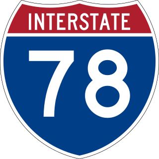
Interstate 78 (I-78) is a part of the Interstate Highway System that runs from Union Township, Lebanon County, Pennsylvania, to New York City. In the US state of New York, I-78 extends 0.5 miles (0.80 km). The entirety of I-78 consists of the Holland Tunnel, which crosses under the Hudson River from New Jersey and ends at an exit rotary in Lower Manhattan. The tunnel and its approaches are maintained by the Port Authority of New York and New Jersey (PANYNJ).

The Steinway Street station is a local station on the IND Queens Boulevard Line of the New York City Subway. Located under Steinway Street between Broadway and 34th Avenue, it is served by the M train on weekdays, the R train at all times except nights, and the E and F trains at night.

Dyer Avenue is a short, north-south thoroughfare in the Hell's Kitchen neighborhood of Manhattan in New York City, located between Ninth Avenue and Tenth Avenue. It is primarily used by traffic exiting the Lincoln Tunnel. Dyer Avenue runs between 30th Street and 42nd Street but functions as three distinct sections due to its connections with the south and center tubes of the Lincoln Tunnel. The southernmost section, between 30th and 31st Streets, leads to and from the Lincoln Tunnel Expressway. Dyer Avenue also exists between 34th and 36th Streets, and between 40th and 42nd Streets; both sections lead directly from the tunnel, but the 34th-36th Streets section also contains a roadway leading to the tunnel. The avenue is owned by the Port Authority of New York and New Jersey.

The Eighth Avenue Line is a public transit line in Manhattan, New York City, running mostly along Eighth Avenue from Lower Manhattan to Harlem. Originally a streetcar line, it is now the M10 bus route and the M20 bus route, operated by the New York City Transit Authority. The M10 bus now only runs north of 57th Street, and the M20 runs south of 66th Street. The whole line was a single route, the M10, until 2000 when the M20 was created.
St. John's Park was a 19th-century park and square, and the neighborhood of townhouses around it, in what is now the Tribeca neighborhood of Lower Manhattan, New York City. The square was bounded by Varick Street, Laight Street, Hudson Street and Beach Street, now also known for that block as Ericsson Place. Although the name "St. John's Park" is still in use, it is no longer a park and is inaccessible to the public.

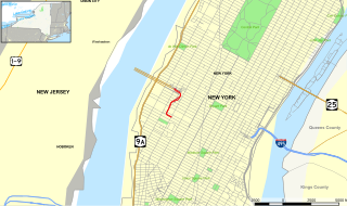
Varick Street runs north–south primarily in the Hudson Square district of Lower Manhattan in New York City, United States. Varick Street's northern terminus is in the West Village, where it is a continuation of Seventh Avenue South south of Clarkson Street. It continues downtown through Hudson Square and TriBeCa until it reaches Leonard Street, where it merges with West Broadway. Motor traffic is one-way southbound. Major east–west streets crossed include Houston Street and Canal Street. Approaching Broome Street, the two rightmost lanes of Varick Street are reserved for traffic entering the Holland Tunnel, where backups often occur at rush hour.

West Broadway is a north-south street in the New York City borough of Manhattan, separated into two parts by Tribeca Park. The northern part begins at Tribeca Park, near the intersection of Avenue of the Americas, Walker Street and Beach Street in Tribeca. It runs northbound as a one-way street past Canal Street and becomes two-way at the intersection with Grand Street one block farther north. West Broadway then operates as a main north-south thoroughfare through SoHo until its northern end at Houston Street, on the border between SoHo and Greenwich Village. North of Houston Street, it is designated as LaGuardia Place, which continues until Washington Square South.

Dey Street is a short street in Lower Manhattan, in New York City. It passes the west side of the World Trade Center site and the World Trade Center Transportation Hub. It runs for one block between Church Street and Broadway. It originally ran to West Street, but the western reaches were demolished to make way for the World Trade Center in the late 1960s. It now extends to Greenwich Street. 15 Dey Street is the site of the first transcontinental telephone call.
The Shelter, also known as Club Shelter, was a New York City house music and techno nightclub in the 1990s and 2000s. The club was at multiple locations including 6 Hubert Street, 157 Hudson Street, 150 Varick Street in Manhattan depending on the date. The Shelter was established by resident DJs Timmy Regisford, Merlin Bobb, and Freddy Sanon. The club is closely associated with record label 157 Shelter Records.

Richmond Hill was a colonial estate in Manhattan Island, that was built on a 26-acre (110,000 m2) parcel of the "King's Farm" obtained on a 99-year lease in 1767 from Trinity Church by Major Abraham Mortier, paymaster of the British army in the colony. Part of the site is now the Charlton-King-Vandam Historic District of Manhattan's Hudson Square neighborhood.

One Hudson Square is an 18-story industrial building located in the Hudson Square neighborhood of Manhattan, New York City. It was built in 1929 and 1930 and was designed by noted architect Ely Jacques Kahn in the modern-classical style.

The Charlton–King–Vandam Historic District is a small historic district in Lower Manhattan, New York City. Designated by the New York City Landmarks Preservation Commission (NYCLPC) in 1966, the district contains "the city's largest concentration of row houses in the Federal style, as well as a significant concentration of Greek Revival houses." It is sometimes included as part of the South Village or Hudson Square, though it is historically distinct from both neighborhoods.

Spring Street is a street in Lower Manhattan, New York City, which runs west–east through the neighborhoods of Hudson Square, SoHo, and Nolita. It runs parallel to and between Dominick, Broome, and Kenmare Streets, and Vandam and Prince Streets. Address numbers ascend as Spring Street travels westward from the Bowery to West Street along the Hudson River.
The Lincoln Tunnel Expressway is an eight block-long, mostly four-lane, north–south arterial road between the portals of the Lincoln Tunnel and West 30th Street in Midtown Manhattan in New York City. Dyer Avenue is an at-grade roadway paralleling part of the mostly depressed roadway and serves traffic entering and leaving the expressway and the tubes of the tunnel. Like the tunnel, the roads are owned and operated by the Port Authority of New York and New Jersey. They traverse the Manhattan neighborhoods of Hell's Kitchen and Chelsea between Ninth and Tenth avenues. The highway serves as the entrance to the Lincoln Tunnel from Manhattan, with the entrance from Weehawken, New Jersey being the Lincoln Tunnel Helix.


