Midtown South

Last updated
Midtown South
Country Flag of the United States.svg  United States
State Flag of New York.svg  New York
County New York
City New York City
Population
 (2010)
  Total28,630
 Neighborhood tabulation area; includes Midtown
Time zone UTC-5 (EST)
  Summer (DST) UTC-4 (EDT)
Area code 212

Midtown South is a macro-neighborhood of the borough of Manhattan in New York City, generally characterized as constituting the southern portion of Midtown Manhattan. [1] Midtown Manhattan hosts over 700,000 daily employees as a busy hub for workers, residents, and tourists. The Empire State Building, the Flatiron Building, Pennsylvania Station, Madison Square Garden, the Macy's Herald Square flagship store, Koreatown, and NYU Langone Medical Center are all located in Midtown South.

Contents

The Empire State Building in the foreground looking southward from the top of Rockefeller Center, with One World Trade Center in the background, at sunset. The Midtown South Community Council acts as a civic caretaker for much of the neighborhood between the high-rise areas of Midtown and Lower Manhattan. Empire State Building with 1WTC in background.png
The Empire State Building in the foreground looking southward from the top of Rockefeller Center, with One World Trade Center in the background, at sunset. The Midtown South Community Council acts as a civic caretaker for much of the neighborhood between the high-rise areas of Midtown and Lower Manhattan.

Neighborhoods

Midtown South is generally used to refer to the portion of Midtown below roughly 42nd Street, [2] particularly the south-central part of Midtown. [3]

One definition of "Midtown South" refers to the boundaries of the Midtown South police precinct. The New York City Police Department (NYPD)'s Midtown South Precinct is bounded by 29th Street to the south, 45th Street to the north, Ninth Avenue to the west, and Lexington Avenue to the east (except for the portion between 40th and 34th Streets, for which Madison Avenue is the eastern boundary). [4]

Midtown South has a different definition in the commercial real estate context, where it is used to refer to the relatively low-rise office submarket located roughly between 34th or 30th Street and Canal or Chambers Street. [5] [6] [7]

As described by The Wall Street Journal , the neighborhood is bounded roughly by 45th Street to the north, 29th Street to the south, Ninth Avenue to the west, and Lexington Avenue to the east, [5] [8] which corresponds closely with the Midtown South police precinct. According to Newsday , Midtown South is bounded by 42nd Street to the north, 23rd Street to the south, Lexington Avenue to the east, and Eighth Avenue to the west. [9] As used by The New York Times Real Estate Pricing Guide, the neighborhood is bounded roughly by 42nd Street to the north, 23rd Street to the south, Sixth Avenue to the west, and Park Avenue to the east. [10]

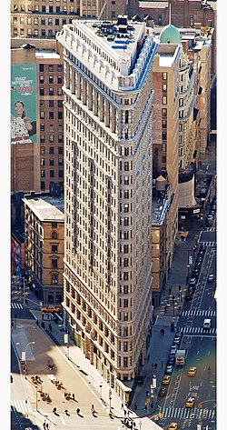
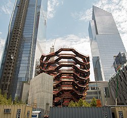
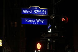
Midtown South encompasses several neighborhoods, including Chelsea, Hudson Yards and the Garment District on the West Side; Koreatown centrally; and Kips Bay, Murray Hill, and Rose Hill on the East Side. Midtown is also sometimes subclassified into "Midtown East" and "Midtown West", or divided by north and south as in the New York City Police Department's Midtown North and Midtown South precincts.

A list of the neighborhoods relative to streets and avenues in the Midtown South macro-neighborhood is as follows:

Midtown South Community Council

The Midtown South Community Council (MSCC) is a community organization based in Midtown South. It was established in 1983, formed as a civic caretaker to combat the many problems confronting residents in this highly commercialized area of Manhattan. [11] It overlaps much of the present-day neighborhood of Midtown South. In the 1980s, the quality of life was suboptimal and crime was rampant. Initially, there were daytime and nighttime councils, separating businesses and residents; the two councils eventually merged. The merger was felt to be the most effective way to bring solutions to the problems facing the business and residential communities of Midtown South, as these problems often involved the two either as allies or adversaries. The U.S. Census population of the macro-neighborhood in 2000 was 25,807, and in 2010, an increase of 2,823 was noted, and bringing the population to 28,630. [12] Today the Midtown South Community Council, a not-for-profit, 501(c)(3) organization, is devoted to building better neighborhoods and stronger relationships within Midtown South. The community councilmembers gather at the New Yorker Hotel and address problems, along with the Midtown South Precinct representatives: usually the inspector, detectives, and members. The meetings have regular visitors from the City Council, District Attorney, Midtown Community Court, Area Community Board, and various civilian outreach groups. They also often receive officers in training, officers from cabaret, crime, traffic, drug, and peddler units.The community council no longer has any ties to the NYPD as of April 2021

See also

Related Research Articles

<span class="mw-page-title-main">Murray Hill, Manhattan</span> Neighborhood in New York City

Murray Hill is a neighborhood on the east side of Manhattan in New York City. Murray Hill is generally bordered to the east by the East River or Kips Bay and to the west by Midtown Manhattan, though the exact boundaries are disputed. Murray Hill is situated on a steep glacial hill that peaked between Lexington Avenue and Broadway. It was named after Robert Murray, the head of the Murray family, a mercantile family that settled in the area in the 18th century.

<span class="mw-page-title-main">Hell's Kitchen, Manhattan</span> Neighborhood in New York City

Hell's Kitchen, also known as Clinton, is a neighborhood on the West Side of Midtown Manhattan in New York City, United States. It is considered to be bordered by 34th Street to the south, 59th Street to the north, Eighth Avenue to the east, and the Hudson River to the west.

<span class="mw-page-title-main">Koreatown, Manhattan</span> Neighborhood of Manhattan in New York City

Koreatown, or K-Town, is an ethnic Korean enclave in Midtown Manhattan, New York City, centered on 32nd Street between Madison Avenue and the intersection with Sixth Avenue and Broadway, which is known as Greeley Square. The neighborhood in Midtown South features over 150 businesses of various types and sizes, ranging from small restaurants and beauty salons to large branches of Korean banking conglomerates. Koreatown, Manhattan, has become described as the "Korean Times Square" and has emerged as the international economic outpost for the Korean chaebol.

<span class="mw-page-title-main">Chelsea, Manhattan</span> Neighborhood of Manhattan in New York City

Chelsea is a neighborhood on the West Side of the borough of Manhattan in New York City. The area's boundaries are roughly 14th Street to the south, the Hudson River and West Street to the west, and Sixth Avenue to the east, with its northern boundary variously described as near the upper 20s or 34th Street, the next major crosstown street to the north. To the northwest of Chelsea is the neighborhood of Hell's Kitchen, as well as Hudson Yards; to the northeast are the Garment District and the remainder of Midtown South; to the east are NoMad and the Flatiron District; to the southwest is the Meatpacking District; and to the south and southeast are the West Village and the remainder of Greenwich Village. Chelsea is named after the Royal Hospital Chelsea in London, England.

<span class="mw-page-title-main">Midtown Manhattan</span> Central business district in New York City

Midtown Manhattan is the central portion of the New York City borough of Manhattan and serves as the city's primary central business district. Midtown is home to some of the city's most prominent buildings, including the Empire State Building, the Chrysler Building, the Hudson Yards Redevelopment Project, the headquarters of the United Nations, Grand Central Terminal, and Rockefeller Center, as well as several prominent tourist destinations including Broadway, Times Square, and Koreatown. Penn Station in Midtown Manhattan is the busiest transportation hub in the Western Hemisphere.

<span class="mw-page-title-main">Herald Square</span> Neighborhood in Manhattan in New York City, New York

Herald Square is a major commercial intersection in the Midtown Manhattan neighborhood of New York City, formed by the intersection of Broadway, Sixth Avenue, and 34th Street. Named for the now-defunct New York Herald, a newspaper formerly headquartered there, it also gives its name to the surrounding area. The bow tie-shaped intersection consists of two named sections: Herald Square to the north (uptown) and Greeley Square to the south (downtown).

<span class="mw-page-title-main">Kips Bay, Manhattan</span> Neighborhood of Manhattan in New York City

Kips Bay, or Kip's Bay, is a neighborhood on the east side of the New York City borough of Manhattan. It is roughly bounded by East 34th Street to the north, the East River to the east, East 27th and/or 23rd Streets to the south, and Third Avenue to the west.

<span class="mw-page-title-main">Turtle Bay, Manhattan</span> Neighborhood of Manhattan in New York City

Turtle Bay is a neighborhood in New York City, on the east side of Midtown Manhattan. It extends from roughly 43rd Street to 53rd Street, and eastward from Lexington Avenue to the East River's western branch. The neighborhood is the site of the headquarters of the United Nations and the Chrysler Building. The Tudor City apartment complex is next to the southeast corner of Turtle Bay.

The New York and Harlem Railroad was one of the first railroads in the United States, and was the world's first street railway. Designed by John Stephenson, it was opened in stages between 1832 and 1852 between Lower Manhattan Island to and beyond Harlem. Horses initially pulled railway carriages, followed by a conversion to steam engines, then on to battery-powered Julien electric traction cars. In 1907, the then leaseholders of the line, New York City Railway, a streetcar operator, went into receivership. Following a further receivership in 1932, the New York Railways Corporation converted the line to bus operation. The Murray Hill Tunnel now carries a lane of road traffic, but not the buses.

<span class="mw-page-title-main">Kingsbridge, Bronx</span> Neighborhood of the Bronx in New York City

Kingsbridge is a residential neighborhood in the northwest portion of the Bronx, New York City. Kingsbridge's boundaries are Manhattan College Parkway to the north, the Major Deegan Expressway or Bailey Avenue to the east, West 230th Street to the south, and Irwin Avenue to the west.

<span class="mw-page-title-main">34th Street (Manhattan)</span> West-east street in Manhattan, New York

34th Street is a major crosstown street in the New York City borough of Manhattan. It runs the width of Manhattan Island from West Side Highway on the West Side to the FDR Drive on the East Side. 34th Street is used as a crosstown artery between New Jersey to the west and Queens to the east, connecting the Lincoln Tunnel to New Jersey with the Queens–Midtown Tunnel to Long Island.

<span class="mw-page-title-main">Manhattan Community Board 5</span> Community District in New York, United States

Manhattan Community Board 5 is a New York City community board, part of the local government apparatus of the city, with the responsibility for the neighborhoods of Midtown, Times Square, most of the Theater District, the Diamond District, the Garment District, Herald Square, Koreatown, NoMad, Murray Hill and the Flatiron District, all in the borough of Manhattan. It is bounded by 59th Street on the north, Eighth Avenue, 26th Street, the Avenue of the Americas on the west, 14th Street on the south, and Lexington Avenue on the east, excluding the area from 34th to 40th Streets between Madison and Lexington Avenues, and the area from 20th to 22nd Streets between Park Avenue South and Lexington Avenue/Irving Place.

<span class="mw-page-title-main">Hudson Yards, Manhattan</span> Neighborhood in New York City

Hudson Yards is a neighborhood on the West Side of Midtown Manhattan in New York City, bounded roughly by 30th Street in the south, 41st Street in the north, the West Side Highway in the west, and Eighth Avenue in the east. The area is the site of a large-scale redevelopment program that is being planned, funded, and constructed under a set of agreements among the State of New York, City of New York, and Metropolitan Transportation Authority (MTA), with the aim of expanding the Midtown Manhattan business district westward to the Hudson River. The program includes a major rezoning of the Far West Side, an extension of the New York City Subway's 7 and <7>​ trains to a new subway station at 34th Street and 11th Avenue, a renovation and expansion of the Javits Center, and a financing plan to fund the various components. The various components are being planned by New York City Department of City Planning and New York City Economic Development Corporation.

<span class="mw-page-title-main">Manhattanville, Manhattan</span> Neighborhood of Manhattan in New York City

Manhattanville is a neighborhood in the New York City borough of Manhattan bordered on the north by 135th Street; on the south by 122nd and 125th Streets; on the west by Hudson River; and on the east by Adam Clayton Powell Jr. Boulevard and the campus of City College.

<span class="mw-page-title-main">West Village</span> Neighborhood of Manhattan in New York City

The West Village is a neighborhood in the western section of the larger Greenwich Village neighborhood of Lower Manhattan, New York City. The West Village is bounded by the Hudson River to the west and 14th Street to the north. The eastern boundary is variously cited as Greenwich Avenue, Seventh Avenue, or Sixth Avenue, while the southern boundary is either Houston Street or Christopher Street.

<span class="mw-page-title-main">Community boards of Manhattan</span>

Community boards of Manhattan are New York City community boards in the borough of Manhattan, which are the appointed advisory groups of the community districts that advise on land use and zoning, participate in the city budget process, and address service delivery in their district.

<span class="mw-page-title-main">9th Precinct, New York City Police Department</span> NYPD precinct in lower Manhattan

The 9th Precinct of the New York City Police Department is a police precinct in New York City. It is one of 77 NYPD patrol areas. Its boundaries are East 14th Street to the north, Broadway to the west, East Houston Street to the south and the East River to the east. It is three-quarters of a square mile in area, and it covers the neighborhoods commonly referred to as the East Village, Alphabet City, Loisaida and NoHo.

<span class="mw-page-title-main">51st Street (Manhattan)</span> West-east street in Manhattan, New York

51st Street is a 1.9-mile (3.1 km) long one-way street traveling east to west across Midtown Manhattan.

References

  1. Ben Casselman, Keith Collins, and Karl Russell (February 15, 2019). "Even Without Amazon, Tech Could Keep Gaining Ground in New York". The New York Times. Retrieved February 16, 2019.{{cite news}}: CS1 maint: multiple names: authors list (link)
  2. East Midtown Rezoning and Related Actions FEIS - 2. Land Use, Zoning and Public Policy
  3. "Manhattan". NYBits. Retrieved 2018-03-20. Midtown's lower-central part is sometimes referred to as 'Midtown South' (although its exact borders' definitions vary quite widely). This area exhibits many features that are more characteristic of Downtown.
  4. "New York City Police Department".
  5. 1 2 Derek Kravitz, Midtown South: Living Where the Action Is, Wall Street Journal, Oct. 23, 2015
  6. Savills Studley Report: New York City office sector, Q3 2017
  7. Avison Young - New York City - Office Report, Third Quarter 2017
  8. Map of Midtown South, Wall Street Journal, Oct. 23, 2015
  9. Emily Ngo, "City Living: Midtown South", Newsday, January 9, 2008
  10. Midtown South Real Estate, New York Times Real Estate Pricing Guide (accessed February 21, 2018)
  11. About, Midtown South Community Council. Accessed May 20, 2022.
  12. "Analysis: NYC 2000 to 2010 demographic change".

40°44′49″N73°58′45″W / 40.7470°N 73.9792°W / 40.7470; -73.9792