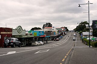
Coromandel, also called Coromandel Town to distinguish it from the wider district, is a town on the Coromandel Harbour, on the western side of the Coromandel Peninsula, which is in the North Island of New Zealand. It is 75 kilometres east of the city of Auckland, although the road between them, which winds around the Firth of Thames and Hauraki Gulf coasts, is 190 km long. The population was 1,930 as of June 2023.

Auckland is one of the 16 regions of New Zealand, which takes its name from the eponymous urban area. The region encompasses the Auckland metropolitan area, smaller towns, rural areas, and the islands of the Hauraki Gulf. Containing 33 percent of the nation's residents, it has by far the largest population and economy of any region of New Zealand, but the second-smallest land area.

Drury is a rural town near Auckland, in northern New Zealand. Located 36 kilometres to the south of Auckland CBD, under authority of the Auckland Council. Drury lies at the southern border of the Auckland metropolitan area, 12 kilometres to the northeast of Pukekohe, close to the Papakura Channel, an arm of the Manukau Harbour.

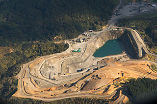
Glenbrook is a rural and industrial area in the Auckland region of New Zealand. The industrial area, that of New Zealand's major steel mill, New Zealand Steel, is not located close to any towns - the surrounding countryside is occupied by farms. The nearest towns are Waiuku, five kilometres to the south, and Pukekohe, 15 kilometres to the east.

The Bombay Hills are a range of hills to the south of Auckland, New Zealand. Though only a small and seemingly insignificant range of hills, they lie at the southern boundary of the Auckland region, and serve as a divide between Auckland and the Waikato region. There is a 19th-century settlement, Bombay, on the old main road south of Auckland, the Great South Road.

Te Papapa is a suburb of Auckland, New Zealand. It is located nine kilometres to the southeast of Auckland city centre, on the northern shore of Māngere Inlet, an arm of the Manukau Harbour. The residential and light-industrial suburb lies between the suburbs of Onehunga, Penrose, and Southdown, and is at the northern end of the Māngere Bridge which connects it with the South Auckland suburb of Māngere. Train services on the Onehunga Line run through the suburb on the Onehunga Branch line, which reopened in 2010. Services at Te Papapa station commenced on 19 September 2010. Carter Holt Harvey's head office is located at 173 Captain Springs Road in the Te Papapa area. It has been suggested that the name of the suburb refers to a fortress built of rock slabs. However, at the time Te Papapa Railway Station first opened the area around was commonly known as "Pumpkin Flat" and a short article in the Auckland Star reported that the general manager of the railways had chosen to name the station after the "Maori long pumpkin or Te Papapa" in remembrance of the commonly used name.
Helensville is a town in the North Island of New Zealand. It is sited 40 kilometres (25 mi) northwest of Auckland, close to the southern extremity of the Kaipara Harbour. State Highway 16 passes through the town, connecting it to Waimauku 16 kilometres (10 mi) to the south, and Kaukapakapa about 12 kilometres (7.5 mi) to the north-east. Parakai is two kilometres (1.2 mi) to the north-west.
Ōkaihau is a small town in the Northland Region of New Zealand's North Island, just north of Kaikohe. State Highway 1 passes through Ōkaihau making it fairly busy. Ōkaihau has a primary school and a secondary school.
Brookby is a rural suburb of Auckland, New Zealand. Brookby is approximately 5 kilometres west of Clevedon and 5 km southeast of Whitford. Originally established as a farming community with few people living in the area, Brookby is now a fast-growing community. It has many newly built houses within the area. The suburb is in the Franklin ward, one of the thirteen administrative divisions of Auckland Council. It is situated in the Hunua Electorate.

Normanby is a small village in South Taranaki, New Zealand. It is approximately 6 km inland from Hāwera along State Highway 3. Eltham is 13 km further north.

Paterangi is a settlement in the Waikato region of New Zealand's North Island. It is located 10 km northwest of Te Awamutu. It is close to the site of one of the most strongly fortified pā built during the New Zealand wars of the late 19th century.
Karetu is a community in the Northland Region of the North Island of New Zealand. Kawakawa is to the west, and Waikare is northeast. The Karetu River flows from the Russell Forest in the southeast through Karetu, and joins the Kawakawa River shortly before it flows into the Bay of Islands.

Spring Creek is a small town in Marlborough, New Zealand. State Highway 1 runs past the settlement to the west, and the Wairau River flows past to the east. Picton is 22 km to the north, and Blenheim is 6 km to the south.
Egmont Village is a settlement in Taranaki, New Zealand. State Highway 3 runs through it. New Plymouth is 12 km to the north-west, and Inglewood is 6 km to the south-east. Waiwhakaiho River and Mangaoraka Stream flow past to the west and east, respectively.
The Gardens is a suburb of Auckland, New Zealand. It is located to the north of Manurewa, east of Wiri and south of Totara Heights. It was formerly under the local governance of Manukau City Council until it was merged with all of Auckland's councils to form the Auckland 'super city' in 2010. It is now under the local governance of Auckland Council.

Mercer is a village in the Waikato District Council area of the Waikato region of the North Island of New Zealand. It is 70 km north of Hamilton and 58 km south of Auckland, on the east bank of the Waikato River, 2 km south of its confluence with the Mangatāwhiri River.
One Tree Hill is a suburb of Auckland, New Zealand. The residential part of the suburb is located to the east and south-east of Maungakiekie / One Tree Hill, from which it takes its name, with the volcanic peak located within the suburb's boundaries.

Kai Iwi is a rural community west of Whanganui in New Zealand's North Island. It lies close to SH 3, approximately halfway between Whanganui and Waitotara. The population centre is at Kai Iwi Beach, also called Mowhanau.
Ararimu is a locality in Auckland, New Zealand. It is in the Franklin ward of Auckland Council.
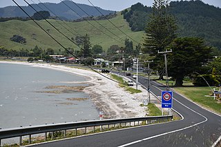
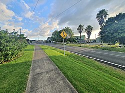
Kawakawa Bay is an east coast bay and settlement in the Franklin area of New Zealand's Auckland Region.