Imabetsu, Aomori

Last updated
Imabetsu
今別町
Town

Imabetsu town hall.JPG

Imabestu Town Hall
Flag of Imabetsu Aomori.JPG
Flag
Emblem of Imabetsu, Aomori.svg
Seal
Imabetsu in Aomori Prefecture Ja.svg
Location of Imabetsu in Aomori Prefecture
Japan location map with side map of the Ryukyu Islands.svg
Red pog.svg
Imabetsu
 
Coordinates: 41°10′54.4″N140°28′54″E / 41.181778°N 140.48167°E / 41.181778; 140.48167 Coordinates: 41°10′54.4″N140°28′54″E / 41.181778°N 140.48167°E / 41.181778; 140.48167
Country Japan
Region Tōhoku
Prefecture Aomori
District Higashitsugaru
Area
  Total 125.27 km2 (48.37 sq mi)
Population (November 30, 2017)
  Total 2,763
  Density 22/km2 (57/sq mi)
Time zone Japan Standard Time (UTC+9)
City symbols 
- Tree Hiba
- Flower Chrysanthemum
- Bird Common gull
Phone number 0174-35-2001
Address 167 Imabetsu, Imabetsu-machi, Higashitsugaru-gun, Aomori-ken 030-1502
Website Official website
Seikan Tunnel entrance Seikan Tunnel Entrance Honshu side.jpg
Seikan Tunnel entrance

Imabetsu(今別町,Imabetsu-machi) is a town located in Aomori Prefecture, Japan. As of 30 November 2017, the town has an estimated population of 2,763 in 1464 households [1] , and a population density of 22 persons per km2. The total area of the town is 125.27 km2 (48.37 sq mi).

Aomori Prefecture Prefecture of Japan

Aomori Prefecture is a prefecture of Japan located in the Tōhoku region. The capital is the city of Aomori.

Japan Constitutional monarchy in East Asia

Japan is an island country in East Asia. Located in the Pacific Ocean, it lies off the eastern coast of the Asian continent and stretches from the Sea of Okhotsk in the north to the East China Sea and the Philippine Sea in the south.

Population All the organisms of a given species that live in the specified region

In biology, a population is all the organisms of the same group or species, which live in a particular geographical area, and have the capability of interbreeding. The area of a sexual population is the area where inter-breeding is potentially possible between any pair within the area, and where the probability of interbreeding is greater than the probability of cross-breeding with individuals from other areas.

Contents

Geography

Imabetsu is in Higashitsugaru District of Aomori Prefecture, and occupies the northern coastline of Tsugaru Peninsula, facing Tsugaru Strait. Much of the town is within the limits of the Tsugaru Quasi-National Park.

Higashitsugaru District, Aomori district of Aomori Prefecture, Japan

Higashitsugaru District is a rural district located in Aomori Prefecture, Japan.

Tsugaru Peninsula

The Tsugaru Peninsula is a peninsula in Aomori Prefecture, at the northern end of Honshū island, Japan. The peninsula projects north into the Tsugaru Strait separating Honshū from Hokkaidō. The western coast is on the Sea of Japan, while on its eastern coast are Aomori Bay and Mutsu Bay. Across the Tsugaru strait to the north is Hokkaidō's Matsumae Peninsula, to which it is linked by the Seikan Tunnel.

Tsugaru Strait strait

The Tsugaru Strait is a strait between Honshu and Hokkaido in northern Japan connecting the Sea of Japan with the Pacific Ocean. It was named after the western part of Aomori Prefecture. The Seikan Tunnel passes under it at its narrowest point 12.1 miles (19.5 km) between Tappi Misaki on the Tsugaru Peninsula in Aomori Prefecture, Honshu, and Shirakami Misaki on the Matsumae Peninsula in Hokkaido.

Neighbouring municipalities

Demographics

Per Japanese census data, [2] the population of Imabetsu has decreased by more than half over the past 40 years.

Census Year Population
1970 7,358
1980 7,113
1990 4,978
2000 4,124
2010 3,217

Climate

The town has a cold humid continental climate (Köppen Cfb) characterized by warm short summers and long cold winters with heavy snowfall. The average annual temperature in Imabetsu is 10.2 °C. The average annual rainfall is 1249 mm with September as the wettest month.The temperatures are highest on average in August, at around 22.9 °C, and lowest in January, at around -1.4 °C. [3]

Humid continental climate Category in the Köppen climate classification system

A humid continental climate is a climatic region defined by Russo-German climatologist Wladimir Köppen in 1900, typified by large seasonal temperature differences, with warm to hot summers and cold winters. Precipitation is usually distributed throughout the year. The definition of this climate regarding temperature is as follows: the mean temperature of the coldest month must be below −3 °C (26.6 °F) and there must be at least four months whose mean temperatures are at or above 10 °C (50 °F). In addition, the location in question must not be semi-arid or arid. The Dfb, Dwb and Dsb subtypes are also known as hemiboreal.

Köppen climate classification widely used climate classification system

The Köppen climate classification is one of the most widely used climate classification systems. It was first published by the Russian climatologist Wladimir Köppen (1846–1940) in 1884, with several later modifications by Köppen, notably in 1918 and 1936. Later, the climatologist Rudolf Geiger introduced some changes to the classification system, which is thus sometimes called the Köppen–Geiger climate classification system.

Climate data for Imabetsu (1981–2010)
MonthJanFebMarAprMayJunJulAugSepOctNovDecYear
Average high °C (°F) 1.4
(34.5)
2.0
(35.6)
5.6
(42.1)
11.9
(53.4)
16.5
(61.7)
19.8
(67.6)
23.4
(74.1)
25.9
(78.6)
22.8
(73)
17.1
(62.8)
10.4
(50.7)
4.4
(39.9)
13.4
(56.2)
Average low °C (°F) −3.5
(25.7)
−3.3
(26.1)
−1.1
(30)
3.2
(37.8)
7.8
(46)
12.1
(53.8)
16.8
(62.2)
18.9
(66)
14.8
(58.6)
8.8
(47.8)
3.4
(38.1)
−1.1
(30)
6.4
(43.5)
Average precipitation mm (inches) 136.0
(5.354)
100.9
(3.972)
91.6
(3.606)
96.6
(3.803)
105.9
(4.169)
78.3
(3.083)
149.7
(5.894)
163.7
(6.445)
171.7
(6.76)
143.9
(5.665)
167.9
(6.61)
154.1
(6.067)
1,560.3
(61.428)
Average snowfall cm (inches) 171
(67.3)
141
(55.5)
88
(34.6)
5
(2)
0
(0)
0
(0)
0
(0)
0
(0)
0
(0)
0
(0)
14
(5.5)
103
(40.6)
522
(205.5)
Mean monthly sunshine hours 32.2 55.1 115.1 177.7 197.7 169.7 142.2 158.5 145.0 133.4 66.9 33.9 1,427.4
Source: Japan Meteorological Agency

History

The area around Imabetsu was controlled by the Tsugaru clan of Hirosaki Domain during the Edo period. During the cadastral reform of 1889, Minmaya, Kanita and Tairadate villages were separated from Imabetsu, which was also organized as a village. On March 31, 1955, Imabetsu annexed the neighboring village of Ippongi and was elevated to town status.

Tsugaru clan

The Tsugaru clan was a Japanese samurai clan who ruled the northwestern half of what is now Aomori Prefecture in the Tōhoku region of Japan under the Edo period Tokugawa shogunate. The Tsugaru were daimyō of Hirosaki Domain and its semi-subsidiary, Kuroishi Domain. The Tsugaru were in constant conflict with their former overlords, the Nanbu clan of adjoining Morioka Domain. During the Boshin War of 1868-69, the Tsugaru clan fought mostly on the pro-imperial side, although it did briefly join the Ōuetsu Reppan Dōmei. In the Meiji period, the former daimyō became part of the kazoku peerage, with Tsugaru Tsuguakira receiving the title of hakushaku (Count). The main Tsugaru line is now extinct.

Hirosaki Domain

Hirosaki Domain, also known as Tsugaru Domain, was a tozama feudal domain of Edo period Japan It is located in Mutsu Province, in northern Honshū. The domain was centered at Hirosaki Castle, located in the center of what is now the city of Hirosaki in Aomori Prefecture. It was ruled by the Tsugaru clan. A branch of the family ruled the adjoining Kuroishi Domain.

Edo period period of Japanese history

The Edo period or Tokugawa period (徳川時代) is the period between 1603 and 1868 in the history of Japan, when Japanese society was under the rule of the Tokugawa shogunate and the country's 300 regional daimyō. The period was characterized by economic growth, strict social order, isolationist foreign policies, a stable population, "no more wars", and popular enjoyment of arts and culture. The shogunate was officially established in Edo on March 24, 1603, by Tokugawa Ieyasu. The period came to an end with the Meiji Restoration on May 3, 1868, after the fall of Edo.

Economy

The economy of Imabetsu is heavily dependent on commercial fishing. Some of the locally caught seafood include sea urchin roe, sea cucumber, scallops, abalone and squid.

Commercial fishing economic activity

Commercial fishing is the activity of catching fish and other seafood for commercial profit, mostly from wild fisheries. It provides a large quantity of food to many countries around the earth, but those who practice it as an industry must often pursue fish far into the ocean under adverse conditions. Large-scale commercial fishing is also known as industrial fishing. This profession has gained in popularity with the development of shows such as Deadliest Catch, Swords, and Wicked Tuna. The major fishing industries are not only owned by major corporations but by small families as well. The industry has had to adapt through the years in order to keep earning a profit. A study taken on some small family-owned commercial fishing companies showed that they adapted to continue to earn a living but not necessarily make a large profit. It is the adaptability of the fishermen and their methods that cause some concern for fishery managers and researchers; they say that for those reasons, the sustainability of the marine ecosystems could be in danger of being ruined.

Scallop common name for several shellfish, many are a food

Scallop is a common name that is primarily applied to any one of numerous species of saltwater clams or marine bivalve mollusks in the taxonomic family Pectinidae, the scallops. However, the common name "scallop" is also sometimes applied to species in other closely related families within the superfamily Pectinoidea, which also includes the thorny oysters.

Abalone any of a group of small to very large sea snails, marine gastropod molluscs in the family Haliotidae

Abalone is a common name for any of a group of small to very large sea snails, marine gastropod molluscs in the family Haliotidae.

Education

Imabetsu has one public elementary school and one public junior high middle school operated by the town government, and one public high school operated by the Aomori Prefectural Board of Education.

Transportation

Railway

Highway

Commons-logo.svg Media related to Imabetsu, Aomori at Wikimedia Commons

Related Research Articles

Kuroishi, Aomori City in Tōhoku, Japan

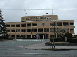
Kuroishi is a city located in Aomori Prefecture, Japan. As of 1 October 2017, the city had an estimated population of 32,260 and a population density of 150 persons per km2. The total area of the city is 217.05 square kilometres (83.80 sq mi).

Goshogawara, Aomori City in Tōhoku, Japan

Goshogawara is a city located in Aomori Prefecture, Japan. As of 31 December 2017, the city has an estimated population of 55,746 in 25540 households, and a population density of 140 persons per km2. The total area of the city is 404.18 square kilometres (156.05 sq mi).

Yokohama, Aomori Town in Tōhoku, Japan

Yokohama is a town located in Aomori Prefecture, Japan. As of 1 February 2017, the town had an estimated population of 4,711, and a population density of 37.3 persons per km², in 2107 households. The total area of the town is 126.38 square kilometres (48.80 sq mi).

Yomogita, Aomori Village in Tōhoku, Japan

Yomogita is a village located in Aomori Prefecture, Japan. As of 31 December 2017, the village had an estimated population of 2,869 in 1166 households, and a population density of 35 persons per km2. The total area of the village is 80.84 square kilometres (31.21 sq mi).

Ajigasawa, Aomori Town in Tōhoku, Japan

Ajigasawa is a town located in Aomori Prefecture, Japan. As of 30 October 2017, the town had an estimated population of 10,330 in 4612 households, and a population density of 30 persons per km2. The total area of the town is 343.08 square kilometres (132.46 sq mi).

Fukaura, Aomori Town in Tōhoku, Japan

Fukaura is a town located in Aomori Prefecture, Japan. As of 30 November 2017, the town had an estimated population of 8477 in 3792 households, and a population density of 17.0 persons per km². The total area of the town is 488.85 km2 (188.75 sq mi).

Nishimeya, Aomori Village in Tōhoku, Japan

Nishimeya is a village located in Aomori Prefecture, Japan. As of 1 January 2018, the village had an estimated population of 1,356 in 531 households, and a population density of 5.91 persons per km2. The total area of the village is 246.02 square kilometres (94.99 sq mi).

Fujisaki, Aomori Town in Tōhoku, Japan

Fujisaki is a town in Aomori Prefecture, Japan. As of 1 September 2016, the town had an estimated population of 15,172 in 5943 households, and a population density of 410 persons per km². The total area of the town is 37.29 square kilometres (14.40 sq mi).

Ōwani, Aomori Town in Tōhoku, Japan

Ōwani is a town located in Aomori Prefecture, Japan. As of 31 December 2017, the town had an estimated population of 9,821in 4230 households and a population density of 60.0 persons per km². The total area of the town is 163.41 square kilometres (63.09 sq mi).

Inakadate, Aomori Village in Tōhoku, Japan

Inakadate is a village in Aomori Prefecture, Japan. As of 30 November 2017, the village has an estimated population of 7,985 in 2,736 households, and a population density of 362 persons per km². The total area of the village is 22.35 square kilometres (8.63 sq mi).

Itayanagi, Aomori Town in Tōhoku, Japan

Itayanagi is a town located in Aomori Prefecture, Japan. As of 31 December 2017, the town had an estimated population of 13,517, and a population density of 320 persons per km². The total area of the town is 41.88 square kilometres (16.17 sq mi).

Tsuruta, Aomori Town in Tōhoku, Japan

Tsuruta is a town located in Aomori Prefecture, Japan. As of 1 April 2017, the town had an estimated population of 13,322 in 5398 households,, and a population density of 290 persons per km2. The total area of the town is 46.4 square kilometres (17.9 sq mi). The name "Tsuruta" is a combination of the character for crane (鶴) with that for rice field (田).

Kazamaura, Aomori Village in Tōhoku, Japan

Kazamaura is a village located in Aomori Prefecture, Japan. As of 1 June 2017, the village had an estimated population of 2,002, and a population density of 28 persons per km2 in 942 households.. The total area of the village is 69.55 square kilometres (26.85 sq mi).

Sai, Aomori Village in Tōhoku, Japan

Sai is a village located in Aomori, Japan. As of 28 February 2017, the village had an estimated population of 2,149, and a population density of 15.9 persons per km2 in 978 households. Its total area of the village is 135.04 square kilometres (52.14 sq mi). In 2016, Sai was selected as one of The Most Beautiful Villages in Japan.

Tsugaru, Aomori City in Tōhoku, Japan

Tsugaru is a city located in Aomori Prefecture, Japan. As of 31 December 2017, the city had an estimated population of 33,254 in 13,750 households, and a population density of 130 persons per km². The total area of the city is 253.55 square kilometres (97.90 sq mi). The city's name is atypical for a Japanese place, in that it is written in hiragana rather than kanji.

Hirakawa, Aomori City in Tōhoku, Japan

Hirakawa is a city located in Aomori Prefecture, Japan. As of 31 December 2017, the city had an estimated population of 31,708 in 11,860 households, and a population density of 92.0 persons per km2. The total area of the city is 346.01 square kilometres (133.60 sq mi).

Oirase, Aomori Town in Tōhoku, Japan

Oirase is a town located in Aomori Prefecture, Japan. As of 1 February 2017, the town had an estimated population of 25,377, and a population density of 353 persons per km², in 10,110 households. The total area of the town is 71.96 square kilometres (27.78 sq mi).

Sotogahama, Aomori Town in Tōhoku, Japan

Sotogahama is a town located in Aomori Prefecture, Japan. As of 30 November 2017, the town had an estimated population of 5,860, and a population density of 25.4 persons per km2. The total area of the town is 230.29 square kilometres (88.92 sq mi).

Nakadomari, Aomori Town in Tōhoku, Japan

Nakadomari is a town located in Aomori Prefecture, Japan. As of 1 January 2018, the town had an estimated population of 11,406 in 5125 households, and a population density of 53 persons per km2. The total area of the town is 34 square kilometres (13 sq mi).

References