Nakadomari, Aomori

Last updated
Nakadomari
中泊町
Town

Tatsudomariline.JPG

Tatsudomari Line between Kodomari and Cape Tappi
Flag of Nakadomari Aomori.gif
Flag
Nakadomari Aomori chapter.JPG
Seal
Nakadomari in Aomori Prefecture Ja.svg
Location of Nakadomari in Aomori Prefecture
Japan location map with side map of the Ryukyu Islands.svg
Red pog.svg
Nakadomari
 
Coordinates: 40°58′N140°26′E / 40.967°N 140.433°E / 40.967; 140.433 Coordinates: 40°58′N140°26′E / 40.967°N 140.433°E / 40.967; 140.433
Country Japan
Region Tōhoku
Prefecture Aomori
District Kitatsugaru
Area
  Total 216.34 km2 (83.53 sq mi)
Population (January 1, 2018)
  Total 11,406
  Density 53/km2 (140/sq mi)
Time zone Japan Standard Time (UTC+9)
Symbols 
• Tree Hiba
• Flower Chrysanthemum
• Bird Barn swallow
Phone number 0173-57-2111
Address 434 Kameyama, Nakasato, Nakadomari-machiKitatsugraru-gun, Aomori-ken 037-0392
Website Official website
Nakadomari Town Hall Nakadomari town hall.JPG
Nakadomari Town Hall

Nakadomari(中泊町,Nakadomari-machi) is a town located in Aomori Prefecture, Japan. As of 1 January 2018, the town had an estimated population of 11,406 in 5125 households [1] , and a population density of 53 persons per km2. The total area of the town is 34 square kilometres (13 sq mi).

Aomori Prefecture Prefecture of Japan

Aomori Prefecture is a prefecture of Japan located in the Tōhoku region. The capital is the city of Aomori.

Japan Constitutional monarchy in East Asia

Japan is an island country in East Asia. Located in the Pacific Ocean, it lies off the eastern coast of the Asian continent and stretches from the Sea of Okhotsk in the north to the East China Sea and the Philippine Sea in the south.

Population All the organisms of a given species that live in the specified region

In biology, a population is all the organisms of the same group or species, which live in a particular geographical area, and have the capability of interbreeding. The area of a sexual population is the area where inter-breeding is potentially possible between any pair within the area, and where the probability of interbreeding is greater than the probability of cross-breeding with individuals from other areas.

Contents

Geography

Nakadomari is in Kitatsugaru District of Aomori Prefecture, and consists of two discontinuous geographic areas in northern Tsugaru Peninsula. The larger area is in the south, and consists of the former town of Nakasato.The smaller area is in the north, and consists of the former village of Kodomari with a coastline on the Sea of Japan at the western end of Tsugaru Strait.

Kitatsugaru District, Aomori district of Japan

Kitatsugaru District is a rural district located in Aomori Prefecture, Japan.

Tsugaru Peninsula

The Tsugaru Peninsula is a peninsula in Aomori Prefecture, at the northern end of Honshū island, Japan. The peninsula projects north into the Tsugaru Strait separating Honshū from Hokkaidō. The western coast is on the Sea of Japan, while on its eastern coast are Aomori Bay and Mutsu Bay. Across the Tsugaru strait to the north is Hokkaidō's Matsumae Peninsula, to which it is linked by the Seikan Tunnel.

Nakasato, Aomori Former municipality in Tōhoku, Japan

Nakasato was a town located in Kitatsugaru District in western Aomori Prefecture, Japan.

Neighboring municipalities

Goshogawara, Aomori City in Tōhoku, Japan

Goshogawara is a city located in Aomori Prefecture, Japan. As of 31 December 2017, the city has an estimated population of 55,746 in 25540 households, and a population density of 140 persons per km2. The total area of the city is 404.18 square kilometres (156.05 sq mi).

Tsugaru, Aomori City in Tōhoku, Japan

Tsugaru is a city located in Aomori Prefecture, Japan. As of 31 December 2017, the city had an estimated population of 33,254 in 13,750 households, and a population density of 130 persons per km². The total area of the city is 253.55 square kilometres (97.90 sq mi). The city's name is atypical for a Japanese place, in that it is written in hiragana rather than kanji.

Yomogita, Aomori Village in Tōhoku, Japan

Yomogita is a village located in Aomori Prefecture, Japan. As of 31 December 2017, the village had an estimated population of 2,869 in 1166 households, and a population density of 35 persons per km2. The total area of the village is 80.84 square kilometres (31.21 sq mi).

Demographics

Per Japanese census data, [2] the population of Nakadomari has decreased steadily over the past 40 years.

Census Year Population
1970 21,061
1980 19,968
1990 17,354
2000 15,325
2010 12,743

Climate

has a cold humid continental climate (Köppen Cfa) characterized by warm short summers and long cold winters with heavy snowfall. The average annual temperature in Nakadomari is 9.4 °C. The average annual rainfall is 1399 mm with September as the wettest month.The temperatures are highest on average in August, at around 22.3 °C, and lowest in January, at around -2.3 °C. [3] Snowfall typically begins in late November and lasts through March and sometimes April. [4] [5] Blizzard-like conditions, created by strong winds and a heavy accumulation of snow, are common during winter. [6] During these times visibility can be reduced to several feet or less. [7]

Humid continental climate Category in the Köppen climate classification system

A humid continental climate is a climatic region defined by Russo-German climatologist Wladimir Köppen in 1900, typified by large seasonal temperature differences, with warm to hot summers and cold winters. Precipitation is usually distributed throughout the year. The definition of this climate regarding temperature is as follows: the mean temperature of the coldest month must be below −3 °C (26.6 °F) and there must be at least four months whose mean temperatures are at or above 10 °C (50 °F). In addition, the location in question must not be semi-arid or arid. The Dfb, Dwb and Dsb subtypes are also known as hemiboreal.

Köppen climate classification widely used climate classification system

The Köppen climate classification is one of the most widely used climate classification systems. It was first published by the Russian climatologist Wladimir Köppen (1846–1940) in 1884, with several later modifications by Köppen, notably in 1918 and 1936. Later, the climatologist Rudolf Geiger introduced some changes to the classification system, which is thus sometimes called the Köppen–Geiger climate classification system.

Climate data for Nakadomari (1981-2010)
MonthJanFebMarAprMayJunJulAugSepOctNovDecYear
Average high °C (°F) 1.8
(35.2)
2.3
(36.1)
5.9
(42.6)
12.0
(53.6)
16.6
(61.9)
20.6
(69.1)
24.1
(75.4)
26.7
(80.1)
23.1
(73.6)
17.3
(63.1)
10.8
(51.4)
4.8
(40.6)
13.8
(56.9)
Average low °C (°F) −3.6
(25.5)
−3.5
(25.7)
−1.2
(29.8)
3.3
(37.9)
8.0
(46.4)
12.6
(54.7)
17.3
(63.1)
19.2
(66.6)
14.6
(58.3)
8.4
(47.1)
3.2
(37.8)
−1.1
(30)
6.4
(43.6)
Average precipitation mm (inches) 111.4
(4.386)
77.4
(3.047)
65.3
(2.571)
72.6
(2.858)
95.3
(3.752)
80.8
(3.181)
135.7
(5.343)
155.9
(6.138)
156.3
(6.154)
123.4
(4.858)
143.5
(5.65)
118.7
(4.673)
1,336.3
(52.611)
Source: "Japan Meteorological Agency [2]" . Retrieved October 2, 2016. 

History

The area around Nakadomari was controlled by the Tsugaru clan of Hirosaki Domain during the Edo period. During the post-Meiji restoration cadastral reform of 1889, the villages of Nakasato and Komadari were created within Kitatsugaru District, Aomori. The town of Nakadomari was created on March 28, 2005 as a result of the merger of these two municipalities.

Tsugaru clan

The Tsugaru clan was a Japanese samurai clan who ruled the northwestern half of what is now Aomori Prefecture in the Tōhoku region of Japan under the Edo period Tokugawa shogunate. The Tsugaru were daimyō of Hirosaki Domain and its semi-subsidiary, Kuroishi Domain. The Tsugaru were in constant conflict with their former overlords, the Nanbu clan of adjoining Morioka Domain. During the Boshin War of 1868-69, the Tsugaru clan fought mostly on the pro-imperial side, although it did briefly join the Ōuetsu Reppan Dōmei. In the Meiji period, the former daimyō became part of the kazoku peerage, with Tsugaru Tsuguakira receiving the title of hakushaku (Count). The main Tsugaru line is now extinct.

Hirosaki Domain

Hirosaki Domain, also known as Tsugaru Domain, was a tozama feudal domain of Edo period Japan It is located in Mutsu Province, in northern Honshū. The domain was centered at Hirosaki Castle, located in the center of what is now the city of Hirosaki in Aomori Prefecture. It was ruled by the Tsugaru clan. A branch of the family ruled the adjoining Kuroishi Domain.

Edo period period of Japanese history

The Edo period or Tokugawa period (徳川時代) is the period between 1603 and 1868 in the history of Japan, when Japanese society was under the rule of the Tokugawa shogunate and the country's 300 regional daimyō. The period was characterized by economic growth, strict social order, isolationist foreign policies, a stable population, "no more wars", and popular enjoyment of arts and culture. The shogunate was officially established in Edo on March 24, 1603, by Tokugawa Ieyasu. The period came to an end with the Meiji Restoration on May 3, 1868, after the fall of Edo.

Economy

Squid drying in Kodomari Squid Drying in Kodomari.jpg
Squid drying in Kodomari

The economy of Nakadomari is heavily dependent on agriculture and commercial fishing.

Education

Nakasato has four public elementary schools (three in Nakasato and one in Kodomari) and two public junior high schools (one in Kodomari and one in Nakasato) operated by the town government. The town has one public high school, located in Nakasato, operated by the Aomori Prefectural Board of Education.

Transportation

Railway [8]

Highway

Culture

Nakadomari has several yearly festivals including a firefly festival, [9] summer festival [10] and winter snow festival. [11] The area is known locally for producing high quality blueberries and dried squid. [12]

Noted people from Nakadomari

Related Research Articles

Hiranai, Aomori Town in Tōhoku, Japan

Hiranai is a town located in Aomori Prefecture, Japan. As of 1 April 2019, the town had an estimated population of 11,016 in 4,951 households, and a population density of 51 persons per km². It is the most heavily populated town in Higashitsugaru District. The total area of the town is 217.08 km2 (83.82 sq mi).

Fujisaki, Aomori Town in Tōhoku, Japan

Fujisaki is a town in Aomori Prefecture, Japan. As of 1 September 2016, the town had an estimated population of 15,172 in 5943 households, and a population density of 410 persons per km². The total area of the town is 37.29 square kilometres (14.40 sq mi).

Itayanagi, Aomori Town in Tōhoku, Japan

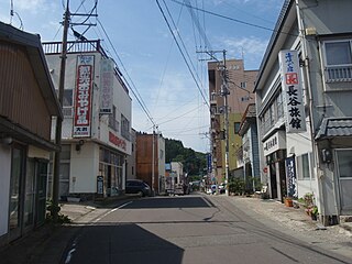
Itayanagi is a town located in Aomori Prefecture, Japan. As of 31 December 2017, the town had an estimated population of 13,517, and a population density of 320 persons per km². The total area of the town is 41.88 square kilometres (16.17 sq mi).

Kodomari, Aomori Former municipality in Tōhoku, Japan

Kodomari was a village located in Kitatsugaru District in western Aomori Prefecture, Japan.

Kazamaura, Aomori Village in Tōhoku, Japan

Kazamaura is a village located in Aomori Prefecture, Japan. As of 1 June 2017, the village had an estimated population of 2,002, and a population density of 28 persons per km2 in 942 households.. The total area of the village is 69.55 square kilometres (26.85 sq mi).

Sai, Aomori Village in Tōhoku, Japan

Sai is a village located in Aomori, Japan. As of 28 February 2017, the village had an estimated population of 2,149, and a population density of 15.9 persons per km2 in 978 households. Its total area of the village is 135.04 square kilometres (52.14 sq mi). In 2016, Sai was selected as one of The Most Beautiful Villages in Japan.

Sannohe, Aomori Town in Tōhoku, Japan

Sannohe is a town located in located in Aomori Prefecture, Japan. As of 1 October 2016, the town had an estimated population of 9,884, and a population density of 65.1 persons per km2. The total area of the town is 151.79 square kilometres (58.61 sq mi).

Takko, Aomori Town in Tōhoku, Japan

Takko is a town located in Aomori Prefecture, Japan. As of 31 January 2017, the town had an estimated population of 5,821, and a population density of 24 persons per km2, in 2,214 households.. The total area of the town is 241.98 square kilometres (93.43 sq mi).

Nanbu, Aomori Town in Tōhoku, Japan

Nanbu is a town located in Aomori Prefecture, Japan. As of 1 March 2017, the town had an estimated population of 18,906, and a population density of 123 persons per km2 in 7482 households. The total area of the town is 153.12 square kilometres (59.12 sq mi).

Hashikami, Aomori Town in Tōhoku, Japan

Hashikami is a town located in Aomori Prefecture, Japan. As of 1 March 2017, the town had an estimated population of 13,900, and a population density of 148 persons per km2 in 5,906 households. The total area of the town is 94.01 square kilometres (36.30 sq mi).

Tsugaru-Nakasato Station railway station in Nakadomari, Kitatsugaru district, Aomori Prefecture, Japan

Tsugaru-Nakasato Station is a railway station on the Tsugaru Railway Line in the town of Nakadomari, Aomori, Japan, operated by the private railway operator Tsugaru Railway Company.

Ashino Chishōgun Prefectural Natural Park

Ashino Chishōgun Prefectural Natural Park is a Prefectural Natural Park on the Tsugaru Peninsula in northwest Aomori Prefecture, Japan. Established in 1958, the park spans the borders of the municipalities of Goshogawara and Nakadomari. It encompasses Lake Ashino (芦野湖) and Ashino Park, which is planted with 2,300 cherry trees.

Natsudomari Peninsula

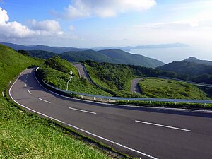
Natsudomari Peninsula is a peninsula on the northern end of the Japanese island, Honshū, that stretches north into Mutsu Bay. Administratively the area is a part of Aomori Prefecture, and the bulk of the area falls within the jurisdiction of the town of Hiranai, with Aomori city on the western periphery of the landform. The peninsula has several small fishing communities scattered around the coastline, but most of the area's people live in the river valley that demarcates the southern boundary of the peninsula. The peninsula is notably an attractive nesting place for Siberian tundra swan.

Ōshima (Aomori) island in Hiranai, Japan

Ōshima is a rocky island off the northern coast of Natsudomari Peninsula in Mutsu Bay. The island is a part of Hiranai in Aomori Prefecture. The island has 3 km (1.9 mi) of coastline and an area of 0.16 km2 (0.062 sq mi). It is a part of the prefecture-maintained, Asamushi-Natsudomari Prefectural Natural Park.

References

  1. official home page (in Japanese)
  2. Nakadomari population statistics
  3. Nakadomari climate data
  4. Agency, Japan Meteorological. "JMA | Climate_Tohoku_district". www.data.jma.go.jp. Retrieved 2016-10-03.
  5. "気象庁|過去の気象データ検索 Japan Meteorological Agency Climate Stats (In Japanese)". www.data.jma.go.jp. Retrieved 2016-10-03.
  6. 青森県中泊町. "地勢と気象 - 青森県中泊町". www.town.nakadomari.lg.jp (in Japanese). Retrieved 2016-10-03.
  7. satokou46 (2014-03-10), Video of someone driving in Kitatsugaru during blizard-like conditions caused by high winds. , retrieved 2016-10-03
  8. "津軽鉄道 株式会社". tsutetsu.com. Retrieved 2016-10-03.
  9. "Nakadomari Town Magazine August 2016" (PDF).
  10. "Nakadomari Town Magazine August 2016 (in Japanese)" (PDF).
  11. "Nakadomari Town Magazine March 2016" (PDF).
  12. 青森県中泊町. "特産品 - 青森県中泊町 Nakadomari Famous Goods (in Japanese)". www.town.nakadomari.lg.jp. Retrieved 2016-10-03.