It has been requested that the title of this article be changed to Goshogawara. Please see the relevant discussion on the discussion page. Do not move the page until the discussion has reached consensus for the change and is closed. |
Goshogawara 五所川原市 | |||
---|---|---|---|
City | |||
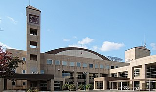
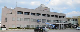
Goshogawara City Hall | |||
| |||
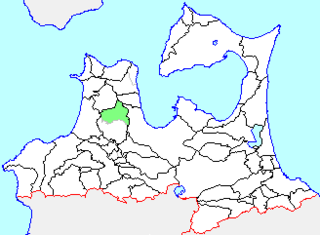
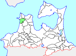
Location of Goshogawara in Aomori Prefecture | |||
Coordinates: 40°48′28.9″N140°26′24.3″E / 40.808028°N 140.440083°E Coordinates: 40°48′28.9″N140°26′24.3″E / 40.808028°N 140.440083°E | |||
Country | Japan | ||
Region | Tōhoku | ||
Prefecture | Aomori | ||
Government | |||
• Mayor | Masatoshi Hirayama | ||
Area | |||
• Total | 404.18 km2 (156.05 sq mi) | ||
Population (December 31, 2017) | |||
• Total | 55,746 | ||
• Density | 140/km2 (360/sq mi) | ||
Time zone | Japan Standard Time (UTC+9) | ||
City symbols | |||
• Tree | Japanese elm | ||
• Flower | Nohanashōbu ( iris ensata var. spontanea) | ||
• Bird | Oriental greenfinch | ||
Phone number | 0173-35-2111 | ||
Address | 12 Iwakichō, Goshogawara-shi, Aomori-ken 037-8686 | ||
Website | Official website |
Goshogawara(五所川原市 Goshogawara-shi) is a city located in Aomori Prefecture, Japan. As of 31 December 2017 [update] , the city has an estimated population of 55,746 in 25540 households, [1] and a population density of 140 persons per km2. The total area of the city is 404.18 square kilometres (156.05 sq mi).
A city is a local administrative unit in Japan. Cities are ranked on the same level as towns and villages, with the difference that they are not a component of districts. Like other contemporary administrative units, they are defined by the Local Autonomy Law of 1947.
Aomori Prefecture is a prefecture of Japan located in the Tōhoku region. The capital is the city of Aomori.
Japan is an island country in East Asia. Located in the Pacific Ocean, it lies off the eastern coast of the Asian continent and stretches from the Sea of Okhotsk in the north to the East China Sea and the Philippine Sea in the south.
Goshogawara occupies two discontinuous areas on Tsugaru Peninsula in western Aomori Prefecture. The Iwaki River flows through the city. The larger section is landlocked, and is in the middle of the peninsula. It contains the original town of Goshogawara, and is the population centre of the city, The smaller exclave to the north is on the Sea of Japan coast. Parts of the city are within the limits of the Tsugaru Quasi-National Park. The city has a cold humid continental climate (Köppen Cfb) characterized by warm short summers and long cold winters with heavy snowfall. The average annual temperature in Goshogawara is 10.4 °C. The average annual rainfall is 1281 mm with September as the wettest month.The temperatures are highest on average in August, at around 23.4 °C, and lowest in January, at around -1.5 °C. [2]
The Tsugaru Peninsula is a peninsula in Aomori Prefecture, at the northern end of Honshū island, Japan. The peninsula projects north into the Tsugaru Strait separating Honshū from Hokkaidō. The western coast is on the Sea of Japan, while on its eastern coast are Aomori Bay and Mutsu Bay. Across the Tsugaru strait to the north is Hokkaidō's Matsumae Peninsula, to which it is linked by the Seikan Tunnel.
The Iwaki River is a river that crosses western Aomori Prefecture, Japan. It is 102 kilometers (63 mi) in length and has a drainage area of 2,544 square kilometers (982 sq mi). Under the Rivers Act of 1964 the Iwaki is designated as a Class 1 River and is managed by the Japanese Ministry of Land, Infrastructure, Transport and Tourism. The Iwaki River is the longest river in Aomori Prefecture, and is the source of irrigation for the large-scale rice and apple production of the prefecture. The Iwaki River, in the Tōhoku region north of the Fukushima Daiichi Nuclear Power Plant, remains unpolluted by radioactive materials after the Fukushima Daiichi nuclear disaster. Testing for caesium-134 and caesium-137 is carried out and published on a bimonthly basis.
The Sea of Japan is the marginal sea between the Japanese archipelago, Sakhalin, the Korean Peninsula and Russia. The Japanese archipelago separates the sea from the Pacific Ocean. It is bordered by Japan, Korea and Russia. Like the Mediterranean Sea, it has almost no tides due to its nearly complete enclosure from the Pacific Ocean. This isolation also reflects in the fauna species and in the water salinity, which is lower than in the ocean. The sea has no large islands, bays or capes. Its water balance is mostly determined by the inflow and outflow through the straits connecting it to the neighboring seas and Pacific Ocean. Few rivers discharge into the sea and their total contribution to the water exchange is within 1%.
Aomori Prefecture
Tsuruta is a town located in Aomori Prefecture, Japan. As of 1 April 2017, the town had an estimated population of 13,322 in 5398 households,, and a population density of 290 persons per km2. The total area of the town is 46.4 square kilometres (17.9 sq mi). The name "Tsuruta" is a combination of the character for crane (鶴) with that for rice field (田).
Nakadomari is a town located in Aomori Prefecture, Japan. As of 1 January 2018, the town had an estimated population of 11,406 in 5125 households, and a population density of 53 persons per km2. The total area of the town is 34 square kilometres (13 sq mi).
Imabetsu is a town located in Aomori Prefecture, Japan. As of 30 November 2017, the town has an estimated population of 2,763 in 1464 households, and a population density of 22 persons per km2. The total area of the town is 125.27 km2 (48.37 sq mi).
Tsugaru is a city located in Aomori Prefecture, Japan. As of 31 December 2017, the city had an estimated population of 33,254 in 13,750 households, and a population density of 130 persons per km². The total area of the city is 253.55 square kilometres (97.90 sq mi). The city's name is atypical for a Japanese place, in that it is written in hiragana rather than kanji.
Itayanagi is a town located in Aomori Prefecture, Japan. As of 31 December 2017, the town had an estimated population of 13,517, and a population density of 320 persons per km². The total area of the town is 41.88 square kilometres (16.17 sq mi).
Per Japanese census data, [3] the population of Goshogawara has declined slightly over the past 40 years.
Census Year | Population |
---|---|
1970 | 67,047 |
1980 | 68,738 |
1990 | 63,843 |
2000 | 63,208 |
2010 | 58,421 |
The area of Goshogawara was part of the holdings of the Tsugaru clan of Hirosaki Domain in the Edo period. After the post-Meiji restoration cadastral reform of 1889, the area became part of Kitatsugaru District, Aomori, and was divided into the village of Goshogawara, Sakae, Miyoshi, Nakagawa, Nagahashi, Nanawa, Matsushima and Itayanagi in 1889. On July 1, 1898, Goshogawara was elevated to town status. On October 1, 1954. Goshogawara absorbed the villages of Sakae, Nakagawa, Nagahashi, Matsushima and Iizume to create the city of Goshogawara. On April 1, 1958, Goshogawara absorbed a portion of the town of Kizukuri.
The Tsugaru clan was a Japanese samurai clan who ruled the northwestern half of what is now Aomori Prefecture in the Tōhoku region of Japan under the Edo period Tokugawa shogunate. The Tsugaru were daimyō of Hirosaki Domain and its semi-subsidiary, Kuroishi Domain. The Tsugaru were in constant conflict with their former overlords, the Nanbu clan of adjoining Morioka Domain. During the Boshin War of 1868-69, the Tsugaru clan fought mostly on the pro-imperial side, although it did briefly join the Ōuetsu Reppan Dōmei. In the Meiji period, the former daimyō became part of the kazoku peerage, with Tsugaru Tsuguakira receiving the title of hakushaku (Count). The main Tsugaru line is now extinct.
Hirosaki Domain, also known as Tsugaru Domain, was a tozama feudal domain of Edo period Japan It is located in Mutsu Province, in northern Honshū. The domain was centered at Hirosaki Castle, located in the center of what is now the city of Hirosaki in Aomori Prefecture. It was ruled by the Tsugaru clan. A branch of the family ruled the adjoining Kuroishi Domain.
The Edo period or Tokugawa period (徳川時代) is the period between 1603 and 1868 in the history of Japan, when Japanese society was under the rule of the Tokugawa shogunate and the country's 300 regional daimyō. The period was characterized by economic growth, strict social order, isolationist foreign policies, a stable population, "no more wars", and popular enjoyment of arts and culture. The shogunate was officially established in Edo on March 24, 1603, by Tokugawa Ieyasu. The period came to an end with the Meiji Restoration on May 3, 1868, after the fall of Edo.
On March 28, 2005, the town of Kanagi, and the village of Shiura were merged into Goshogawara.
Goshogawara has a mayor-council form of government with a directly elected mayor and a unicameral city legislature of 26 members.
The economy of Goshogawara is mixed. The city serves as a regional commercial center. Agricultural produce includes rice and apples, and commercial fishing includes clams. The Aomori Technopolis High-Tech Industrial Park is located in the city. [4]
Goshogawara has 11 public elementary schools and six public junior high schools operated by the city government. The city has schools and five public high schools operated by the Aomori prefectural Board of Education. The city also has two private high schools.
Prefectural
Private
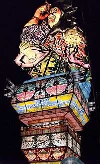
Goshogawara is famous for its Tachineputa Festival, held annually from August 4th to August 8th. The tachineputa floats are much taller than their counterparts in Aomori and Hirosaki, reaching heights of up to 23 meters. [5]
Aomori is the capital city of Aomori Prefecture, in the Tōhoku region of Japan. As of 1 April 2017, the city had an estimated population of 287,800 in 136,209 households, and a population density of 350 persons per km2. The city is one of Japan's 48 core cities. The total area of the city was 824.61 square kilometres (318.38 sq mi).
Yomogita is a village located in Aomori Prefecture, Japan. As of 31 December 2017, the village had an estimated population of 2,869 in 1166 households, and a population density of 35 persons per km2. The total area of the village is 80.84 square kilometres (31.21 sq mi).
Fujisaki is a town in Aomori Prefecture, Japan. As of 1 September 2016, the town had an estimated population of 15,172 in 5943 households, and a population density of 410 persons per km². The total area of the town is 37.29 square kilometres (14.40 sq mi).
Ōwani is a town located in Aomori Prefecture, Japan. As of 31 December 2017, the town had an estimated population of 9,821in 4230 households and a population density of 60.0 persons per km². The total area of the town is 163.41 square kilometres (63.09 sq mi).
Kanagi was a town located in Kitatsugaru District in western Aomori Prefecture, Japan.
Shiura was a village located in Kitatsugaru District in western Aomori Prefecture, Japan.
Kitatsugaru District is a rural district located in Aomori Prefecture, Japan.
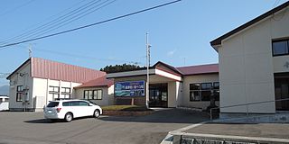
Kanagi Station is a railway station on the Tsugaru Railway Line in the city of Goshogawara, Aomori, Japan, operated by the private railway operator Tsugaru Railway Company.
Kōnan Bus Company is a bus company in Japan.
Sotogahama is a town located in Aomori Prefecture, Japan. As of 30 November 2017, the town had an estimated population of 5,860, and a population density of 25.4 persons per km2. The total area of the town is 230.29 square kilometres (88.92 sq mi).
Aomori 1st district is a single-member constituency of the House of Representatives in the national Diet of Japan. It is located in Northwestern Aomori and covers the cities of Aomori, Goshogawara and the East Tsugaru and North Tsugaru counties.
The Osamu Dazai Memorial Museum, also commonly referred to as Shayōkan (斜陽館), is a writer's home museum located in the Kanagi area of Goshogawara in Aomori Prefecture, Japan. It is dedicated to the late author Osamu Dazai, who spent some of his early childhood in Konagi, and houses antique furniture, ornaments and a collection of Osamu Dazai's works.
Wikimedia Commons has media related to Goshogawara, Aomori . |