
Whitbourne is a town on the Avalon Peninsula in Newfoundland and Labrador, Canada in Division 1.
Division No. 1, Subdivision A is an unorganized subdivision on the Avalon Peninsula in Newfoundland and Labrador, Canada. It is in Division No. 1, and lies between Trinity Bay and Placentia Bay.

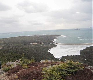
Fogo Island is the largest of the offshore islands of Newfoundland and Labrador, Canada. The Town of Fogo Island encompasses Fogo, Joe Batt's Arm-Barr'd Islands-Shoal Bay, Seldom-Little Seldom and Tilting, with the unincorporated areas of Fogo Island. It lies off the northeast coast of Newfoundland, northwest of Musgrave Harbour across Hamilton Sound, just east of the Change Islands. The island is about 25 kilometres (16 mi) long and 14 kilometres (8.7 mi) wide. The total area is 237.71 km2 (91.78 sq mi).

Division 1, Newfoundland and Labrador is a census division covering the entire Avalon Peninsula including the Isthmus of Avalon of the Canadian province of Newfoundland and Labrador. Like all census divisions in Newfoundland and Labrador, but unlike the census divisions of some other provinces, the division exists only as a statistical division for census data, and is not a political entity.

Avalon is a federal electoral district on Newfoundland Island in Newfoundland and Labrador, Canada. It has been represented in the House of Commons of Canada since 2004.
Argentia is a Canadian commercial seaport and industrial park located in the Town of Placentia, Newfoundland and Labrador. It is situated on the southwest coast of the Avalon Peninsula and defined by a triangular shaped headland which reaches northward out into Placentia Bay creating a natural harbour 3 km (1.9 mi) in length.
Bay Bulls is a small fishing town in the province of Newfoundland and Labrador, Canada.
Bay de Verde is an incorporated town in Conception Bay on the northern tip of the Bay de Verde Peninsula of Newfoundland and Labrador, Canada. The first recorded inhabitants at Bay de Verde arrived in 1662. Bay de Verde became an incorporated town in 1950.
St. Mary's Bay is one of many bays in Newfoundland, Canada, where bay is taken as a regional subdivision, somewhat along the lines of county divisions. It is the most southern and eastern of Newfoundland's major bays.

English Harbour East is a town in the Canadian province of Newfoundland and Labrador. It is located on the northeast side of Fortune Bay. Settled first by the Mi’kmaq of Newfoundland which used land on the “Neck” of the Harbour, they were joined in the early 1800s, by the English Dodge family and by Irishman Thomas Hynes Sr. European fishermen were first brought to the small community by English merchant family of Newman and Co. based in Harbour Breton, the firm of merchant John Gorman, and the Jersey firm of Nicholle and Co. The town had a population of 139 in the Canada 2016 Census.
Ship Harbour is a community in Newfoundland and Labrador, Canada located on the eastern shore of Placentia Bay.

South East Bight (SEB) is a community located on the western shores of Placentia Bay on the Burin Peninsula of Newfoundland and Labrador. The community is not connected by road and is only accessible by ferry from Petite Forte. Many people from the community travel to Monkstown in the winter by snowmobile, but is very uncommon to try to get there in the summer, because of marsh, bogs, ponds and hills. To get to South East Bight one must travel towards Marystown on the Burin Peninsula, turn off the highway at Boat Harbour, travel to Petite Forte and then take a half-hour ferry ride to South East Bight.
Swells Cove was a small community in Newfoundland and Labrador. It is located near Ship Harbour, Placentia Bay, and is accessible from Ship Harbour through "The American Road".
Haystack was a former fishing settlement located on the northern portion of Long Island, Placentia Bay of the island of Newfoundland in the province of Newfoundland and Labrador, Canada. It was resettled during the resettlement program of the 1950s and 60s.
Division No. 1, Subdivision B is an unorganized subdivision on the Avalon Peninsula in Newfoundland and Labrador, Canada. It is in Division 1 and contains the unorganized communities of Iona, Little Barasway, Placentia Junction, Point Verde and Ship Harbour.

Little Placentia Sound is an abandoned town in Newfoundland and Labrador that had a peak population of 47 in 1901. It is named after the body of water (sound) that encompasses the former community located within Placentia Bay on the Avalon Peninsula in the Canadian province of Newfoundland and Labrador. There was once a lead mine called Silver Cliff Mine located within the town.
Rose au Rue is an abandoned whaling town in Newfoundland and Labrador, Canada that had a small population of 11 in 1891.
Pays Cove is an abandoned town in Newfoundland and Labrador, Canada that had a peak population of 11 in 1935.
Cape Roger Harbour is a tiny abandoned town located near St. Joseph's, Placentia Bay in Newfoundland and Labrador, Canada that had a tiny population of 4 in 1845. Despite only being sparsely inhabited, the harbour has been used since the early 19th century for the fishery, particularly that of the herring and salmon fishery.


