Iona, Idaho

Last updated

Iona, Idaho
Iona Idaho.JPG
A grain elevator near the train tracks.
Bonneville County Idaho Incorporated and Unincorporated areas Iona Highlighted 1640420.svg
Location of Iona in Bonneville County, Idaho.
Coordinates: 43°31′35″N111°55′43″W / 43.52639°N 111.92861°W / 43.52639; -111.92861
Country United States
State Idaho
County Bonneville
Settled1883
IncorporatedApril 10, 1905
Government
  MayorDaniel Gubler
Area
[1]
  Total1.16 sq mi (3.02 km2)
  Land1.16 sq mi (3.02 km2)
  Water0.00 sq mi (0.00 km2)
Elevation
4,783 ft (1,458 m)
Population
 (2010) [2]
  Total1,803
  Estimate 
(2019) [3]
2,354
  Density2,022.34/sq mi (780.59/km2)
Time zone UTC-7 (Mountain (MST))
  Summer (DST) UTC-6 (MDT)
ZIP code
83427
Area code(s) 208, 986
FIPS code 16-40420
GNIS feature ID0397811
Website www.cityofiona.org
A farm in Iona Feeding the Horses by midiman.jpeg
A farm in Iona

Iona is a city in Bonneville County, Idaho, United States. It is part of the Idaho Falls, Idaho Metropolitan Statistical Area. The population was 1,803 at the 2010 census.

Contents

Geography

Iona is located at 43°31′35″N111°55′43″W / 43.52639°N 111.92861°W / 43.52639; -111.92861 (43.526319, -111.928478). [4]

According to the United States Census Bureau, the city has a total area of 1.10 square miles (2.85 km2), all of it land. [5]

Demographics

Historical population
CensusPop.Note
1910 353
1920 63078.5%
1930 386−38.7%
1940 51834.2%
1950 502−3.1%
1960 70239.8%
1970 89026.8%
1980 1,07220.4%
1990 1,049−2.1%
2000 1,20114.5%
2010 1,80350.1%
2020 2,71750.7%
U.S. Decennial Census [6]

2010 census

As of the census [2] of 2010, there were 1,803 people, 578 households, and 481 families residing in the city. The population density was 1,639.1 inhabitants per square mile (632.9/km2). There were 601 housing units at an average density of 546.4 per square mile (211.0/km2). The racial makeup of the city was 97.7% White, 0.2% African American, 0.3% Native American, 0.1% Asian, 0.7% from other races, and 1.1% from two or more races. Hispanic or Latino of any race were 3.9% of the population.

There were 578 households, of which 45.7% had children under the age of 18 living with them, 72.7% were married couples living together, 6.2% had a female householder with no husband present, 4.3% had a male householder with no wife present, and 16.8% were non-families. 14.0% of all households were made up of individuals, and 5.9% had someone living alone who was 65 years of age or older. The average household size was 3.12 and the average family size was 3.44.

The median age in the city was 31.5 years. 35.1% of residents were under the age of 18; 6.6% were between the ages of 18 and 24; 25.8% were from 25 to 44; 21.1% were from 45 to 64; and 11.5% were 65 years of age or older. The gender makeup of the city was 49.1% male and 50.9% female.

2000 census

As of the census [7] of 2000, there were 1,201 people, 372 households, and 318 families residing in the city. The population density was 1,526.0 inhabitants per square mile (589.2/km2). There were 385 housing units at an average density of 489.2 per square mile (188.9/km2). The racial makeup of the city was 98.42% White, 0.08% African American, 0.17% Native American, 0.08% Asian, 0.83% from other races, and 0.42% from two or more races. Hispanic or Latino of any race were 2.91% of the population.

There were 372 households, out of which 44.6% had children under the age of 18 living with them, 76.3% were married couples living together, 5.9% had a female householder with no husband present, and 14.5% were non-families. 12.4% of all households were made up of individuals, and 5.4% had someone living alone who was 65 years of age or older. The average household size was 3.23 and the average family size was 3.55.

In the city, the population was spread out, with 35.6% under the age of 18, 7.2% from 18 to 24, 24.5% from 25 to 44, 21.2% from 45 to 64, and 11.6% who were 65 years of age or older. The median age was 33 years. For every 100 females, there were 100.5 males. For every 100 females age 18 and over, there were 98.5 males.

The median income for a household in the city was $39,904, and the median income for a family was $42,692. Males had a median income of $32,105 versus $21,818 for females. The per capita income for the city was $14,334. 17.6% of the population and 14.0% of families were below the poverty line. 11.6% of those under the age of 18 and 6.1% of those 65 and older were living below the poverty line.

Education

Iona is served by the Bonneville Joint School District#93, [8] with Iona Elementary School within the Iona city limits. Students are bussed to Black Canyon Middle School and Thunder Ridge High School.

Related Research Articles

<span class="mw-page-title-main">Bonneville County, Idaho</span> County in Idaho, United States

Bonneville County is a county located in the U.S. state of Idaho. As of the 2020 census, the population was 123,964, making it the fourth-most populous county in Idaho and the most populous in eastern Idaho. Its county seat and largest city is Idaho Falls. Bonneville County was established in 1911 and named after Benjamin Bonneville (1796–1878), a French-born officer in the U.S. Army, fur trapper, and explorer in the American West. Benjamin was the son of Nicholas Bonneville of France, an Illuminati member who had written the "Illuminati Manifesto for World Revolution" in 1792, which played a significant role in the French revolution. Bonneville County is part of the Idaho Falls Metropolitan Statistical Area.

<span class="mw-page-title-main">Ammon, Idaho</span> City in Idaho, United States

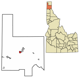
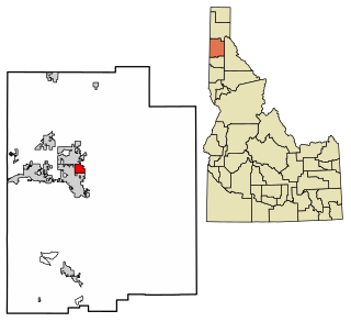
Ammon is a suburb city in Bonneville County, Idaho, United States. As of the 2010 US Census, the population of Ammon was 13,816. By the 2020 census, Ammon's population had grown to 17,694. It lies directly to the east of Idaho Falls and to the west of the Ammon foothills, and is the second most populous city in the Idaho Falls metropolitan area.

<span class="mw-page-title-main">Irwin, Idaho</span> City in Idaho, United States

Irwin is a city in Bonneville County, Idaho, United States. It is part of the Idaho Falls, Idaho Metropolitan Statistical Area. The population was 219 at the 2010 census.

<span class="mw-page-title-main">Swan Valley, Idaho</span> City in Idaho, United States

Swan Valley is a city in Bonneville County, Idaho, United States. It is part of the Idaho Falls, Idaho Metropolitan Statistical Area. The population was 204 at the 2010 census.

<span class="mw-page-title-main">Ucon, Idaho</span> City in Idaho, United States

Ucon is a city in Bonneville County, Idaho, United States. It is part of the Idaho Falls, Idaho Metropolitan Statistical Area. The population was 1,108 at the 2010 census. Ucon was first settled in 1883.

<span class="mw-page-title-main">Drummond, Idaho</span> City in Idaho, United States

Drummond is a city in Fremont County, Idaho, United States. The population was 16 at the 2010 census. It is part of the Rexburg, Idaho Micropolitan Statistical Area.

<span class="mw-page-title-main">Onaway, Idaho</span> City in Idaho, United States

Onaway is a city in Latah County, Idaho, United States. The population was 187 at the 2010 census, down from 230 in 2000.

<span class="mw-page-title-main">Maysville, Iowa</span> City in Iowa, United States

Maysville is a city in Scott County, Iowa, United States. The population was 156 at the time of the 2020 census.

<span class="mw-page-title-main">Wildwood, Kentucky</span> City in Kentucky, United States

Wildwood is a home rule-class city in Jefferson County, Kentucky, United States. The population was 261 at the 2010 census.

<span class="mw-page-title-main">Milton Township, Antrim County, Michigan</span> Civil township in Michigan, United States

Milton Township is a civil township of Antrim County in the U.S. state of Michigan. The population was 2,355 at the 2020 census.

<span class="mw-page-title-main">Ostrander, Minnesota</span> City in Minnesota, United States

Ostrander is a city in Fillmore County, Minnesota, United States. The population was 254 at the 2010 census.

<span class="mw-page-title-main">Iona, Minnesota</span> City in Minnesota, United States

Iona is a city in Murray County, Minnesota, United States. The population was 166 at the 2020 census, up from 137 in 2010.

<span class="mw-page-title-main">Echo, Minnesota</span> City in Minnesota, United States

Echo is a city in Yellow Medicine County, Minnesota, United States. The population was 243 at the 2020 census.

<span class="mw-page-title-main">Black Eagle, Montana</span> CDP in Montana, United States

Black Eagle is a census-designated place (CDP) in Cascade County, Montana, United States. The population was 904 at the 2010 census. It is a suburb of Great Falls.

<span class="mw-page-title-main">Huerfano, New Mexico</span> CDP in New Mexico, United States

Huerfano is a census-designated place (CDP) in San Juan County, New Mexico, United States. The population was 104 at the 2000 census. It is part of the Farmington Metropolitan Statistical Area. Huerfano is named after El Huerfano Mountain, located a mile to the northeast.

<span class="mw-page-title-main">Labish Village, Oregon</span> Unincorporated community in the state of Oregon, United States

Labish Village is a census-designated place (CDP) in Marion County, Oregon, United States. The population was 454 at the 2020 census. It is part of the Salem Metropolitan Statistical Area.

<span class="mw-page-title-main">North Bonneville, Washington</span> City in Washington, United States

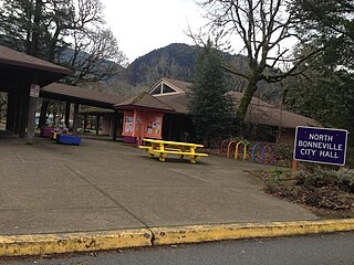
North Bonneville is a city in the Columbia River Gorge National Scenic Area along the Columbia River in Skamania County, Washington, United States. The population was 593 at the 2000 census and 956 at the 2010 census.

<span class="mw-page-title-main">Mount Sterling, Wisconsin</span> Village in Wisconsin, United States

Mount Sterling is a village in Crawford County, Wisconsin, United States. The population was 211 at the 2010 census.

<span class="mw-page-title-main">Rib Mountain (CDP), Wisconsin</span> CDP in Wisconsin, United States

Rib Mountain is a census-designated place (CDP) in the town of Rib Mountain in Marathon County, Wisconsin, United States. The population was 6,061 at the 2020 census.

<span class="mw-page-title-main">Clearbrook, New Jersey</span> Populated place in Middlesex County, New Jersey, US

Clearbrook is a gated community and census-designated place (CDP) located in Monroe Township, Middlesex County, in the U.S. state of New Jersey. It is in the western part of the township, bordered to the north by Encore at Monroe and to the east by Concordia and The Ponds. It is 3.5 miles (5.6 km) southwest of Jamesburg and 5 miles (8 km) northeast of Hightstown.

References

  1. "2019 U.S. Gazetteer Files". United States Census Bureau. Retrieved July 9, 2020.
  2. 1 2 "U.S. Census website". United States Census Bureau . Retrieved December 18, 2012.
  3. "US Gazetteer files: 2010, 2000, and 1990". United States Census Bureau. February 12, 2011. Retrieved April 23, 2011.
  4. "US Gazetteer files 2010". United States Census Bureau. Archived from the original on January 25, 2012. Retrieved December 18, 2012.
  5. "Census of Population and Housing". Census.gov. Retrieved June 4, 2015.
  6. "U.S. Census website". United States Census Bureau . Retrieved January 31, 2008.
  7. "2020 CENSUS - SCHOOL DISTRICT REFERENCE MAP: Bonneville County, ID" (PDF). U.S. Census Bureau . Retrieved May 6, 2021.