
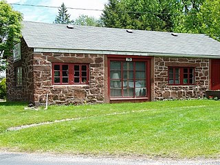
The Blackstone Manufacturing Company Historic District encompasses the "New City" or "High Rocks" area of Blackstone, Massachusetts, an industrial village associated with the Blackstone Manufacturing Company, which began operations in 1809. It includes an area roughly surrounding Butler, Canal, Church, County, Ives, Main, Mendon, Old Mendon, and School Streets. The district includes a wide variety of worker housing, as well as a granite storehouse, the only surviving company structure. The district was added to the National Register of Historic Places in 1995.
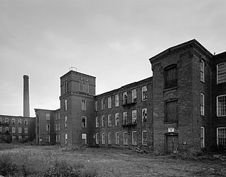
The Somersville Historic District encompasses the historic components of the mill village of Somersville in western Somers, Connecticut, United States. The district is centered on a mill complex on the Scantic River, which divides the district. The most significant years of development were between about 1835 and 1935, although the area has a history dating to the 1760s. The district was listed on the National Register of Historic Places in 1995. The Mill itself has since burned down and as of October 2018 is currently open field, although the canal structure remains in place.

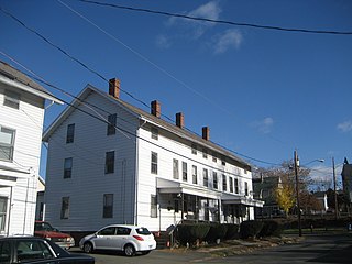
Mill Conversion or mill rehab is a form of adaptive reuse in which a historic mill or industrial factory building is restored or rehabilitated into another use, such as residential housing, retail shops, office, or a mix of these non-industrial elements (mixed-use).

The Lower Highlands Historic District encompasses one of the oldest residential areas of Fall River, Massachusetts. The district is roughly bounded by Cherry, Main, Winter, and Bank Streets, and is located just east of the Downtown Fall River Historic District and directly south of the Highlands Historic District. This area was settled by 1810, has architecture tracing the city's growth as a major industrial center. The historic district was added to the National Register of Historic Places in 1984.

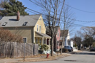
The Acushnet Heights Historic District is a predominantly residential historic district in central New Bedford, Massachusetts. It encompasses a densely-built urban area about 20 acres (8.1 ha) in size, which was developed as a working-class area, beginning in the 1860s, for the many workers in the city's factories. The district was listed on the National Register of Historic Places in 1989. It abuts the North Bedford Historic District, which is just to the south, and includes the following separately-listed properties: the Union Street Railway Carbarn, the Bradford Smith Building, and the Dawson Building.

The Mill Village Historic District is a historic district encompassing a well-preserved 19th century mill village in Williamstown, Massachusetts. It is located on Cole Avenue and other streets east of Cole and south of the Hoosac River, which provided the mill's power. The complex dates to the mid-19th century, and includes tenement houses, housing for supervisors and specialty personnel, as well as a surviving mill building. The village district was listed on the National Register of Historic Places in 1983.
The Renfrew Mill No. 2 was a historic mill complex at 217 Columbia Street in Adams, Massachusetts. Most of its buildings were built between 1867 and 1878, and were brick buildings with Italianate styling. They were built by the Renfrew Manufacturing Company, a textile manufacturer, to replace an earlier complex further down Columbia Street that had been demolished. The property was acquired by the Arnold Print Works in 1928. The mill was the town's largest employer for much of the second half of the 19th century.

The Ware Millyard Historic District encompasses a 19th-century mill complex and industrial mill village in the town of Ware, Massachusetts. It is roughly bounded by South Street, the Ware River, Upper Dam Complex, Park Street, Otis Avenue and Church Street. The area includes surviving mill buildings, the oldest of which date to the 1840s, and a collection of tenement-style housing built for the millworkers, built between 1845 and the 1880s.

The Brown Stocking Mill Historic District in Ipswich, Massachusetts encompasses the mill building of Harry S. Brown's stocking-making factory, and associated mill worker housing Brown had built. Brown, a supervisor at the Ipswich Mills, established his company in 1906, constructed a factory on Brownville Avenue, and built a series of worker housing units on Brownville and several nearby streets. The historic district was listed on the National Register of Historic Places in 1996. It includes properties at 24—32 Broadway Avenue, 3—41 Brownville Avenue, 10 Burleigh Avenue, 3—5 Burleigh Place, and 35—47 Topsfield Road.

The Lawton Place Historic District is a historic district on Lawton Place between Amory Road and Jackson Street in Waltham, Massachusetts. The district preserves some of the nation's oldest textile mill worker housing. The duplex houses located on the south side of Lawton Place were built c. 1815-17 by the Boston Manufacturing Company (BMC), the first mill to process textiles entirely under one roof. They were originally located at what is now the Waltham Common, and were moved to Lawton Place in 1889. On the north side stands a rowhouse that was built in 1889; it is the last instance of a type of row housing that was once commonly built for mill workers. The district was listed on the National Register of Historic Places in 1989.

The Central Mills Historic District encompasses a historic mill complex on the Quinebaug River in central Southbridge, Massachusetts. Located at the corner of Foster and North Streets, the site consists of three brick buildings, the oldest of which has portions dating to 1837. Despite being extensively rebuilt in the early 20th century, the complex has an appearance that is more typical of 19th century mills.
The Saco–Lowell Shops Housing Historic District encompasses the only 20th-century factory working housing enclave in the city of Newton, Massachusetts. It is located in Newton Upper Falls, near the Saco–Pettee Machine Shops, and was developed to provide housing for employees of the machinery manufacturers located there. It is roughly bounded by Oak, Williams, Butts, and Saco Streets, and includes eight small-scale brick houses with vernacular Colonial Revival styling. These houses were built in 1919 and 1920, adjoining a small number of worker houses built in the early 1890s. The district was listed on the National Register of Historic Places in 1990.

The Jaffrey Mills is a historic mill complex at 41 Main Street, in the central business district of Jaffrey, New Hampshire. It consists of a connected series of primarily brick buildings flanking the Contoocook River just north of Main Street. Its oldest buildings, the original mill and office building, are on the west side of the river. They were built in 1868, and feature mansard roofs and banded dentil brick cornices. The mill building has a tower that originally sported a cupola, but this was removed early in the 20th century. In 1872 the building on the east side was built, and the two sides joined by timber-frame bridges were added in 1897, at the same time the east building was extended northward. Later additions to the north of the east building include a storage area and a loading dock. The mill complex, the only 19th-century industrial complex of its type to be built in Jaffrey, was listed on the National Register of Historic Places in 1982. It has been converted into residences.

The Exeter Waterfront Commercial Historic District encompasses the historic commercial and residential waterfront areas of Exeter, New Hampshire. The district extends along the north side of Water Street, roughly from Main Street to Front Street, and then along both sides of Water and High streets to the latter's junction with Portsmouth Street. It also includes properties on Chestnut Street on the north side of the Squamscott River. This area was where the early settlement of Exeter took place in 1638, and soon developed as a shipbuilding center. The district was listed on the National Register of Historic Places in 1980. It was enlarged in 1986 to include the mill complex of the Exeter Manufacturing Company on Chestnut Street.

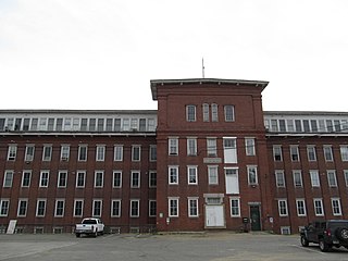
The Cocheco Mills comprise a historic mill complex in the heart of Dover, New Hampshire. The mills occupy a bend in the Cochecho River that has been site of cotton textile manufacturing since at least 1823, when the Dover Manufacturing Company supplanted earlier sawmills and gristmills. The present mill buildings were built between the 1880s and the early 20th century, and were listed on the National Register of Historic Places in 2014.
The Salmon Falls Mill Historic District encompasses a historic mill complex on Front Street in Rollinsford, New Hampshire. The complex includes four major structures and seven smaller ones, on about 14 acres (5.7 ha) of land along the Salmon Falls River. They were built between about 1840 and the mid-1860s, and have an unusual architectural unity, for additions made to the buildings were done with attention to matching design elements from the existing structures. The Number 2 Mill, built in 1848, was an early location where a turbine was used instead of a waterwheel to provide power to the mill machinery. The district was listed on the National Register of Historic Places in 1980.

The Nashua Gummed and Coated Paper Company Historic District encompasses a collection of former industrial buildings on the north side of the Nashua River in Nashua, New Hampshire. Located on Franklin and Front Streets west of Main Street, the complex was developed by the Nashua Gummed and Coated Paper Company, later the Nashua Corporation, beginning in the late 19th century. It was a major manufacturing and employment center for the city until mid-1990s, when the company's business declined. One of its former storehouses was converted to residences in the 2000s, and the main complex is, in 2015-16, undergoing the same process. The complex of surviving buildings was listed on the National Register of Historic Places in 2015.
The Lewiston Mills and Water Power System Historic District encompasses the major 19th-century mill complexes and associated water power systems in Lewiston, Maine. Developed beginning in 1850, Lewiston's canals and mills were the largest textile mill complex in the state, and one of the best-preserved mature large-scale expressions of the Lowell system of cotton textile manufacturing, perfected at Waltham and Lowell, Massachusetts earlier in the 19th century. The district includes a series power canals and mill complexes developed over a 100-year period, along with mill worker housing and transportation infrastructure. It was listed on the National Register of Historic Places in 2015.
The Bigelow-Hartford Carpet Mills Historic District encompasses a company-built factory and residential area in the Thompsonville area of Enfield, Connecticut. In addition to the former factory buildings of the Bigelow-Hartford Carpet Mills, it includes more than 150 housing units built by the company between about 1830 and 1920. It is roughly bounded on the north by Lafayette Street and Alden Avenue, the east by Hartford Avenue and Lincoln Street, the south by High Street, and the west by River Street. It was listed on the National Register of Historic Places in 1994.

The Manchaug Village Historic District is a historic district encompassing the 19th century industrial village center of Manchaug in Sutton, Massachusetts. Developed in the 1820s around textile mills on the Mumford River, it was the largest industrial area in Sutton, with at least three mill complexes in operation. The district is centered on the junction of Main Street with Manchaug, Putnam Hill, and Whitins Roads.


