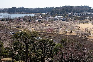
Ibaraki Prefecture is a prefecture of Japan located in the Kantō region of Honshu. Ibaraki Prefecture has a population of 2,828,086 and has a geographic area of 6,097.19 square kilometres. Ibaraki Prefecture borders Fukushima Prefecture to the north, Tochigi Prefecture to the northwest, Saitama Prefecture to the southwest, Chiba Prefecture to the south, and the Pacific Ocean to the east.
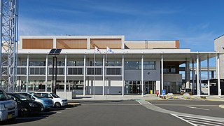
Jōsō is a city located in Ibaraki Prefecture, Japan. As of 1 October 2020, the city had an estimated population of 59,314 in 21,168 households and a population density of 480 persons per km2. The percentage of the population aged over 65 was 38.8%. The total area of the city is 123.64 square kilometres (47.74 sq mi). The city has a large expatriate population from Brazil.
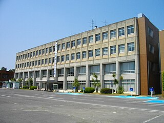
Toride is a city located in Ibaraki Prefecture, Japan. As of 1 January 2024, the city had an estimated population of 103,717 in 47,545 households and a population density of 1482 persons per km2. The percentage of the population aged over 65 was 34.8%. The total area of the city is 69.94 square kilometres (27.00 sq mi).

Chōshi is a city located in Chiba Prefecture, Japan. As of 1 December 2020, the city had an estimated population of 59,174 in 27,160 households and a population density of 700 inhabitants per square kilometre (1,800/sq mi). The total area of the city is 84.19 km2 (32.5 sq mi).

Narita is a city in Chiba Prefecture, Japan. As of 30 November 2020, the city had an estimated population of 131,852 in 63,098 households and a population density of 620 persons per km². The total area of the city is 213.84 square kilometres (82.56 sq mi). It is the site of Narita International Airport, one of the two main international airports serving the Greater Tokyo Area.

Kashiwa is a city located in Chiba Prefecture, Japan. As of May 1, 2024, the city had an estimated population of 435,578 in 199,926 households and a population density of 3800 persons per km2. The total area of the city is 114.72 square kilometres (44.29 sq mi).

Kashima is a city located in Ibaraki Prefecture, Japan. As of 1 July 2020, the city had an estimated population of 67,197 in 28,873 households and a population density of 634 persons per km2. The percentage of the population aged over 65 was 31.5%. The total area of the city is 106.02 square kilometres (40.93 sq mi). Kashima is the home of the J. League's Kashima Antlers. Its home field, Kashima Soccer Stadium, was used as a site during the 2002 FIFA World Cup. The city is also the site of the Kashima Shrine, one of the oldest Shinto shrines in eastern Japan, and considered the birthplace of many influential styles of Japanese swordsmanship (Kenjutsu).

Kashima is a city located in the southern part of Saga Prefecture on the island of Kyushu, Japan. As of 31 May 2024, the city had an estimated population of 27,360 in 10949 households, and a population density of 240 persons per km2. The total area of the city is 112.12 km2 (43.29 sq mi).

Kamisu is a city located in Ibaraki Prefecture, Japan. As of 1 July 2020, the city had an estimated population of 95,384 in 40,759 households and a population density of 649 persons per km2. The percentage of the population aged over 65 was 23.6%. The total area of the city is 146.97 square kilometres (56.75 sq mi).
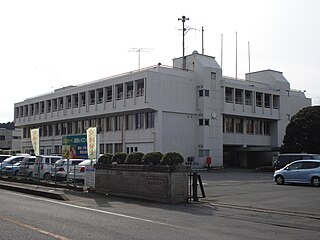
Hokota is a city located in Ibaraki Prefecture, Japan. As of 1 July 2020, the city had an estimated population of 45,997 in 18,455 households and a population density of 221.6 persons per km². The percentage of the population aged over 65 was 34.1%. The total area of the city is 207.60 square kilometres (80.15 sq mi).
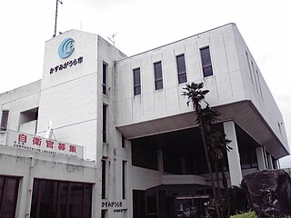
Kasumigaura is a city located in Ibaraki Prefecture, Japan. As of 1 July 2020, the city had an estimated population of 40,254 in 15,839 households and a population density of 257 persons per km². The percentage of the population aged over 65 was 32.0%. The total area of the city is 156.60 square kilometres (60.46 sq mi).. The city takes its name from the nearby lake, Lake Kasumigaura. The city has the distinction of having the longest name in Japan, together with Ichikikushikino, Kagoshima Prefecture and Tsukubamirai. Much of the city is within the borders of the Suigō-Tsukuba Quasi-National Park.
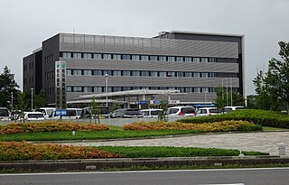
Inashiki is a city located in Ibaraki Prefecture, Japan. As of 1 July 2020, the city had an estimated population of 39,127 in 14,733 households and a population density of 191 persons per km2. The percentage of the population aged over 65 was 37.1%. The total area of the city is 205.81 square kilometres (79.46 sq mi).

Bandō is a city located in Ibaraki Prefecture, Japan. As of 1 October 2020, the city had an estimated population of 51,577 in 18,441 households and a population density of 419 persons per km2. The percentage of the population aged over 65 was 30.7%. The total area of the city is 123.03 square kilometres (47.50 sq mi).

Kantō Railway is a private railway company, which operates two lines in Ibaraki Prefecture in Japan. The company is a subsidiary of Keisei Electric Railway and other companies. Additionally, the company has a bus department in Ibaraki Prefecture and Chiba Prefecture in Japan.

Katori is a city located in Chiba Prefecture, Japan. As of 1 November 2020, the city had an estimated population of 74,469 in 31,113 households and a population density of 280 persons per km2. The total area of the city is 262.31 square kilometres (101.28 sq mi). Katori Shrine is in the city of Katori, as is the old merchant town and canal of Sawara.

Namegata is a city located in Ibaraki Prefecture, Japan. As of 1 July 2020, the city had an estimated population of 32,144 in 11,412 households and a population density of 144.5 persons per km2. The percentage of the population aged over 65 was 35.9%. The total area of the city is 222.48 square kilometres (85.90 sq mi).

Omitama is a city located in Ibaraki Prefecture, Japan. As of 1 July 2020, the city had an estimated population of 48,776 in 18,311 households and a population density of 337 persons per km2. The percentage of the population aged over 65 was 30.0%. The total area of the city is 144.74 square kilometres (55.88 sq mi).
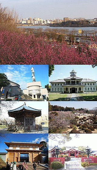
Mito is the capital city of Ibaraki Prefecture, in the northern Kantō region of Japan. As of 1 January 2024, the city had an estimated population of 268,036 in 126,055 households and a population density of 1,233 persons per km2. The percentage of the population aged over 65 was 27.1%. The total area of the city is 217.32 square kilometres (83.91 sq mi).
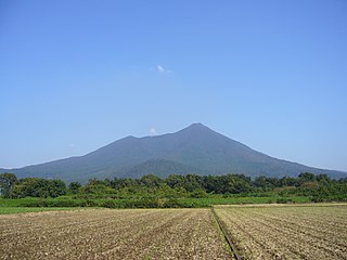
Suigō-Tsukuba Quasi-National Park is a quasi-national park in the Kantō region of Honshū in Japan. It is rated a protected landscape according to the IUCN.

The Suigō-Itako Bus Terminal is a bus terminal situated in Itako, Ibaraki, Japan. It is used by the Kantō Railway, Keisei Bus and JR Bus Kantō, among others.


