Middle:Tsuchiura Castle, Tsuchiura Station
Lower:Skyline"},"image_flag":{"wt":"Flag of Tsuchiura, Ibaraki.svg"},"flag_alt":{"wt":""},"image_seal":{"wt":"Emblem of Tsuchiura, Ibaraki.svg"},"seal_alt":{"wt":""},"image_shield":{"wt":""},"shield_alt":{"wt":""},"image_blank_emblem":{"wt":""},"nickname":{"wt":""},"motto":{"wt":""},"image_map":{"wt":"Tsuchiura in Ibaraki Prefecture Ja.svg"},"map_alt":{"wt":""},"map_caption":{"wt":"Location of Tsuchiura in Ibaraki Prefecture"},"pushpin_map":{"wt":"Japan"},"pushpin_label_position":{"wt":""},"pushpin_map_alt":{"wt":""},"pushpin_map_caption":{"wt":" "},"coordinates":{"wt":"{{coord|36|4|N|140|12|E|region:JP|display=inline,title}}"},"coor_pinpoint":{"wt":""},"coordinates_footnotes":{"wt":"\n"},"subdivision_type":{"wt":"[[List of sovereign states|Country]]"},"subdivision_name":{"wt":"[[Japan]]"},"subdivision_type1":{"wt":"[[List of regions of Japan|Region]]"},"subdivision_name1":{"wt":"[[Kantō region|Kantō]]"},"subdivision_type2":{"wt":"[[Prefectures of Japan|Prefecture]]"},"subdivision_name2":{"wt":"[[Ibaraki Prefecture|Ibaraki]]"},"subdivision_type3":{"wt":""},"subdivision_name3":{"wt":""},"established_title":{"wt":"First official recorded"},"established_date":{"wt":"770 AD"},"established_title2":{"wt":"City Settled"},"established_date2":{"wt":"November 3, 1940"},"founder":{"wt":""},"named_for":{"wt":""},"seat_type":{"wt":""},"seat":{"wt":""},"government_footnotes":{"wt":""},"leader_party":{"wt":""},"leader_title":{"wt":"Mayor"},"leader_name":{"wt":"[[:ja:安藤真理子|Mariko Andō]] (from November 2019)"},"leader_title1":{"wt":""},"leader_name1":{"wt":"\n"},"total_type":{"wt":""},"unit_pref":{"wt":"\n"},"area_magnitude":{"wt":""},"area_footnotes":{"wt":""},"area_total_km2":{"wt":"122.89"},"area_land_km2":{"wt":""},"area_water_km2":{"wt":""},"area_water_percent":{"wt":""},"area_note":{"wt":""},"elevation_footnotes":{"wt":""},"elevation_m":{"wt":""},"population_footnotes":{"wt":""},"population_total":{"wt":"142,181"},"population_as_of":{"wt":"January 2024"},"population_density_km2":{"wt":"auto"},"population_est":{"wt":""},"pop_est_as_of":{"wt":""},"population_demonym":{"wt":""},"population_note":{"wt":""},"timezone1":{"wt":"[[Japan Standard Time]]"},"utc_offset1":{"wt":"+9"},"timezone1_DST":{"wt":""},"utc_offset1_DST":{"wt":""},"postal_code_type":{"wt":""},"postal_code":{"wt":""},"area_code_type":{"wt":""},"area_code":{"wt":""},"blank_name_sec1":{"wt":"Phone number"},"blank_info_sec1":{"wt":"029-826-1111"},"blank1_name_sec1":{"wt":"Address"},"blank1_info_sec1":{"wt":"9-1 Yamato-cho, Tsuchiura-shi, Ibaraki-ken 300-8686\n"},"blank_name_sec2":{"wt":"[[Köppen climate classification|Climate]]"},"blank_info_sec2":{"wt":"[[Humid subtropical climate|Cfa]]\n"},"website":{"wt":"{{Official|http://www.city.tsuchiura.lg.jp/}}"},"footnotes":{"wt":""},"module":{"wt":"{{Infobox place symbols| embedded=yes\n | tree = [[Populus]], [[Zelkova serrata]]\n | flower = [[Sakura]]\n | bird = [[Great reed warbler]], [[Japanese bush warbler]]\n | flowering_tree = \n | butterfly = \n | fish = \n | other_symbols = \n}}"}},"i":0}}]}" id="mwAg">City in Kantō, Japan
Tsuchiura 土浦市 | |
---|---|
Upper: Kijo Park Middle:Tsuchiura Castle, Tsuchiura Station Lower:Skyline | |
![]() Location of Tsuchiura in Ibaraki Prefecture | |
Coordinates: 36°4′N140°12′E / 36.067°N 140.200°E | |
Country | Japan |
Region | Kantō |
Prefecture | Ibaraki |
First official recorded | 770 AD |
City Settled | November 3, 1940 |
Government | |
• Mayor | Mariko Andō (from November 2019) |
Area | |
• Total | 122.89 km2 (47.45 sq mi) |
Population (January 2024) | |
• Total | 142,181 |
• Density | 1,200/km2 (3,000/sq mi) |
Time zone | UTC+9 (Japan Standard Time) |
Phone number | 029-826-1111 |
Address | 9-1 Yamato-cho, Tsuchiura-shi, Ibaraki-ken 300-8686 |
Climate | Cfa |
Website | Official website |
Symbols | |
Bird | Great reed warbler, Japanese bush warbler |
Flower | Sakura |
Tree | Populus, Zelkova serrata |
Tsuchiura (土浦市, Tsuchiura-shi) is a city located in Ibaraki Prefecture, Japan. As of 1 January 2024 [update] , the city had an estimated population in 2024 of 142,181 people in 66,629 households, and a population density of 1,157 persons per squate kilometre. The proportion of the population aged over 65 was 29.7%. [1] The total area of the city is 122.89 square kilometres (47.45 sq mi). About 3,000 residents are non-Japanese, a large proportion of these being Filipinos, Chinese or Brazilians.
Located in southwestern Ibaraki Prefecture, Tsuchiura is situated along the western shore of Lake Kasumigaura, the second largest lake in Japan. Tokyo lies about 60 km to the south, and Tsukuba science city borders Tsuchiura to the west.
Ibaraki Prefecture
Tsuchiura has a Humid continental climate (Köppen Cfa) characterized by warm summers and cool winters with light snowfall. The average annual temperature in Tsuchiura is 13.9 °C. The average annual rainfall is 1286 mm with September as the wettest month. The temperatures are highest on average in August, at around 25.8 °C, and lowest in January, at around 2.8 °C. [2]
Climate data for Tsuchiura (1991−2020 normals, extremes 1978−present) | |||||||||||||
---|---|---|---|---|---|---|---|---|---|---|---|---|---|
Month | Jan | Feb | Mar | Apr | May | Jun | Jul | Aug | Sep | Oct | Nov | Dec | Year |
Record high °C (°F) | 18.3 (64.9) | 24.1 (75.4) | 26.3 (79.3) | 29.0 (84.2) | 33.5 (92.3) | 35.2 (95.4) | 38.1 (100.6) | 38.5 (101.3) | 37.1 (98.8) | 33.7 (92.7) | 25.4 (77.7) | 25.1 (77.2) | 38.5 (101.3) |
Mean daily maximum °C (°F) | 9.4 (48.9) | 10.1 (50.2) | 13.4 (56.1) | 18.6 (65.5) | 22.9 (73.2) | 25.4 (77.7) | 29.4 (84.9) | 31.0 (87.8) | 27.1 (80.8) | 21.6 (70.9) | 16.4 (61.5) | 11.6 (52.9) | 19.7 (67.5) |
Daily mean °C (°F) | 4.0 (39.2) | 4.8 (40.6) | 8.2 (46.8) | 13.2 (55.8) | 17.8 (64.0) | 21.0 (69.8) | 24.9 (76.8) | 26.2 (79.2) | 22.8 (73.0) | 17.3 (63.1) | 11.5 (52.7) | 6.3 (43.3) | 14.8 (58.7) |
Mean daily minimum °C (°F) | −0.9 (30.4) | −0.1 (31.8) | 3.2 (37.8) | 8.3 (46.9) | 13.5 (56.3) | 17.6 (63.7) | 21.5 (70.7) | 22.9 (73.2) | 19.4 (66.9) | 13.5 (56.3) | 6.9 (44.4) | 1.5 (34.7) | 10.6 (51.1) |
Record low °C (°F) | −7.6 (18.3) | −7.1 (19.2) | −4.9 (23.2) | −1.6 (29.1) | 3.6 (38.5) | 10.1 (50.2) | 13.4 (56.1) | 16.0 (60.8) | 8.8 (47.8) | 2.7 (36.9) | −1.9 (28.6) | −6.5 (20.3) | −7.6 (18.3) |
Average precipitation mm (inches) | 48.8 (1.92) | 45.8 (1.80) | 90.5 (3.56) | 105.1 (4.14) | 121.3 (4.78) | 123.5 (4.86) | 123.6 (4.87) | 99.1 (3.90) | 171.9 (6.77) | 177.7 (7.00) | 74.8 (2.94) | 47.4 (1.87) | 1,229.3 (48.40) |
Average precipitation days (≥ 1.0 mm) | 4.8 | 5.4 | 9.4 | 10.0 | 10.7 | 11.7 | 10.4 | 7.5 | 10.8 | 10.6 | 7.3 | 5.4 | 104 |
Mean monthly sunshine hours | 196.6 | 176.6 | 180.8 | 184.7 | 180.3 | 128.5 | 150.3 | 181.5 | 136.6 | 136.5 | 151.4 | 174.4 | 1,978.2 |
Source: Japan Meteorological Agency [3] [4] |
According to Census data, [5] the population of Tsuchiura has recently plateaued after a long period of growth.
Year | Pop. | ±% |
---|---|---|
1950 | 78,344 | — |
1960 | 79,779 | +1.8% |
1970 | 98,313 | +23.2% |
1980 | 121,300 | +23.4% |
1990 | 137,103 | +13.0% |
2000 | 144,106 | +5.1% |
2010 | 143,839 | −0.2% |
2020 | 142,074 | −1.2% |
Human settlement in the Tsuchiura area dates to the Japanese Paleolithic period. Hunter-gatherers inhabited the coastal area of the Pacific Ocean (now Lake Kasumigaura) forming large shell middens, examples of which can be seen at the Kamitakatsu archeological site. Locals began wet-rice cultivation, and development of iron and bronze technology, during the Yayoi period. In the Kofun period numerous Burial mounds were constructed in the area.
During the Nara period the area was organized under the Taihō Code with what is now Tsuchiura occupying four districts of Hitachi Province. In 939, during the Heian period, Taira no Masakado led an uprising against the central government by attacking the provincial capital at Ishioka, a few kilometers to the north of Tsuchiura.
During the Kamakura period and the Sengoku period, the area was dominated by several samurai clans. During the Edo period, part of what is now Tsuchiura was administered as a castle town by Tsuchiura Domain, one of the feudal domains under the Tokugawa shogunate. The area prospered due to its position on the Mito Kaidō, a highway connecting Edo with Mito, and on a canal connecting Lake Kasumigaura to Edo Bay.
With the creation of modern municipalities after the Meiji Restoration on April 1, 1889, the town of Tsuchiura was established within Ibaraki Prefecture. In 1895 railroad service was started in Tsuchiura. The Gothic Revival architecture of the old junior high school from this period can be seen at the Dai'ichi high school.
Tsuchiura was elevated to city status when the towns of Manabe and Tsuchiura were merged on November 3, 1940. During World War II the city suffered damage in an air raid on June 10, 1945.
On September 1, 1951, Tsuchiura absorbed parts of the village of Asahi on the shore of Arakawa and also absorbed the village of Towa. The city absorbed the village of Kamiotsu on November 1, 1954. On February 20, 2006, the village of Niihari (from Niihari District) was merged into Tsuchiura.
The city is managed by the mayor's office and the city council under the mayor-council government system. The mayor is elected through a citywide election and the members of the city council are elected from districts within the city. The mayor's office is made up of the Mayor, Kiyoshi Nakagawa (中川清), and two Vice Mayors, Hideaki Goto (五頭英明) and Hiroshi Koizumi (小泉祐司). The 28-member city council is headed by Chairperson Kiyoshi Yaguchi (矢口清). Tsuchiura's political system is similar to that of other cities in Japan, as the Local Autonomy Law makes all municipalities uniform in powers and organization.
Tsuchiura sends three members to the Ibaraki Prefectural Assembly.
Tsuchiura is part of Ibaraki 6th district for elections to the lower house of the Diet of Japan.
Tsuchiura was formerly the center of commerce in southern Ibaraki Prefecture due to its good rail connections and location on Lake Kasumigaura. It was also the location of a major base of the Imperial Japanese Navy Air Corps both before and during the war. In the postwar era, the development of the Japanese national highway system, selection of neighboring Tsukuba as a center for government investment and development, and increasing suburbanization has resulted in the closure of many department stores and commercial facilities in the center of the city. The city has several industrial parks. Present land usage is over 30% agricultural, [1] with lotus root as a famous local crop.
Cerulean City from the Japanese game series Pokémon is geographically placed in the real-world location of Tsuchiura City because of the lake nearby. [6]
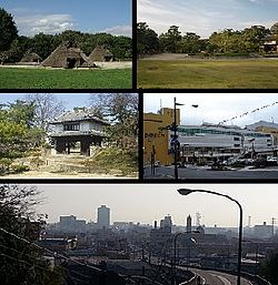
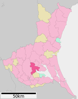
Ibaraki Prefecture is a prefecture of Japan located in the Kantō region of Honshu. Ibaraki Prefecture has a population of 2,828,086 and has a geographic area of 6,097.19 square kilometres. Ibaraki Prefecture borders Fukushima Prefecture to the north, Tochigi Prefecture to the northwest, Saitama Prefecture to the southwest, Chiba Prefecture to the south, and the Pacific Ocean to the east.
Ishioka is a city located in Ibaraki Prefecture, Japan. As of 1 January 2024, the city had an estimated population of 70,124 in 28,892 households and a population density of 325 persons per km2. The percentage of the population aged over 65 was 33.5%. The total area of the city is 215.53 square kilometres (83.22 sq mi).
Ryūgasaki is a city located in Ibaraki Prefecture, Japan. As of 1 January 2024, the city had an estimated population of 75,212 in 33,421 households and a population density of 958 persons per km². The percentage of the population aged over 65 was 31.1% in July 2020. The total area of the city is 78.59 square kilometres (30.34 sq mi).
Shimotsuma is a city located in Ibaraki Prefecture, Japan. As of 1 January 2024, the city had an estimated population of 41,621 in 17,294 households and a population density of 515 persons per km². The percentage of the population aged over 65 was 29.0%. The total area of the city is 80.88 square kilometres (31.23 sq mi).
Kitaibaraki is a city in Ibaraki Prefecture, Japan. As of 1 July 2020, the city had an estimated population of 41,750 in 17,034 households and a population density of 220 persons per km2. The percentage of the population aged over 65 was 34.6%. The total area of the city is 186.80 square kilometres (72.12 sq mi).
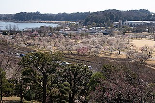
Kasama is a city located in Ibaraki Prefecture, Japan. Kasama is the home of Kasama ware and known for Japanese chestnuts. As of 1 July 2020, the city had an estimated population of 73,805 in 29,362 households and a population density of 307 persons per km². The percentage of the population aged over 65 was 32.2%. The total area of the city is 240.400 square kilometres (92.819 sq mi).
Ushiku is a city located in Ibaraki Prefecture, Japan. As of 1 January 2024, the city had an estimated population of 83,826 in 36,380 households and a population density of 1423 persons per km2. The percentage of the population aged over 65 was 29.5%. The total area of the city is 58.92 square kilometres (22.75 sq mi).
Abiko is a city located in Chiba Prefecture, Japan. As of 1 February 2024, the city had an estimated population of 131,183 in 62,193 households and a population density of 3000 persons per km2. The total area of the city is 43.19 square kilometres (16.68 sq mi).
Hitachi Province was an old province of Japan in the area of Ibaraki Prefecture. It was sometimes called Jōshū (常州). Hitachi Province bordered on Shimōsa, Shimotsuke, and Mutsu Provinces. Generally, its northern border was with Mutsu.
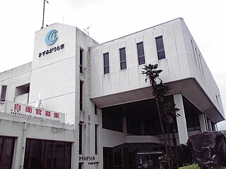
Kasumigaura is a city located in Ibaraki Prefecture, Japan. As of 1 July 2020, the city had an estimated population of 40,254 in 15,839 households and a population density of 257 persons per km². The percentage of the population aged over 65 was 32.0%. The total area of the city is 156.60 square kilometres (60.46 sq mi).. The city takes its name from the nearby lake, Lake Kasumigaura. The city has the distinction of having the longest name in Japan, together with Ichikikushikino, Kagoshima Prefecture and Tsukubamirai. Much of the city is within the borders of the Suigō-Tsukuba Quasi-National Park.
Niihari was a district located in Ibaraki, Japan. The district was dissolved on March 27, 2006.
Chikusei is a city located in Ibaraki Prefecture, Japan. As of 1 January 2024, the city had an estimated population of 98,031 in 39,075 households and a population density of 478 persons per km2. The percentage of the population aged over 65 was 31.2%. The total area of the city is 205.30 square kilometres (79.27 sq mi).
Tsukubamirai is a city located in Ibaraki Prefecture, Japan. As of 1 October 2020, the city had an estimated population of 51,035 in 20,030 households and a population density of 645 persons per km². The percentage of the population aged over 65 was 26.3%. The total area of the city is 79.16 square kilometres (30.56 sq mi).
Omitama is a city located in Ibaraki Prefecture, Japan. As of 1 July 2020, the city had an estimated population of 48,776 in 18,311 households and a population density of 337 persons per km2. The percentage of the population aged over 65 was 30.0%. The total area of the city is 144.74 square kilometres (55.88 sq mi).
Tsukuba is a city located in Ibaraki Prefecture, Japan. As of January 1, 2024, the city had an estimated population of 256,526 in 121,001 households and a population density of 900 persons per km2. The percentage of the population aged over 65 was 20.3%. The total area of the city is 283.72 square kilometres (109.54 sq mi). It is known as the location of the Tsukuba Science City, a planned science park developed in the 1960s.
Mito is the capital city of Ibaraki Prefecture, in the northern Kantō region of Japan. As of 1 January 2024, the city had an estimated population of 268,036 in 126,055 households and a population density of 1,233 persons per km2. The percentage of the population aged over 65 was 27.1%. The total area of the city is 217.32 square kilometres (83.91 sq mi).
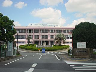
Tsuchiura Station is a railway station in the city of Tsuchiura, Ibaraki Prefecture, Japan, operated by East Japan Railway Company. It is also a freight depot for the Japan Freight Railway Company.
Tsuchiura Domain was a feudal domain under the Tokugawa shogunate of Edo period Japan, located in Hitachi Province, Japan. It was centered on Tsuchiura Castle in what is now the city of Tsuchiura, Ibaraki. It was ruled for much of its history by the Tsuchiya clan.
Ibaraki 6th district is a single-member constituency of the House of Representatives in the national Diet of Japan located in Ibaraki Prefecture.
Media related to Tsuchiura, Ibaraki at Wikimedia Commons
Tsuchiura travel guide from Wikivoyage