Baca County is a county located in the U.S. state of Colorado. As of the 2020 census, the population was 3,506. The county seat is Springfield. Located at the southeast corner of Colorado, the county shares state borders with Kansas, New Mexico, and Oklahoma.

Ohatchee is a town in Calhoun County, Alabama, United States. At the 2020 census, the population was 1,157. It is included in the Anniston–Oxford, Alabama Metropolitan Statistical Area.

Winfield is a city in Marion and Fayette counties in the U.S. state of Alabama. The population was 4,845 at the 2020 census, the second largest city in Marion County.

Ragland is a town in St. Clair County, Alabama, United States southeast of Ashville. It incorporated in 1899. At the 2020 census, the population was 1,693, up slightly from 1,639 in 2010. It is part of the Birmingham-Hoover-Cullman Combined Statistical Area.

Whitesburg is a town in Carroll County, Georgia, United States. The population was 596 in 2020.
Aldora is a town in Lamar County, Georgia, United States. As of the 2020 census, the city had a recorded population of 0, due to a "0 percent self-response rate" to the 2020 census. The actual population was estimated at 103.

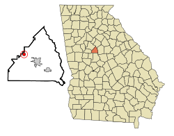
Concord is a city in Pike County, Georgia, United States. The population was 375 at the 2010 census.

Experiment is an unincorporated community and census-designated place (CDP) in Spalding County, Georgia, United States. The population was 3,233 at the 2000 census.

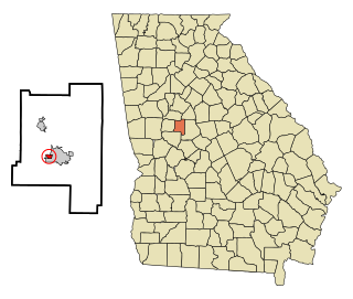
Orchard Hill is a town in Spalding County, Georgia, United States. The population was 230 at the 2000 census.

Lone Rock is a city in Kossuth County, Iowa, United States. The population was 146 at the time of the 2020 census. The city is named after a large boulder.

Minden is a city in Pottawattamie County, Iowa, United States. The population was 600 at the time of the 2020 census.

Newcastle is a town in Lincoln County, Maine, United States. The population was 1,848 at the 2020 census. The village of Newcastle is located in the eastern part of the town, on the Damariscotta River. Together with the village of Damariscotta linked by the Main Street bridge, they form the Twin Villages.

Silver City is a town in Humphreys County, Mississippi, United States. The population was 217 at the 2021 census, a massive decline from the 2000 census.

Glen Allen is a village in central Bollinger County in Southeast Missouri, United States, located near the intersection of State Highway 34 and Route ZZ just west of Marble Hill. The population was 57 at the 2020 census.

Lula is a town in Coahoma County, Mississippi, United States. Per the 2020 census, the population was 204.

Cardington is a village in Morrow County, Ohio, United States. The population was 2,051 at the 2020 census. Mount Gilead, Ohio, the county seat, is located northeast of Cardington on U.S. Route 42.
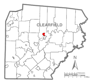
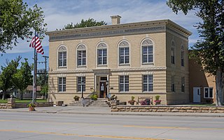
Plymptonville is a census-designated place (CDP) in Clearfield County, Pennsylvania, United States. The population was 972 at the 2020 census.
Sycamore is a town in Allendale County, South Carolina, United States. The population was 180 as of the 2010 census. On April 5, 2022, the town was hit by an EF3 tornado, although it had weakened to EF1 strength by the time it moved through town and only minor damage occurred. One person was injured by this tornado south of Allendale, South Carolina.

Cross Lanes is a census-designated place (CDP) and suburb of Charleston in Kanawha County, West Virginia, United States. As of the 2010 census, its population was 9,995.

Dixon is a town in Carbon County, Wyoming, United States. The population was 97 at the 2010 census.