Flovilla, Georgia

Last updated

Flovilla, Georgia
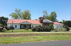
Flovilla City Hall.jpg
Flovilla City Hall
Logo of Flovilla, Georgia.png
Butts County Georgia Incorporated and Unincorporated areas Flovilla Highlighted.svg
Location in Butts County and the state of Georgia
Coordinates: 33°15′20″N83°53′54″W / 33.25556°N 83.89833°W / 33.25556; -83.89833
Country United States
State Georgia
County Butts
Area
[1]
  Total1.96 sq mi (5.07 km2)
  Land1.96 sq mi (5.07 km2)
  Water0.00 sq mi (0.00 km2)
Elevation
541 ft (165 m)
Population
 (2020)
  Total643
  Density328.40/sq mi (126.80/km2)
Time zone UTC-5 (Eastern (EST))
  Summer (DST) UTC-4 (EDT)
ZIP code
30216
Area code 770
FIPS code 13-30312 [2]
GNIS feature ID0355853 [3]
Website cityofflovilla.org

Flovilla is a city in Butts County, Georgia, United States. The population was 653 at the 2010 census, [4] and 643 in 2020.

Contents

Indian Springs State Park is nearby.

History

Flovilla incorporated in 1885. [5] Flovilla is a coined name meaning "village of flowers". [6]

Geography

Flovilla is located in southeastern Butts County at 33°15′20″N83°53′54″W / 33.255441°N 83.898218°W / 33.255441; -83.898218 . [7] U.S. Route 23 passes through the center of the city, leading northwest 5 miles (8 km) to Jackson, the county seat, and southeast 34 miles (55 km) to Macon. Indian Springs State Park is located 2 miles (3 km) west of the city along Georgia State Route 42 and contains a lake, a campground, and the springs for which it is named.

According to the United States Census Bureau, the city has a total area of 2.0 square miles (5.1 km2), all land. [4]

Demographics

Historical population
CensusPop.Note
1890 422
1900 52323.9%
1910 495−5.4%
1920 371−25.1%
1930 230−38.0%
1940 2404.3%
1950 31531.3%
1960 284−9.8%
1970 2891.8%
1980 45858.5%
1990 60231.4%
2000 6528.3%
2010 6530.2%
2020 643−1.5%
U.S. Decennial Census [8]
Flovilla city, Georgia – Racial and Ethnic Composition
(NH = Non-Hispanic)
Note: the US Census treats Hispanic/Latino as an ethnic category. This table excludes Latinos from the racial categories and assigns them to a separate category. Hispanics/Latinos may be of any race.
Race / EthnicityPop 2010 [9] Pop 2020 [10] % 2010% 2020
White alone (NH)32232849.31%51.01%
Black or African American alone (NH)31627048.39%41.99%
Native American or Alaska Native alone (NH)000.00%0.00%
Asian alone (NH)230.31%0.47%
Pacific Islander alone (NH)000.00%0.00%
Some Other Race alone (NH)030.00%0.47%
Mixed Race/Multi-Racial (NH)4250.61%3.89%
Hispanic or Latino (any race)9141.38%2.18%
Total653643100.00%100.00%

In 2010, the city had a population of 653, before declining to 643 at the 2020 census. [9] [10]

Related Research Articles

<span class="mw-page-title-main">Newton County, Georgia</span> County in Georgia, United States

Newton County is a county located in the north central portion of the U.S. state of Georgia. As of the 2020 census, the population was 112,483. The county seat is Covington. Newton County is included in the Atlanta-Sandy Springs-Roswell MSA.

<span class="mw-page-title-main">Monroe County, Georgia</span> County in Georgia, United States

Monroe County is a county located in the central portion of the U.S. state of Georgia. As of the 2020 census, the population was 27,957. The county seat is Forsyth. The county was created on May 15, 1821. The county was named for James Monroe. Monroe County is included in the Macon, GA metropolitan statistical area.

<span class="mw-page-title-main">Lamar County, Georgia</span> County in Georgia, United States

Lamar County is a county located in the west central portion of the U.S. state of Georgia. As of the 2020 census, the population was 18,500. The county seat is Barnesville.
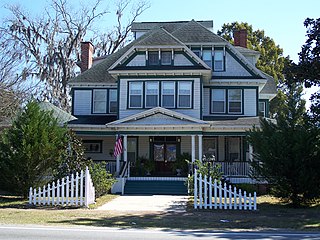
<span class="mw-page-title-main">Greenville, Florida</span> Town in the state of Florida, United States

Greenville is a town in Madison County, Florida, United States. The population was 746 at the 2020 census, down from 843 at the 2010 census.

<span class="mw-page-title-main">Keysville, Georgia</span> Town in Georgia, United States

Keysville is a town in Burke and Jefferson counties in the U.S. state of Georgia. As of the 2020 census, the city's population was 300.

<span class="mw-page-title-main">Edison, Georgia</span> City in Georgia, United States

Edison is a city in Calhoun County, Georgia, United States. Per the 2020 census, the population was 1,230. The Edison Commercial Historic District is listed on the National Register of Historic Places.

<span class="mw-page-title-main">Byromville, Georgia</span> Town in Georgia, United States

Byromville is a town in Dooly County, Georgia, United States. The population was 546 at the 2010 census, up from 415 in 2000. In 2020, its population was 422.

<span class="mw-page-title-main">Dooling, Georgia</span> Town in Georgia, United States

Dooling is a town in Dooly County, Georgia, United States. The population was 68 at the 2020 census.

<span class="mw-page-title-main">Union Point, Georgia</span> City in Georgia, United States

Union Point is a city in Greene County, Georgia, United States. As of the 2020 census, the city population was 1,597.

<span class="mw-page-title-main">White Plains, Georgia</span> City in Georgia, United States

White Plains is a city in Greene County, Georgia, United States. The population was 284 at the 2010 census.

<span class="mw-page-title-main">Oglethorpe, Georgia</span> City in Georgia, United States

Oglethorpe is a city in Macon County, Georgia, United States. The population was 995 at the 2020 census, down from 1,328 in 2010. The city is the county seat of Macon County. It was named for Georgia's founder, James Oglethorpe.
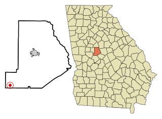
<span class="mw-page-title-main">Culloden, Georgia</span> City in Georgia, United States

Culloden is a city in Monroe County, Georgia, United States. The population was 200 in the 2020 census. It is part of the Macon metropolitan statistical area.

<span class="mw-page-title-main">Richland, Georgia</span> City in Georgia, United States

Richland is a city in Stewart County, Georgia, United States. Per the 2020 census, the population was 1,370.

<span class="mw-page-title-main">Junction City, Georgia</span> Town in Georgia, United States

Junction City is a town in Talbot County, Georgia, United States. The population was 138 at the 2020 census.

<span class="mw-page-title-main">Boston, Georgia</span> City in Georgia, United States

Boston is a city in Thomas County, Georgia, United States. As of the 2020 census, the city had a population of 1,207.

<span class="mw-page-title-main">Harrison, Georgia</span> Town in Georgia, United States

Harrison is a town in Washington County, Georgia, United States. The population was 339 in 2020.

<span class="mw-page-title-main">Tennille, Georgia</span> City in Georgia, United States

Tennille is a city in Washington County, Georgia, United States. The population was 1,469 in 2020.

<span class="mw-page-title-main">Pineview, Georgia</span> Town in Georgia, United States

Pineview is a town in Wilcox County, Georgia, United States. Per the 2020 census, the population was 454.
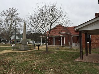
<span class="mw-page-title-main">Charles City, Virginia</span> Census-designated place in Virginia, United States

Charles City is a census-designated place (CDP) in Charles City County, Virginia, United States. It is the county seat of Charles City County. The population as of the 2020 census was 104.

Lamont is an unincorporated community and census-designated place (CDP) in Jefferson County, Florida, United States. As of the 2020 census,the population was 170, down from 178 at the 2010 census. It is part of the Tallahassee, Florida Metropolitan Statistical Area.
References

  1. "2020 U.S. Gazetteer Files". United States Census Bureau. Retrieved December 18, 2021.
  2. "U.S. Census website". United States Census Bureau . Retrieved January 31, 2008.
  3. "US Board on Geographic Names". United States Geological Survey. October 25, 2007. Retrieved January 31, 2008.
  4. 1 2 "Geographic Identifiers: 2010 Demographic Profile Data (G001): Flovilla city, Georgia". U.S. Census Bureau, American Factfinder. Archived from the original on February 12, 2020. Retrieved November 8, 2013.
  5. "Flovilla". GeorgiaGov. Archived from the original on January 11, 2019. Retrieved May 24, 2018.
  6. "City History". City of Flovilla. Archived from the original on September 9, 2022. Retrieved May 24, 2018.
  7. "US Gazetteer files: 2010, 2000, and 1990". United States Census Bureau. February 12, 2011. Retrieved April 23, 2011.
  8. "Census of Population and Housing". Census.gov. Retrieved June 4, 2015.
  9. 1 2 "P2 HISPANIC OR LATINO, AND NOT HISPANIC OR LATINO BY RACE – 2010: DEC Redistricting Data (PL 94-171) – Flovilla city, Georgia". United States Census Bureau .
  10. 1 2 "P2 HISPANIC OR LATINO, AND NOT HISPANIC OR LATINO BY RACE - 2020: DEC Redistricting Data (PL 94-171) - Flovilla city, Georgia". United States Census Bureau .