Toyama Prefecture is a prefecture of Japan located in the Chūbu region of Honshu. Toyama Prefecture has a population of 1,044,588 and has a geographic area of 4,247.61 km2. Toyama Prefecture borders Ishikawa Prefecture to the west, Gifu Prefecture to the south, Nagano Prefecture to the east, and Niigata Prefecture to the northeast.

The Ōno River is a river that originates in Ōita Prefecture, Japan. After running through the southern and central portions of Ōita Prefecture, it runs through the eastern part of Kumamoto Prefecture and the northern part of Miyazaki Prefecture.

Hida is a city located in Gifu, Japan. As of 1 December 2017, the city had an estimated population of 24,726, and a population density of 31 persons per km2, in 8,905 households. The total area of the city was 792.53 square kilometres (306.00 sq mi). The official kanji for the city is actually 飛驒, which uses the old rendering of the 騨 character. However, the 驒 character is not included on the official list of usable characters, so the 騨 character is often used outside of the city.
Itai-itai disease was the name given to the mass cadmium poisoning of Toyama Prefecture, Japan, starting around 1912. The term "itai-itai disease" was coined by locals for the severe pains people with the condition felt in the spine and joints. Cadmium (Cd) poisoning can also cause softening of the bones and kidney failure. Effective treatments involve the use of chelators to promote urinary excretion of Cd. The cadmium was released into rivers by mining companies in the mountains, which were successfully sued for the damage. Remediation efforts in the affected region have been ongoing since 1972 and were mostly complete as of 2012. Monetary costs of the cleanup have been paid for in part by Japan's national government, Mitsui Mining, and the Gifu and Toyama prefectural governments. Itai-itai disease is known as one of the Four Big Pollution Diseases of Japan.

Shirakawa is a village located in Ōno District, Gifu Prefecture, Japan. It is best known for being the site of Shirakawa-gō, a small, traditional village showcasing a building style known as gasshō-zukuri. Together with Gokayama in Nanto, Toyama, it is one of UNESCO's World Heritage Sites.

The Yahagi River is a river that flows from Nagano Prefecture's Mount Ōkawairi, through Gifu Prefecture, and enters Mikawa Bay from Aichi Prefecture in Japan. It is designated an A class river by the Ministry of Land, Infrastructure, Transport and Tourism (MLIT).

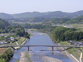
The Takahara River has its source at Mount Norikura in the northern part of Gifu Prefecture, Japan, and flows into Toyama Prefecture, where it joins with the Jinzū River. It is a Class 1 River.

The Shō River has its source in Mount Eboshi in the Shōkawa-chō area of Takayama, Gifu Prefecture, Japan. After flowing for 115 km (71 mi) through the northern part of Gifu Prefecture and the western part of Toyama Prefecture, it empties into Toyama Bay.

The Shōnai River is a Class 1 river flowing through Gifu and Aichi prefectures in Japan. In Gifu Prefecture, it is also referred to as the Toki River ; around the city of Kasugai in Aichi Prefecture, it is referred to as the Tamano River. Fujimae-higata exists in the River mouth.

The Ashida River is a river that flows through the eastern part of Hiroshima Prefecture, Japan. The river provides the primary drainage for the Bingo region.

The Gōnokawa River is a river that runs through Hiroshima and Shimane prefectures in Japan. It is the largest river in the Chūgoku region. It is also called the Gōgawa River and, in Hiroshima, the Enokawa River.

The Ōyodo River is a river which runs through Kagoshima Prefecture and Miyazaki Prefecture in Japan and ultimately drains into the Pacific Ocean.

Mount Norikura is a potentially active volcano located on the borders of Gifu and Nagano prefectures in Japan. It is part of the Hida Mountains and is listed among the 100 Famous Japanese Mountains and the New 100 Famous Japanese Mountains.
The Oyabe River is a river in Toyama Prefecture, Japan. The river rises from Mount Daimon on the border of Ishikawa Prefecture and enters the sea at Toyama Bay.

Suigō Prefectural Natural Park is a Prefectural Natural Park in northeast Mie Prefecture, Japan. Established in 1953, the park comprises one unified area that spans the borders of the municipalities of Kuwana and Kisosaki. In Heisei 16 (2004), nearly six-and-a-half million visitors entered the park, making it second in the prefecture, amongst its Natural Parks, to Ise-Shima National Park, and exceeding the number of visitors to Yoshino-Kumano National Park, Suzuka Quasi-National Park, and Murō-Akame-Aoyama Quasi-National Park. As of 31 March 2020, of its total designated area of 6,842 hectares, state land totalled 2,362 hectares, other public land 114 hectares, and private land 4,366 hectares.
Takahara is a Japanese surname. Notable people with the surname include:

Kuji River is a river in Fukushima Prefecture, Tochigi Prefecture and Ibaraki Prefecture, Japan. It rises at the northern slope of Mount Yamizo, where the border of these three prefectures is located, and flows into Pacific Ocean at Hitachi and Tokai in Ibaraki Prefecture. It has a length of 124 kilometers (77 mi) and a drainage area of 1,490 square kilometers (580 sq mi), and is designated as a Class A river.

The Kita River is a river in Shiga and Fukui Prefectures, Japan. It is designated a Class A river by the Ministry of Land, Infrastructure, Transport and Tourism (MLIT). It empties into Obama Bay, a sub-bay of Wakasa Bay on the Sea of Japan about 280 metres (920 ft) northeast of the mouth of the Minami River. It has been ranked among the best rivers in Japan for water quality since 1981.


