
Akita Prefecture [a̠kʲita̠] is a prefecture of Japan located in the Tōhoku region of Honshu. Its population is estimated 915,691 and its geographic area is 11,637 km2. Akita Prefecture is bordered by Aomori Prefecture to the north, Iwate Prefecture to the east, Miyagi Prefecture to the southeast, and Yamagata Prefecture to the south.

Yamagata Prefecture is a prefecture of Japan located in the Tōhoku region of Honshu. Yamagata Prefecture has a population of 1,028,055 and has a geographic area of 9,325 km2. Yamagata Prefecture borders Akita Prefecture to the north, Miyagi Prefecture to the east, Fukushima Prefecture to the south, and Niigata Prefecture to the southwest.

Noshiro is a city located in Akita Prefecture, Japan. As of 28 February 2023, the city had an estimated population of 49,150 in 24,079 households, and a population density of 120 persons per km2. The total area of the city is 426.95 square kilometres (164.85 sq mi).

Ōdate is a city in Akita Prefecture, Japan. As of 28 February 2023, the city had an estimated population of 67,865 in 31,433 households, and a population density of 75 persons per km2. The total area of the city is 913.22 square kilometres (352.60 sq mi).

Dewa Province was a province of Japan comprising modern-day Yamagata Prefecture and Akita Prefecture, except for the city of Kazuno and the town of Kosaka. Dewa bordered on Mutsu and Echigō Provinces. Its abbreviated form name was Ushū (羽州).

Fujisato is a town located in Akita, Japan. As of 28 February 2023, the town had an estimated population of 2,890 in 1315 households, and a population density of 10 persons per km2. The total area of the town is 281.98 square kilometres (108.87 sq mi).

Yamamoto District is a rural district located in Akita Prefecture, Japan.

Kitaakita is a city located in Akita Prefecture, Japan. As of 28 February 2023, the city had an estimated population of 29,201, and a population density of 120 persons per km2. and a population density of 25 persons per km2. The total area of the city is 1,152.76 square kilometres (445.08 sq mi).

The Omono River is located in Akita Prefecture, Japan. The river flows from Mount Daisen on the border of Akita Prefecture with Miyagi and Yamagata Prefectures in the city of Yuzawa and drains into the Sea of Japan at the city of Akita. The river's drainage basin is essentially the entire southern half of Akita Prefecture. The river is free of dams for its entire length. It is regarded as a "first class river" in the Japanese river classification system.

Mitane is a town located in Akita Prefecture, Japan. As of 28 February 2023, the town had an estimated population of 14,936, in 6729 households, and a population density of 60 persons per km2 The total area of the town is 247.98 square kilometres (95.75 sq mi).

Happō is a town located in Akita, Japan. As of 31 January 2023, the town had an estimated population of 6,466 in 2981 households, and a population density of 28 persons per km2. The total area of the town is 234.14 square kilometres (90.40 sq mi).

National Route 7 is a major north-south national highway on the Sea of Japan side of the island of Honshū, Japan. It traverses four prefectures, with Niigata at its southern end, then Yamagata, Akita, and finally, Aomori at its northern end. The 471.8-kilometer (293.2 mi) long highway begins at an intersection with national routes 8, 17, 113, 116, 289, 350, and 402 in the capital of Niigata, Niigata. Travelling north, the highway links the prefectural capitals Akita and Aomori. In central Aomori the highway ends at the northern terminus of National Route 4 and National Route 45.

Odate–Noshiro Airport is an airport in Kitaakita, Akita Prefecture, Japan and is 15.4 km (9.6 mi) west of Ōdate, at 84 m (276 ft) above sea level. It is also informally known as Akita North Airport.

Akita Prefectural University is a Japanese prefectural university, located in Akita City, Japan.
The Akita Expressway is a national expressway in the Tōhoku region of Japan. The 229.2-kilometer-long (142.4 mi) expressway begins at an interchange with the Tōhoku Expressway in Kitakami, Iwate from where it proceeds northwest towards the capital of Akita Prefecture, Akita. From there, it travels northeast back to another interchange along the Tōhoku Expressway in the town of Kosaka. It is jointly owned and operated by East Nippon Expressway Company and the Ministry of Land, Infrastructure, Transport and Tourism (MLIT). The Akita Expressway is numbered E7 between Kosaka and Kitakami Junctions and E46 between Kitakami and Kawabe Junctions under the MLIT's "2016 Proposal for Realization of Expressway Numbering."
National Route 101 is a national highway of Japan connecting the capitals of Aomori and Akita prefectures, Aomori and Akita in northern Japan, with a total length of 241.6 kilometers (150.1 mi). The majority of the highway travels along the coast of the Sea of Japan, paralleling the more inland National Route 7. The present-day highway largely follows the path of the Ōmagoe-kaidō, an Edo period road that linked the Kubota and Hirosaki feudal domains.

The Gonō Line is a railway line in Japan linking Higashi-Noshiro Station in Akita Prefecture with Kawabe Station in Aomori Prefecture, in the northern Tōhoku region of Honshu. The line stretches 147.2 km (91.5 mi) along the Sea of Japan coast with a total of 43 stations. The Gonō Line is operated by East Japan Railway Company.

The Akita Northern Happinets are a Japanese professional basketball team based in Akita that competes in the Eastern Conference of the First Division of the B.League. The team was formed as an expansion team of the bj league in 2010 and found success for the first time in 2013–14, finishing their fourth season as league runners-up. They went on to finish as runners-up for the second year in a row in 2014–15 and in third place in 2015–16, the final season of the bj league.

Akita Prefectural General Pool is a swimming venue in Akita, Akita, Japan. An Olympic competitor, Hiroko Nagasaki is the honorary director. It hosted the 2001 World Games, and it is the largest swimming pool in the prefecture.
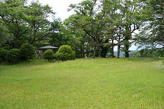
Hiyama Castle is a Sengoku period Japanese castle located in what is now part of the city of Noshiro, Akita Prefecture, in the Tōhoku region of Japan. The site of Hiyama Castle proper, the outlying Ōdate (大館跡), and Chausu (茶臼館跡) fortifications and the ruins of the temple of Kokusei-ji (国清寺跡) were collectively designated a National Historic Site of Japan in 1979.

