Takase River (Aomori)

Last updated • 1 min readFrom Wikipedia, The Free Encyclopedia
Takase River
高瀬川
Paddy fields in Aomori Prefecture (3646592676).jpg
A view of paddy fields and Takase River in the border between Tohoku and Shichinohe
Native nameTakasegawa (Japanese)
Location
Country Japan
Prefecture Aomori
Physical characteristics
Mouth Pacific Ocean
  coordinates
40°53′10″N141°23′34″E / 40.8860°N 141.3928°E / 40.8860; 141.3928
Length64 kilometres (40 mi)
Basin size867 square kilometres (335 sq mi)

The Takase River (高瀬川, Takasegawa) is a Class A river system that flows through Aomori Prefecture, Japan. It flows from Mt. Yahata, through Lake Ogawara into the Pacific Ocean. [1] [2]

Contents

The river is very important to the economy of the region. [1] Approximately 80,000 people live in the river's catchment area. [1]

Every July, the annual Lake Festival (湖水まつり, Kosui-matsuri) is held along the banks of the Takase River. [3] The Takase River Office uses the opportunity to exhibit the "creatures that live in Lake Ogawara", which is popular with families. [3] They also raise awareness about flood control, and water quality improvement of the lake.

In Japanese, takase means "shallow river". [2]

Geography

The river has a length of 64 kilometres (40 mi) and a catchment area of 867 square kilometres (335 sq mi). [1] [4] [5] The basin area contains 2 cities, 4 towns, and 1 village. [5]

Upstream from Lake Ogawara, the slope of the river ranges between 1:50 and 1:2000. [5] Between the river and the Pacific Ocean, the slope is 1:30000 (almost horizontal). [5] The water flows backwards from the sea into Lake Ogawara, causing it to be slightly brackish. [5]

Environment

Many species live in the Takase River system, such as river lamprey, killifish, and japanese smelt. Lake Ogawara, located downstream, contains many brackish and freshwater aquatic plants like Braun's stonewort, and Ruppia maritima. [6] Freshwater clams can also be found in the area. [6]

Lake Ogawara is designated as one of Japan's 500 Important Wetlands by the Ministry of the Environment. [6] [5]

Flooding

Since the Shōwa era, eight major floods have been observed. [7] The most recent was in 2007. [7]

YearCause of floodAffected communitiesDamage
1958 Typhoon Ida Towada, Misawa, Shichinohe, Kamikitachō3 dead or missing, 17 injured, 151 buildings destroyed, 2,801 buildings flooded
1965 1965 Pacific typhoon season Towada, Misawa, Kamikitachō, Tōhoku 85 buildings partially damaged, 57 buildings flooded
1968 Cyclone Tōhoku106 buildings partially damaged, 93 buildings flooded
1990CycloneKamikitachō, Rokkasho 1 building partially damaged, 239 buildings flooded
1994Weather frontMisawa, Kamikitachō88 buildings flooded
1998CycloneKamikitachō, Tenmabayashi 12 buildings flooded
2006CycloneTōhoku9 buildings flooded
2007CycloneTōhoku3 buildings flooded

Related Research Articles

<span class="mw-page-title-main">Abe River</span> River in Shizuoka Prefecture, Japan

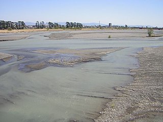
The Abe River is a Class A river in Shizuoka Prefecture of central Japan. It is 53.3 kilometres (33.1 mi) long and has a watershed of 567 square kilometres (219 sq mi). Approximately 170,000 people live in the basin area.

<span class="mw-page-title-main">Abukuma River</span> River in Tōhoku, Japan

The Abukuma River, with a length of 234 km (145 mi), is the second longest river in the Tōhoku region of Japan and the 6th longest river in the country. It is designated as a Class A river.

<span class="mw-page-title-main">Ōno River</span> River in Ōita, Japan

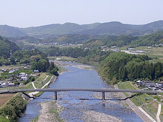
The Ōno River is a river that originates in Ōita Prefecture, Japan. After running through the southern and central portions of Ōita Prefecture, it runs through the eastern part of Kumamoto Prefecture and the northern part of Miyazaki Prefecture.

<span class="mw-page-title-main">Ministry of Land, Infrastructure, Transport and Tourism</span> Government ministry of Japan

The Ministry of Land, Infrastructure, Transport and Tourism, abbreviated MLIT, is a ministry of the Japanese government. It is responsible for one-third of all the laws and orders in Japan, and is the largest Japanese ministry in terms of employees, as well as the second-largest executive agency of the Japanese government after the Ministry of Defense. The ministry oversees four external agencies including the Japan Coast Guard, the Japan Meteorological Agency and the Japan Tourism Agency.

<span class="mw-page-title-main">Agano River</span> River in Hokuriku, Japan

The Agano River is a river system in the Hokuriku region of Honshu, Japan. It is also called the Aga River or the Ōkawa River in Fukushima. It is designated as a Class A river.

<span class="mw-page-title-main">Kano River</span> River in Japan

The Kano River is an A class river in Shizuoka Prefecture of central Japan. It is 46 kilometres (29 mi) long and has a watershed of 853 square kilometres (329 sq mi).

<span class="mw-page-title-main">Nemuro Nakashibetsu Airport</span> Airport in Hokkaidō, Japan

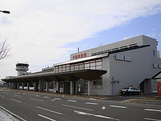
Nemuro Nakashibetsu Airport is an airport located 2 NM from Nakashibetsu, Hokkaidō, Japan. It serves Nakashibetsu and the nearby city of Nemuro, and is the easternmost airport in the country.

<span class="mw-page-title-main">Agatsuma River</span> River in Japan

The Agatsuma River is a major river in the northern Kantō region of Japan. It is 76.22 kilometres (47.36 mi) in length and has a basin area of 1,366 square kilometres (527 sq mi). Located entirely within Gunma Prefecture, it is one of the prefecture's major rivers. It is also a major tributary of the Tone River. The river is an important source of hydroelectric power, and 17 power plants are located on its banks.

<span class="mw-page-title-main">Abashiri River</span> River in Hokkaidō, Japan

Abashiri River is a Class A river in Hokkaidō, Japan.

<span class="mw-page-title-main">Shiribeshi-Toshibetsu River</span> River in Hokkaidō, Japan

The Shiribeshi-Toshibetsu River is a Class A river in Hokkaidō, Japan. It flows through Hiyama District, and empties into the Sea of Japan.

<span class="mw-page-title-main">Lake Ogawara</span> Lake in Aomori Prefecture, Japan

Lake Ogawara is Japan's eleventh largest lake and the largest in Aomori Prefecture. It spans the boundaries of the city of Misawa, the town of Tōhoku, and the village of Rokkasho in Kamikita District.

<span class="mw-page-title-main">Gōnokawa River</span> River in Hiroshima, Japan

The Gōnokawa River is a river that runs through Hiroshima and Shimane prefectures in Japan. It is the largest river in the Chūgoku region. It is also called the Gōgawa River and, in Hiroshima, the Enokawa River.

<span class="mw-page-title-main">Ōyodo River</span> River in Miyazaki, Japan

The Ōyodo River is a river which runs through Kagoshima Prefecture and Miyazaki Prefecture in Japan and ultimately drains into the Pacific Ocean.

<span class="mw-page-title-main">Neo River</span> River in Japan

The Neo River is a river in Japan which flows through Gifu Prefecture, and is part of the Kiso River system. North of Ōno, the river is also called the Yabu River.

<span class="mw-page-title-main">Great Tenmei famine</span> Famine in Japan (1782–1788)

The Great Tenmei famine affected Japan during the Edo period. The famine was the deadliest one during the early modern period in Japan. It is considered to have begun in 1782 and lasted until 1788. It was named after the Tenmei era (1781–1789) during the reign of Emperor Kōkaku. The ruling shoguns during the famine were Tokugawa Ieharu and Tokugawa Ienari.

<span class="mw-page-title-main">Koyoshi River</span> River in Honshu, Japan

Koyoshi River is a river in Akita Prefecture, Japan. It originates from Mount Chōkai, where the border of Akita Prefecture and Yamagata Prefecture is located, and flows through Yurihonjō and finally into Sea of Japan. The headstream of the river is called Chōkai River. It has the third largest drainage area of the class A rivers that flow through Akita Prefecture, after Omono River and Yoneshiro River.

<span class="mw-page-title-main">Aka River</span> River in Honshu, Japan

Aka River is a river in Yamagata Prefecture, Japan. It flows into the Sea of Japan.

<span class="mw-page-title-main">Seki River</span> River in Honshu, Japan

The Seki River (関川) is a Class A river in Niigata Prefecture and Nagano Prefecture, Japan. Approximately 210,000 people live in the basin area.

<span class="mw-page-title-main">Oze River</span> River in Honshu, Japan

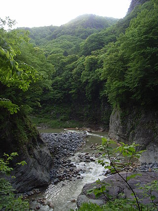
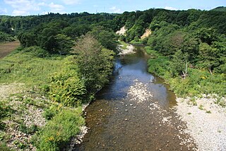
The Oze River is a river in Hiroshima Prefecture and Yamaguchi Prefecture, Japan. The river forms part of the border between the two prefectures, which used to be the border between former Suō Province and Aki Province. It is also known as Kono River (木野川).

<span class="mw-page-title-main">Kako River (Japan)</span> River in Hyōgo Prefecture, Japan

The Kako River is a river that flows through Hyōgo Prefecture, Japan. It is the largest river in Hyōgo Prefecture, both in terms of total length and basin area, encompassing 21% of the prefecture's land area. It rises at Mount Awaga, and flows 96 kilometres (60 mi) south, reaching the Harima Sea and forming part of the border between Kakogawa and Takasago cities. The Ministry of Land, Infrastructure, Transport and Tourism (MLIT) has designated the Kako River system as Class A.

References

  1. 1 2 3 4 "日本の川 - 東北 - 高瀬川 - 国土交通省水管理・国土保全局". www.mlit.go.jp. Retrieved 2024-03-03.
  2. 1 2 "日本の川 - 東北 - 高瀬川 - 国土交通省水管理・国土保全局". www.mlit.go.jp. Retrieved 2024-03-03.
  3. 1 2 "日本の川 - 東北 - 高瀬川 - 国土交通省水管理・国土保全局". www.mlit.go.jp. Retrieved 2024-03-03.
  4. http://wanokawa.sakura.ne.jp/html/wanokawa/110705mizuki3.pdf
  5. 1 2 3 4 5 6 https://www.pref.aomori.lg.jp/soshiki/kankyo/kankyo/files/plan07.pdf
  6. 1 2 3 "日本の川 - 東北 - 高瀬川 - 国土交通省水管理・国土保全局". www.mlit.go.jp. Retrieved 2024-03-03.
  7. 1 2 "日本の川 - 東北 - 高瀬川 - 国土交通省水管理・国土保全局". www.mlit.go.jp. Retrieved 2024-03-03.