Jiribam district

Last updated

Jiribam district
Jiribam District Map.png
Location in Manipur
CountryFlag of India.svg  India
State Manipur
Established2016
Headquarters Jiribam
Area
  Total
212 km2 (82 sq mi)
  Rank15
Population
 (2011)
  Total
43,838
  Density210/km2 (540/sq mi)
Language(s)
  Official Meitei (officially called Manipuri)
  Spoken Bengali   Hmar   Other tribal languages
Time zone UTC+05:30 (IST)
Major highways NH-37
Website https://jiribam.nic.in/

Jiribam District (Meitei pronunciation: /jee-ree-baam/) is a district at the western periphery state of Manipur, India. It borders the Cachar district of Assam on the west, and serves as the western gateway for Manipur. Formerly a subdivision of the Imphal East district, it was made an independent district in December 2016. [1]

Contents

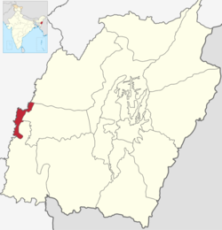
Geography and history

Languages of Jiribam district (2011) [2]

   Bengali (50.79%)
   Manipuri (30.51%)
   Hmar (8.04%)
   Bishnupuriya (2.66%)
   Hindi (1.63%)
   Kabui (1.46%)
   Kuki (1.11%)
  Others (3.80%)

Jiribam district lies in the valley between the Bhuban range on the west (in Assam's Cachar district) and the Vangai range ("Vangaitang") in the east. The Barak River flows due north in the valley from Tipaimukh, turning west near Jirimukh, about 10 km south of Jiribam. Also at Jirimukh, the Jiri River that flows from north in the same valley drains into the Barak River.

The area of Jiribam district appears to have been part of the Cachar kingdom at the beginning of the 19th century. After annexing the kingdom in 1832, the British made an agreement with Raja Gambhir Singh of Manipur ceding all claims to the territory up to the western stretch of Barak River [a] and the Jiri River. Thus the eastern portion of the Jiribam valley came under the control of Manipur, while the rest remained under Cachar which became part of Assam. [3] [4]

The Jiribam Valley was at that time forested and mostly uninhabited. [5] The Cachar portion of the valley had a ferry port at Jirighat, which was used by the travellers on the Silchar–Manipur road (called "Cachar Road" in Manipur). [6] The Manipur state government decided to open the valley for agricultural settlement in 1907, [5] and by 1911, 14,346 bighas of land is said to have been settled. [7] Rice and sugarcane were cultivated, and betel leaf (pan) in areas unsuitable for rice cultivation. [7]

By 1931, there were 46 villages in the Jiribam settlement, populated by Manipuri (Meitei) Hindus and Muslims, Bengali Hindus and Muslims, a few Kukis and Kabuis. [5] Jiribam also had 5 primary schools, the same number as in the Imphal Valley outside the city of Imphal. [8] Most of the settlers in Jiribam came from the Cachar district, very few from the Imphal Valley (Manipur valley). [5] This meant that the settlers had to be treated as 'British subjects' rather than 'Manipur state subjects' and revenue settlement orders and dispute resolutions had to be carried out by the British Political Agent. [9]

Independent India

After the independence of India, Manipur elected a legislative assembly under its own constitution. Ten seats in the assembly were allocated to the hill areas, which included Jiribam. [10] Soon afterwards, Manipur merged into India and was governed under the Constitution of India as a union territory. [b] The territory of Manipur was divided into 8 subdivisions, one of which was based at Jiribam. The Jiribam subdivision covered the Vangai range, and stretched up to Tipaimukh in the south. [11] It was designated as a hill subdivision. [12]

In 1969, when Manipur was divided into five districts, the southern part of the Jiribam subdivision was separated into the Tipaimukh subdivision of the 'Manipur South' district (now in Pherzawl district), and the remaining Jiribam subdivision was included in the 'Manipur Central' district headquartered at Imphal. [13] [14] [15] This also meant that Jiribam became part of the valley area of Manipur, rather than hill area. [10] To avoid the anomaly, the eastern part of the subdivision consisting of the Vangai range was transferred to the Tipaimukh subdivision in stages. [16] With the reorganisation of 'Manipur Central', the subdivision got attached to the Imphal East district.

A movement for a separate revenue district for Jiribam took shape in 2006 and a Jiribam District Demand Committee (JDDC) was formed. During 2011, the committee conducted several strikes and economic blockades along NH-37, which passes through Jiribam. [17] [18] In November 2011, the state government agreed to the demands of JDDC and signed a memorandum of understanding. The government also agreed to upgrade the Borobekra Circle in the southern part of the region into a subdivision. [19] [20]

In 2016, Jiribam subdivision became an independent Jiribam district. [21]

Insurgencies

According to multiple sources, the proscribed Meitei insurgent groups, United National Liberation Front (UNLF) and People's Liberation Army of Manipur (PLA), used the Jiribam valley and the neighbouring Cachar district of Assam as their main area of operations. [22] [23] The region was originally used by Meitei insurgent groups in the 1960s as a launching pad to access the training camps run by Inter-Services Intelligence (ISI) in East Pakistan (present-day Bangladesh). With the liberation of Bangladesh in 1971, this activity was briefly halted, but it resumed in 1975 with the advent of military rule in Bangladesh. [24]

Security expert E. M. Rammohan states that the hilly region bounded by NH-37 [c] in the north, Thangjing Hills in the east, Tipaimukh Road in the south, and the Jiribam–Tipaimukh Road on the west, was a "free zone", with minimal presence of security forces, which was adopted by UNLF, PLA and Hmar People's Convention–Democracy for setting up camps and bases. [25] The PLA and UNLF are said to have entered this area after the Kuki-Naga conflict (in the 1990s) by helping resettle the displaced Kukis in Churachandpur district and obtaining land in return. [26] Rammohan also states that HPC-Democracy was allied with UNLF. [25]

The entente between UNLF and the Hmar community came to an end after the mass rape of 21 women and girls allegedly carried out by the UNLF and the allied group Kangleipak Communist Party (KCP) in the neighbouring Tipaimukh subdivision in 2006. [27] [28] Afterwards, the insurgent groups were forced to leave the area. [29] [30] The local people also credited the 7th India Reserve Battalion (IRB) forces stationed at Uchathol and Jakuradhor for establishing peace in Jiribam district. [31]

Demographics

Religions in Jiribam district (2011) [32]
ReligionPercent
Hinduism
48.64%
Islam
34.07%
Christianity
13.34%
Other (Sanamahi or Heraka)
3.77%
Other or not stated
0.18%

At the time of the 2011 census, the district had a population of 42,838. Jiribam had a sex ratio of 945 females per 1000 males and a literacy rate of 63.11%. 16.75% of the population lived in urban areas. Scheduled Castes and Scheduled Tribes made up 16.94% and 12.52% of the population respectively. [33]

At the time of the 2011 census, 50.79% of the population spoke Bengali, 30.51% Manipuri, 8.04% Hmar, 2.66% Bishnupuriya, 1.63% Hindi, 1.46% Kabui and 1.11% Kuki as their first language. [2]

Administrative divisions

Prior to 2017, when Jiribam was a subdivision in the Imphal East district, it was divided into two circles: Jiri Circle in the north, headquartered at Jiribam, and Barak Circle in the south, headquartered at Borobekra. After Jiribam became a district, the two circles have been upgraded to subdivisons: Jiribam Subdivision and Borobekra Subdivision.

The local administration in the Jiribam Subdivision is divided into the Jiribam municipality and three gram panchayats (village councils) based at Hilghat, Dibong and Sonapur. The local administration in the Borobekra Subdivision has three gram panchayats: Latingkhal, Borobekra and Jakuradhor. [34]

Jiribam district as a whole forms one legislative assembly constituency. [35]

2023–2024 Manipur violence

On 3 May 2023, major ethnic violence broke out between the Meitei and Kuki-Zo communities of Manipur. Within weeks over 100 people died and 60,000 people got displaced. All the Kuki-Zo people in the Imphal Valley and the Meitei people in the Kuki-Zo-dominated hill districts were forced to flee to the other side. The Jiribam district, consisting of both the classes of population but also other communities such as Bengalis, was affected in a unique fashion.

During the first week of violence, Meitei mobs led by the Arambai Tenggol militia attacked Kuki-Zo localities in the Jiribam Town. The security forces quickly controlled the violence and brokered a peace agreement between the communities. This agreement held for almost a year. Even though there were sporadic incidents such as house burning and abduction, there were no deaths. [36] [37]

The peace was shattered by twin murders in May–June 2024, the first of a Kuki individual named Seigoulen Singson in May, and the second of a Meitei individual named Soibam Saratkumar Singh in June. Rumours spread that Saratkumar's body was founded beheaded, inflaming Meitei feelings. Meitei mobs led by Arambai Tenggol started torching houses in the Jiribam area, inviting retaliation from Kuki mobs. In the ensuing mayhem, the entire population of Hmars and Thadou Kukis from the Jiribam town got displaced to Assam's Cachar district. A Hmar village called Hmarkhawlien near Lakhipur became their refuge. [36] The Meiteis in the tribal parts of the district fled to relief camps in and around the Jiribam town. [38]

The Kuki-Zo villages in the southern hills of the district got cut off from the Jiribam town, which was now under the control of hostile Meitei mobs and militias. In order to obtain supplies, they had to use the river route, the Jiri River and then the Barak River, leading to Hmarkhawlien. The villagers pooled money and stocked up on supplies. [36] The Indigenous Tribes Advocacy Committee (ITAC) asked the government to prevent Arambai Tenggol and Meitei extremists from entering the tribal villages and requested special protection to the villages of Zairawn, Mongbung, Phaitol, Muolzawl and Sejang. [39]

See also

Notes

  1. The Barak River flows south till Tipaimukh and then makes an almost 180°-bend to flow north till Jirimukh. The region between these two stretches might have been contested between Manipur and Kachar prior to 1833.
  2. In 1950, it was termed a Part 'C' state, later changed to 'union territory' in 1956.
  3. NH-37 was earlier calleld National Highway 53.

Related Research Articles

<span class="mw-page-title-main">Manipur</span> State in northeastern India

Manipur is a state in northeast India, with the city of Imphal as its capital. The state borders Myanmar, with Sagaing Region to the east and Chin State to the southeast. It has the Indian states of Nagaland to the north, Mizoram to the south and Assam to the west. The state covers an area of 8,621 square miles (22,330 km2) of mostly hilly territory, with an embedded valley of 700 square miles, where the Meitei community lives and has had a historical kingdom. The surrounding hills are populated by hill tribes classified into Naga and Kuki groups. The official language of the state is Meitei, which belongs to the Tibet-Burman family. The hill tribes speak separate Tibeto-Burman languages.

<span class="mw-page-title-main">Imphal East district</span> District of Manipur in India

Imphal East district is one of the 16 districts of Manipur state in northeastern India. In 2011, it was the second most populous district in the state, after Imphal West. In 2016, the Jiribam subdivision, which was an exclave at the western periphery of the state, was separated as an independent district.

<span class="mw-page-title-main">Senapati district</span> District of Manipur in India

Senapati district, is one of the 16 districts of the Indian state of Manipur. The present Senapati district was formed in December 2016, after spawning off the Sadar Hills region in the south into a separate Kangpokpi district. The district headquarter is located in the town of Senapati, also known as Tahamzam.

Jiribam is a town governed by a municipal council in the Jiribam district of the state of Manipur, India. It is one of the fastest-growing towns in Manipur.

Tipaimukh Dam, officially "Tipaimukh Multipurpose Hydroelectric Dam Project", is a proposed dam on the Barak River at Sipuikawn (Tipaimukh) in Manipur, India. The purpose of the dam is flood control and hydroelectric power generation. The project was approved by the Government of India in 1999 and entrusted to the North Eastern Electric Power Corporation Limited, later switched to NHPC Limited. Due to environmental concerns as well as concerns in Bangladesh over downstream effects, the project remains under discussion and no construction has yet taken place.

<span class="mw-page-title-main">Pherzawl district</span> District of Manipur in India

Pherzawl district is located in the southern part of the state of Manipur. It is bounded on the east by Churachandpur District; on the north by Tamenglong District, Noney District and Jiribam district; on the west by the Cachar District of Assam and on the South by Sinlung Hills, Mizoram. Pherzawl District has approximately 200 villages.

Thangjing Hill , is a mountain peak in the Indian state of Manipur. It is in the Churachandpur district, to the west of Moirang. The north–south-running mountain range on which it sits is also called Thangjing range or Thangjing Hills. The range forms part of the western border of the Imphal Valley.

On 3 May 2023, ethnic violence erupted in India's north-eastern state of Manipur between the Meitei people, a majority that lives in the Imphal Valley, and the Kuki-Zo tribal community from the surrounding hills. According to government figures, as of 3 May 2024, 221 people have been killed in the violence and 60,000 people have been displaced. Earlier figures also mentioned over 1,000 injured, and 32 missing. 4,786 houses were burnt and 386 religious structures were vandalised, including temples and churches. Unofficial figures are higher.

<span class="mw-page-title-main">Arambai Tenggol</span> Armed militia organisation in Manipur, India

Arambai Tenggol is a Meitei activist organisation in the Indian state of Manipur founded by Manipur's titular ling and Rajya Sabha member Leishemba Sanajaoba, who also remains as its chairman. Arambai Tenggol has been described as a radical organisation, or as a radicalised armed militia. It is also a revivalist organisation that aims to reestablish the pre-Hindu, native Sanamahi religion among the Meiteis. It enjoys the patronage of Sanajaoba as well as the chief minister N. Biren Singh. During the 2023–2024 Manipur violence, members of the Kuki-Zo community blamed it for having carried out deadly attacks against them. In January 2024, the organisation demonstrated its influence by summoning all the elected Meitei legislators of the state for a meeting to deliberate on the defence of Meiteis in the prevailing conflict.

<span class="mw-page-title-main">2024 Indian general election in Manipur</span> Election to constitute the 18th Lok Sabha in 2024

The 2024 Indian general election was held in Manipur on 19 April and 26 April to elect two members of the 18th Lok Sabha, from the constituencies of Inner Manipur and Outer Manipur. The election got scheduled in the midst of year-long ethnic violence between the valley-based Meitei community and the hill-based Kuki-Zo community. There were reports of violence and intimidation by armed militias during the campaigning as well as polling but, on the whole, the election got conducted peacefully. Opposition Indian National Congress candidates, Bimol Akoijam and Alfred Kanngam Arthur, won the two seats respectively.

Kangvai is a village in the Churachandpur district of Manipur, India, near its contested border with Bishnupur district. It is on the bank of the Kangvai stream that flows down from the eastern slopes of the Thangjing Hill into the Imphal Valley, stretching from the foothills to the Tedim Road. Kangvai is also the headquarters of the Kangvai Subdivision in the Churachandpur district. In the 2011 census, it had a population of 939, most of them Kuki-Zo people. Next to Kangvai along Tedim Road is a Meitei village called Phougakchao Ikhai, which is considered part of Bishnupur district.

The Khamenlok search operation on 12–14 June 2023, in the course of 2023–2024 Manipur violence between the Meitei and Kuki people, in the Khamenlok river valley, a branch valley of the Iril River valley, in the Saikul subdivision of Kangpokpi district. According to intelligence reports, the Manipur police received information that more than 3,000 Meitei militants, some armed with sophisticated weapons, launched an attack on the kuki villages in the Khamenlok and surrounding areas. Over a period of three days, the meiteis burned houses and rampaged through the area. While the kuki villagers escaped upon the arrival of the assailants, the Assam Rifles were blocked from reaching the area by Meitei women. Finally, on June 13, while the assailants were celebrating in a church building, the kuki village defense volunteers descended from hills and carried out a wholesale massacre of the meiteis mobs.

Borobekra, also spelt Barabekra, is a village in the Jiribam district in Manipur, India, and the headquarters of an eponymous subdivision. It is about 30 km south of Jiribam, the headquarters of the district. The village is on the bank of the Barak River, near the confluence of a tributary that flows down from the Vangaitang range to the east. The Barak River flows north in this region, up to Jirimukh, where it turns northwest. The Barak River also forms the border with the Assam state of India.

Jarolpokpi, also called Zairawn, is a census village at the southern end of the Jiribam plain in the Jiribam district, Manipur, India. It occupies a narrow plain between the Vangaitang range in the east and Sejang hills in the west, covering 2.47 km2 (0.95 sq mi) area. Included in the census village are a Hmar village Zairawn, two Thadou Kuki villages Mongbung and Sejang Kuki, and a Meitei village Mongbung Meitei. The combined population of the Jarolpokpi census village is 1,237 people, of whom 64.2 percent are Scheduled Tribes.

Phaitol is a village in Manipur, India. It is at the foothills of the Vangaitang range, close to the National Highway 37. The village is part of Tamenglong district, Tousem Subdivision, but it is geographically located within the precincts of Jiribam district.

Kaiphundai, also called New Kaiphundai or "Kaiphundai Naga", is a village in Tamenglong district, Manipur, India, close to its border with Jiribam district. The village is on top of the Vangaitang range, at an elevation of 330 m (1,080 ft). An older village that is now referred to as Old Kaiphundai or "Kaiphundai Kuki" is at a lower elevation of 236 m (774 ft) on the same range. Both the villages are along the National Highway 37 and are part of the 'Tamenglong West' subdivision.

Durgapur is a census village in the Borobekra subdivision, Jiribam district, Manipur, India. It is about 35 km south of Jiribam, the headquarters of the district, close to the border with the Pherzawl district in the south. The village is on the bank of the Barak River, spanning a narrow valley between two forested hilly areas. The Barak River flows north in this region, up to Jirimukh, where it turns northwest. The Barak River also forms the border with the Assam state of India.

Ankhasuo, also called Sibapurikhal, is a census village in the Vangai Range subdivision, Pherzawl district, Manipur, India. The village is on the bank of the Barak River, close to the border between Pherzawl and Jiribam districts. Savomphai, the next village to the north is the last village in Pherzawl district. Other villages in the vicinity are Kasurbali and Khangbor, the latter of which is enumerated within Ankhasuo for the census.

Uchathol is a census village in Jiribam district, Manipur, India. It is close to the National Highway 37, on Kashmirpur Road which branches off at Gularthol. The next village to its east is Kuki-Zo-dominated Phaitol, which is in Tamenglong district. Being close to the tribal population, Uchathol played a seminal role during the 2023–2024 Manipur violence.

Leishabithol is a census village in Jiribam district, Manipur, India. It is along the low-lying ridges of the Vangaitang range, close to the Vangaichungpao railway station. Also close-by are the villages of Mullargao and Nungkhal.

References

  1. "Creation of new districts could be game-changer in Manipur polls | opinion". Hindustan Times . Retrieved 30 June 2017.
  2. 1 2 "Table C-16 Population by mother tongue: Manipur". Census of India . Registrar General and Census Commissioner of India. 2011.
  3. Sanjeev, Thingnam (2015), "Recasting Space: Politics of frontier-making", in Arambam Noni; Kangujam Sanatomba (eds.), Colonialism and Resistance: Society and State in Manipur, Routledge, p. 243, ISBN   978-1-317-27066-9
  4. Goshwami, Hareshwar (2019). History of the People of Manipur (Revised ed.). YAOL. pp. 24–25, 251. ISBN   978-1-9993057-0-3 via archive.org.
  5. 1 2 3 4 Administration Report for 1931-32 (1932), p. 55.
  6. Gazetteer of Bengal and North-East India (1979) , p. 189; Imperial Gazetteer of India, Vol. XIV, pp. 177–178
  7. 1 2 Higgins, J. C. (1912), Administration Report of The Manipur State For The Year 1911-12, Calcutta: Thacker, Spink & Co, p. 4 via archive.org
  8. Administration Report for 1931-32 (1932), p. 41.
  9. Administration Report for 1931-32 (1932), pp. 57–58.
  10. 1 2 Shakum, Rev. Banjamin (18 July 2017), "Hill People of Jiribam-Quo Vadimus (Where are we Going)?", Fox Journal, archived from the original on 10 April 2018
  11. Manipur Administrative Atlas (2005), pp. 12–15, Map 7.
  12. Manipur Gazette, No. 10-E-3, 25 May 1951. "The Hill areas of the State of Manipur shall consist of the following: 1. The whole of the Ukhrul, Churachandpur, Tamenglong, and Jiribam Sub-Divisions and the areas formerly comprised in the now-defunct Mao and Tengnoupal Subdivisions which have since been amalgamated with the Sadar and Thoubal Sub-Divisions respectively...."
  13. Kshetri, Rajendra (2006), District Councils in Manipur:Formation and Functioning, Akansha, pp. 10–11, ISBN   8183700411
  14. Census of India, 1971 (1972), p. 1.
  15. Manipur Administrative Atlas (2005), pp. 16–17, Map 8.
  16. Manipur Administrative Atlas (2005), pp. 18–19, Map 9.
  17. New district demand, Imphal Free Press, 3 June 2011. ProQuest   895491938
  18. Manipur braces for NH stir again, The Times of India, 5 June 2011. ProQuest   870312015
  19. State government signs MoU assuring of separate Jiribam district, Imphal Free Press, 9 November 2011. ProQuest   902780790
  20. Manipur govt signs MoU with JDDC, The Assam Tribune, 10 Nov 2011. ProQuest   902849896
  21. Khelen Thokchom, More districts in Manipur, The Telegraph (Kolkata), 9 December 2016. ProQuest   2290178396
  22. Laishram, Dhanabir (2007), North-East in Benthic Zone, Akansha Publishing House, p. 90, ISBN   9788183701143, UNLF and PLA's main area of operation is Manipur's Jiribam valley and Cachar. In the recent past, a unified command of MPLF enduringly engaged with the Border Security Force in a gun-fight for four days in which the later had to withdrew without attaining any significant result.
  23. Hussain, Wasbir (2013), "Ethno-Nationalism and the Politics of Terror in India's Northeast", in P. R. Kumaraswamy; Ian Copland (eds.), South Asia: The Spectre of Terrorism, Routledge, p. 89, ISBN   9781317967729, Insurgent politics in the region registered a very important development in the year 2000—the signing of a deal for joint operations by the Assamese ULFA and the United National Liberation Front (UNLF), a Manipuri insurgent group whose primary area of operation has been Manipur's Jiribam valley and neighbouring Assam's Cachar district.
  24. Dar, Fulcrum of Evil (2006), p. 108.
  25. 1 2 Rammohan, E. N. (April 2021), "Manipur: A degenerated insurgency", USI Journal, archived from the original on 25 April 2021
  26. Chadha, Low Intensity Conflicts in India (2005), pp. 318–319.
  27. Hmingchullo, Ruth (2017), "Ethics in Journalism from a Human Rights Perspective", in Paromita Das; Charu Joshi; G. P. Pandey (eds.), Problems and Perspectives of the Relationship between the Media and Human Rights, Cambridge Scholars Publishing, pp. 118–120, ISBN   9781443878326
  28. Role of Women in Conflict Management: A study of insurgency in valley areas of Manipur, Human Development Society, New Delhi, retrieved 20 November 2024.
  29. Parbung, Thanlon cleared of UGs : GOC, The Sangai Express, via e-pao.net, 22 January 2006.
  30. UNLF thumbs nose at Army - Militants ready to 'face any challenge', The Telegraph (India), 9 February 2006.
  31. Sit in demands 7th IRB in Barak Circle, Imphal Free Press, 17 July 2014. ProQuest   1545673732
  32. "Table C-01 Population by religious community: Manipur". Census of India . Registrar General and Census Commissioner of India. 2011.
  33. "District Census Hand Book - Imphal East" (PDF). Census of India . Registrar General and Census Commissioner of India.
  34. Local Administrative Unit, Jiribam District Administration, retrieved 10 November 2024.
  35. "Jiribham assembly seat".
  36. 1 2 3 Greeshma Kuthar, Stagnant Strife: Disinformation draws Manipur’s last district into violence, The Caravan, 1 September 2024.
  37. Kuki Inpi Publishes Chronology of Jiribam Violence, Condemns Atrocities by Meitei Radicals, The Hills Journal, 22 November 2024.
  38. Suspected Kuki Assailants Kill Farmer in Jiribam, Sparking Communal Tension, Curfew Clamped, Ukhrul Times, 7 June 2024.
  39. Ganesh Rajaraman, Fresh Wave of Violence Erupts, Newsreel Asia, 12 June 2024. ProQuest   3067512215

Bibliography