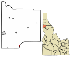
Juliaetta | |
---|---|
City | |
Coordinates: 46°34′44″N116°42′22″W / 46.57889°N 116.70611°W | |
Country | United States |
State | Idaho |
County | Latah |
Settled | 1878 |
Incorporated (town) | April 19, 1892 |
Government | |
• Mayor | Richard Groseclose [1] |
Area | |
• Total | 0.71 sq mi (1.84 km2) |
• Land | 0.70 sq mi (1.81 km2) |
• Water | 0.01 sq mi (0.03 km2) |
Elevation | 1,171 ft (357 m) |
Population | |
• Total | 579 |
• Estimate (2019) [5] | 601 |
• Density | 861.03/sq mi (332.53/km2) |
Time zone | UTC-8 (Pacific (PST)) |
• Summer (DST) | UTC-7 (PDT) |
ZIP Code | 83535 |
Area code | 208 |
FIPS code | 16-42130 |
GNIS feature ID | 399940 [6] |
Website | cityofjuliaetta |
Juliaetta is a city in Latah County, Idaho, United States. The town was named after the daughters of an early settler. In 2020, Juliaetta had a population of 624. [7]
Juliaetta was originally known as Schupferville, named for Rupert Schupfer who homesteaded the land in 1878. He plotted one-half of his homestead as a town site and operated the first general store. By 1878, the town had a population of 200. [8]
In 1876, Charles Snyder established a post office and named the town after his daughters, Julia and Etta. He was the first postmaster of Juliaetta. [8] The city was incorporated in 1892 when the railroad was extended to that point. [9]
In 1885 the first flour mill was built. The flour was labeled “Pride of the Potlatch” and was shipped all over the west coast of the United States. This business became Juliaetta Milling and Light Company. [8]
By 1889, the town had a bank, a newspaper, a jewelry store, a saddlery store, and a general store. Farmers in the area raised wheat, flax, oats, and hay in addition to fruit trees and large gardens. [8]
The town became incorporated in 1892. Agricultural products were transported via a tram from the ridges around town. By 1902, Juliaetta had two hotels, Grand Central Hotel and Palace Hotel. Dr. Robert Foster Sr. established Foster's School of Healing in 1903. The Juliaetta Cannery employed 100 people seasonally and produced up to 10,000 cans per day. It burned in 1911. [8]
Other businesses operating in Juliaetta in the early 1900s included a mercantile, undertakers, barber, shoeshine services, millinery, confectionery, dressmaker, skating rink, and dance hall. Juliaetta also had an opera house and a theater company. [8]
Juliaetta is approximately 2 mi (3.2 km) north of the Nez Perce Indian Reservation; the Potlatch River runs parallel to Highway 3 on the east side of Juliaetta.
According to the United States Census Bureau, the city has a total area of 0.73 square miles (1.89 km2), of which, 0.72 square miles (1.86 km2) is land and 0.01 square miles (0.03 km2) is water. [10]
Census | Pop. | Note | %± |
---|---|---|---|
1900 | 287 | — | |
1910 | 414 | 44.3% | |
1920 | 427 | 3.1% | |
1930 | 274 | −35.8% | |
1940 | 337 | 23.0% | |
1950 | 365 | 8.3% | |
1960 | 368 | 0.8% | |
1970 | 423 | 14.9% | |
1980 | 522 | 23.4% | |
1990 | 488 | −6.5% | |
2000 | 609 | 24.8% | |
2010 | 579 | −4.9% | |
2020 | 624 | 7.8% | |
U.S. Decennial Census [11] |
As of the census [4] of 2010, there were 579 people, 263 households, and 163 families residing in the city. The population density was 804.2 inhabitants per square mile (310.5/km2). There were 294 housing units at an average density of 408.3 units per square mile (157.6 units/km2). The racial makeup of the city was 95.7% White, 0.2% African American, 1.7% Native American, and 2.4% from two or more races. Hispanic or Latino of any race were 1.4% of the population.
There were 263 households, of which 23.6% had children under the age of 18 living with them, 47.5% were married couples living together, 9.5% had a female householder with no husband present, 4.9% had a male householder with no wife present, and 38.0% were non-families. 31.2% of all households were made up of individuals, and 12.9% had someone living alone who was 65 years of age or older. The average household size was 2.20 and the average family size was 2.72.
The median age in the city was 46.8 years. 18.7% of residents were under the age of 18; 6.8% were between the ages of 18 and 24; 22.3% were from 25 to 44; 31.5% were from 45 to 64; and 20.9% were 65 years of age or older. The gender makeup of the city was 49.2% male and 50.8% female.
As of the census [12] of 2000, there were 609 people, 255 households, and 175 families residing in the city. The population density was 856.1 inhabitants per square mile (330.5/km2). There were 275 housing units at an average density of 386.6 units per square mile (149.3 units/km2). The racial makeup of the city was 96.72% White, 2.13% Native American, 0.16% Asian, and 0.99% from two or more races. Hispanic or Latino of any race were 0.82% of the population.
There were 255 households, out of which 25.5% had children under the age of 18 living with them, 56.5% were married couples living together, 9.8% had a female householder with no husband present, and 31.0% were non-families. 27.5% of all households were made up of individuals, and 14.5% had someone living alone who was 65 years of age or older. The average household size was 2.39 and the average family size was 2.89.
In the city, the population was spread out, with 24.1% under the age of 18, 7.7% from 18 to 24, 22.8% from 25 to 44, 28.1% from 45 to 64, and 17.2% who were 65 years of age or older. The median age was 41 years. For every 100 females, there were 106.4 males. For every 100 females age 18 and over, there were 101.7 males.
The median income for a household in the city was $33,295, and the median income for a family was $39,250. Males had a median income of $31,875 versus $18,594 for females. The per capita income for the city was $14,606. About 4.2% of families and 12.3% of the population were below the poverty line, including 16.7% of those under age 18 and 5.7% of those age 65 or over.
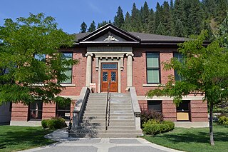
Two sites in Juliaetta are listed on the National Register of Historic Places:
Juliaetta Community Library, opened in 1977, is part of the Latah County Library District. [17]
The Corkill Memorial Trail is a paved 5.3-mile (8.5 km) rail trail along the Potlatch River between Juliaetta and Kendrick, built on a former 1890s Northern Pacific Railway line. The trail ends at Juliaetta Centennial Park and baseball field. [18]
The town of has a mayor, along with four council members, a city treasurer and a clerk. The city employs two maintenance workers. [7]
Juliaetta is in the Kendrick Joint School District; the elementary school is located in Juliaetta, while the high school is in neighboring Kendrick. Combined, they are referred to as Kendrick Joint School District 283. [19]
Adams County is a rural county in the state of Idaho. As of the 2020 census, the county had a population of 4,379, making it the sixth-least populous county in Idaho. The county seat and largest city is Council. Established in 1911, the county was named for second U.S. President John Adams. Adams County is home to the Brundage Mountain ski area, northeast of New Meadows, and the Little Ski Hill, just west of McCall.
Nez Perce County is a county located in the U.S. state of Idaho. As of the 2020 census, the population was 42,090. The county seat is Lewiston. The county is named after the Native American Nez Perce tribe. Nez Perce County is part of the Lewiston, Idaho–WA Metropolitan Statistical Area.
Shoshone Countyshə-SHOHN is a county in the U.S. state of Idaho. As of the 2020 census, the population was 13,169. The county seat is Wallace and the largest city is Kellogg. The county was established in 1864, named for the Native American Shoshone tribe.
Latah County is a county located in the north central region of the U.S. state of Idaho. As of the 2020 census, the population was 39,517. The county seat and largest city is Moscow, the home of the University of Idaho, the state's flagship university.
Clearwater County is a county located in the U.S. state of Idaho. As of the 2020 census, the population was 8,734. The county seat is Orofino. Established in 1911, the county was named after the Clearwater River. The county is home to North Fork of the Clearwater River, and a small portion of the South Fork and the main Clearwater. Also in the county are the Dworshak Reservoir, Dworshak State Park, Dworshak National Fish Hatchery, and the Dworshak Dam, third highest in the U.S. The modest Bald Mountain ski area is located between Orofino and Pierce.
Blaine County is a county in the U.S. state of Idaho. As of the 2020 United States Census, the population was 24,272. The county seat and largest city is Hailey. It is also home to the Sun Valley ski resort, adjacent to Ketchum.
Eagle is a city in Ada County, Idaho, ten miles (16 km) northwest of downtown Boise. The population was 30,346 at the 2020 census.
Greenleaf is a city in Canyon County, Idaho, United States. The population was 846 at the 2010 census. Greenleaf is part of the Boise-Nampa metropolitan area. The town was established by Quakers in the early-1900s and is named after Quaker poet and abolitionist John Greenleaf Whittier.
Dubois is a city in Clark County, Idaho, United States. The population was 511 at the 2020 census. The city is the county seat of Clark County.
Elk River is a city in the northwestern United States in Clearwater County, Idaho. The population was 125 at the 2010 census, down from 156 in 2000. It is accessed from State Highway 8 from Bovill, to the west in adjacent Latah County. Formerly the site of a Potlatch sawmill, it was phased out after several decades during the 1930s.
Bovill is a city in Latah County, Idaho, United States. The population was 260 at the 2010 census, down from 305 in 2000.
Deary is a city in Latah County, Idaho. The population was 506 at the time of the 2010 census, down from 552 in 2000. It is located 24 miles (39 km) east of Moscow and 43 miles (69 km) northeast of Lewiston.
Genesee is a city in Latah County, Idaho, United States. The population was 955 at the 2010 census, up from 946 in 2000. The city was named for the Genesee region of western New York, although it may also be a modification of the biblical Genesis.
Kendrick is a city in Latah County, Idaho, United States. Its population was 303 at the 2010 census, a decrease from 369 in 2000.
Onaway is a city in Latah County, Idaho, United States. The population was 187 at the 2010 census, down from 230 in 2000.
Potlatch is a city in the northwest United States, located in north central Idaho in Latah County, about six miles (10 km) east of the border with Washington. On the Palouse north of Moscow, it is served by State Highway 6, and bordered on the northeast by the small community of Onaway. The population of Potlatch was 804 at the 2010 census.
Troy is a city in Latah County, Idaho, United States. Located in the eastern part of the Palouse region, its population was 862 at the 2010 census.
Kendrick is a town in Lincoln County, Oklahoma, United States. The population was 139 at the 2010 census.
Lewiston is a city in Cache County, Utah, United States. It is situated at the northern Utah border and borders the state of Idaho. The population was 1,939 at the 2020 census. It is included in the Logan, Utah-Idaho (partial) Metropolitan Statistical Area.
Latah is a town in Spokane County, Washington, United States. The population was 185 at the 2020 census. It was named for the nearby creek, Latah Creek, from the native word for fish. The town was formerly called, Hangman's Creek and Alpha.