Related Research Articles

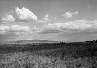
Idaho is a landlocked state in the Pacific Northwest and Mountain West subregions of the Western United States. It borders Montana and Wyoming to the east, Nevada and Utah to the south, and Washington and Oregon to the west; it shares a small portion of the Canada–United States border to the north, with the province of British Columbia. The state's capital and largest city is Boise. With an area of 83,569 square miles (216,440 km2), Idaho is the 14th-largest state by land area. With a population of approximately 2.0 million, it ranks as the 13th-least populous and the seventh-least densely populated of the 50 U.S. states.

The Snake River is a major river in the interior Pacific Northwest region of the United States. About 1,080 miles (1,740 km) long, it is the largest tributary of the Columbia River, which is the largest North American river that empties into the Pacific Ocean. Beginning in Yellowstone National Park, western Wyoming, it flows across the arid Snake River Plain of southern Idaho, the rugged Hells Canyon on the borders of Idaho, Oregon and Washington, and finally the rolling Palouse Hills of southeast Washington. It joins the Columbia River just downstream from the Tri-Cities, Washington, in the southern Columbia Basin.
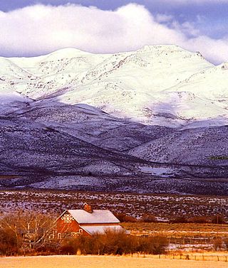
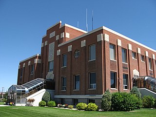
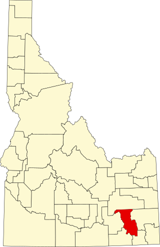
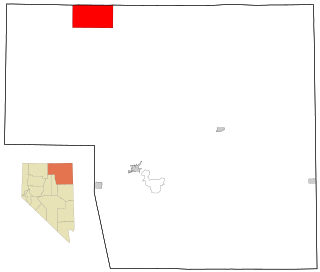
Owyhee County is a county in the southwestern corner of the U.S. state of Idaho. As of the 2020 census, the population was 11,913. The county seat is Murphy, and its largest city is Homedale. In area it is the second-largest county in Idaho, behind Idaho County.

Gooding County is a county located in the U.S. state of Idaho. As of the 2020 census, the population was 15,598. Its county seat is Gooding. The county was created by the Idaho Legislature on January 28, 1913, by a partition of Lincoln County. It is named for Frank R. Gooding, the 7th governor and a United States Senator from Idaho.
Cassia County is a county in the U.S. state of Idaho. As of the 2020 Census the county had a population of 24,655. The county seat and largest city is Burley. Cassia County is included in the Burley, ID Micropolitan Statistical Area.
Bannock County is a county in the southeastern part of Idaho. As of the 2020 census, the population was 87,018, making it the sixth-most populous county in Idaho. The county seat and largest city is Pocatello. The county was established in 1893 and named after the local Bannock tribe. It is one of the counties with territories included in the Fort Hall Indian Reservation of the federally recognized Shoshone-Bannock Tribes.

Pocatello is the county seat and largest city of Bannock County, with a small portion on the Fort Hall Indian Reservation in neighboring Power County, containing the city's airport. It is the principal city of the Pocatello metropolitan area, which encompasses all of Bannock County in the southeastern part of the U.S. state of Idaho.

Rigby is a city in and the county seat of Jefferson County, Idaho, United States. The population was 5,038 at the 2020 census, up from 3,945 in 2010.

Salmon is a city in Lemhi County, Idaho. The population was 3,119 at the 2020 census. The city is the county seat of Lemhi County.

Twin Falls is the county seat and largest city of Twin Falls County, Idaho, United States. The city had a population of 51,807 as of the 2020 census. In the Magic Valley region, Twin Falls is the largest city in a 100-mile (160 km) radius, and is the regional commercial center for south-central Idaho and northeastern Nevada. It is the principal city of the Twin Falls metropolitan statistical area, which officially includes the entirety of Twin Falls and Jerome Counties. The border town resort community of Jackpot, Nevada, 50 mi (80 km) south at the state line, is unofficially considered part of the greater Twin Falls area. Located on a broad plain at the south rim of the Snake River Canyon, Twin Falls, is where daredevil Evel Knievel attempted to jump across the canyon in 1974 on a steam-powered rocket. The jump site is northeast of central Twin Falls, midway between Shoshone Falls and the Perrine Bridge.
Owyhee is a census-designated place (CDP) in Elko County, Nevada, United States, along the banks of the Owyhee River. The population was 953 at the 2010 census. It is part of the Elko Micropolitan Statistical Area. It is the primary town of the federally recognized Shoshone-Paiute tribe's Duck Valley Indian Reservation, which covers portions of northern Nevada and southern Idaho, and the majority of its population are Native American.
The Shoshone or Shoshoni are a Native American tribe with four large cultural/linguistic divisions:
Fort Hall was a fort in the Western United States that was built in 1834 as a fur trading post by Nathaniel Jarvis Wyeth. It was located on the Snake River in the eastern Oregon Country, now part of present-day Bannock County in southeastern Idaho. Wyeth was an inventor and businessman from Boston, Massachusetts, who also founded a post at Fort William, in present-day Portland, Oregon, as part of a plan for a new trading and fisheries company. In 1837, unable to compete with the powerful British Hudson's Bay Company, based at Fort Vancouver, Wyeth sold both posts to it. Great Britain and the United States both operated in the Oregon Country in these years.
Shoshone-Bannock Jr./Sr. High School, commonly known as Sho-Ban School is a high school in Fort Hall, Idaho. It serves the Fort Hall Indian Reservation. It is operated by Shoshone-Bannock School District #537, though it does not geographically include any area in Bannock County. The state of Idaho classifies it as a school district.

The Idaho Transportation Department (ITD) is the state of Idaho governmental organization responsible for state transportation infrastructure. This includes ongoing operations and maintenance as well as planning for future needs of the state and its citizens. The agency is responsible for overseeing the disbursement of federal, state, and grant funding for transportation programs in the state.

Southwestern Idaho is a geographical term for the area along the U.S. state of Idaho's borders with Oregon and Nevada. It includes the populous areas of the Boise metropolitan area and the Treasure Valley.

Salmon Falls Creek is a tributary of the Snake River, flowing from northern Nevada into Idaho in the United States. Formed in high mountains at the northern edge of the Great Basin, Salmon Falls Creek flows northwards 121 miles (195 km), draining an arid and mountainous basin of 2,103 square miles (5,450 km2). The Salmon Falls Creek valley served as a trade route between the Native American groups of the Snake River Plain and Great Basin. Today, most of its water is used for irrigation.

The Lemhi Reservation was a United States Indian Reservation for the Lemhi Shoshone from 1875 to 1907. During almost all this time their main chief was Tendoy.
Northern Shoshone are Shoshone of the Snake River Plain of southern Idaho and the northeast of the Great Basin where Idaho, Wyoming and Utah meet. They are culturally affiliated with the Bannock people and are in the Great Basin classification of Indigenous People.
References
- ↑ "Idaho" (PDF). U.S. Census Bureau. p. 1. Retrieved November 5, 2024.
- ↑ "School districts". Idaho Department of Education . Retrieved July 21, 2021.
- ↑ "2020 CENSUS - SCHOOL DISTRICT REFERENCE MAP: Bannock County, ID" (PDF). U.S. Census Bureau . Retrieved July 20, 2021. - Text list - The district is absent from the Census Bureau listing of school districts in the county.