Kandelaar | |
|---|---|
Neighborhood of Rotterdam | |
 | |
| Country | |
| Province | South Holland |
| COROP | Rotterdam |
| Borough | Overschie |
| Time zone | UTC+1 (CET) |
Kandelaar is a neighborhood of Rotterdam, Netherlands.
Kandelaar | |
|---|---|
Neighborhood of Rotterdam | |
| | |
| Country | |
| Province | South Holland |
| COROP | Rotterdam |
| Borough | Overschie |
| Time zone | UTC+1 (CET) |
Kandelaar is a neighborhood of Rotterdam, Netherlands.
The Zhongsha Islands is a Chinese term for a collection of two skerries, many entirely submerged banks, seamounts, and shoals in the South China Sea. There are no islands in the Macclesfield Bank, the main part of Zhongsha. The Scarborough Shoal, which consists of two skerries, is not contiguous with the Macclesfield Bank but Chinese sources treat them as one chain of geographical features. The whole of the region is claimed by both the PRC and the ROC, and various bits of the eastern parts are claimed by the Philippines. No country has constant control of the whole region, and there are disputes - for example, see the Scarborough Shoal standoff.
This is a list of the extreme points of the United Kingdom: the points that are farther north, south, east or west than any other location. Traditionally the extent of the island of Great Britain has stretched "from Land's End to John o' Groats".

Grenadines is an administrative parish of Saint Vincent and the Grenadines, comprising the islands of the Grenadines other than those belonging to Grenada. The capital is Port Elizabeth. It's the only parish in the country that's not located on the main island.

Ameide is a city in the Dutch province of Utrecht. It is a part of the municipality of Vijfheerenlanden, and lies about 9 km southwest of IJsselstein.
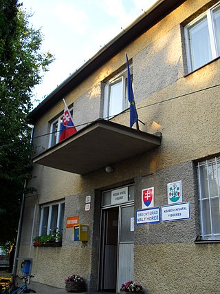
Malý Horeš is a village and municipality in the Trebišov District in the Košice Region of south-eastern Slovakia.

Almuniente is a municipality located in the province of Huesca, Aragon, Spain. According to the 2004 census (INE), the municipality has a population of 571 inhabitants.

Villaveza de Valverde is a municipality located in the province of Zamora, Castile and León, Spain. According to the 2004 census (INE), the municipality has a population of 129 inhabitants.

San Miguel de Bernuy is a municipality located in the province of Segovia, Castile and León, Spain. As of 2016, the municipality has a population of 148.
Egelner Mulde is a Verbandsgemeinde in the Salzlandkreis district, in Saxony-Anhalt, Germany. Before 1 January 2010, it was a Verwaltungsgemeinschaft. The seat of the Verbandsgemeinde is in Egeln.
Hanstein-Rusteberg is a Verwaltungsgemeinschaft in the district Eichsfeld, in Thuringia, Germany. The seat of the Verwaltungsgemeinschaft is in Hohengandern. Hanstein Castle is in Hanstein-Rusteberg.
Mellingen is a Verwaltungsgemeinschaft in the district Weimarer Land in Thuringia, Germany. The seat of the Verwaltungsgemeinschaft is in Mellingen.
Yeghnik, known until 1946 as Dadalu, is a village in the Talin Municipality of the Aragatsotn Province of Armenia. The village's church, Saint Nshan, dates back to 1866.

An Tức is a rural commune (xã) and village of the Tri Tôn District of An Giang Province, Vietnam.
The Oracabessa River is a river of Jamaica.
The Ottenstein Plateau is part of the Lower Saxon Weser Uplands and lies between Bodenwerder and Bad Pyrmont.

Hillegersberg-Schiebroek is a borough in northern Rotterdam. The borough has 40,846 inhabitants.
Terbregge is a neighborhood of Rotterdam, Netherlands.
The Pyrmont Uplands are a muschelkalk region within the Lower Saxon Hills and covers an area of 180 km2. Their maximum elevation is about 350 metres above sea level (NN). The valley of the Emmer divides the uplands into the Ottenstein Plateau in the east and Pyrmont Heights in the west. In these muschelkalk hills lies the Pyrmont Basin on the fault lines of which mineral and brine springs rise, and to which the town of Bad Pyrmont owes its status as a spa town.

Rainbow/Q'iwentem Provincial Park is a provincial park in the Cariboo region of British Columbia. The park was established in 2013 and is 385 hectares in size, protecting the land between Sulphurous Lake and Deka Lake. While there are no developed trails in the park, routes used by locals exist connecting roads on the North Shore of Deka Lake to the North Shore of Sulphurous Lake. The park is accessible by road only from the southwest.
51°57′N4°24′E / 51.950°N 4.400°E
| | This South Holland location article is a stub. You can help Wikipedia by expanding it. |