A geographic coordinate system is a coordinate system that enables every location on Earth to be specified by a set of numbers, letters or symbols. The coordinates are often chosen such that one of the numbers represents a vertical position and two or three of the numbers represent a horizontal position; alternatively, a geographic position may be expressed in a combined three-dimensional Cartesian vector. A common choice of coordinates is latitude, longitude and elevation. To specify a location on a plane requires a map projection.
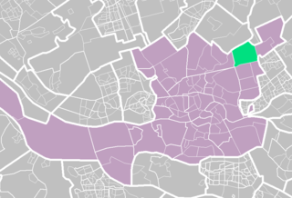
Rotterdam is the second-largest city and a municipality of the Netherlands. It is located in the province of South Holland, at the mouth of the Nieuwe Maas channel leading into the Rhine–Meuse–Scheldt delta at the North Sea. Its history goes back to 1270, when a dam was constructed in the Rotte, after which people settled around it for safety. In 1340, Rotterdam was granted city rights by the Count of Holland.
South Holland is a province of the Netherlands with a population of just over 3.6 million as of 2015 and a population density of about 1,300/km2 (3,400/sq mi), making it the country's most populous province and one of the world's most densely populated areas. Situated on the North Sea in the west of the Netherlands, South Holland covers an area of 3,403 km2 (1,314 sq mi), of which 585 km2 (226 sq mi) is water. It borders North Holland to the north, Utrecht and Gelderland to the east, and North Brabant and Zeeland to the south. The provincial capital is The Hague, while its largest city is Rotterdam.
The Netherlands is a country located mainly in Northwestern Europe. The European portion of the Netherlands consists of twelve separate provinces that border Germany to the east, Belgium to the south, and the North Sea to the northwest, with maritime borders in the North Sea with Belgium, Germany and the United Kingdom. Together with three island territories in the Caribbean Sea—Bonaire, Sint Eustatius and Saba— it forms a constituent country of the Kingdom of the Netherlands. The official language is Dutch, but a secondary official language in the province of Friesland is West Frisian.
Nesselande consists of three development areas: Tuinstad, Badplaats and Waterwijk. On the south side, located near the A20 motorway, there is a modest business park which forms a logical buffer between the motorway and the housing. Within the new development, an ecological park known as Rietveldpark provides for natural elements.
The A20 motorway is a motorway in the Netherlands. It is approximately 39 kilometers in length.
A business park or office park is an area of land in which many office buildings are grouped together. All of the work that goes on is commercial, not large-scale industrial nor residential. The first office park opened in Mountain Brook, Alabama, in the early 1950s to avoid racial tension in city centers.
A park is an area of natural, semi-natural or planted space set aside for human enjoyment and recreation or for the protection of wildlife or natural habitats. Urban parks are green spaces set aside for recreation inside towns and cities. National parks and Country parks are green spaces used for recreation in the countryside. State parks and Provincial parks are administered by sub-national government states and agencies. Parks may consist of grassy areas, rocks, soil and trees, but may also contain buildings and other artifacts such as monuments, fountains or playground structures. Many parks have fields for playing sports such as soccer, baseball and football, and paved areas for games such as basketball. Many parks have trails for walking, biking and other activities. Some parks are built adjacent to bodies of water or watercourses and may comprise a beach or boat dock area. Urban parks often have benches for sitting and may contain picnic tables and barbecue grills.
Line B of the Rotterdam Metro was extended to the area in 2005.
The Rotterdam Metro is a rapid transit system operated in Rotterdam, Netherlands and surrounding municipalities by RET. The first line, called Noord – Zuidlijn opened in 1968 and ran from Centraal Station to Zuidplein, crossing the river Nieuwe Maas in a tunnel. It was the first metro system to open in the Netherlands. At the time it was also one of the shortest metro lines in the world with a length of only 5.9 km (3.7 mi).
This page is based on this Wikipedia article Text is available under the CC BY-SA 4.0 license; additional terms may apply. Images, videos and audio are available under their respective licenses.
Related Research Articles
The Hook of Holland is a town in the southwestern corner of Holland, at the mouth of the New Waterway shipping canal into the North Sea. The town is administered by the municipality of Rotterdam as a district of that city. Its district covers an area of 16.7 km2, of which 13.92 km2 is land. On 1 January 1999 it had an estimated population of 9,400.
The M4, a motorway in the United Kingdom running from west London to southwest Wales, was originally referred to as the London-South Wales Motorway. The English section to the Severn Bridge was constructed between 1961 and 1971; the Welsh element was completed in 1993. The Second Severn Crossing officially renamed the Prince of Wales Bridge, was inaugurated on 5 June 1996 by HRH The Prince of Wales and the M4 was rerouted. Apart from its two spurs—the A48(M) and the M48—the M4 is the only motorway in Wales.
The Maasvlakte is a massive man-made westward extension of the Europoort port and industrial facility within the Port of Rotterdam. Situated in the municipality of Rotterdam in the Netherlands, the Maasvlakte is built on land reclaimed from the North Sea.
Prins Alexander is a borough in the northeast of Rotterdam, Netherlands.
Ommoord is a neighbourhood in the borough Prins Alexander, part of the municipality of Rotterdam, South Holland, the Netherlands. Ommoord is surrounded by the neighbourhoods Zevenkamp, Het Lage Land and Terbregge. It has around 25.000 inhabitants across 12.500 households.
The West Cross Route (WCR) is a 0.75 miles (1.21 km)-long dual carriageway section of the A3220 route in central London in The Royal Borough of Kensington and Chelsea, with a small part being shared with borderlining borough Hammersmith and Fulham. It runs north-south between the northern elevated roundabout junction with the western end of Westway (A40) and the southern Holland Park Roundabout. It opened in 1970, together with Westway.
Kralingen-Crooswijk is a township of the city of Rotterdam, Netherlands. It is located at the immediate east of the city's centre. As of 2005 it has about 52,379 inhabitants and has a territory of about 1,286 ha. It consists of the two boroughs Kralingen and Crooswijk, the former being a village itself until it was incorporated in the city of Rotterdam in the late 19th century.
Topsportcentrum Rotterdam is an indoor arena located in Rotterdam right next to the Feijenoord Stadion. The arena opened in 2000 and has a capacity of 2,500 seats and holds many sports events in various sports and levels like international World and European Championships as well as Dutch National Championships.
The A4119 links Tonypandy with Cardiff in South Wales.
The A4 Motorway, also called Rijksweg 4, is a motorway in the Netherlands, running from Amsterdam southwards through the cities of The Hague and Rotterdam, to the Belgian border near Zandvliet, north of the city of Antwerp. The A4 is divided into two parts: the first and longest part from Amsterdam to the A15 near the city of Rotterdam. The second part starts near Heijningen, where the A29 and the A4 meet, going to the Belgian border.
The A4050 road connects Barry, Vale of Glamorgan with Culverhouse Cross on the outskirts of Cardiff, Wales. It is approximately 10 miles (16 km) long, and is the key link road between the M4 motorway and Cardiff International Airport.
Museumpark is an urban park in Rotterdam, Netherlands, located between the Museum Boijmans Van Beuningen, Westersingel, Westzeedijk and the complex of the Erasmus MC, a medical centre affiliated with the Erasmus University.
The A4241 is a distributor road serving Port Talbot, Wales.
The North Fringe of Bristol, England is a mostly developed area between the northern edge of the administrative city of Bristol and the M4 and M5 motorways. Its eastern edge is usually defined as the M32 motorway. The area falls within South Gloucestershire Council, and is the northern part of Greater Bristol.
Cardiff Gate is a business park development, located on the junction 30 of the M4 motorway and the A4232 north east of Cardiff, South Wales.
Swansea Vale is a 160-acre (0.65 km2) mixed used new suburb development site in Swansea, Wales. The area is bounded east by Birchgrove; south by Swansea Enterprise Park, west by the River Tawe and north by the M4 motorway.
Kleiwegkwartier is a neighbourhood quarter in Rotterdam, Netherlands. It is in the southern part of Hillegersberg with origins dating from the early 1600s.
Stadsdriehoek is a neighborhood at the center of Rotterdam, The Netherlands. The name Stadsdriehoek refers to the historical triangular form of the city of Rotterdam, which was bordered by the Coolsingel and the Schiedamsevest to the west, the Goudsevest to the northeast, and by the Nieuwe Maas to the south.
Zestienhoven is a neighborhood of Rotterdam, Netherlands and is part of the borough Overschie. Zestienhoven is the largest district in Overschie, but is sparsely populated. The Polder Zestienhoven is within the district, east of the urban area of Overschie. On the east side is the neighborhood Schiebroek and on the north side Rotterdam The Hague Airport.