
The M20 is a motorway in Kent, England. It follows on from the A20 at Swanley, meeting the M25, and continuing on to Folkestone, providing a link to the Channel Tunnel and the ports at Dover. It is 50.6 miles (81.4 km) long. Although not signposted in England, this road is part of the European route E15. It is also used as a holding area for goods traffic when traffic across the English Channel is disrupted, such as Operation Stack and Operation Brock.
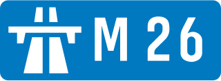
The M26 is a motorway in Kent, England. It is a short link between the M25 at Sevenoaks and the M20 near West Malling, which provides connectivity between southern England and the Channel ports in Kent.

Alamo Square is a residential neighborhood in San Francisco, California with a park of the same name. Located in the Western Addition, its boundaries are Buchanan Street on the east, Turk Street on the north, Baker Street on the west, and Page Street Street on the south.
Ommoord is a neighbourhood in the former borough Prins Alexander, part of the municipality of Rotterdam, South Holland, the Netherlands. Ommoord is surrounded by the neighbourhoods Zevenkamp, Het Lage Land and Terbregge. It has around 25.000 inhabitants across 12.500 households. Ommoord shares postal codes 3068 and 3069 with Zevenkamp.

Hillegersberg is a neighbourhood of Rotterdam, Netherlands. Primarily a green residential area with lakes, canals and parks, it was incorporated into the city of Rotterdam in 1941. Settlement around its Hillegonda church was first established here in 990.

The A249 is a road in Kent, England, running from Maidstone to Sheerness on the Isle of Sheppey. It mainly functions as a link between the M2 and M20 motorways, and for goods vehicle traffic to the port at Sheerness.
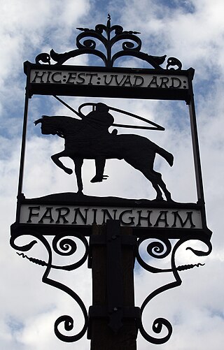
Farningham is a village and civil parish in the Sevenoaks District of Kent, England. It is located 3 miles (5 km) south-east of Swanley. It has a population of 1,314.

East Cross Route (ECR) is a dual-carriageway road constructed in east London as part of the uncompleted Ringway 1 as part of the London Ringways plan drawn up the 1960s to create a series of high speed roads circling and radiating out from central London. The road was constructed between 1967 and 1973 and runs from Hackney Wick in north-east London, through the Blackwall Tunnel, to Kidbrooke in south-east London. The ECR was initially designated as part of the A102, but has, subsequently, been partially renumbered so that sections of it are now the A2 and A12.
Gholhak is a neighborhood located in District 3 of Tehran Municipality. It is bounded on the east by the Darrous neighborhood, on the west by the Gholhak River, on the north by the British Embassy Garden, and on the south by the Pourmeshkani Street and Zafar Street (Dastgerdi).

Amsterdam-Noord is a borough of Amsterdam, Netherlands with a population of about 90,000. The IJ, the body of water which separates it from Amsterdam-Centrum and the rest of the city, is situated southwest of Amsterdam-Noord. The borough, which has an area of 49.01 km2, borders the municipalities of Zaanstad, Oostzaan, Landsmeer and Waterland to the north, all part of the province of North Holland like Amsterdam. It borders the Markermeer to the east.

Katendrecht is a neighbourhood of Rotterdam, on the south bank of the Nieuwe Maas. It is located between the Rijnhaven and the Maashaven. Katendrecht was a separate municipality from 1817 to 1874, when it merged with Charlois.

Zevenhuizen is a village in the Dutch province of South Holland. It is located about 12 km northeast of the city of Rotterdam.

The Flehe Bridge, is a single tower cable stayed bridge located in Düsseldorf, over the Rhine. It connects the A 46 motorway from the left bank of the Rhine with the Bergisches Land on the right bank and the south of Düsseldorf. It forms at the same time the southern part of the ring of motorways around Düsseldorf. It includes a pedestrian and cyclist strip.

The A2020 is a previous road in Kent but has been renumbered to A20 following the construction of the M20 motorway.

The Rotte is a river in the Rhine-Maas-delta in the Netherlands. The Rotte is the eponym of the city of Rotterdam: the city was founded in the 13th century when a dam was built along the river.
Buikslotermeer is a neighborhood and a polder of Amsterdam, Netherlands. The Buikslotermeer is a reclaimed lake, now largely located within the city of Amsterdam-Noord. Nowadays, the name 'Buikslotermeer' is used to refer to the entire Buikslotermeerpolder of the similarly named neighborhood, located in the south-east of the polder.

Rivierenbuurt is a neighbourhood of Amsterdam, Netherlands. The neighbourhood is situated in the eastern part of the borough of Amsterdam-Zuid, bordered by the river Amstel to the east, the Boerenwetering canal in the west, the Amstelkanaal in the north and the A10 motorway in the south. In 2013, the Rivierenbuurt had approximately 28,400 residents.

Hillegersberg-Schiebroek is a borough in northern Rotterdam. The borough has 40,846 inhabitants.

Kleiwegkwartier is a neighbourhood quarter in Rotterdam, Netherlands. It is in the southern part of Hillegersberg with origins dating from the early 1600s.
