North Brabant, also unofficially called Brabant, is a province in the south of the Netherlands. It borders the provinces of South Holland and Gelderland to the north, Limburg to the east, Zeeland to the west, and the Flemish provinces of Antwerp and Limburg to the south. The northern border follows the Meuse westward to its mouth in the Hollands Diep strait, part of the Rhine–Meuse–Scheldt delta. North Brabant had a population of about 2,626,000 as of January 2023. Major cities in North Brabant are Eindhoven, Tilburg, Breda, its provincial capital 's-Hertogenbosch, and Helmond

Baarn is a municipality and a town in the Netherlands, near Hilversum in the province of Utrecht.

Drimmelen is a municipality and a town in southern Netherlands, in the province North Brabant.

Reusel-De Mierden is a municipality in the southern Netherlands. It is located in the North Brabant province, and has an area of 78.66 km2 (30.37 sq mi). It had a population of 13,127 in 2021.

Alphen aan den Rijn is a city and municipality in the western Netherlands, in the province of South Holland. The city is situated on the banks of the river Oude Rijn, where the river Gouwe branches off. The municipality had a population of 112,587 in 2021, and covers an area of 132.50 km2 (51.16 sq mi) of which 6.27 km2 (2.42 sq mi) is water.

Nieuw-Lekkerland is a town in the western Netherlands, in the province of South Holland. It is situated on the southern shores of the Lek River, in the north-west of the Alblasserwaard.

Prins Alexander is a borough in the northeast of Rotterdam, Netherlands. As of 2017, it had 94.905 inhabitants, making it the most populated borough in the city.
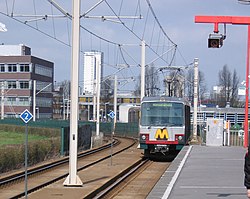
Ommoord is a neighbourhood in the former borough Prins Alexander, part of the municipality of Rotterdam, South Holland, the Netherlands. Ommoord is surrounded by the neighbourhoods Zevenkamp, Het Lage Land and Terbregge. It has around 25.000 inhabitants across 12.500 households. Ommoord shares postal codes 3068 and 3069 with Zevenkamp.

Leidsche Rijn is a new construction site and neighborhood in Utrecht, the capital of the Dutch province of Utrecht. The area is located west of the Amsterdam–Rhine Canal and its name is derived from the Leidse Rijn canal, which runs through it. At the time of its inception in the 1990s and in the decades that followed, Leidsche Rijn was the largest Vinex location in the Netherlands. Most of this location was on the territory of the former municipality of Vleuten-De Meern, located west of the city of Utrecht. A smaller part of this location, namely the area of Hoge and Lage Weide, was located in the municipality of Utrecht.

Hillegersberg is a neighbourhood of Rotterdam, Netherlands. Primarily a green residential area with lakes, canals and parks, it was incorporated into the city of Rotterdam in 1941. Settlement around its Hillegonda church was first established here in 990.

The Maritime Museum is a maritime museum in Amsterdam in the Netherlands.

Kralingen-Crooswijk is a township of the city of Rotterdam, Netherlands. It is located at the immediate east of the city's centre. As of 2005 it has about 52,379 inhabitants and has a territory of about 1,286 ha. It consists of the two boroughs Kralingen and Crooswijk, the former being a village itself until it was incorporated in the city of Rotterdam in the late 19th century.

Engelen is a village in the Dutch province of North Brabant. It is part of the municipality of 's-Hertogenbosch.
Amsterdam Nieuw-West is a borough comprising the westernmost neighbourhoods of the city of Amsterdam, Netherlands. It was created in 2010 after a merger of the former boroughs Osdorp, Geuzenveld-Slotermeer and Slotervaart. In 2017, the borough had almost 150,000 inhabitants.

Waterwijk is a neighborhood of Amsterdam, Netherlands built on the site of the Amsterdam municipal waterworks on the corner of Haarlemmerweg and Van Hallstraat in Amsterdam-West. In this neighborhood, an ecodistrict has been implemented.

Afrikaanderwijk is a neighborhood of Rotterdam, Netherlands. It lies in the Feijenoord district of the city, and is traditionally a working-class neighborhood. The neighborhood was one of the first in the Netherlands to have a majority of residents with a foreign background, primarily consisting of Turks, Moroccans, Surinamese, and Antilleans.
Terbregge is a neighborhood of Rotterdam, Netherlands.

The Low Light of the Hook of Holland is a lighthouse that once stood at the Hook of Holland, but has since been dismantled and reassembled near the Rotterdam maritime museum.

Oudeschans is a small village with a population of around 100 in the municipality of Westerwolde in the province of Groningen in the Netherlands. The 16th-century fortification is now a state protected village area with several national heritage sites, among which include a 17th-century garrison church, and the Vestingmuseum Oudeschans.

Pan-Netherlands, sometimes translated as Whole-Netherlands, is an irredentist concept which aims to unite the Low Countries into a single state. It is an example of Pan-Nationalism.