Nieuwe Westen

Last updated
Nieuwe Westen
Neighborhood of Rotterdam
Rotterdamse wijken-nieuwe westen.PNG
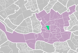
The location of Nieuwe Westen (green) in Rotterdam
CountryFlag of the Netherlands.svg  Netherlands
Province South Holland
COROP Rotterdam
Borough Delfshaven
Time zone UTC+1 (CET)

Nieuwe Westen is a pre-war neighbourhood in the west of Rotterdam, located between the Heemraadssingel and the Delfshavense Schie in the Delfshaven district.

Nieuwe Westen was built in the early twentieth century. As in the neighbouring Middelland district, Nieuwe Westen is a district of contrasts: completely renovated streets can be found within 100 metres of the stately Heemraadssingel and Mathenesserlaan. A well-known landmark in the neighbourhood is Mathenesserplein, built between 1927 and 1929 to a design by Jo van den Broek.

Over 18,000 people live in Nieuwe Westen, almost three quarters of whom have a non-European background. The area had long been one of the most unsafe neighbourhoods in the Netherlands, its quality of life severely affected by a lack of generally accepted values and norms. An active residents' organisation has long been working successfully to bring about improvement. It is an open organisation with 300 participating residents.

The term "opzoomeren" originated in the late 1980s in the Opzoomerstraat in Nieuwe Westen and has been used by many cities elsewhere in the world.

Nieuwe Westen borders the neighbourhoods of Spangen and Middelland.

51°54′47″N4°26′58″E / 51.91306°N 4.44944°E / 51.91306; 4.44944

Related Research Articles

<span class="mw-page-title-main">Nieuwe Waterweg</span> Ship canal in the Netherlands

The Nieuwe Waterweg is a ship canal in the Netherlands from het Scheur west of the town of Maassluis to the North Sea at Hook of Holland: the Maasmond, where the Nieuwe Waterweg connects to the Maasgeul. It is the artificial mouth of the river Rhine.

<span class="mw-page-title-main">Regent Park</span> Neighbourhood in Toronto, Ontario, Canada

Regent Park is a neighbourhood located in downtown Toronto, Ontario built in the late 1940s as a public housing project managed by Toronto Community Housing. It sits on what used to be a significant part of the Cabbagetown neighbourhood and is bounded by Gerrard Street East to the north, River Street to the east, Shuter Street to the south and Parliament Street to the west. Regent Park's residential dwellings, prior to the ongoing redevelopment, were entirely social housing and covered all of the 69 acres (280,000 m2) which comprise the community. The original neighbourhood was razed in the process of creating Regent Park. The nickname Cabbagetown is now applied to the remaining historical, area north and west of the housing project, which has experienced considerable gentrification since the 1960s and 1970s.

<span class="mw-page-title-main">Chiltern District</span> Former non-metropolitan district in England

Chiltern District was a local government district of Buckinghamshire in south-central England from 1974 to 2020. It was named after the Chiltern Hills on which the region sits.

<span class="mw-page-title-main">Federal Social Court</span> German federal court

The Federal Social Court is the German federal court of appeals for social security cases, mainly cases concerning the public health insurance, long-term care insurance, pension insurance and occupational accident insurance schemes. Trial courts for these cases are the Sozialgerichte. Appeals against decisions of these courts are heard by the Landessozialgerichte, before the cases may wind up at the Bundessozialgericht.

<span class="mw-page-title-main">Kimpton, Hertfordshire</span> Human settlement in England

Kimpton is a village in Hertfordshire, England, six miles south of Hitchin, seven miles north of St Albans and four miles from Harpenden and Luton. The population at the 2011 Census was 2,167.

<span class="mw-page-title-main">International Avenue, Calgary</span> Business Revitalization Zone in Alberta, Canada

International Avenue is a Business Revitalization Zone (BRZ) in Calgary, Alberta. The district is centered on 17 Avenue SE in the neighbourhood of Forest Lawn in the east of the city. The district was created in 1993 to celebrate the rich cultural diversity that exists in east central Calgary. The area has since become a popular location for ethnic restaurants and shopping.

<span class="mw-page-title-main">Jordaan</span> Neighbourhood of Amsterdam in North Holland, Netherlands

The Jordaan is a neighbourhood of the city of Amsterdam, Netherlands. It is part of the borough of Amsterdam-Centrum. The area is bordered by the Singelgracht canal and the neighbourhood of Frederik Hendrikbuurt to the west; the Prinsengracht to the east; the Brouwersgracht to the north and the Leidsegracht to the south. The former canal Rozengracht is the main traffic artery through the neighbourhood.

<span class="mw-page-title-main">Downtown Calgary</span> Neighbourhood in Calgary, Alberta, Canada

Downtown Calgary is a dense urban district in central Calgary, Alberta. It contains the second largest concentration of head offices in Canada, despite only being the country's fourth largest city in terms of population. The downtown is divided into several residential, commercial, corporate, and mixed-use neighbourhoods, including the Financial District (CBD), Eau Claire, Chinatown, East Village, Beltline, and the West End.

<span class="mw-page-title-main">Bankview, Calgary</span> Neighbourhood in Calgary, Alberta, Canada

Bankview is a neighbourhood in the southwest quadrant of the city of Calgary, Alberta.

<span class="mw-page-title-main">Feijenoord</span> Place in South Holland, Netherlands

Feijenoord is a district in Rotterdam and is located south of the Nieuwe Maas. As of 1 January 2004 there were 72,320 inhabitants. The area is 6.44 km². It is not the current home of the city's main football club, Feyenoord, which is now in the neighbouring township of IJsselmonde.

<span class="mw-page-title-main">Katendrecht</span>

Katendrecht is a neighbourhood of Rotterdam, on the south bank of the Nieuwe Maas. It is located between the Rijnhaven and the Maashaven. Katendrecht was a separate municipality from 1817 to 1874, when it merged with Charlois.

<span class="mw-page-title-main">De Pijp</span> Neighbourhood of Amsterdam in North Holland, Netherlands

De Pijp is a neighbourhood of Amsterdam, Netherlands. It is located directly south of Amsterdam's city centre and it is part of the borough Amsterdam-Zuid, in a part of the city known as the Old South. It is served by De Pijp metro station. Most streets in De Pijp are named after Dutch painters, like Jan Steen, Frans Hals, Ruysdael and Vincent van Gogh. The three districts composing the area are Oude Pijp, Nieuwe Pijp and Diamantbuurt.

<span class="mw-page-title-main">Nieuwe Pijp</span> Neighborhood of Amsterdam in North Holland, Netherlands

Nieuwe Pijp is a neighbourhood in Amsterdam, Netherlands. It is part of the borough of Amsterdam-Zuid. The Nieuwe Pijp is bordered by Ceintuurbaan and Sarphatipark in the north, Van Woustraat in the east, Amstel Canal in the south and Boerenwetering canal in the west. Along with the Oude Pijp, situated north of the Nieuwe Pijp, it is often simply referred to as De Pijp.

<span class="mw-page-title-main">Rivierenbuurt (Amsterdam)</span> Neighbourhood of Amsterdam in North Holland, Netherlands

Rivierenbuurt is a neighbourhood of Amsterdam, Netherlands. The neighbourhood is situated in the eastern part of the borough of Amsterdam-Zuid, bordered by the river Amstel to the east, the Boerenwetering canal in the west, the Amstelkanaal in the north and the A10 motorway in the south. In 2013, the Rivierenbuurt had approximately 28,400 residents.

<span class="mw-page-title-main">Schinkelbuurt</span> Neighborhood of Amsterdam in North Holland, Netherlands

Schinkelbuurt is a little neighborhood of Amsterdam, Netherlands. It is located directly south of Amsterdam's city centre and it is part of the borough Amsterdam-Zuid, in the part of the city known as the Old South.

<span class="mw-page-title-main">Rotterdam Centrum</span> Place in Netherlands

Rotterdam Centrum is a borough of Rotterdam. It was established on March 3, 2010. The center has 33,983 inhabitants.

<span class="mw-page-title-main">Blijdorp district</span> Neighbourhood of Rotterdam in South Holland, Netherlands

Blijdorp is a neighbourhood in northern Rotterdam and is part of the borough Noord. The neighbourhood has around 9500 inhabitants.

<span class="mw-page-title-main">Oude Westen</span> Neighborhood of Rotterdam in South Holland, Netherlands

Oude Westen is a neighborhood of Rotterdam, Netherlands adjacent to the city center.

<span class="mw-page-title-main">Schiemond</span> Neighborhood of Rotterdam in South Holland, Netherlands

Schiemond is a neighborhood of Rotterdam, Netherlands.

Flo is an unincorporated community in Leon County, Texas, about 12 miles from Centerville.