Karaga, Ghana

Last updated

Karaga
District Capital
Ghana adm location map.svg
Red pog.svg
Karaga
Location of Karaga in Northern region
Coordinates: 9°55′30″N0°25′47″W / 9.92500°N 0.42972°W / 9.92500; -0.42972
CountryGhana
Region Northern Region
District Karaga District
Elevation
197 m (518 ft)
Population
 (2010)
  Totalapprox. 10,000
Time zone GMT
  Summer (DST) GMT

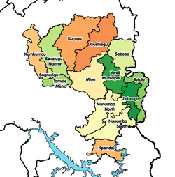
Karaga is a small town and is the capital of Karaga district, a district in the Northern Region of north Ghana. [1] It has a population of approximately 15,000. Karaga is one of the Principle Towns of the Dagbon empire. Dagbon is a name used for the Dagomba tribe. This tribe is the controlling tribe over a large area including Gushiegu, Yendi, Kpatinga, and other towns stretching from Gushiegu to the Bolga road, and bordering on Nalarigu on the north. The presiding chief is one of three or four powerful chiefs having many sub-chiefs under him. Karaga has electricity, but no running water. It has two dams and numerous boreholes which provide water for its citizens. Karaga has a hospital and clinic which can provide basic services, as well as numerous pharmacies spread throughout the town. The largest organized religion in the area is Islam, but the town also has an Assembly of God church and a Korean Missionary outreach. Animism, or ancestor worship is still widely practiced, involving witch doctors and juju-men. Sacrifice and traditional festivals are still a large part of Dagomba life. A large market gathers there every six days and provides goods, services and trade for a large area surrounding the town. Karaga has cellular phone service which provides communication and also data for web-surfing. It is the location of Dizem Bella child and maternal health center, run by Nayina Karim, one of MTN Ghana's 2016 Heroes of Change [2] [3]

Related Research Articles

<span class="mw-page-title-main">Tamale, Ghana</span> Major city in Northern Region, Ghana

Tamale, officially called Tamale Metropolitan Area, is the capital city of the Northern Region of Ghana. Tamale is Ghana's third largest city. It has a projected population of 950,124 according to the Tamale Metropolitan Assembly Official Website. It is the fastest-growing city in West Africa. It is located 600 km (370 mi) north of Accra. Most residents of Tamale are Muslims and Dagombas by tribe, as reflected by the multitude of mosques in Tamale, most notably the Central Mosque, Afa Ajura Mosque, Afa Basha mosque and The Ahmadiyyah Muslim mission Mosque.

<span class="mw-page-title-main">Culture of Ghana</span> Culture of an area

Ghana is a country of 28.21 million people and many native groups, such as:

Yaa Naa Yakubu Andani II was the King of Dagbon, the traditional kingdom of the Dagomba people in northern Ghana, from 31 May 1974 until his assassination on 27 March 2002. He was born in August 1945 in Sagnarigu, a suburb of Tamale in the Northern Region of Ghana. Yakubu II was killed on 27 March 2002 at Yendi, the capital of the Kingdom of Dagbon, by unknown people when clashes broke out between the two feuding Gates of Dagbon Kingship. For 600 years the Abudu and Andani clans, named after two sons of the ancient Dagbon king Ya Naa Yakubu I, cordially rotated control of the kingdom centred in Yendi, 530 kilometres (330 mi) north of Accra, the capital of Ghana. As of January 2014, a regent has acted as sovereign of the kingdom until 18 January 2019 when a new ruler is chosen to occupy the revered Lion Skins of Yendi.

The Dagombas or Dagbamba are a Gur ethnic group of northern Ghana, numbering more than 3.1 million people. The term Dagbamba is also used to refer to other descendants of Naa Gbewaa including the Mamprusi and Nanumba. They inhabit the Northern Region of Ghana in the Guinea savanna region. They speak the Dagbani language which belongs to the Mole-Dagbani sub-group of the Gur languages. There are more than 3 million native speakers of Dagbani. The Dagomba are historically related to the Mossi people. The Mossi Kingdoms were founded by Yennenga, a daughter of the founder of the Dagbon Kingdom, Naa Gbewaa. The Mohi/Mossi now have their homeland in central present-day Burkina Faso. Aside the Mossi, the Dagombas are the progenitors of the Bouna state of Ivory Coast, and the Dagaaba states of Upper West Region of Ghana. The homeland of the Dagomba is called Dagbon and now covers about 20,000 km2 in area.

The name Tchamba sometimes spelled Chamba, stands for both a city located in Tchamba Prefecture in the Centrale Region of Togo, and the tribe living in that area.

<span class="mw-page-title-main">East Mamprusi Municipal Assembly</span> District in North East region, Ghana

East Mamprusi Municipal Assembly is one of the six districts in North East Region, Ghana. Originally created as an ordinary district assembly in 1988 when it was known as East Mamprusi District, which was created from the former Mamprusi District Council, until the eastern part of the district was split off by a decree of president John Agyekum Kufuor on 19 August 2004 to create Bunkpurugu-Yunyoo District; thus the remaining part has been retained as East Mamprusi District. However on 15 March 2018, it was elevated to municipal district assembly status to become East Mamprusi Municipal District. The municipality is located in the eastern part of North East Region and has Gambaga as its capital town.

<span class="mw-page-title-main">West Mamprusi Municipal Assembly</span> District in North East region, Ghana

West Mamprusi Municipal Assembly is one of the six districts in North East Region, Ghana. Originally created as an ordinary district assembly in 1988 when it was known as West Mamprusi District, which was created from the former Mamprusi District Council, until the western part of the district was split off on 28 June 2012 to create Mamprugu-Moagduri District; thus the remaining part has been retained as West Mamprusi District. However, on 15 March 2018, it was elevated to municipal district assembly status to become West Mamprusi Municipal District. The municipality is located in the western part of North East Region and has Walewale as its capital town. Other settlements within the municipal assembly include Wulugu.

<span class="mw-page-title-main">Languages of Ghana</span> Languages of a geographic region

Ghana is a multilingual country in which about eighty languages are spoken. Of these, English, which was inherited from the colonial era, is the official language and lingua franca. Of the languages indigenous to Ghana, Akan is the most widely spoken in the south. Dagbani is most widely spoken in the north.

<span class="mw-page-title-main">Gushegu Municipal District</span> Municipal District in Northern Region, Ghana

Gushegu Municipal District is one of the sixteen districts in Northern Region, Ghana. Originally it was formerly part of the then-larger Gushegu-Karaga District in 1988, which was created from the former East Dagomba District Council, until the western part of the district was split off to create Karaga District on 27 August 2004; thus the remaining part has been renamed as Gushegu District, which it was later elevated to municipal district assembly status on that same year to become Gushegu Municipal District. The municipality is located in the northeast part of Northern Region and has Gushegu as its capital town.

<span class="mw-page-title-main">Karaga District</span> District in Northern Region, Ghana

Karaga District is one of the sixteen districts in Northern Region, Ghana. Originally it was formerly part of the then-larger Gushegu-Karaga District in 1988, which was created from the former East Dagomba District Council, until the western part of the district was split off to create Karaga District on 27 August 2004; thus the remaining part has been renamed as Gushegu District, which it was later elevated to municipal district assembly status on that same year to become Gushegu Municipal District. The district assembly is located in the northeast part of Northern Region and has Karaga as its capital town.

<span class="mw-page-title-main">Bugum Chugu</span> Festival in Ghana by the Dagombas.

The Buɣim Chuɣu is the first Dagomba festival in the year. It is celebrated in the first month of the Dagomba lunar year, the Bugum Goli, and is celebrated on the ninth day of the month. The festival is celebrated to remember the "lost of a chief son" during the old days.

<span class="mw-page-title-main">Yendi Municipal District</span> Municipal District in Northern, Ghana

Yendi Municipal District is one of the sixteen districts in Northern Region, Ghana. Originally created as an ordinary district assembly in 1988 when it was known as Yendi District, which was created from the former East Dagomba District Council, until it was elevated to municipal district assembly status on 29 February 2008 to become Yendi Municipal District; However on 28 June 2012, the western part of the district was later split off to create Mion District; thus the remaining part has been retained as Yendi Municipal District. The municipality is located in the central part of Northern Region and has Yendi as its capital town.

Savelugu is a town and the capital of Savelugu Municipal, a municipality in the Northern Region of north Ghana. Savelugu has a 2012 settlement population of 38,074 people. There are many villages under Savelugu kingship. Most of the villages are smaller.

<span class="mw-page-title-main">Damba festival</span>

The Damba festival is celebrated by the chiefs and peoples of the Northern, Savanna, North East and Upper West Regions of Ghana. The name Damba in Dagbani, Damma in Mampruli and Jingbenti in Waali. The festival is celebrated in the Dagomba lunar month of Damba, corresponding to the third month of the Islamic calendar, Rabia al-Awwal. Damba is celebrated to mark the birth and naming of Muhammad, but the actual content of the celebration is a glorification of the chieftaincy, not specific Islamic motifs. The Damba is also celebrated among the Gonjas of the Savanna region. The Gonjas normally have a specific month of which the celebrate the festival. The festival is categorized into three sessions; the Somo Damba, the Naa Damba and the Belkulsi.

Bimbilla is the capital town of Nanumba North District, a district in the Northern Region of Ghana. It is located in the East of the region, and is near the Oti River.

<span class="mw-page-title-main">Kingdom of Dagbon</span> Traditional Empire of Dagbon and Kingdom of the Dagomba people in Ghana

The Kingdom of Dagbon (Dagbaŋ) is the oldest and one of the most organised traditional kingdoms in Ghana founded by the Dagomba people (Dagbamba) in the 15th century. During its rise, it comprised, at various points, the Northern, Upper West, Upper East, Savannah Region and North East regions of present-day Ghana. It also covered portions of Burkina Faso, North East Ivory Coast and North West Togo. Since Ghana's independence in 1957, the Kingdom just like all of Ghana's kingdoms and ethnic states has assumed a traditional, customary role.

<span class="mw-page-title-main">Konkomba people</span> Ethnic group in Ghana

The Konkomba people are a Gur ethnic group residing mainly in the Northern, Brong Ahafo, Volta, Eastern and Greater Accra Regions of Ghana. Saboba, Chereponi and Nanumba Districts, Gushiegu and Karaga districts, East Mamprusi, Yunyoo-Nasuan, Zabzugu and Tatale-Sanguli districts in the Northern Region and the Nkwanta North and South Districts in the Volta Region are a few examples of administrative districts where Bikpakpaam are seen in huge populations. Other key districts where Bikpakpaam are in Ghana are Atebubu, Kintampo, Techiman and Yeji in the Brong Ahafo Region. According to the Act 280 of the Anatomy act of Ghana, the Konkomba people are the second largest ethnic group in the Northern Region of Ghana.

<span class="mw-page-title-main">Nanumba people</span> Mole-Dagbon ethnic group in North East of Ghana

The Nanumba people are an ethnic group whose traditional homeland is in the southeast of the Northern Region of Ghana. They speak Nanugli, a Gur language.

The Zabarma Emirate was an Islamic state that existed from the 1860s to 1897 in what is today parts of Ghana and Burkina Faso.

Kasuliyili is a community under Tolon District in the northern region of Ghana. Most inhabitants of Kasuliyili community are farmers, including women. There are four basic schools, two Junior High Schools, and one Senior High School in the town. It has a clinic for health delivery. Kasuliyili is ruled by the Kasul Lana, who is enskinned by the King of Dagbon, the Yaa Naa.

References

  1. Karaga district
  2. "MTN heroes of change season II inspires unsung heroes" . Retrieved 2016-08-03.
  3. Okine, Sammy Heywood. "Paulina Opai Wins MTN Hero Of Change 2016" . Retrieved 2016-08-03.