This article needs additional citations for verification .(January 2024) |
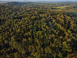
Katar is a village in the Uttara Kannada district in Karnataka, India.[ citation needed ]
This article needs additional citations for verification .(January 2024) |
Katar is a village in the Uttara Kannada district in Karnataka, India.[ citation needed ]
31°18′N77°26′E / 31.300°N 77.433°E
| | This article related to a location in Uttara Kannada district, Karnataka, India is a stub. You can help Wikipedia by expanding it. |

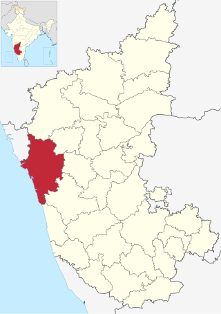
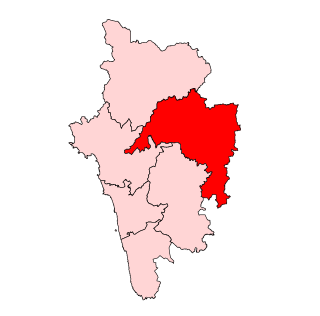
Uttara Kannada is a fifth largest district in the Indian state of Karnataka, It is bordered by the state of Goa and Belagavi districts to the north, Dharwad District and Haveri District to the east, Shivamogga District, and Udupi District to the south, and the Laccadive Sea to the west. Karwar is the district headquarters, Kumta and Sirsi are the major commercial centers in the district. The district's agroclimatic divisions include the coastal plain consisting of Karwar, Ankola, Kumta, Honnavar Bhatkal taluks and Malenadu consisting of Sirsi, Siddapur, Yellapur, Haliyal, Dandeli, Joida, Mundgod taluks.

Kanara or Canara, also known as Karavali, is the historically significant stretch of land situated by the southwestern Konkan coast of India, alongside the Arabian Sea in the present-day Indian state of Karnataka. The subregion comprises three civil districts, namely: Uttara Kannada, Udupi, and Dakshina Kannada. Kasaragod was included prior to the States Reorganisation Act.
Malnad is a region in the state of Karnataka, India. Malenadu covers the western and eastern slopes of the Western Ghats mountain range and is roughly 100 kilometers in width. It includes the districts of Uttara Kannada, Chikmagalur, Chamarajanagar, Udupi, Belgaum, Dakshina Kannada, Hassan, Kodagu, Shimoga. The region experiences heavy annual rainfall of 1,000–3,800 millimetres ; it includes the village of Agumbe, which receives the highest annual rainfall in Karnataka.
Amadalli is a village in the southern state of Karnataka, India. It is located in the Karwar taluk of Uttara Kannada district in Karnataka.
Bailur is a village in the southern state of Karnataka, India, located in the Bhatkal taluk of Uttara Kannada district in Karnataka.
Bengre is a village in the southern state of Karnataka, India. It is located in the Bhatkal taluk of Uttara Kannada district in Karnataka.
Abbolli is a village in the southern state of Karnataka, India. It is located in the Kumta taluk of Uttara Kannada district in Karnataka.
Achanalli is a village in the southern state of Karnataka, India. It is located in the Sirsi taluk of Uttara Kannada district in Karnataka.
Adalli is a village in the southern state of Karnataka, India. It is located in the Sirsi taluk of Uttara Kannada district.
Adnalli is a village in the southern state of Karnataka, India. It is located in the Sirsi taluk of Uttara Kannada district in Karnataka.
Aigalkurve is a village in the southern state of Karnataka, India. It is located in the Kumta taluk of Uttara Kannada district in Karnataka.
Ajjarni is a village in the southern state of Karnataka, India. It is located in the Sirsi taluk of Uttara Kannada district.
Akkunji is a village in the southern state of Karnataka, India. It is located in the Siddapur taluk of Uttara Kannada district in Karnataka.

Haliyal Assembly constituency is one of the 224 Legislative Assembly constituencies of Karnataka in India.

Karwar Assembly constituency is one of the 224 Legislative Assembly constituencies of Karnataka in India.
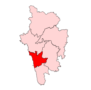
Kumta Assembly constituency is one of the 224 Legislative Assembly constituencies of Karnataka in India.
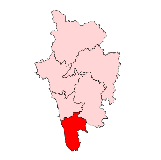
Bhatkal Assembly constituency is one of the 224 Legislative Assembly constituencies of Karnataka in India.

Sirsi Assembly constituency is one of the 224 Legislative Assembly constituencies of Karnataka in India.
Yellapur Assembly constituency is one of the 224 Legislative Assembly constituencies of Karnataka in India.