Adnalli | |
|---|---|
village | |
| Country | |
| State | Karnataka |
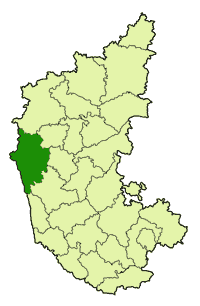
| District | Uttara Kannada |
| Talukas | Sirsi |
| Government | |
| • Body | Village Panchayat |
| Languages | |
| • Official | Kannada |
| Time zone | UTC+5:30 (IST) |
| Nearest city | Uttara Kannada |
| Civic agency | Village Panchayat |
Adnalli is a village in the southern state of Karnataka, India. [1] [2] It is located in the Sirsi taluk of Uttara Kannada district in Karnataka.

Karnataka is a state in the south western region of India. It was formed on 1 November 1956, with the passage of the States Reorganisation Act. Originally known as the State of Mysore, it was renamed Karnataka in 1973. The state corresponds to the Carnatic region. The capital and largest city is Bangalore.

India is a country in South Asia. It is the seventh-largest country by area, the second-most populous country, and the most populous democracy in the world. Bounded by the Indian Ocean on the south, the Arabian Sea on the southwest, and the Bay of Bengal on the southeast, it shares land borders with Pakistan to the west; China, Nepal, and Bhutan to the north; and Bangladesh and Myanmar to the east. In the Indian Ocean, India is in the vicinity of Sri Lanka and the Maldives; its Andaman and Nicobar Islands share a maritime border with Thailand and Indonesia.

Sirsi is a hill station elevated about 2,600 ft (790 m) above sea level in the Indian state of Karnataka and it is home to Elephants, Tigers, Leopard and unique Black panther. Sirsi was also known as Kalyanapattana during the Sonda Dynasty. This town is surrounded by thick green forest & many water falls. Hubli being the nearest city, business opportunities are plenty. Growing Arecanut or betel nut is the main occupation of the people. People own areca farms in acres & are satisfying the needs of the people all over India & abroad. Sirsi - is a tranquil town, dotted with terracotta-tiled houses, Jain Basadis (temples) and ancient Hindu temples. The 16th Century Marikamba Temple enshrines a wooden deity that is believed to have been found in a tank. Once in every two years, the temple celebrates Marikamba jatra (festival) in tribute to Goddess Marikamba. The nearest international airport is Dabolim Airport, Goa.