Bengre | |
|---|---|
village | |
| Country | |
| State | Karnataka |
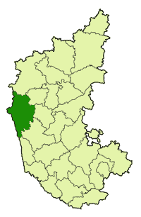
| District | Uttara Kannada |
| Talukas | Bhatkal |
| Population (2001) | |
| • Total | 7,718 |
| Languages | |
| • Official | Kannada |
| Time zone | UTC+5:30 (IST) |
Bengre is a village in the southern state of Karnataka, India. [1] [2] It is located in the Bhatkal taluk of Uttara Kannada district in Karnataka.

Karnataka is a state in the south western region of India. It was formed on 1 November 1956, with the passage of the States Reorganisation Act. Originally known as the State of Mysore, it was renamed Karnataka in 1973. The state corresponds to the Carnatic region. The capital and largest city is Bangalore (Bengaluru).

India, also known as the Republic of India, is a country in South Asia. It is the seventh largest country by area and with more than 1.3 billion people, it is the second most populous country as well as the most populous democracy in the world. Bounded by the Indian Ocean on the south, the Arabian Sea on the southwest, and the Bay of Bengal on the southeast, it shares land borders with Pakistan to the west; China, Nepal, and Bhutan to the northeast; and Bangladesh and Myanmar to the east. In the Indian Ocean, India is in the vicinity of Sri Lanka and the Maldives, while its Andaman and Nicobar Islands share a maritime border with Thailand and Indonesia.

Bhatkal, also known as 'Batecala' in some historical Portuguese texts, is a port town in the Uttara Kannada District of the South Indian state of Karnataka. The town of Bhatkal lies on National Highway 66, which runs between Mumbai and Kochi, and has one of the major railway stations along the Konkan Railway line, which runs between Mumbai and Mangaluru.