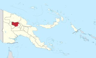
Kerevat lies near Ataliklikun Bay, 6 miles (9.7km) east of Vunakanau.[1] The Kerevat River flows through Keravet, 3 miles (4.8km) from the beach to the prison (known as "Kindaim", meaning “crayfish" or “shrimp”). The river flows between the Keravat High School and the prison fence.[2] A coastal road connects Kerevat to Rabaul in the north-east.[3] The average annual rainfall in Kerevat is 278 centimetres (109in).[4]
History
Keravat Airfield was constructed September 1943 by the Imperial Japanese during World War II, but was never fully operational.[5] The airfield was neutralized by Allied air bombing from 1944, and was abandoned after the cessation of hostilities. In the 1970s, "small trials in natural regeneration management" were conducted here.[6] The New Guinea Electricity Commission operated a power station of 1065kW in Kerevat as of June 1973.[7]
Economy
The Kerevat area has been subject to land resettlement and is a notable producer of cocoa; Australians began cultivating the land in May 1930.[8][9] Due to its status in cocoa production, Kerevat contains the Cocoa and Coconut Research Institute.[10] Kerevat has also been a notable research centre for entomology. A new center for entomological activity was established in Kerevat in 1928 by the Department of Agriculture, operated by scientists such as J. L. Froggatt, B. A. O'Connor, and Gordon Dun.[11] Kerevat Correctional Institution, or Kerevat Prison, nicknamed "Kindam" encourages prisoners to help farm the land.[12][13]
Kerevat National High School
Kerevat National High School and Kerevat Education Centre,[14] are often used to train teachers, medical orderlies, and artisans for the government.[15][16] Kerevat National High School, the only national high school in the New Guinea Islands region, had an enrollment of 50 to 60 per cent of students from the Islands region and the balance drawn from the rest of the country. The teaching programme covered technical and vocational skills to meet the nation's need to further the development activities.[17] In the past several years, the student who graduated from this school occupied important positions both in the government and public enterprises.
The school's reputation has taken a sharp decline resulting in its temporary closure during 2011 for reasons of “cult activities, the satanic worship reports, fights and other social problems and deteriorating school facilities”.[18] In 2012, Peter O’Neill, Prime Minister of PNG addressed this issue, stating that “Closure of the school is not an option,” and to graduate from classes 11 and 12, standards would be ensured. He also directed his education Minister to institute an inquiry into the affairs of the school administration, particularly regarding misuse of funds during the last five years. This inquiry would also look into the aspect of funding the school from the national exchequer.[19] AusAID and the PNG Government have provided K3 million for refurbishing and upgrading activities.[18]
Islands Regional Centres (IRCs - Kerevat)
In 1913, Germans had plans to establish an Agricultural Research Station in Kerevat on the western boundary of the Vunirima and acquired land for the same. In May 1930, Australians started work on the station, the delay attributed to non availability of a superintendent to supervise the works.[20] The agricultural station encouraged development of rice, maize and peanuts, developed in a rotational cycle and also trained sixteen trainees. Cocoa was introduced in the research station in the later part of the 1940s and early 50s along with copra, and extension officers propagated it widely. Cocoa techniques were modernized to raise crops (as a peasant cash crop), which would be competitive in the world market of cocoa for which Cocoa Growers Association was also established.[20]
In PNG, sweet potatogermplasm is currently held at the NARI Highlands Programme, formerly the Highlands Agricultural Experiment Station (1158 accession in 1998), Aiyura, and the NARI Wet-Lowlands, Keravat, formerly the Lowlands Wetland Agricultural Station, Keravat (1062 accessions in 1998). Under the Secretariat for the Pacific Commission (SPC) and Pacific Regional Agricultural Programme (PRAP), PNG sweet potato varieties are being evaluated, indexed and tissue cultured at NARI, Keravat. The Keravat station also has 73 collections from abroad.[21]
Forestry stations, research centres and nurseries were also established at Keravat and in one year in the 1960s, the nursery produced 73,500 teak stumps, and 26,200 Terminalia species seedlings.[22] Assessments have indicated 1,022 genera of Tectona grandis and 624 Eucalyptus species in Kerevat. The climate in the area is of tropical savanna and the annual rainfall varies between 1,750 and 2280mm per annum with an average of 2,077mm.[23]
Rice production in the only large rice mill at Kerevat is able to meet the requirement of the Gazelle Peninsula (District). With funding from CSHQ, the number of cocoa trees and rice production could be enhanced to meet the feed requirements of livestock; plans have been charted for the same.[12]
Keravat has an inland fishing project with more than five ponds where breeding of carp and Sepik Talapia takes place; the present stock in the ponds consists of more than 2,500 carp and 5,000 Sepik talapia.[12]
Agricultural research
The research activities in agricultural sciences are promoted through the Wet Lowlands Islands Programme (WLIP), earlier name was the "National Agricultural Research Institute". It is part of the "Lowlands Agricultural Experiment Station (LAES)" at Keravat. The agricultural research activities of all the five Islands provinces of East New Britain, West New Britain, New Ireland, Manus and North Solomon, each of which has its own distinct geographic identity, ethnic diversity and political affiliations (though have similar flora and fauna) are dictated by farmers and stakeholders requirements. The research activities, which are adoptive in nature, tested at the laboratory and sites, are to cover: “Alternative Cash Crops such as vanilla, nutmeg, pepper, turmeric, cardamom, balsa; vegetables like pitpit and aibika; staple crops such as sweet potato, taro, Singapore taro, banana, cassava and yam; fruits and nuts -Indigenous nuts such as galip, okari and pau; commercialization of cocoa and other alternative cash crops; development and processing of rice, grains & pulses, maize, lowlands rice; and weeds management, Atolls agriculture development and Plant derived Pesticides.” Training is an essential part of the research involving farmers with field visits, film shows and other publicity materials.[24]
National Agricultural Research Institute, Papua New Guinea in its Islands Regional Research Centre at Keravat (one of the four in PNG) has taro germplasm collection apart from traditional and exotic fruits and nuts species and traditional vegetables. Plant genetic resources held in ex situ in the field and in the lab are: Keravta field collections are 105 national collections of sweet potato, 60 of bananas and 10 of taro; and Kerevata tissue culture are 5 working collections of sweet potatoes, 23 working collections of bananas and 5 working collections of Taro.[25]
At the Lowlands Agricultural Experiment Station (LAES), the regional (islands) research station of the National Agricultural Research Institute (NARI) of PNG at Kerevat, eight selected clones (derived from 20 seedling trees that were evaluated over a 20-year period between 1980 and 1992 of durian (Durio zibethinus Murr) trees of the humid tropics were released to farmers with small holdings. The edible fruit from this tree has a distinctive and delicious flavor (may not be popular for its smell to many). NARI Keravat, has a programme of distributing grafted seedlings of these selected trees to those interested to plant and raise them. The eight local varieties identified for their “yield, taste, flesh and colour” are “NKDZ5, NKDZ7, NKDZ8, NKDZ9, NKDZ11, NKDZ12, NKDZ15 and NKDZ20”.[26]
Papua New Guinea, officially the Independent State of Papua New Guinea, is a country in Oceania that comprises the eastern half of the island of New Guinea and its offshore islands in Melanesia. Its capital, located along its southeastern coast, is Port Moresby. The country is the world's third largest island country, with an area of 462,840 km2 (178,700 sq mi).
The economy of Papua New Guinea (PNG) is largely underdeveloped with the vast majority of the population living below the poverty line. However, according to the Asian Development Bank its GDP is expected to grow 3.4% in 2022 and 4.6% in 2023. It is dominated by the agricultural, forestry, and fishing sector and the minerals and energy extraction sector. The agricultural, forestry, and fishing sector accounts for most of the labour force of PNG while the minerals and energy extraction sector, including gold, copper, oil and natural gas is responsible for most of the export earnings.
Bougainville, officially the Autonomous Region of Bougainville, is an autonomous region in Papua New Guinea. The largest island is Bougainville Island, while the region also includes Buka Island and a number of outlying islands and atolls. The current capital is Buka, situated on Buka Island.
Enga is one of the provinces in Papua New Guinea (PNG). It is located in the north most region of the highlands of PNG, having been divided from the Western Highlands to become a separate province when the provinces were created at the time of independence in 1975. The people of Enga are called Engans—they are a majority ethnic group—speaking one language in all its five districts: approximately 500,000 people. A small minority of Engans' land on the eastern side of the region remained in the Western Highlands, their territory being accessible by road from Mount Hagen but not directly from elsewhere in Enga territory.
Taro is a root vegetable. It is the most widely cultivated species of several plants in the family Araceae that are used as vegetables for their corms, leaves, stems and petioles. Taro corms are a food staple in African, Oceanic, Southeast Asian and South Asian cultures. Taro is believed to be one of the earliest cultivated plants.
Agriculture in Nigeria is one of the major parts of the Nigerian economy, representing up to 35% of total national employment in 2020. As reported by the FAO, agriculture remains the foundation of the Nigerian economy. It is the main source of livelihood for most Nigerians, both in terms of food production and providing millions of jobs. Along with crude oil, Nigeria relies on the agricultural products it exports to generate most of its national revenue. The Agricultural sector in Nigeria is made up of four sub-sectors: crop production, livestock, forestry and fishing.
Papua New Guinea together with the West Papua region of Indonesia make up a major tropical wilderness area that still contains 5% of the original and untouched tropical high-biodiversity terrestrial ecosystems. PNG in itself contains over 5% of the world's biodiversity in less than 1% of the world's total land area. The flora of New Guinea is unique because it has two sources of origin; the Gondwana flora from the south and flora with Asian origin from the west. As a result, New Guinea shares major family and genera with Australia and the East Asia, but is rich in local endemic species. The endemicity is a result of mountainous isolation, topographic and soil habitat heterogeneity, high forest disturbance rates and abundant aseasonal rainfall year round. PNG boasts some 15–21,000 higher plants, 3,000 species of orchids, 800 species of coral, 600 species of fish, 250 species of mammals and 760 species of birds and 8 species of tree-kangaroos out of which 84 genera of animals are endemic. Ecosystems range from lowland forests to montane forests, alpine flora down to coastal areas which contains some of the most extensive pristine mangrove areas in the world. Much of this biodiversity has remained intact for thousands of years because the ruggedness of the terrain made the interior lands inaccessible; furthermore low population density and restrictions on the effectiveness of traditional tools, ensured that these biodiversity was never overexploited.
Agriculture in Ghana consists of a variety of agricultural products and is an established economic sector, providing employment on a formal and informal basis. It is represented by the Ministry of Food and Agriculture. Ghana produces a variety of crops in various climatic zones which range from dry savanna to wet forest which run in east–west bands across Ghana. Agricultural crops, including yams, grains, cocoa, oil palms, kola nuts, and timber, form the base of agriculture in Ghana's economy. In 2013 agriculture employed 53.6% of the total labor force in Ghana.
Michael John Manning OBE was an Australian-born Papua New Guinean anti-corruption activist and economist. Manning served as the second Chairman of Transparency International PNG (TIPNG), one of Papua New Guinea's largest organizations dedicated to eradicating corruption, from 2003 until 2008. He was a naturalized citizen of Papua New Guinea.
Indigenous horticulture is practised in various ways across all inhabited continents. Indigenous refers to the native peoples of a given area and horticulture is the practice of small-scale intercropping.
Coffee production in Papua New Guinea is the country's second largest agricultural export, after oil palm, and employs approximately 2.5 million people. It accounts for approximately 1% of world production, according to the United Nations Conference on Trade and Development (UNCTAD).
Agriculture in Papua New Guinea has more than a 7,000 years old history, and developed out of pre-agricultural plant/food collecting and cultivation traditions of local hunter-gatherers. Currently around 85% of Papua New Guinea's population lives from semi-subsistence agriculture.
Situm is a government ex-servicemen block outside of Lae in Labuta Rural LLG, Morobe Province, Papua New Guinea.
Bugandi is a suburb of Lae in the Morobe Province, Papua New Guinea.
Yalu is a large village in Wampar Rural LLG, located in the Markham Valley of Morobe Province, Papua New Guinea. It lies along the Highlands Highway 21.5 kilometres (13.4 mi) north-west of Lae, 7 kilometres (4.3 mi) southeast of Nadzab. The landscape is typically lowland rainforest.
9 Mile is a large village in the Markham Valley of Morobe Province, Papua New Guinea. It lies along the Highlands Highway 9 miles (14 km) from the center of Lae between the foothills of the Atzera Range and the Markham River. The Atzera Range starts at Bugandi and runs adjacent to the Markham River has an elevation of 280 meters above sea level. northwest of Lae, 7 kilometres (4.3 mi) southeast of Nadzab. The landscape is typically lowland rainforest.
The cuisine of Papua New Guinea are the traditional varied foods found in the eastern part of the New Guinea island. Approximately 80% of the population is reliant on subsistence agriculture, so a large percentage of food energy and protein consumed in Papua New Guinea is produced locally, while the balance is imported. The staple foods in Papua New Guinea includes root crops, bananas, and sago. Papua New Guinea's diet is largely vegetarian, especially in the Gulf and Highlands regions.
The means by which agriculture expanded into the Philippines is argued by many different anthropologists and an exact date of its origin is unknown. However, there are proxy indicators and other pieces of evidence that allow anthropologists to get an idea of when different crops reached the Philippines and how they may have gotten there. Rice is an important agricultural crop today in the Philippines and many countries throughout the world import rice and other products from the Philippines.
Maria Linibi is the founder and president of the Papua New Guinea Women in Agriculture Development Foundation.
Kerevat National High School, also known as the Kerevat School of Excellence, is a government high school in the East New Britain Province of Papua New Guinea (PNG) that takes admissions from throughout PNG for Grades 11 and 12. It was founded in 1947.
↑ University of Papua New Guinea. Language and Literature Dept (1999). Savannah flames. University of Papua New Guinea Campus Writers. Retrieved 8 September 2012.
↑ Bulbeck, Chilla (2002) [1992], "The civilising mission", in Bulbeck, Chilla (ed.), Australian women in Papua New Guinea: colonial passages, 1920-1960, Cambridge: Cambridge University Press, pp.181–182, ISBN9780521523202. Preview.
This page is based on this Wikipedia article Text is available under the CC BY-SA 4.0 license; additional terms may apply. Images, videos and audio are available under their respective licenses.