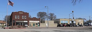
West Des Moines is a city in Polk, Dallas, Warren, and Madison counties in the U.S. state of Iowa. A majority of the city is located in Polk County, a minority of the city is located in Dallas County, and small portions extend into Warren and Madison counties.

Duncan is a village in Platte County, Nebraska, United States. The population was 351 at the 2010 census.
Fultonville is a village in Montgomery County, New York, United States. The village is named after Robert Fulton, inventor of the steamboat.

Manilla is a small town in New South Wales, Australia, located on Fossickers Way 45 kilometres northwest of the regional city of Tamworth and 27 kilometres northeast of the historic village Somerton. Manilla is famous for its setting as a fishing and paragliding area. The name Manilla comes from the Gamilaraay word 'Maneela', which is said to mean 'meeting of the rivers'.

Warrawee is a suburb on the Upper North Shore of Sydney in the state of New South Wales, Australia. Warrawee is located 17 kilometres north-west of the Sydney Central Business District in the local government area of Ku-ring-gai Council. Warrawee is predominantly a small residential suburb with few commercial entities. Notably, its railway station provides no commercial activity which is uncommon in the Sydney train network.

Tweed Heads is a coastal town at the mouth of the Tweed River in the Northern Rivers region of the state of New South Wales, Australia. Tweed Heads is the northern most town in New South Wales, and is located in the Tweed Shire local government area. It is situated 830 km (520 mi) north of Sydney and 103 km (64 mi) south of Brisbane. The town is next to the border with Queensland and is adjacent to its "twin town" of Coolangatta, which is a suburb of the Gold Coast in Queensland.

Murwillumbah is a town in the Northern Rivers region of New South Wales, Australia, in the Tweed Shire, on the Tweed River. Sitting on the south eastern foothills of the McPherson Range in the Tweed Volcano valley, Murwillumbah is 848 km north-east of Sydney, 13 km south of the Queensland border and 132 km south of Brisbane.

Coolangatta is a coastal suburb in the City of Gold Coast, Queensland, Australia. It is the Gold Coast's southernmost suburb and it borders New South Wales. In the 2016 census, Coolangatta had a population of 5,948 people.

Uki is a village situated near Mount Warning in the Tweed Valley of far northern New South Wales, Australia in the Tweed Shire. At the 2011 census, Uki had a population of 765 people. Its name may have come from an aboriginal word for "small water plant with a yellow flower and edible root".. The name UKI was actually derived from the limber mills in the area. Prime timber for export was marked UK 1, as in timber destined for the United Kingdom - grade 1. Hence UK1, which colloquially named the township UKI.

West Pymble is a suburb on the Upper North Shore of Sydney in the state of New South Wales, Australia 15 kilometres (9.3 mi) north-west of the Sydney Central Business District in the local government area of Ku-ring-gai Council. Pymble is a separate suburb to the east, sharing the postcode of 2073.

Wingham is a town in the Mid North Coast region of New South Wales, Australia in the Mid-Coast Council area 329 kilometres (204 mi) north of Sydney. According to the 2021 census, Wingham had a population of 5,395.

Stratford is a town on the Avon River in Victoria, Australia, 232 kilometres (144 mi) east of Melbourne on the Princes Highway in Shire of Wellington. At the 2016 census, Stratford had a population of 2617. The town services the local regional community and travellers on the Princes Highway. Stratford's principal industries are dairying, sheep, cattle and horse breeding and vegetable crops. The town has numerous coffee shops and cafes, a cellar door for a local winery, Design Gallery, model railway shop, a pub, parks and playgrounds for car travelers to break their journey.

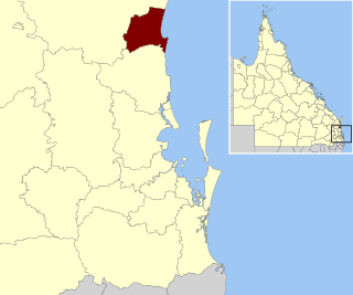
The Shire of Noosa is a local government area about 130 kilometres (81 mi) north of Brisbane in the Sunshine Coast district of South East Queensland, Australia. The shire covers an area of 870 square kilometres (335.9 sq mi). It existed as a local government entity from 1910 until 2008, when it was amalgamated with the Shire of Maroochy and City of Caloundra to form the Sunshine Coast Region. The shire was re-established on 1 January 2014. In the 2021 census, the shire had a population of 56,298 people.

Tweed Shire is a local government area located in the Northern Rivers region of New South Wales, Australia. It is adjacent to the border with Queensland, where that meets the Coral Sea. Administered from the town of Murwillumbah, Tweed Shire covers an area of 1,321 square kilometres (510 sq mi), and has existed as a local government entity since 1947. It was named for the Tweed River.

Telegraph Point is a small village on the North Coast of New South Wales, Australia. It is located on the Pacific Highway north of Port Macquarie, and on the North Coast railway line. The village spans both sides of the Wilson River.

Bilpin is a small town on the historic Bells Line of Road in the City of Hawkesbury local government area in the Blue Mountains, west of Sydney, New South Wales.

Mount Mee is a rural town and locality in the City of Moreton Bay, Queensland, Australia. In the 2021 census, Mount Mee had a population of 519 people.
Tumbulgum is a village in northern New South Wales, Australia. It is in the Tweed Shire local government area, at the confluence of the Rous and Tweed Rivers, 818 kilometres (508 mi) north east of the state capital, Sydney and 120 kilometres (75 mi) south east of Brisbane. At the 2006 census, Tumbulgum had a population of 349.
Ruby Plains Station is a pastoral lease and cattle station located about 41 kilometres (25 mi) south of Halls Creek in the Kimberley region of Western Australia. It is situated along the Tanami Track and is used as a stopping place along the Canning Stock Route.
Wooyung is a small town located in the Northern Rivers Region of New South Wales. The most recent census indicated a population of 139, with a median age of 49. Wooyung means 'slow' in the local Bundjalung language, and is believed to reflect the natural tranquility of the area.


