Lane, Kansas

Last updated

Lane, Kansas
Lane, KS.jpg
Kansas Avenue (2022)
Franklin County Kansas Incorporated and Unincorporated areas Lane Highlighted.svg
Location within Franklin County and Kansas
Map of Franklin Co, Ks, USA.png
Coordinates: 38°26′23″N95°04′55″W / 38.43972°N 95.08194°W / 38.43972; -95.08194 [1]
Country United States
State Kansas
County Franklin
Founded1855
Incorporated 1908
Named for James Lane
Area
[2]
  Total
0.24 sq mi (0.61 km2)
  Land0.23 sq mi (0.59 km2)
  Water0.01 sq mi (0.02 km2)
Elevation
[1]
886 ft (270 m)
Population
 (2020) [3]
  Total
241
  Density1,000/sq mi (400/km2)
Time zone UTC-6 (CST)
  Summer (DST) UTC-5 (CDT)
ZIP code
66042
Area code 785
FIPS code 20-38400
GNIS ID 2395627 [1]
Website City info

Lane is a city in Franklin County, Kansas, United States. [1] As of the 2020 census, the population of the city was 241. [3]

Contents

History

The first temporary settlement near what would become Lane occurred in 1838 when Rev. Robert Simerwell established a Baptist Mission Station "on the south side of Pottawatomie Creek" following the Potawatomie Trail of Death. [4] When the Federal Government moved the Potawatomie (and the Baptist Mission) to the Kansas River valley in the mid-1840s, brothers William, Peter, and "Dutch" Henry Sherman were left as the first permanent settlers. [5] The community was known as Dutch Henry's Crossing because a wagon road forded the creek near the Sherman cabin. [5]

The area of Lane west of Kansas Avenue was originally laid out under the name Shermanville in 1855. It was renamed Lane in 1863 for James H. Lane, a leader of the Jayhawkers abolitionist movement, who served as one of the first Senators from Kansas. [6] [7]

When the Missouri Pacific Railroad arrived in 1879, a competing community, called either Emerson or Avondale, was laid out east of Kansas Avenue. [8] [9] Within two years the competition between the two towns ceased, and both townsites had merged into the single community of Lane. [9] Lane was incorporated as a city in 1908. [10]

Lane is near the site where in 1856, the abolitionist John Brown and four other of his followers hacked five pro-slavery men, one of whom was William Sherman, to death with broadswords near Mosquito Creek and Pottawatomie Creek. The event is commonly referred to as the Pottawatomie massacre.

Geography

According to the United States Census Bureau, the city has a total area of 0.24 square miles (0.62 km2), all of it land. [11]

Climate

The climate in this area is characterized by hot, humid summers and generally mild to cool winters. According to the Köppen Climate Classification system, Lane has a humid subtropical climate, abbreviated "Cfa" on climate maps. [12]

Demographics

Historical population
CensusPop.Note
1880 166
1910 272
1920 35129.0%
1930 291−17.1%
1940 234−19.6%
1950 200−14.5%
1960 28241.0%
1970 254−9.9%
1980 249−2.0%
1990 247−0.8%
2000 2563.6%
2010 225−12.1%
2020 2417.1%
U.S. Decennial Census

2020 census

The 2020 United States census counted 241 people, 100 households, and 64 families in Lane. [13] [14] The population density was 1,034.3 per square mile (399.4/km2). There were 114 housing units at an average density of 489.3 per square mile (188.9/km2). [13] [15] The racial makeup was 88.8% (214) white or European American (88.8% non-Hispanic white), 1.66% (4) black or African-American, 0.83% (2) Native American or Alaska Native, 0.41% (1) Asian, 0.0% (0) Pacific Islander or Native Hawaiian, 0.83% (2) from other races, and 7.47% (18) from two or more races. [16] Hispanic or Latino of any race was 2.49% (6) of the population. [17]

Of the 100 households, 37.0% had children under the age of 18; 43.0% were married couples living together; 19.0% had a female householder with no spouse or partner present. 28.0% of households consisted of individuals and 8.0% had someone living alone who was 65 years of age or older. [13] The average household size was 2.1 and the average family size was 2.9. [18] The percent of those with a bachelor’s degree or higher was estimated to be 2.5% of the population. [19]

20.7% of the population was under the age of 18, 8.3% from 18 to 24, 22.8% from 25 to 44, 27.8% from 45 to 64, and 20.3% who were 65 years of age or older. The median age was 44.1 years. For every 100 females, there were 79.9 males. [13] For every 100 females ages 18 and older, there were 78.5 males. [13]

The 2016-2020 5-year American Community Survey estimates show that the median household income was $30,938 (with a margin of error of +/- $9,165) and the median family income was $38,214 (+/- $19,838). [20] Males had a median income of $31,875 (+/- $17,550) versus $24,375 (+/- $6,096) for females. The median income for those above 16 years old was $28,393 (+/- $3,429). [21] Approximately, 24.1% of families and 14.3% of the population were below the poverty line, including 0.0% of those under the age of 18 and 29.9% of those ages 65 or over. [22] [23]

2010 census

As of the census [24] of 2010, there were 225 people, 102 households, and 61 families residing in the city. The population density was 937.5 inhabitants per square mile (362.0/km2). There were 112 housing units at an average density of 466.7 per square mile (180.2/km2). The racial makeup of the city was 98.2% White, 0.9% Asian, 0.4% from other races, and 0.4% from two or more races. Hispanic or Latino of any race were 1.8% of the population.

There were 102 households, of which 23.5% had children under the age of 18 living with them, 47.1% were married couples living together, 9.8% had a female householder with no husband present, 2.9% had a male householder with no wife present, and 40.2% were non-families. 27.5% of all households were made up of individuals, and 5.9% had someone living alone who was 65 years of age or older. The average household size was 2.21 and the average family size was 2.72.

The median age in the city was 45.1 years. 21.8% of residents were under the age of 18; 8.5% were between the ages of 18 and 24; 19.5% were from 25 to 44; 35.1% were from 45 to 64; and 15.1% were 65 years of age or older. The gender makeup of the city was 52.0% male and 48.0% female.

2000 census

As of the census [25] of 2000, there were 97 households, and 71 families residing in the city. The population density was 1,177.8 inhabitants per square mile (454.8/km2). There were 105 housing units at an average density of 483.1 per square mile (186.5/km2). The racial makeup of the city was 96.48% White, 0.39% Black or African American, 0.39% Native American, 0.39% Asian, and 2.34% from two or more races. Hispanic or Latino of any race were 0.39% of the population.

There were 97 households, out of which 33.0% had children under the age of 18 living with them, 57.7% were married couples living together, 11.3% had a female householder with no husband present, and 25.8% were non-families. 22.7% of all households were made up of individuals, and 7.2% had someone living alone who was 65 years of age or older. The average household size was 2.64 and the average family size was 2.99.

In the city, the population was spread out, with 26.2% under the age of 18, 10.5% from 18 to 24, 30.5% from 25 to 44, 20.3% from 45 to 64, and 12.5% who were 65 years of age or older. The median age was 35 years. For every 100 females, there were 103.2 males. For every 100 females age 18 and over, there were 110.0 males.

The median income for a household was $41,500, and the median income for a family was $42,500. Males had a median income of $32,031 versus $21,429 for females. The per capita income for the city was $19,144. About 11.4% of families and 12.0% of the population were below the poverty line, including 13.1% of those under the age of 18 and none of those 65 and older.

Education

Lane is a part of Central Heights USD 288 school district, headquarters located in Richmond. School mascot is Central Heights Vikings. [26]

Lane schools were closed through school unification in 1965. The Lane High School mascot was Lane Lions. [27]

Related Research Articles

<span class="mw-page-title-main">Greeley, Kansas</span> City in Anderson County, Kansas

Greeley is a city in Anderson County, Kansas, United States. As of the 2020 census, the population of the city was 273.

<span class="mw-page-title-main">Gove City, Kansas</span> City in Gove County, Kansas

Gove City, more commonly known as Gove, is a city in and the county seat of Gove County, Kansas, United States. As of the 2020 census, the population of the city was 80.

<span class="mw-page-title-main">Holton, Kansas</span> City in Jackson County, Kansas

Holton is a city in and the county seat of Jackson County, Kansas, United States. As of the 2020 census, the population of the city was 3,401.

<span class="mw-page-title-main">Edgerton, Kansas</span> City in Kansas, United States

Edgerton is a city in Johnson County, Kansas, United States, and part of the Kansas City metropolitan area. As of the 2020 census, the population of the city was 1,748. It is home to a large BNSF intermodal train facility named Logistics Park Kansas City.

<span class="mw-page-title-main">Kingman, Kansas</span> City in Kingman County, Kansas

Kingman is a city in and the county seat of Kingman County, Kansas, United States. As of the 2020 census, the population of the city was 3,105.

<span class="mw-page-title-main">Dighton, Kansas</span> City in Lane County, Kansas

Dighton is a city in and the county seat of Lane County, Kansas, United States. As of the 2020 census, the population of the city was 960. Dighton is named for Dick Dighton, a surveyor.

<span class="mw-page-title-main">Linn Valley, Kansas</span> City in Kansas, United States

Linn Valley is a city in Linn County, Kansas, United States. As of the 2020 census, the population of the city was 956.

<span class="mw-page-title-main">Neosho Rapids, Kansas</span> City in Lyon County, Kansas

Neosho Rapids is a city in Lyon County, Kansas, United States. As of the 2020 census, the population of the city was 229.

<span class="mw-page-title-main">Osawatomie, Kansas</span> City in Kansas, United States

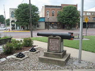
Osawatomie is a city in Miami County, Kansas, United States, 61 miles (98 km) southwest of Kansas City. As of the 2020 census, the population of the city was 4,255. It derives its name as a portmanteau of two nearby streams, the Marais des Cygnes River and Pottawatomie Creek.

<span class="mw-page-title-main">Belvue, Kansas</span> City in Pottawatomie County, Kansas

Belvue is a city in Pottawatomie County, Kansas, United States. As of the 2020 census, the population of the city was 177.

<span class="mw-page-title-main">Emmett, Kansas</span> City in Pottawatomie County, Kansas

Emmett is a city in Pottawatomie County, Kansas, United States. As of the 2020 census, the population of the city was 170.

<span class="mw-page-title-main">Havensville, Kansas</span> City in Pottawatomie County, Kansas

Havensville is a city in Pottawatomie County, Kansas, United States. As of the 2020 census, the population of the city was 119.

<span class="mw-page-title-main">Louisville, Kansas</span> City in Pottawatomie County, Kansas

Louisville is a city in Pottawatomie County, Kansas, United States. As of the 2020 census, the population of the city was 131.

<span class="mw-page-title-main">Olsburg, Kansas</span> City in Pottawatomie County, Kansas

Olsburg is a city in Pottawatomie County, Kansas, United States. As of the 2020 census, the population of the city was 218.

<span class="mw-page-title-main">Onaga, Kansas</span> City in Pottawatomie County, Kansas

Onaga is a city in Pottawatomie County, Kansas, United States. As of the 2020 census, the population of the city was 679.

<span class="mw-page-title-main">Coats, Kansas</span> City in Pratt County, Kansas

Coats is a city in Pratt County, Kansas, United States. As of the 2020 census, the population of the city was 68. It is located approximately 12 miles southwest of Pratt.

<span class="mw-page-title-main">Park City, Kansas</span> City in Sedgwick County, Kansas

Park City is a city in Sedgwick County, Kansas, United States and a suburb of Wichita. As of the 2020 census, the population of the city was 8,333.

<span class="mw-page-title-main">Auburn, Kansas</span> City in Shawnee County, Kansas

Auburn is a city in Shawnee County, Kansas, United States. As of the 2020 census, the population of the city was 1,273.

<span class="mw-page-title-main">Hoxie, Kansas</span> City in Sheridan County, Kansas

Hoxie is a city in and the county seat of Sheridan County, Kansas, United States. As of the 2020 census, the population of the city was 1,211.

<span class="mw-page-title-main">Edwardsville, Kansas</span> City in Kansas, United States

Edwardsville is a city in Wyandotte County, Kansas, United States, and part of the Kansas City Metropolitan Area. As of the 2020 census, the population of the city was 4,717.

References

  1. 1 2 3 4 U.S. Geological Survey Geographic Names Information System: Lane, Kansas
  2. "2019 U.S. Gazetteer Files". United States Census Bureau. Retrieved July 24, 2020.
  3. 1 2 "Profile of Lane, Kansas in 2020". United States Census Bureau. Archived from the original on June 25, 2022. Retrieved June 25, 2022.
  4. Barr, Thomas P. (Winter 1977). "The Pottawatomie Baptist Manual Labor Training School" (PDF). Kansas Historical Quarterly, Kansas State Historical Society.
  5. 1 2 Baker, Joseph N. "Early History of Pottawatomie Township, Franklin County, Kansas" (PDF). Franklin County Historical Society.
  6. Kansas State Historical Society (1916). Biennial Report of the Board of Directors of the Kansas State Historical Society. Kansas State Printing Plant. pp.  191.
  7. Blackmar, Frank Wilson (1912). Kansas: A Cyclopedia of State History, Volume 2. Standard Publishing Company. pp.  98.
  8. Gannett, Henry (1898). A Gazetteer of Kansas. Govt. Print. Off. p. 128.
  9. 1 2 Cutler, William G. "History of the State of Kansas, Franklin County, Part 15, Lane". Kansas Collection Books.
  10. "Dates of Incorporation" (PDF). Kansas State Historical Society.
  11. "US Gazetteer files 2010". United States Census Bureau. Archived from the original on July 2, 2012. Retrieved July 6, 2012.
  12. Climate Summary for Lane, Kansas
  13. 1 2 3 4 5 "US Census Bureau, Table DP1: PROFILE OF GENERAL POPULATION AND HOUSING CHARACTERISTICS". data.census.gov. Retrieved January 3, 2024.
  14. "US Census Bureau, Table P16: HOUSEHOLD TYPE". data.census.gov. Retrieved January 3, 2024.
  15. "Gazetteer Files". Census.gov. United States Census Bureau. Retrieved December 30, 2023.
  16. "US Census Bureau, Table P1: RACE". data.census.gov. Retrieved January 3, 2024.
  17. "US Census Bureau, Table P2: HISPANIC OR LATINO, AND NOT HISPANIC OR LATINO BY RACE". data.census.gov. Retrieved January 3, 2024.
  18. "US Census Bureau, Table S1101: HOUSEHOLDS AND FAMILIES". data.census.gov. Retrieved January 3, 2024.
  19. "US Census Bureau, Table S1501: EDUCATIONAL ATTAINMENT". data.census.gov. Retrieved January 3, 2024.
  20. "US Census Bureau, Table S1903: MEDIAN INCOME IN THE PAST 12 MONTHS (IN 2020 INFLATION-ADJUSTED DOLLARS)". data.census.gov. Retrieved January 3, 2024.
  21. "US Census Bureau, Table S2001: EARNINGS IN THE PAST 12 MONTHS (IN 2020 INFLATION-ADJUSTED DOLLARS)". data.census.gov. Retrieved January 3, 2024.
  22. "US Census Bureau, Table S1701: POVERTY STATUS IN THE PAST 12 MONTHS". data.census.gov. Retrieved January 3, 2024.
  23. "US Census Bureau, Table S1702: POVERTY STATUS IN THE PAST 12 MONTHS OF FAMILIES". data.census.gov. Retrieved January 3, 2024.
  24. "U.S. Census website". United States Census Bureau . Retrieved July 6, 2012.
  25. "U.S. Census website". United States Census Bureau . Retrieved January 31, 2008.
  26. "Central Heights USD 288". USD 288. Retrieved January 7, 2017.
  27. "Pomona Beats Lane", The Ottawa Herald, 4 January 1964, p.2.

Further reading