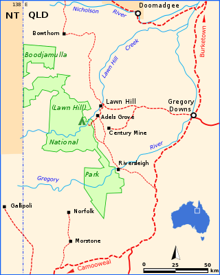
Boodjamulla National Park, formerly known as Lawn Hill National Park, is a national park in the Shire of Burke, Queensland, Australia. The Riversleigh World Heritage Area is a World Heritage Site within the park.

Boulia is an outback town and locality in the Shire of Boulia, Queensland, Australia. In the 2021 census, the locality of Boulia had a population of 314 people.
Doomadgee is a town and a locality in the Aboriginal Shire of Doomadgee, Queensland, Australia. It is a mostly Indigenous community, situated about 140 kilometres (87 mi) from the Northern Territory border, and 93 kilometres (58 mi) west of Burketown.

Mutchilba is a rural town and locality in the Shire of Mareeba, in Far North Queensland, Australia. It is known for its production of mangoes.

Burketown is an isolated outback town and coastal locality in the Shire of Burke, Queensland, Australia. In the 2021 census, the locality of Burketown had a population of 204 people.

The Shire of Burke is a local government area in North West Queensland, Australia. The shire lies on the south coast of the Gulf of Carpentaria and abuts the border with the Northern Territory. It covers an area of 39,864 square kilometres (15,391.6 sq mi), and has existed as a local government entity since 1885. The major town and administrative centre of the shire is Burketown.

The Aboriginal Shire of Doomadgee is a special local government area in North West Queensland, Queensland, Australia. It is managed under a Deed of Grant in Trust under the Local Government Act 2004.

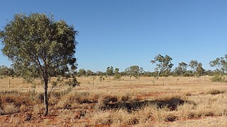
The Gulf Country or North West Queensland is the region of woodland and savanna grassland surrounding the Gulf of Carpentaria in north western Queensland and eastern Northern Territory on the north coast of Australia. The region is also called the Gulf Savannah. The Gulf Country is crossed by the Savannah Way highway.

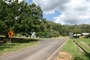
Gregory is an outback town and locality in the Shire of Burke, Queensland, Australia. In the 2021 census, the locality of Gregory had a population of 122 people.
Irvinebank is a rural town and locality in the Shire of Mareeba, Queensland, Australia. In the 2021 census, the locality of Irvinebank had a population of 113 people.

Watsonville is a rural town and locality in the Shire of Mareeba, Queensland, Australia. In the 2021 census, the locality of Watsonville had a population of 176 people.
Nicholson is a coastal locality in the Shire of Burke, Queensland, Australia. It is on the border with the Northern Territory. In the 2021 census, Nicholson had a population of 32 people.

Iron Range is a coastal locality in the Shire of Cook, Queensland, Australia. The town of Portland Road is on a north-east headland in the locality. In the 2021 census, Iron Range had a population of 30 people.
Waverley is an outback locality in the Shire of Boulia, Queensland, Australia. In the 2021 census, Waverley had a population of 6 people.

Four Ways is an outback locality in the Shire of Cloncurry, Queensland, Australia. In the 2021 census, Four Ways had a population of 76 people.

Gunpowder is an outback town and locality in the City of Mount Isa, Queensland, Australia. In the 2021 census, the locality of Gunpowder had a population of 104 people.
Kirknie is a rural locality in the Shire of Burdekin, Queensland, Australia. In the 2021 census, Kirknie had a population of 70 people.

Porcupine is an outback locality in the Shire of Flinders, Queensland, Australia. In the 2021 census, Porcupine had a population of 39 people.
Gangalidda is a coastal locality in the Aboriginal Shire of Doomadgee, Queensland, Australia, on the Gulf of Carpentaria. In the 2021 census, Gangalidda had "no people or a very low population".

Barkly is an outback locality in the City of Mount Isa, Queensland, Australia. The locality is on the Queensland border with Northern Territory. In the 2021 census, Barkly had a population of 25 people.

