{{native name|se|Davvesiidda gielda}}
{{native name|fkv|Lebespyyn komuuni}}"},"former_name":{"wt":""},"image_skyline":{"wt":"Lebesby Ifjordfjellet.JPG"},"image_caption":{"wt":"View of the Ifjordfjellet in Lebesby"},"idnumber":{"wt":"5624"},"county":{"wt":"Finnmark"},"district":{"wt":"Øst-Finnmark"},"capital":{"wt":"[[Kjøllefjord]]"},"established":{"wt":"1 Jan 1838"},"preceded":{"wt":"none"},"demonym":{"wt":"Lebesbyværing"},"language":{"wt":"Bokmål"},"coatofarms":{"wt":"Lebesby komm.svg"},"flag":{"wt":"Flag of Lebesby.png"},"webpage":{"wt":"www.lebesby.kommune.no"},"mayor":{"wt":"Sigurd Rafaelsen"},"mayor_party":{"wt":"[[Norwegian Labour Party|Ap]]"},"mayor_as_of":{"wt":"2019"},"elevation_max_m":{"wt":"1066.8"},"highest_point_ref":{"wt":"{{Cite web |date=2024-01-16 |title=Høgaste fjelltopp i kvar kommune |url=https://www.kartverket.no/til-lands/fakta-om-norge/hoyeste-fjelltopp-i-kommunen |publisher=[[Kartverket]] |language=no}}"},"area_rank":{"wt":"8"},"area_total_km2":{"wt":"3460.50"},"area_land_km2":{"wt":"3230.88"},"area_water_km2":{"wt":"229.62"},"area_water_percent":{"wt":"6.6"},"population_as_of":{"wt":"2024"},"population_rank":{"wt":"320"},"population_total":{"wt":"1215"},"population_density_km2":{"wt":"0.4"},"population_increase":{"wt":"-9.4"},"coordinates":{"wt":"{{coord|70|56|43|N|27|21|04|E|region:NO|display=inline,title}}"},"utm_zone":{"wt":"35W"},"utm_northing":{"wt":"7869108"},"utm_easting":{"wt":"0508755"},"geo_cat":{"wt":"adm2nd"}},"i":0}}]}" id="mwBg">Municipality in Finnmark, Norway
Lebesby Municipality Lebesby kommune | |
---|---|
View of the Ifjordfjellet in Lebesby | |
![]() Finnmark within Norway | |
![]() Lebesby within Finnmark | |
Coordinates: 70°56′43″N27°21′04″E / 70.94528°N 27.35111°E | |
Country | Norway |
County | Finnmark |
District | Øst-Finnmark |
Established | 1 Jan 1838 |
• Created as | Formannskapsdistrikt |
Administrative centre | Kjøllefjord |
Government | |
• Mayor (2019) | Sigurd Rafaelsen (Ap) |
Area | |
• Total | 3,460.50 km2 (1,336.11 sq mi) |
• Land | 3,230.88 km2 (1,247.45 sq mi) |
• Water | 229.62 km2 (88.66 sq mi) 6.6% |
• Rank | #8 in Norway |
Highest elevation | 1,066.8 m (3,500.0 ft) |
Population (2024) | |
• Total | 1,215 |
• Rank | #320 in Norway |
• Density | 0.4/km2 (1/sq mi) |
• Change (10 years) | ![]() |
Demonym | Lebesbyværing [2] |
Official language | |
• Norwegian form | Bokmål |
Time zone | UTC+01:00 (CET) |
• Summer (DST) | UTC+02:00 (CEST) |
ISO 3166 code | NO-5624 [4] |
Website | Official website |
Lebesby (Northern Sami : Davvesiida and Kven : Lebespyy) is a municipality in Finnmark county, Norway. The administrative centre of the municipality is the village of Kjøllefjord. Other villages in the municipality include Ifjord, Kunes, Lebesby, and Veidnes.
The 3,460.5-square-kilometre (1,336.1 sq mi) municipality is the 8th largest by area out of the 357 municipalities in Norway. Lebesby is the 320th most populous municipality in Norway with a population of 1,215. The municipality's population density is 0.4 inhabitants per square kilometre (1.0/sq mi) and its population has decreased by 9.4% over the previous 10-year period. [5] [6]
The municipality consists of the western half of the Nordkinn Peninsula, along with areas around the Laksefjorden. Most people live in the village of Kjøllefjord. This municipality is dominated by ethnic Norwegians, whereas the areas around the Laksefjorden are predominantly Sami. Fishing is the mainstay of the population.
There are 17 wind turbines that generate electrical power in Kjøllefjord, as of 2024. [7] The world's northernmost dairy farm that produces milk (Norwegian : melkebruk) is located in Bekkarfjord. [8]
The parish of Lebesby was established as a municipality on 1 January 1838 (see formannskapsdistrikt law). In 1864, the eastern part of Lebesby that surrounds the Tanafjorden (population: 1,388) was separated to become the new Tana Municipality. Tana was later separated into three: Tana Municipality, Gamvik Municipality, and Berlevåg Municipality. The borders of Lebesby have remained unchanged since that time. [9]
On 1 January 2020, the municipality became part of the newly formed Troms og Finnmark county. Previously, it had been part of the old Finnmark county. [10] On 1 January 2024, the Troms og Finnmark county was divided and the municipality once again became part of Finnmark county. [11]
The origins of the municipal name are uncertain. There are two main possibilities. Lebesby may be a Norwegianized form of a Northern Sami name Leaibbessiida. The first element is the genitive form of the word leaibi which means "grey alder". The last element is siida which means "reindeer camp" or "dwelling place". A second option for the origin of the name is that Lebesby is a corruption of the Old Norse word Liðvarðsbýr. The first element is Liðvarð which is a male name from long ago. The last element is býr which means "dwelling place" or "farmstead". [12] [13]
The coat of arms was granted on 22 July 1988. The official blazon is "Per fess embattled grady with three steps and two peaks Or and Sable" (Norwegian : Delt av gult og svart ved tredobbelt tindesnitt med to tinder). This means the arms have a field (background) that is divided by a line that is "embattled grady". A line embattled grady consists of series of two or three steps, as if each merlon has a smaller merlon atop it. The field below the line has a tincture of sable and the field above the line has a tincture of Or which means it is commonly colored yellow, but if it is made out of metal, then gold is used. The idea is that the arms represent the Finnkirka ("the Finn Church"), a cliff by the sea in the municipality. This cliff formation has the appearance of a church, and in former times was used by Sami people as a place of sacrifice. The arms were designed by Arvid Sveen. [14] [15] [16]
The municipality consists of the areas around the Laksefjorden, including the eastern part of the Sværholt Peninsula and the western half of the Nordkinn Peninsula. At the entrance to the Kjøllefjorden at the northwestern tip of the Nordkinn Peninsula, one finds the spectacular Finnkirka sea cliff, so named because of its soaring spires that look like a church. On the other side of the Oksefjorden on the northern end of the peninsula, the Kinnarodden cape (shared with Gamvik Municipality) is the northernmost point on the European mainland. There are several large lakes in the municipality including Kjæsvannet, Store Måsvannet, and Suolojávri. The highest point in the municipality is the 1,066.78-metre (3,499.9 ft) tall mountain Rásttigáisá. [1]
The same seacliffs mentioned above hold large numbers of breeding seabirds. In fact Norway's third largest seabird colony can be found in the municipality. Experiencing a seabird colony is one of nature's great experiences, here you can see and listen to thousands of birds with such species as fulmar and Atlantic puffin being a part of a fascinating ecosystem.
The world's northernmost birch forest is located in this municipality, near Oksefjorden, 9 kilometres (5.6 mi) east of Kjøllefjord ( 70°58′N27°34′E / 70.967°N 27.567°E ). [17]
Climate data for Lebesby | |||||||||||||
---|---|---|---|---|---|---|---|---|---|---|---|---|---|
Month | Jan | Feb | Mar | Apr | May | Jun | Jul | Aug | Sep | Oct | Nov | Dec | Year |
Daily mean °C (°F) | −6.8 (19.8) | −6.6 (20.1) | −4.5 (23.9) | −1.1 (30.0) | 3.5 (38.3) | 8.0 (46.4) | 11.0 (51.8) | 10.2 (50.4) | 6.5 (43.7) | 1.7 (35.1) | −2.3 (27.9) | −5.5 (22.1) | 1.2 (34.2) |
Average precipitation mm (inches) | 44 (1.7) | 36 (1.4) | 30 (1.2) | 29 (1.1) | 28 (1.1) | 38 (1.5) | 57 (2.2) | 54 (2.1) | 58 (2.3) | 59 (2.3) | 45 (1.8) | 42 (1.7) | 520 (20.5) |
Source: Norwegian Meteorological Institute [18] |
Lebesby Municipality is responsible for primary education (through 10th grade), outpatient health services, senior citizen services, welfare and other social services, zoning, economic development, and municipal roads and utilities. The municipality is governed by a municipal council of directly elected representatives. The mayor is indirectly elected by a vote of the municipal council. [19] The municipality is under the jurisdiction of the Indre og Østre Finnmark District Court and the Hålogaland Court of Appeal.
The municipal council (Kommunestyre) of Lebesby is made up of 17 representatives that are elected to four year terms. The tables below show the current and historical composition of the council by political party.
Party name (in Norwegian) | Number of representatives | |
---|---|---|
Labour Party (Arbeiderpartiet) | 10 | |
Conservative Party (Høyre) | 3 | |
Centre Party (Senterpartiet) | 2 | |
Socialist Left Party (Sosialistisk Venstreparti) | 2 | |
Total number of members: | 17 |
Party name (in Norwegian) | Number of representatives | |
---|---|---|
Labour Party (Arbeiderpartiet) | 8 | |
Conservative Party (Høyre) | 1 | |
Centre Party (Senterpartiet) | 4 | |
Socialist Left Party (Sosialistisk Venstreparti) | 2 | |
Lebesby Cross-Party List (Lebesby Tverrpolitiske liste) | 2 | |
Total number of members: | 17 |
Party name (in Norwegian) | Number of representatives | |
---|---|---|
Labour Party (Arbeiderpartiet) | 8 | |
Green Party (Miljøpartiet De Grønne) | 2 | |
Conservative Party (Høyre) | 1 | |
Socialist Left Party (Sosialistisk Venstreparti) | 1 | |
Lebesby Cross-Party List (Lebesby Tverrpolitiske liste) | 5 | |
Total number of members: | 17 |
Party name (in Norwegian) | Number of representatives | |
---|---|---|
Labour Party (Arbeiderpartiet) | 11 | |
Non-Socialist Common List (Borgerlig Fellesliste) | 6 | |
Total number of members: | 17 |
Party name (in Norwegian) | Number of representatives | |
---|---|---|
Labour Party (Arbeiderpartiet) | 11 | |
Conservative Party (Høyre) | 2 | |
Centre Party (Senterpartiet) | 2 | |
Socialist Left Party (Sosialistisk Venstreparti) | 2 | |
Total number of members: | 17 |
Party name (in Norwegian) | Number of representatives | |
---|---|---|
Labour Party (Arbeiderpartiet) | 8 | |
Conservative Party (Høyre) | 3 | |
Centre Party (Senterpartiet) | 2 | |
Socialist Left Party (Sosialistisk Venstreparti) | 4 | |
Total number of members: | 17 |
Party name (in Norwegian) | Number of representatives | |
---|---|---|
Labour Party (Arbeiderpartiet) | 9 | |
Conservative Party (Høyre) | 4 | |
Coastal Party (Kystpartiet) | 2 | |
Socialist Left Party (Sosialistisk Venstreparti) | 2 | |
Total number of members: | 17 |
Party name (in Norwegian) | Number of representatives | |
---|---|---|
Labour Party (Arbeiderpartiet) | 10 | |
Conservative Party (Høyre) | 5 | |
Socialist Left Party (Sosialistisk Venstreparti) | 5 | |
Dyfjord Village List (Dyfjord Bygdeliste) | 1 | |
Total number of members: | 21 |
Party name (in Norwegian) | Number of representatives | |
---|---|---|
Labour Party (Arbeiderpartiet) | 11 | |
Conservative Party (Høyre) | 5 | |
Socialist Left Party (Sosialistisk Venstreparti) | 5 | |
Total number of members: | 21 |
Party name (in Norwegian) | Number of representatives | |
---|---|---|
Labour Party (Arbeiderpartiet) | 13 | |
Conservative Party (Høyre) | 3 | |
Christian Democratic Party (Kristelig Folkeparti) | 2 | |
Socialist Left Party (Sosialistisk Venstreparti) | 3 | |
Total number of members: | 21 |
Party name (in Norwegian) | Number of representatives | |
---|---|---|
Labour Party (Arbeiderpartiet) | 14 | |
Conservative Party (Høyre) | 3 | |
Christian Democratic Party (Kristelig Folkeparti) | 1 | |
Centre Party (Senterpartiet) | 1 | |
Socialist Left Party (Sosialistisk Venstreparti) | 2 | |
Total number of members: | 21 |
Party name (in Norwegian) | Number of representatives | |
---|---|---|
Labour Party (Arbeiderpartiet) | 12 | |
Conservative Party (Høyre) | 5 | |
Christian Democratic Party (Kristelig Folkeparti) | 2 | |
Centre Party (Senterpartiet) | 1 | |
Joint list of the Socialist Left Party (Sosialistisk Venstreparti) and the Communist Party (Kommunistiske Parti) | 1 | |
Total number of members: | 21 |
Party name (in Norwegian) | Number of representatives | |
---|---|---|
Labour Party (Arbeiderpartiet) | 13 | |
Conservative Party (Høyre) | 3 | |
Christian Democratic Party (Kristelig Folkeparti) | 2 | |
Socialist Left Party (Sosialistisk Venstreparti) | 2 | |
Local List(s) (Lokale lister) | 1 | |
Total number of members: | 21 |
Party name (in Norwegian) | Number of representatives | |
---|---|---|
Labour Party (Arbeiderpartiet) | 17 | |
Conservative Party (Høyre) | 4 | |
Total number of members: | 21 |
Party name (in Norwegian) | Number of representatives | |
---|---|---|
Labour Party (Arbeiderpartiet) | 14 | |
Conservative Party (Høyre) | 3 | |
List of workers, fishermen, and small farmholders (Arbeidere, fiskere, småbrukere liste) | 4 | |
Total number of members: | 21 |
Party name (in Norwegian) | Number of representatives | |
---|---|---|
Labour Party (Arbeiderpartiet) | 16 | |
Conservative Party (Høyre) | 2 | |
List of workers, fishermen, and small farmholders (Arbeidere, fiskere, småbrukere liste) | 3 | |
Total number of members: | 21 |
Party name (in Norwegian) | Number of representatives | |
---|---|---|
Labour Party (Arbeiderpartiet) | 14 | |
List of workers, fishermen, and small farmholders (Arbeidere, fiskere, småbrukere liste) | 4 | |
Local List(s) (Lokale lister) | 3 | |
Total number of members: | 21 |
Party name (in Norwegian) | Number of representatives | |
---|---|---|
Labour Party (Arbeiderpartiet) | 14 | |
List of workers, fishermen, and small farmholders (Arbeidere, fiskere, småbrukere liste) | 1 | |
Local List(s) (Lokale lister) | 4 | |
Total number of members: | 19 |
Party name (in Norwegian) | Number of representatives | |
---|---|---|
Labour Party (Arbeiderpartiet) | 12 | |
Joint List(s) of Non-Socialist Parties (Borgerlige Felleslister) | 3 | |
Local List(s) (Lokale lister) | 1 | |
Total number of members: | 16 |
Party name (in Norwegian) | Number of representatives | |
---|---|---|
Labour Party (Arbeiderpartiet) | 11 | |
Communist Party (Kommunistiske Parti) | 1 | |
List of workers, fishermen, and small farmholders (Arbeidere, fiskere, småbrukere liste) | 2 | |
Local List(s) (Lokale lister) | 2 | |
Total number of members: | 16 |
Party name (in Norwegian) | Number of representatives | |
---|---|---|
Labour Party (Arbeiderpartiet) | 5 | |
List of workers, fishermen, and small farmholders (Arbeidere, fiskere, småbrukere liste) | 3 | |
Local List(s) (Lokale lister) | 8 | |
Total number of members: | 16 |
Party name (in Norwegian) | Number of representatives | |
---|---|---|
Labour Party (Arbeiderpartiet) | 8 | |
List of workers, fishermen, and small farmholders (Arbeidere, fiskere, småbrukere liste) | 1 | |
Joint List(s) of Non-Socialist Parties (Borgerlige Felleslister) | 6 | |
Local List(s) (Lokale lister) | 1 | |
Total number of members: | 16 | |
Note: Due to the German occupation of Norway during World War II, no elections were held for new municipal councils until after the war ended in 1945. |
The mayors (Norwegian : ordfører) of Lebesby: [39]
The Church of Norway has two parishes (sokn) within the municipality of Lebesby. It is part of the Hammerfest prosti (deanery) in the Diocese of Nord-Hålogaland.
Parish (sokn) | Church name | Location of the church | Year built |
---|---|---|---|
Kjøllefjord | Kjøllefjord Church | Kjøllefjord | 1951 |
Lebesby | Lebesby Church | Lebesby | 1962 |
Kunes Chapel | Kunes | 1982 |
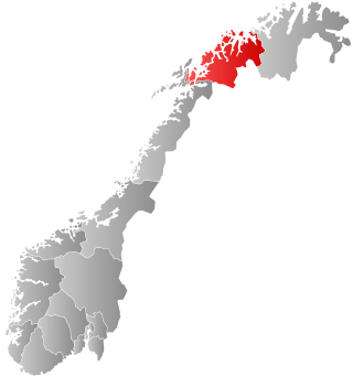
Vardø is a municipality in Finnmark county in the extreme northeastern part of Norway. Vardø is the easternmost town in Norway, more to the east than Saint Petersburg or Istanbul. The administrative centre of the municipality is the town of Vardø. Two of the larger villages in the municipality are Kiberg and Svartnes.
Nordkapp is a municipality in Finnmark county, Norway. The administrative centre of the municipality is the town of Honningsvåg, where most residents live. Other settlements in Nordkapp include the villages of Gjesvær, Kåfjord, Kamøyvær, Kjelvik, Nordvågen, Repvåg, Skarsvåg, and Valan.
Porsanger is a municipality in Finnmark county, Norway. The administrative centre of the municipality is the village of Lakselv. Other villages in the municipality include Børselv, Brenna, Indre Billefjord, Kistrand, Olderfjord, and Skoganvarre.
(Norwegian) or Kárášjohka is a municipality in Finnmark county, Norway. The administrative centre of the municipality is the village of Karasjok. Other villages include Dorvonjárga, Šuoššjávri, and Váljohka.
is a municipality in Finnmark county, Norway. The administrative centre of the municipality is the village of Mehamn. The other notable villages in Gamvik include Gamvik and Skjånes. Gamvik is known as one of the poorest and most undeveloped municipalities in Norway. The number of inhabitants rose at one moment in 2012, but in 2014, after the fish factory closed, the population declined dramatically with the departure of the eastern European fishermen.
Deatnu (Northern Sami) or Tana (Norwegian) is a municipality in Finnmark county, Norway. The administrative centre of the municipality is the village of Tana bru. Among the other villages in the municipality are Austertana, Bonakas, Polmak, Rustefjelbma, and Skiippagurra.
Båtsfjord is a municipality in Finnmark county, Norway. The administrative centre of the municipality is the village of Båtsfjord. Båtsfjord Airport is a new, modern airport, located just outside Båtsfjord village. The Hurtigruten coastal express ferry also has regularly-scheduled stops in Båtsfjord village.
Sør-Varanger is a municipality in Finnmark county, Norway. The administrative centre of the municipality is the town of Kirkenes. Other settlements in the municipality include the villages of Bjørnevatn, Bugøynes, Elvenes, Grense Jakobselv, Hesseng, Jakobsnes, Neiden, and Sandnes. Located west of the Norway–Russia border, Sør-Varanger is the only Norwegian municipality that shares a land border with Russia, with the only legal border crossing at Storskog.
Leirfjord is a municipality in Nordland county, Norway. It is part of the Helgeland traditional region. The administrative centre of the municipality is the village of Leland. Other villages in Leirfjord include Bardal and Sundøya. The large Helgeland Bridge is partly located in the municipality, connecting it to Alstahaug Municipality and the town of Sandnessjøen.
Ibestad is a municipality in Troms county, Norway. It is part of the traditional region of Central Hålogaland. The administrative centre of the municipality is the village of Hamnvik. Some of the other larger villages in Ibestad include Engenes, Laupstad, Rollnes, Sørrollnes, Sørvika, and Å.
Gratangen (Norwegian) or Rivtták (Northern Sami) is a municipality in Troms county, Norway. It is part of the traditional region of Central Hålogaland. The administrative centre of the municipality is the village of Årstein.
Lavangen (Norwegian) or Loabák (Northern Sami) is a municipality in Troms county, Norway. The administrative centre of the municipality is the village of Tennevoll. Other villages in Lavangen include Fossbakken and Spansdalen and Kjeiprød, Røkenes, Låternes, Tennevoll, Hesjevika, Soløy, and Å.
Bardu is a municipality in Troms county, Norway. The administrative centre of the municipality is the village of Setermoen, the largest urban area in the municipality.
Målselv is a municipality in Troms county, Norway. The administrative centre of the municipality is the village of Moen. The main commercial centre of the municipality is the town of Bardufoss. Other villages in the municipality include Alapmoen, Fossmoen, Holmen, and Skjold.
Sørreisa is a municipality in Troms county, Norway. The administrative centre of the municipality is the village of Sørreisa. Other villages include Grunnreisa, Skøelva, and Smørsgård.
Dyrøy is a municipality in Troms county, Norway. The administrative centre of the municipality is the village of Brøstadbotn. Other villages include Dyrøyhamn, Espenes, Holm, and Hundstrand.
Storfjord (Norwegian), Omasvuotna, or Omasvuono (Kven) is a municipality in Troms county, Norway. The administrative centre of the municipality is the village of Hatteng. Other villages in Storfjord include Elvevoll, Oteren, and Skibotn.
Kåfjord (Norwegian), Gáivuotna[ˈkaːjːvuo̯tna] (Northern Sami), or Kaivuono (Kven) is a municipality in Troms county, Norway. The administrative centre of the municipality is the village of Olderdalen. Other notable villages include Løkvollen, Manndalen, Birtavarre, Trollvik, Samuelsberg, Nordmannvik, and Djupvik.
Nordreisa (Norwegian), Ráisa, or Raisi (Kven) is a municipality in Troms county, Norway. The administrative centre of the municipality is the village of Storslett. Other villages include Oksfjordhamn, Sørkjosen, and Rotsund.
Kvænangen is a municipality in Troms county, Norway. The administrative centre of the municipality is the village of Burfjord. Other notable villages in the municipality include Alteidet, Badderen, Kjækan, and Sekkemo. The European route E6 highway goes through the municipality and over the Sørstraumen Bridge, and many people stop at the Kvænangsfjellet pass to view the scenery of the Kvænangen fjord.
verdens nordligste melkebruk