Lehigh, Oklahoma

Last updated

Lehigh, Oklahoma
Lehigh, Oklahoma.jpg
Owl Grocery in Lehigh, 2012
OKMap-doton-Lehigh.PNG
Location of Lehigh, Oklahoma
Coordinates: 34°28′14″N96°13′15″W / 34.47056°N 96.22083°W / 34.47056; -96.22083
Country United States
State Oklahoma
County Coal
Area
[1]
  Total1.62 sq mi (4.20 km2)
  Land1.57 sq mi (4.07 km2)
  Water0.05 sq mi (0.14 km2)
Elevation
[2]
600 ft (200 m)
Population
 (2020)
  Total272
  Density173.14/sq mi (66.84/km2)
Time zone UTC-6 (Central (CST))
  Summer (DST) UTC-5 (CDT)
ZIP code
74556
Area code 580
FIPS code 40-42200 [3]
GNIS feature ID2410817 [2]

Lehigh is a city in Coal County, Oklahoma, United States. Its population was 356 at the 2010 census. [4]

Contents

History

Lehigh began as the first mining camp in what is now Coal County, Oklahoma. [5] At the time of its founding, Lehigh was located in Atoka County, Choctaw Nation. [6] It was originally named Boone, but the name was changed to Lehigh. [5] The new name was taken from Lehigh County, Pennsylvania, a coal-mining region. [7] [5]

A post office opened in Lehigh, Indian Territory, on April 4, 1882, and several railroads built lines to Lehigh, including the Missouri–Kansas–Texas Railroad, the Chicago, Rock Island and Pacific Railway, and the Gulf, Colorado and Santa Fe Railway. [5] [lower-alpha 1] In addition to mining, ranching was an important contributor to the local economy. Stockyards were built in 1884 and, even as they neared completion, 23 railroad cars of cattle and seven carloads of hogs awaited shipping. [9]

During the late 19th and early 20th centuries, Lehigh was a growing settlement that greatly profited from the coal mines surrounding it. [10] During the 1910s and 1920s, the demand for coal lessened as railroads switched to oil-powered trains. [10] [lower-alpha 2] The mines eventually closed, and in the early 1920s, boll weevils destroyed the cotton crops in the area. [10] Many businesses closed, and people left the town. [10] The Merchants National Bank Building in Lehigh is the only structure that remains from the once-prosperous downtown area. [10]

Geography

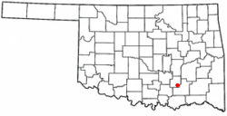
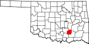
Lehigh is located in southeastern Coal County. U.S. Route 75 passes through the city, leading north 5 miles (8 km) to Coalgate, the county seat, and southeast 9 miles (14 km) to Atoka.

According to the United States Census Bureau, the city has a total area of 1.6 square miles (4.1 km2), of which 0.04 square miles (0.10 km2) (2.47%) is covered by water.

Climate

Climate data for Lehigh, Oklahoma
MonthJanFebMarAprMayJunJulAugSepOctNovDecYear
Mean daily maximum °F (°C)49.2
(9.6)
54.6
(12.6)
63.9
(17.7)
73.5
(23.1)
79.6
(26.4)
87.4
(30.8)
93.4
(34.1)
94.1
(34.5)
85.7
(29.8)
75.7
(24.3)
63.4
(17.4)
52.9
(11.6)
72.8
(22.7)
Mean daily minimum °F (°C)27.0
(−2.8)
31.4
(−0.3)
40.6
(4.8)
50.2
(10.1)
58.5
(14.7)
66.6
(19.2)
71.0
(21.7)
70.1
(21.2)
63.0
(17.2)
51.3
(10.7)
40.9
(4.9)
30.9
(−0.6)
50.1
(10.1)
Average precipitation inches (mm)2.0
(51)
2.5
(64)
3.6
(91)
4.6
(120)
5.3
(130)
4.2
(110)
2.5
(64)
2.5
(64)
4.8
(120)
3.7
(94)
3.2
(81)
2.3
(58)
41.3
(1,050)
Source 1: weather.com
Source 2: Weatherbase.com [12]

Demographics

Historical population
CensusPop.Note
1900 1,500
1910 1,88025.3%
1920 1,8981.0%
1930 497−73.8%
1940 5194.4%
1950 352−32.2%
1960 296−15.9%
1970 2960.0%
1980 284−4.1%
1990 3036.7%
2000 3154.0%
2010 35613.0%
2020 272−23.6%
U.S. Decennial Census [13]

At the 2000 census, [3] 315 people, 114 households and 77 families were residing in the city. The population density was 199.9 inhabitants per square mile (77.2/km2). The 144 housing units had an average density of 91.4 per square mile (35.3/km2). The racial makeup of the city was 76.51% White, 0.95% African American, 14.92% Native American, 0.95% Asian, and 6.67% from two or more races. Hispanics or Latinos of any race were 1.27% of the population.

Of the 114 households,29.8% had children under 18 living with them, 50.9% were married couples living together, 10.5% had a female householder with no husband present, and 31.6% were not families. About 24.6% of all households were made up of individuals, and 8.8% had someone living alone who was 65 or older. The average household size was 2.76, and the average family size was 3.26.

The age distribution was 28.9% under 18, 9.2% from 18 to 24, 26.7% from 25 to 44, 21.3% from 45 to 64, and 14.0% who were 65 or older. The median age was 35 years. For every 100 females, there were 111.4 males. For every 100 females 18 and over, there were 101.8 males.

The median household income was $24,16, and the median family income was $25,156. Males had a median income of $20,278 compared with $17,344 for females. The per capita income was $10,699. About 18.8% of families and 27.7% of the population were below the poverty line, including 37.8% of those under 18 and 12.5% of those 65 or over.

Notable people

Notes

  1. At least one other railroad, the Clinton and Oklahoma Western Railway Company, was chartered specifically to build a line to Lehigh—this one from Clinton, Oklahoma—but never did so. This company did build a line in the opposite direction, becoming the Clinton and Oklahoma Western Railroad. [8]
  2. By the time of the Thirty-sixth annual report of the Department of Mines and Minerals in 1943, combined yearly production by the Lehigh Coal Company, Dawley Coal Company and the Wells Coal Company—all of Lehigh—was 2,562 tons. For comparison, combined production by companies in Henryetta, Oklahoma, that year was over 600,000 tons. [11]

See also

Related Research Articles

<span class="mw-page-title-main">Pittsburg County, Oklahoma</span> County in Oklahoma, United States

Pittsburg County is a county located in the U.S. state of Oklahoma. As of the 2020 census, the population was 43,773. Its county seat is McAlester. The county was formed from part of the Choctaw Nation in Indian Territory in 1907. County leaders believed that its coal production compared favorably with Pittsburgh, Pennsylvania at the time of statehood.

<span class="mw-page-title-main">Latimer County, Oklahoma</span> County in Oklahoma, United States

Latimer County is a county located in the southeastern part of the U.S. state of Oklahoma. Its county seat is Wilburton. As of the 2020 census, the population was 9,444. The county was created at statehood in 1907 and named for James L. Latimer, a delegate from Wilburton to the 1906 state Constitutional Convention. Prior to statehood, it had been for several decades part of Gaines County, Sugar Loaf County, and Wade County in the Choctaw Nation.

<span class="mw-page-title-main">Johnston County, Oklahoma</span> County in Oklahoma, United States

Johnston County is a county located in the U.S. state of Oklahoma. As of the 2020 census, the population was 10,272. Its county seat is Tishomingo. It was established at statehood on November 16, 1907, and named for Douglas H. Johnston, a governor of the Chickasaw Nation.

<span class="mw-page-title-main">Coal County, Oklahoma</span> County in Oklahoma, United States

Coal County is a county located in the U.S. state of Oklahoma. As of the 2020 census, the population was 5,266. Its county seat is Coalgate.

<span class="mw-page-title-main">Atoka County, Oklahoma</span> County in Oklahoma, United States

Atoka County is a county located in the U.S. state of Oklahoma. As of the 2020 census, the population was 14,143. Its county seat is Atoka. The county was formed before statehood from Choctaw Lands, and its name honors a Choctaw Chief named Atoka. The county is part of Choctaw Nation reservation lands.

<span class="mw-page-title-main">Lehigh, Iowa</span> City in Iowa, United States

Lehigh is a city in Webster County, Iowa, United States. The population was 395 at the time of the 2020 census.

<span class="mw-page-title-main">Atoka, Oklahoma</span> City in Oklahoma, United States

Atoka is a city in and the county seat of Atoka County, Oklahoma, United States. The population was 3,107 at the 2010 census, an increase of 4.0 percent from the figure of 2,988 in 2000. As of 2021, the population has grown to 3,188.

<span class="mw-page-title-main">Caney, Oklahoma</span> Town in Oklahoma, United States

Caney is a town in Atoka County, Oklahoma, United States. The population was 205 at the 2010 census.

<span class="mw-page-title-main">Tushka, Oklahoma</span> Town in Oklahoma, United States

Tushka is a town in Atoka County, Oklahoma, United States. The population was 312 at the 2010 census, a decline of 9.6 percent from the figure of 345 recorded in 2000.

<span class="mw-page-title-main">Coalgate, Oklahoma</span> City in Oklahoma, United States

Coalgate is a city in and the county seat of Coal County, Oklahoma, United States. The population was 1,967 at the 2010 census, a 1.9 percent decrease from the figure of 2,005 recorded in 2000. The town was founded in 1889 in the Choctaw Nation, Indian Territory as a coal mining camp named Liddle. The name changed to Coalgate on January 23, 1890.

<span class="mw-page-title-main">Phillips, Oklahoma</span> Town in Oklahoma, United States

Phillips is a town in Coal County, Oklahoma, United States. The population was 135 at the 2010 census.

McCurtain is a town in Haskell County, Oklahoma, United States. The population was 357 at the 2020 census, a 30.8% decrease over the figure of 516 recorded in 2010. A coal mine disaster in 1912 killed 73 miners and ended McCurtain's prosperity. The mine explosion remains one of the worst disasters in Oklahoma history.

<span class="mw-page-title-main">Wilburton, Oklahoma</span> City in Oklahoma, United States

Wilburton is a city in Latimer County, Oklahoma, United States. It is the county seat of Latimer County. The city had a population of 2,285 as of the 2020 Census. Robbers Cave State Park is 5 miles (8.0 km) north of Wilburton.

<span class="mw-page-title-main">Howe, Oklahoma</span> Town in Oklahoma, United States

Howe is a town in Le Flore County, Oklahoma, United States. It is part of the Fort Smith, Arkansas-Oklahoma Metropolitan Statistical Area. The population was 802 at the 2010 census, a gain of 15.1 percent over the figure of 697 recorded in 2000. The town was once noted for producing coal and coke, but today is chiefly supported by agriculture.

<span class="mw-page-title-main">Panama, Oklahoma</span> Town in Oklahoma, United States

Panama is a town in Le Flore County, Oklahoma, United States. It is part of the Fort Smith, Arkansas-Oklahoma Metropolitan Statistical Area. The population was 1,413 at the 2010 census.

<span class="mw-page-title-main">Shady Point, Oklahoma</span> Town in Oklahoma, United States

Shady Point, sometimes referred to as Shadypoint, is a town in Le Flore County, Oklahoma, United States. It is part of the Fort Smith, Arkansas-Oklahoma Metropolitan Statistical Area. The population was 1,026 at the 2010 census, a 21.0 percent increase over the figure of 848 recorded in 2000.

<span class="mw-page-title-main">Haileyville, Oklahoma</span> City in Oklahoma, United States

Haileyville is a city in Pittsburg County, Oklahoma, United States. The population was 813 at the 2010 census.

<span class="mw-page-title-main">Krebs, Oklahoma</span> City in Oklahoma, United States

Krebs is a city in Pittsburg County, Oklahoma, United States. The population was 2,053 at the 2010 census, a slight increase from 2,051 in 2000. Its nickname is "Little Italy." Krebs was founded before Oklahoma statehood as a coal-mining town in the Choctaw Nation of Indian Territory.

Pittsburg is a town in Pittsburg County, Oklahoma, United States. The population was 280 at the 2000 census.

<span class="mw-page-title-main">Savanna, Oklahoma</span> Town in Oklahoma, United States

Savanna is a town in Pittsburg County, Oklahoma, United States. The population was 686 at the 2010 census, a decline of 6.0 percent from the figure of 730 recorded in 2000.

References

Commons-logo.svg Media related to Lehigh, Oklahoma at Wikimedia Commons

  1. "ArcGIS REST Services Directory". United States Census Bureau. Retrieved September 20, 2022.
  2. 1 2 U.S. Geological Survey Geographic Names Information System: Lehigh, Oklahoma
  3. 1 2 "U.S. Census website". United States Census Bureau . Retrieved January 31, 2008.
  4. "Geographic Identifiers: 2010 Demographic Profile Data (G001): Lehigh city, Oklahoma". U.S. Census Bureau, American Factfinder. Archived from the original on March 9, 2015. Retrieved March 4, 2015.
  5. 1 2 3 4 Caruthers, Lorene. "Lehigh," Encyclopedia of Oklahoma History and Culture, Oklahoma Historical Society, Accessed July 4, 2015.
  6. Morris, John W. Historical Atlas of Oklahoma (Norman: University of Oklahoma, 1986), plate 38.
  7. Gannett, Henry (1905). The Origin of Certain Place Names in the United States. U.S. Government Printing Office. p.  184.
  8. "Railroads of Oklahoma, June 6, 1870 to April 1, 1978, p.36". Oklahoma Digital Prairie. Retrieved October 12, 2021.
  9. The Branding Iron newspaper, published in Atoka, Indian Territory, March 15, 1884, page 1.
  10. 1 2 3 4 5 Jim Gabbart (October 26, 2006). "National Register of Historic Places Inventory/Nomination: Merchants National Bank Building" (pdf). National Park Service.{{cite journal}}: Cite journal requires |journal= (help) "Accompanying 7 photos, from 2006" (pdf). National Register of Historic Places Inventory.
  11. "Thirty-sixth annual report of the Department of Mines and Minerals, 1943, pp.12- 15". Oklahoma Digital Prairie. Retrieved May 8, 2021.
  12. "Historical Weather for Lehigh, Oklahoma, United States".
  13. "Census of Population and Housing". Census.gov. Retrieved June 4, 2015.
  14. Meserve, John Bartlett. "Chief Benjamin Franklin Smallwood and Chief Jefferson Gardner," Archived 2016-03-04 at the Wayback Machine Chronicles of Oklahoma, Volume 19, No. 3, September, 1941.
  15. Muriel Hazel Wright, Joey Horsley, FemBio.org, retrieved 8 February 2015