Lewisville, Idaho

Last updated

Lewisville, Idaho
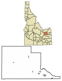
Jefferson County Idaho Incorporated and Unincorporated areas Lewisville Highlighted 1646720.svg
Location of Lewisville in Jefferson County, Idaho
Coordinates: 43°41′41″N112°0′44″W / 43.69472°N 112.01222°W / 43.69472; -112.01222
Country United States
State Idaho
County Jefferson
Area
[1]
  Total
0.60 sq mi (1.56 km2)
  Land0.60 sq mi (1.56 km2)
  Water0.00 sq mi (0.00 km2)
Elevation
4,800 ft (1,463 m)
Population
 (2010) [2]
  Total
458
  Estimate 
(2019) [3]
520
  Density860.93/sq mi (332.50/km2)
Time zone UTC-7 (Mountain (MST))
  Summer (DST) UTC-7 (MDT)
ZIP code
83431
Area code 208
FIPS code 16-46720
GNIS feature ID0396790
Website www.cityoflewisville.org

Lewisville is a city in Jefferson County, Idaho, United States. The population was 458 at the 2010 census.

Contents

Lewisville is part of the Idaho Falls Metropolitan Statistical Area.

History

Lewisville was established in 1882.

In 1960, Lewisville became the corporate headquarters of Idahoan Foods, a producer of dehydrated potato products such as instant mashed potatoes, potato casserole, and hash browns. In 2011, the headquarters was moved to Idaho Falls, 14 mi (23 km) south, though it still maintains its main plant in Lewisville. [4]

For the city's important role in Idaho's potato industry, Governor Butch Otter proclaimed August 11, 2007 "Lewisville Day" statewide. [5]

Geography

Lewisville is located at 43°41′41″N112°0′44″W / 43.69472°N 112.01222°W / 43.69472; -112.01222 (43.694860, -112.012110). [6]

According to the United States Census Bureau, the city has a total area of 0.63 square miles (1.63 km2), all of it land. [7]

Demographics

Historical population
CensusPop.Note
1910 346
1920 38310.7%
1930 285−25.6%
1940 37130.2%
1950 4028.4%
1960 385−4.2%
1970 46821.6%
1980 5027.3%
1990 471−6.2%
2000 467−0.8%
2010 458−1.9%
2019 (est.)520 [3] 13.5%
U.S. Decennial Census [8]

As of 2000 the median income for a household in the city was $55,481, and the median income for a family was $56,442 . Males had a median income of $30,476 versus $12,115 for females. The per capita income for the city was $16,306. About 1.60% of families and 7.11% of the population were below the poverty line.

2010 census

As of the census [9] of 2010, there were 458 people, 159 households, and 129 families residing in the city. The population density was 732.52 inhabitants per square mile (282.83/km2). There were 167 housing units at an average density of 265.8 units per square mile (102.6 units/km2). The racial makeup of the city was 89.74% White, 11.35% Hispanic, 0.87% Native American, 0.44% Asian, 7.21% from other races, and 1.75% from two or more races.

There were 129 households, of which 34.6% had children under the age of 18 living with them, 66.7% were married couples living together, 9.4% had a female householder with no husband present, 5% had a male householder with no wife present. 16.4% had someone living alone who was 65 years of age or older. The average household size was 2.88 and the average family size was 3.19.

In the city, the population was spread out, with 28.6% under the age of 18, 7.3% from 18 to 24, 23.1% from 25 to 44, 25.8% from 45 to 64, and 15.2% who were 65 years of age or older. The median age was 34 years. For every 100 females, there were 105.7 males. For every 100 females age 18 and over, there were 102.5 males.

Education

Lewisville is in Jefferson County School District 251. [10] It is zoned to Midway Elementary School in Menan. [11]

Related Research Articles

<span class="mw-page-title-main">Jefferson County, Idaho</span> County in Idaho, United States

Jefferson County is a county located in the U.S. state of Idaho. As of the 2020 Census, the county's population was 30,891. The county seat and largest city is Rigby. The county was established in 1913 and named after Thomas Jefferson, the third U.S. President. Jefferson County is part of the Idaho Falls, ID Metropolitan Statistical Area.

<span class="mw-page-title-main">Lewisville, Arkansas</span> City in Arkansas, United States

Lewisville is a city in Lafayette County, Arkansas, United States. The population was 1,280 at the 2010 census. It is the county seat of Lafayette County.

<span class="mw-page-title-main">Garden City, Idaho</span> City in Idaho, United States

Garden City is a city in Ada County, Idaho. The population was 12,316 at the time of the 2020 census. Garden City is nearly surrounded by Boise but retains a separate municipal government.

<span class="mw-page-title-main">Chubbuck, Idaho</span> City in Idaho, United States

Chubbuck is a city in Bannock County, Idaho. It is part of the Pocatello Metropolitan Statistical Area. The population was 15,570 at the 2020 census. Chubbuck is located immediately north of Pocatello, Idaho, and has opposed several consolidation proposals since the 1960s.
<span class="mw-page-title-main">Downey, Idaho</span> City in Bannock County, Idaho, United States

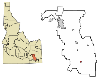
Downey is a city in the Marsh Valley in southern Bannock County, Idaho, United States. It is part of the Pocatello Metropolitan Statistical Area. The population was 571 at the 2020 census.
<span class="mw-page-title-main">Basalt, Idaho</span> City in Bingham County, Idaho, United States

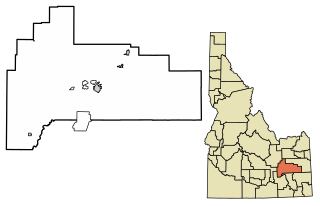
Basalt is a city in Bingham County, Idaho, United States. The population was 394 at the 2010 census.
<span class="mw-page-title-main">Firth, Idaho</span> City in Bingham County, Idaho, United States

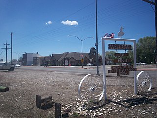
Firth is a town in Bingham County, Idaho, United States. The population was 517 at the 2020 census.

<span class="mw-page-title-main">Shelley, Idaho</span> City in Bingham County, Idaho, United States

Shelley is a city in Bingham County, Idaho, United States. The population was 4,409 at the 2010 census.
<span class="mw-page-title-main">Ucon, Idaho</span> City in Idaho, United States

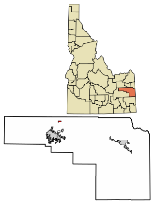
Ucon is a city in Bonneville County, Idaho, United States. It is part of the Idaho Falls, Idaho Metropolitan Statistical Area. The population was 1,108 at the 2010 census. Ucon was first settled in 1883.

<span class="mw-page-title-main">Wilder, Idaho</span> City in Idaho, United States

Wilder is a city in Canyon County, Idaho, United States. The population was 1,533 at the 2010 census.

<span class="mw-page-title-main">Albion, Idaho</span> City in Idaho, United States

Albion is a city in Cassia County, Idaho, United States. It is part of the Burley, Idaho Micropolitan Statistical Area. The population was 234 at the 2020 census. Albion was the county seat of Cassia County from 1879 to 1918.

<span class="mw-page-title-main">Oxford, Idaho</span> City in Idaho, United States

Oxford is a city in Franklin County, Idaho, United States. The population was 42 at the 2020 census.

<span class="mw-page-title-main">Drummond, Idaho</span> City in Idaho, United States

Drummond is a city in Fremont County, Idaho, United States. The population was 16 at the 2010 census. It is part of the Rexburg, Idaho Micropolitan Statistical Area.

<span class="mw-page-title-main">Hamer, Idaho</span> City in Idaho, United States

Hamer is a city in Jefferson County, Idaho, United States. It is part of the Idaho Falls Metropolitan Statistical Area. The population was 83 at the 2020 census.

<span class="mw-page-title-main">Menan, Idaho</span> City in Idaho, United States

Menan is a city in Jefferson County, Idaho, United States. It is part of the Idaho Falls, Idaho Metropolitan Statistical Area. The population was 741 at the 2010 census.

<span class="mw-page-title-main">Mud Lake, Idaho</span> City in Idaho, United States

Mud Lake is a city in Jefferson County, Idaho, United States. It is part of the Idaho Falls, Idaho Metropolitan Statistical Area. The population was 358 at the 2010 census. Since then the population has grown to 419 as seen in the 2020 census as well as Idaho demographics

<span class="mw-page-title-main">Rigby, Idaho</span> City in Idaho, United States

Rigby is a city in and the county seat of Jefferson County, Idaho, United States. The population was 5,038 at the 2020 census, up from 3,945 in 2010.

<span class="mw-page-title-main">Roberts, Idaho</span> City in Idaho, United States

Roberts is a city in Jefferson County, Idaho, United States. It is part of the Idaho Falls, Idaho Metropolitan Statistical Area. The population was 580 at the 2010 census.

<span class="mw-page-title-main">Rockland, Idaho</span> City in Idaho, United States

Rockland is a city in Power County, Idaho, United States. The population was 295 at the 2010 census.

<span class="mw-page-title-main">Idaho Falls metropolitan area</span> Metropolitan Statistical Area in Idaho, United States

The Idaho Falls Metropolitan Statistical Area, as defined by the United States Census Bureau, is an area consisting of three counties in eastern Idaho, anchored by the city of Idaho Falls. As of the 2020 census, the MSA had a population of 154,855. It is just north of the Pocatello, Idaho Metropolitan Area.
References

  1. "2019 U.S. Gazetteer Files". United States Census Bureau. Retrieved July 9, 2020.
  2. "U.S. Census website". United States Census Bureau . Retrieved December 18, 2012.
  3. 1 2 "Population and Housing Unit Estimates". United States Census Bureau. May 24, 2020. Retrieved May 27, 2020.
  4. "Idahoan Foods to Move Headquarters to Downtown Idaho Falls" (PDF). Idahoan. April 22, 2011. Archived from the original (PDF) on January 25, 2016. Retrieved July 29, 2014.
  5. Proclamation of City of Lewisville Day Archived 2008-11-10 at the Wayback Machine , Governor Butch Otter, 2007-08-06. Accessed 2007-12-06.
  6. "US Gazetteer files: 2010, 2000, and 1990". United States Census Bureau. February 12, 2011. Retrieved April 23, 2011.
  7. "US Gazetteer files 2010". United States Census Bureau. Archived from the original on January 12, 2012. Retrieved December 18, 2012.
  8. "Census of Population and Housing". Census.gov. Retrieved June 4, 2015.
  9. "U.S. Census website". United States Census Bureau . Retrieved January 31, 2008.
  10. "2020 CENSUS - SCHOOL DISTRICT REFERENCE MAP: Jefferson County, ID" (PDF). U.S. Census Bureau . Retrieved May 6, 2021.
  11. "School Boundaries" (PDF). Jefferson County School District 251 . Retrieved May 6, 2021.