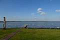
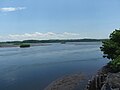
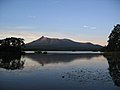
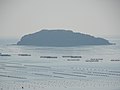
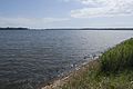
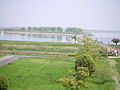
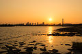
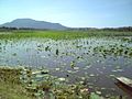
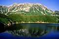
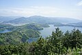
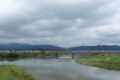
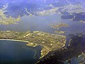
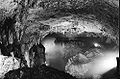
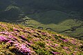
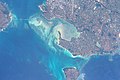
Name Prefecture Municipality Altitude Area Designated Image National park status Coords. Ref. Kutcharo-ko (クッチャロ湖 Hokkaido Hamatonbetsu 1–2 m 1,607 ha 1989 N/A 45°09′N 142°20′E / 45.150°N 142.333°E / 45.150; 142.333 (Kutcharo-ko ) Sarobetsu-genya (サロベツ原野 Hokkaido Horonobe , Toyotomi 3–7 m 2,560 ha 2005 Rishiri-Rebun-Sarobetsu National Park 45°03′N 141°42′E / 45.050°N 141.700°E / 45.050; 141.700 (Sarobetsu-genya ) Tofutsu-ko (濤沸湖 Hokkaido Abashiri , Koshimizu 1 m 900 ha 2005 Abashiri Quasi-National Park 43°56′N 144°24′E / 43.933°N 144.400°E / 43.933; 144.400 (Tofutsu-ko ) Uryunuma-shitsugen ( 雨竜沼湿原 Hokkaido Uryū 850–900 m 624 ha 2005 Shokanbetsu-Teuri-Yagishiri Quasi-National Park 43°41′N 141°36′E / 43.683°N 141.600°E / 43.683; 141.600 (Uryunuma-shitsugen ) Notsuke-hanto and Notsuke-wan (野付半島・野付湾 Hokkaido Betsukai , Shibetsu 0–10 m 6,053 ha 2005 N/A 43°34′N 145°16′E / 43.567°N 145.267°E / 43.567; 145.267 (Notsuke-hanto and Notsuke-wan ) Akan-ko (阿寒湖 Hokkaido Kushiro 420 m 1,318 ha 2005 Akan National Park 43°27′N 144°06′E / 43.450°N 144.100°E / 43.450; 144.100 (Akan-ko ) Miyajima-numa (宮島沼 Hokkaido Bibai 13 m 41 ha 2002 N/A 43°20′N 141°43′E / 43.333°N 141.717°E / 43.333; 141.717 (Miyajima-numa ) Furen-ko & Shunkuni-tai (風蓮湖 春国岱 Hokkaido Betsukai, Nemuro 1 m 6,139 ha 2005 N/A 43°17′N 145°21′E / 43.283°N 145.350°E / 43.283; 145.350 (Furen-ko and Shunkuni-tai ) Kushiro-shitsugen (釧路湿原 Hokkaido Kushiro City , Kushiro Town , Shibecha , Tsurui 3–10 m 7,863 ha 2005 Kushiro-shitsugen National Park 43°09′N 144°26′E / 43.150°N 144.433°E / 43.150; 144.433 (Kushiro-shitsugen ) Kiritappu-shitsugen (霧多布湿原 Hokkaido Hamanaka 0–3 m 2,504 ha 1993 N/A 43°05′N 145°05′E / 43.083°N 145.083°E / 43.083; 145.083 (Kiritappu-shitsugen ) Akkeshi-ko & Bekambeushi-shitsugen (厚岸湖 別寒辺牛湿原 Hokkaido Akkeshi 0–20 m 5,277 ha 1993 N/A 43°03′N 144°54′E / 43.050°N 144.900°E / 43.050; 144.900 (Akkeshi-ko and Bekambeushi-shitsugen ) Utonai-ko (ウトナイ湖 Hokkaido Tomakomai 1–5 m 510 ha 1991 N/A 42°42′N 141°43′E / 42.700°N 141.717°E / 42.700; 141.717 (Utonai-ko ) Onuma ( 大沼 Hokkaido Nanae 1–5 m 510 ha 2012 Ōnuma Quasi-National Park 41°59′N 140°40′E / 41.983°N 140.667°E / 41.983; 140.667 (Onuma ) Hotokenuma (仏沼 Aomori Misawa 0–10 m 222 ha 2005 N/A 40°49′N 141°22′E / 40.817°N 141.367°E / 40.817; 141.367 (Hotokenuma ) Izu-numa and Uchi-numa (伊豆沼・内沼 Miyagi Kurihara , Tome 7 m 559 ha 1985 N/A 38°43′N 141°06′E / 38.717°N 141.100°E / 38.717; 141.100 (Izu-numa and Uchi-numa ) Kabukuri-numa and the surrounding rice paddies ( 蕪栗沼 ・周辺水田 Miyagi Kurihara, Tome, Ōsaki 5.7 m 423 ha 2005 N/A 38°38′N 141°06′E / 38.633°N 141.100°E / 38.633; 141.100 (Kabukuri-numa and the surrounding rice paddies ) Kejo-numa ( 化女沼 Miyagi Ōsaki 25.9 m 34 ha 2008 N/A 38°37′N 141°57′E / 38.617°N 141.950°E / 38.617; 141.950 (Kejo-numa ) Shizugawa-wan ( 志津川湾 Miyagi Minamisanriku 0 m 5,793 ha 2018 Sanriku Fukkō National Park 38°40′N 141°30′E / 38.667°N 141.500°E / 38.667; 141.500 (Shizugawa-wan ) Oyama Kami-ike and Shimo-ike ( 大山上池・下池 Yamagata Tsuruoka 12 m 39 ha 2008 N/A 38°44′N 139°45′E / 38.733°N 139.750°E / 38.733; 139.750 (Oyama Kami-ike and Shimo-ike ) Hinuma ( 涸沼 Ibaraki Hokota , Ōarai 0 m 935 ha 2015 N/A 36°16′N 140°30′E / 36.267°N 140.500°E / 36.267; 140.500 (Hinuma ) Oze (尾瀬 Fukushima , Gunma , Niigata Hinoemata , Katashina , Uonuma 1,400–2,356 m 8,711 ha 2005 Oze National Park 36°53′N 139°11′E / 36.883°N 139.183°E / 36.883; 139.183 (Oze ) Oku-Nikko-shitsugen ( 奥日光 の湿原 Tochigi Nikkō 1,400–1,475 m 260 ha 2005 Nikkō National Park 36°47′N 139°26′E / 36.783°N 139.433°E / 36.783; 139.433 (Oku-Nikko-shitsugen ) Watarase-yusuichi ( 渡良瀬遊水地 Ibaraki, Tochigi, Gunma, Saitama Koga , Tochigi , Oyama , Nogi , Itakura , Kazo 2–23 m 2,861 ha 2012 N/A 36°14′N 139°41′E / 36.233°N 139.683°E / 36.233; 139.683 (Watarase-yusuichi ) Yoshigadaira Wetlands (芳ヶ平湿地群 Gunma Kusatsu , Nakanojō 1,200–2,160 m 887 ha 2015 Jōshin'etsu-kōgen National Park 36°39′N 138°33′E / 36.650°N 138.550°E / 36.650; 138.550 (Yoshigadaira Wetlands ) Yatsu-higata (谷津干潟 Chiba Narashino 0 m 40 ha 1993 N/A 35°40′N 140°00′E / 35.667°N 140.000°E / 35.667; 140.000 (Yatsu-higata ) Kasai Marine Park (葛西臨海公園 Tokyo Edogawa -4–4 m 366 ha 2018 N/A 35°38′N 139°51′E / 35.633°N 139.850°E / 35.633; 139.850 (Kasai Marine Park ) Hyo-ko (瓢湖 Niigata Agano 8.6 m 24 ha 2008 N/A 37°50′N 139°14′E / 37.833°N 139.233°E / 37.833; 139.233 (Hyo-ko ) Sakata ( 佐潟 Niigata Niigata 5 m 76 ha 1996 Sado-Yahiko-Yoneyama Quasi-National Park 37°49′N 138°53′E / 37.817°N 138.883°E / 37.817; 138.883 (Sakata ) Tateyama Midagahara and Dainichidaira (立山弥陀ヶ原・大日平 Toyama Tateyama 1,040–2,120 m 574 ha 2012 Chūbu-Sangaku National Park 36°34′N 137°32′E / 36.567°N 137.533°E / 36.567; 137.533 (Tateyama Midagahara and Dainichidaira ) Katano-kamoike ( 片野鴨池 Ishikawa Kaga 2.5–8 m 10 ha 1993 Echizen-Kaga Kaigan Quasi-National Park 36°19′N 136°17′E / 36.317°N 136.283°E / 36.317; 136.283 (Katano-kamoike ) Nakaikemi-shichi ( 中池見湿地 Fukui Tsuruga 45 m 87 ha 2012 Echizen-Kaga Kaigan Quasi-National Park 35°39′N 136°05′E / 35.650°N 136.083°E / 35.650; 136.083 (Nakaikemi-shicchi ) Mikata-goko (三方五湖 Fukui Wakasa , Mihama 0 m 1,110 ha 2005 Wakasawan Quasi-National Park 35°33′N 135°52′E / 35.550°N 135.867°E / 35.550; 135.867 (Sarobetsu-genya ) Tokai Hilly Land Spring-fed Mires ( 東海丘陵湧水湿地群 Aichi Toyota 190–244 m 22.5 ha 2012 Aichi Kōgen Quasi-National Park 35°08′N 137°21′E / 35.133°N 137.350°E / 35.133; 137.350 (Tokai Hilly Land Spring-fed Mires ) Fujimae-higata (藤前干潟 Aichi Nagoya , Tobishima -4-1 m 323 ha 2002 N/A 35°04′N 136°50′E / 35.067°N 136.833°E / 35.067; 136.833 (Fujimae-higata ) Biwa-ko (琵琶湖 Shiga 10 cities 86 m 65,984 ha 1993 Biwako Quasi-National Park 35°15′N 136°05′E / 35.250°N 136.083°E / 35.250; 136.083 (Biwa-ko ) Lower Maruyama River and the surrounding rice paddies (円山川下流域・周辺水田 Hyōgo Toyooka 0–20 m 1,094 ha 2012 Sanin Kaigan National Park 35°59′N 134°59′E / 35.983°N 134.983°E / 35.983; 134.983 (Lower Maruyama River and the surrounding rice paddies ) Kushimoto Coral Communities (串本沿岸海域 Wakayama Kushimoto -20–0 m 574 ha 2005 Yoshino-Kumano National Park 33°28′N 135°44′E / 33.467°N 135.733°E / 33.467; 135.733 (Kushimoto Coral Communities ) Nakaumi (中海 Tottori , Shimane Yonago , Sakaiminato , Matsue , Yasugi 0 m 8,043 ha 2005 N/A 35°32′N 133°09′E / 35.533°N 133.150°E / 35.533; 133.150 (Nakaumi ) Shinji-ko (宍道湖 Shimane Matsue, Izumo 0.3 m 7,652 ha 2005 N/A 35°26′N 132°57′E / 35.433°N 132.950°E / 35.433; 132.950 (Shinji-ko ) Miyajima (宮島 Hiroshima Hatsukaichi 0–80 m 142 ha 2012 Setonaikai National Park 34°14′N 132°17′E / 34.233°N 132.283°E / 34.233; 132.283 (Miyajima ) Akiyoshidai Groundwater System (秋吉台地下水系 Yamaguchi Mine 80–426 m 563 ha 2005 Akiyoshidai Quasi-National Park 34°15′N 131°18′E / 34.250°N 131.300°E / 34.250; 131.300 (Akiyoshidai Groundwater System ) Higashiyoka-higata ( 東よか干潟 Saga Saga -3–1 m 218 ha 2015 N/A 33°10′N 103°15′E / 33.167°N 103.250°E / 33.167; 103.250 (Higashiyoka-higata ) Hizen Kashima-higata (肥前鹿島干潟 Saga Kashima -3-1 m 57 ha 2015 N/A 33°6′N 130°7′E / 33.100°N 130.117°E / 33.100; 130.117 (Hizen Kashima-higata ) Arao-higata ( 荒尾干潟 Kumamoto Kumamoto 0 m 754 ha 2012 N/A 32°58′N 130°25′E / 32.967°N 130.417°E / 32.967; 130.417 (Arao-higata ) Kuju Bogatsuru and Tadewara-shitsugen ( くじゅう坊ガツル・タデ原湿原 Ōita Kokonoe , Taketa 1,000–1,270 m 91 ha 2005 Aso Kujū National Park 33°06′N 131°15′E / 33.100°N 131.250°E / 33.100; 131.250 (Kuju Bogatsuru and Tadewara-shitsugen ) Imuta-ike (藺牟田池 Kagoshima Satsumasendai 296 m 60 ha 2005 N/A 31°49′N 130°28′E / 31.817°N 130.467°E / 31.817; 130.467 (Imuta-ike ) Izumi Wintering Habitat of Cranes (出水ツルの越冬地 Kagoshima Izumi 478 ha 2021 N/A 32°06′N 130°16′E / 32.100°N 130.267°E / 32.100; 130.267 (Izumi Wintering Habitat of Cranes ) Yakushima Nagata-hama (屋久島永田浜 Kagoshima Yakushima <10 m 10 ha 2005 Kirishima-Yaku National Park 30°24′N 130°25′E / 30.400°N 130.417°E / 30.400; 130.417 (Yakushima Nagata-hama ) Streams in Kumejima (久米島の渓流・湿地 Okinawa Kumejima 120–280 m 255 ha 2009 N/A 26°22′N 126°46′E / 26.367°N 126.767°E / 26.367; 126.767 (Streams in Kumejima ) Kerama-shoto Coral Reef (慶良間諸島海域 Okinawa Zamami , Tokashiki 0 m 353 ha 2005 Kerama Shotō National Park 26°12′N 127°21′E / 26.200°N 127.350°E / 26.200; 127.350 (Keramashoto Coral Reef ) Manko (漫湖 Okinawa Tomigusuku , Naha -0.5 m 58 ha 1999 N/A 26°11′N 127°41′E / 26.183°N 127.683°E / 26.183; 127.683 (Manko ) Yonaha-wan ( 与那覇湾 Okinawa Miyakojima 0 m 704 ha 2012 N/A 24°45′N 125°16′E / 24.750°N 125.267°E / 24.750; 125.267 (Yonaha-wan ) Nagura-Ampuru ( 名蔵アンパル Okinawa Ishigaki 0 m 157 ha 2005 N/A 24°23′N 124°08′E / 24.383°N 124.133°E / 24.383; 124.133 (Nagura amparu )