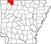
List of lakes in Carroll County, Arkansas

Last updated
Map all coordinates using: OpenStreetMap  ·  Google Maps
Download coordinates as: KML  ·  GPX

There are at least 10 named lakes and reservoirs in Carroll County, Arkansas .

Lake A body of relatively still water, in a basin surrounded by land

A lake is an area filled with water, localized in a basin, that is surrounded by land, apart from any river or other outlet that serves to feed or drain the lake. Lakes lie on land and are not part of the ocean, and therefore are distinct from lagoons, and are also larger and deeper than ponds, though there are no official or scientific definitions. Lakes can be contrasted with rivers or streams, which are usually flowing. Most lakes are fed and drained by rivers and streams.

Reservoir A storage space for fluids

A reservoir is, most commonly, an enlarged natural or artificial lake, pond or impoundment created using a dam or lock to store water.

Carroll County, Arkansas County in the United States

Carroll County is a county located in the U.S. state of Arkansas. As of the 2010 census, the population was 27,446. The county has two county seats, Berryville and Eureka Springs. Carroll County is Arkansas's 26th county, formed on November 1, 1833, and named after Charles Carroll of Carrollton, the last surviving signer of the United States Declaration of Independence.

Contents

Lakes

According to the United States Geological Survey, there are no named lakes in Carroll County, Arkansas.

United States Geological Survey Scientific agency of the United States government

The United States Geological Survey is a scientific agency of the United States government. The scientists of the USGS study the landscape of the United States, its natural resources, and the natural hazards that threaten it. The organization has four major science disciplines, concerning biology, geography, geology, and hydrology. The USGS is a fact-finding research organization with no regulatory responsibility.

Reservoirs

Although Table Rock Dam is actually in Missouri, Table Rock Lake extends into three Arkansas counties as well, including Carroll County. Aerial photo of Table Rock Dam, lake, and White River, October 2009.jpg
Although Table Rock Dam is actually in Missouri, Table Rock Lake extends into three Arkansas counties as well, including Carroll County.
Beaver Lake (Arkansas) lake in Arkansas, United States

Beaver Lake is a man-made reservoir in the Ozark Mountains of Northwest Arkansas and is formed by a dam across the White River. Beaver Lake has some 487 miles (784 km) of shoreline. With towering limestone bluffs, natural caves, and a wide variety of trees and flowering shrubs, it is a popular tourist destination. Beaver Lake is the source of drinking water in Northwest Arkansas, which is managed, treated and sold by Beaver Water District.

Table Rock Lake reservoir on Missouri-Arkansas border

Table Rock Lake is an artificial lake or reservoir in the Ozarks of southwestern Missouri and northwestern Arkansas. The lake is impounded by Table Rock Dam constructed from 1954 to 1958 on the White River by the U.S. Army Corps of Engineers.

See also

Notes

  1. "Beaver Lake". Geographic Names Information System . United States Geological Survey.
  2. "Brewer Lake". Geographic Names Information System . United States Geological Survey.
  3. "Eureka Springs City Lake". Geographic Names Information System . United States Geological Survey.
  4. "Farwell Spider Creek Lake". Geographic Names Information System . United States Geological Survey.
  5. "Fuller Lake". Geographic Names Information System . United States Geological Survey.
  6. "Jackson Lake". Geographic Names Information System . United States Geological Survey.
  7. "Lake Lucerene". Geographic Names Information System . United States Geological Survey.
  8. "Lake of No Return". Geographic Names Information System . United States Geological Survey.
  9. "Leatherwood Lake". Geographic Names Information System . United States Geological Survey.
  10. "Table Rock Lake". Geographic Names Information System . United States Geological Survey.